List of United Kingdom locations: Upper A-Upper H

Last updated

The United Kingdom Uk-map.svg
The United Kingdom

This is part of the list of United Kingdom locations: a gazetteer of place names in the United Kingdom showing each place's locality and geographical coordinates.

Upper A-H

LocationLocality Coordinates
(links to map & photo sources)
OS grid
reference
Upper Affcot Shropshire 52°28′N2°49′W / 52.46°N 02.82°W / 52.46; -02.82 SO4486
Upper Ardchronie Highland 57°52′N4°22′W / 57.86°N 04.36°W / 57.86; -04.36 NH6088
Upper Arley Worcestershire 52°25′N2°21′W / 52.41°N 02.35°W / 52.41; -02.35 SO7680
Upper Armley Leeds 53°48′N1°36′W / 53.80°N 01.60°W / 53.80; -01.60 SE2634
Upper Arncott Oxfordshire 51°50′N1°07′W / 51.84°N 01.11°W / 51.84; -01.11 SP6117
Upper Astley Shropshire 52°45′N2°41′W / 52.75°N 02.69°W / 52.75; -02.69 SJ5318
Upper Aston Shropshire 52°32′N2°17′W / 52.53°N 02.28°W / 52.53; -02.28 SO8193
Upper Astrop Northamptonshire 52°01′N1°15′W / 52.02°N 01.25°W / 52.02; -01.25 SP5137
Upper Badcall Highland 58°19′N5°10′W / 58.31°N 05.16°W / 58.31; -05.16 NC1541
Upper Bangor Gwynedd 53°13′N4°08′W / 53.22°N 04.14°W / 53.22; -04.14 SH5772
Upper Basildon Berkshire 51°29′N1°09′W / 51.48°N 01.15°W / 51.48; -01.15 SU5976
Upper Batley Kirklees 53°43′N1°38′W / 53.72°N 01.63°W / 53.72; -01.63 SE2425
Upper Battlefield Shropshire 52°44′N2°43′W / 52.74°N 02.72°W / 52.74; -02.72 SJ5117
Upper Beeding West Sussex 50°52′N0°18′W / 50.87°N 00.30°W / 50.87; -00.30 TQ1910
Upper Belvedere Bexley 51°28′44″N0°08′31″E / 51.479°N 00.142°E / 51.479; 00.142 TQ489777
Upper Benefield Northamptonshire 52°29′N0°33′W / 52.49°N 00.55°W / 52.49; -00.55 SP9889
Upper Bentley Worcestershire 52°17′N2°01′W / 52.29°N 02.01°W / 52.29; -02.01 SO9966
Upper Bighouse Highland 58°29′N3°55′W / 58.48°N 03.92°W / 58.48; -03.92 NC8857
Upper Birchwood Derbyshire 53°05′N1°21′W / 53.08°N 01.35°W / 53.08; -01.35 SK4354
Upper Blainslie Scottish Borders 55°41′N2°44′W / 55.68°N 02.74°W / 55.68; -02.74 NT5344
Upper Boat Rhondda, Cynon, Taff 51°34′N3°18′W / 51.57°N 03.30°W / 51.57; -03.30 ST1087
Upper Boddam Aberdeenshire 57°21′N2°38′W / 57.35°N 02.63°W / 57.35; -02.63 NJ6230
Upper Boddington Northamptonshire 52°10′N1°17′W / 52.17°N 01.29°W / 52.17; -01.29 SP4853
Upper Bonchurch Isle of Wight 50°35′N1°11′W / 50.59°N 01.19°W / 50.59; -01.19 SZ5778
Upper Booth Derbyshire 53°22′N1°51′W / 53.36°N 01.85°W / 53.36; -01.85 SK1085
Upper Borth Ceredigion 52°28′N4°04′W / 52.47°N 04.06°W / 52.47; -04.06 SN6088
Upper Boyndlie Aberdeenshire 57°38′N2°10′W / 57.64°N 02.16°W / 57.64; -02.16 NJ9062
Upper Brailes Warwickshire 52°02′N1°34′W / 52.04°N 01.56°W / 52.04; -01.56 SP3039
Upper Brandon Parva Norfolk 52°38′N1°01′E / 52.63°N 01.01°E / 52.63; 01.01 TG0408
Upper Breakish Highland 57°14′N5°50′W / 57.23°N 05.84°W / 57.23; -05.84 NG6823
Upper Breinton Herefordshire 52°03′N2°47′W / 52.05°N 02.78°W / 52.05; -02.78 SO4640
Upper Broadheath Worcestershire 52°12′N2°17′W / 52.20°N 02.29°W / 52.20; -02.29 SO8056
Upper Brockholes Calderdale 53°45′N1°55′W / 53.75°N 01.91°W / 53.75; -01.91 SE0629
Upper Broughton Nottinghamshire 52°49′N0°59′W / 52.82°N 00.99°W / 52.82; -00.99 SK6826
Upper Broxwood Herefordshire 52°10′N2°56′W / 52.17°N 02.93°W / 52.17; -02.93 SO3653
Upper Bruntingthorpe Leicestershire 52°29′N1°07′W / 52.48°N 01.11°W / 52.48; -01.11 SP6088
Upper Brynamman Carmarthenshire 51°48′N3°52′W / 51.80°N 03.87°W / 51.80; -03.87 SN7114
Upper Buckenhill Herefordshire 51°59′N2°35′W / 51.99°N 02.59°W / 51.99; -02.59 SO5933
Upper Bucklebury Berkshire 51°24′N1°13′W / 51.40°N 01.22°W / 51.40; -01.22 SU5468
Upper Bullington Hampshire 51°10′N1°20′W / 51.16°N 01.34°W / 51.16; -01.34 SU4641
Upper Burgate Hampshire 50°56′N1°47′W / 50.94°N 01.78°W / 50.94; -01.78 SU1516
Upper Bush Kent 51°22′N0°25′E / 51.36°N 00.42°E / 51.36; 00.42 TQ6966
Upperby Cumbria 54°52′N2°56′W / 54.86°N 02.93°W / 54.86; -02.93 NY4053
Upper Caldecote Bedfordshire 52°05′N0°18′W / 52.09°N 00.30°W / 52.09; -00.30 TL1645
Upper Cam Gloucestershire 51°41′N2°22′W / 51.68°N 02.36°W / 51.68; -02.36 ST7599
Upper Canada North Somerset 51°19′N2°55′W / 51.31°N 02.91°W / 51.31; -02.91 ST3658
Upper Canterton Hampshire 50°54′N1°38′W / 50.90°N 01.63°W / 50.90; -01.63 SU2612
Upper Catesby Northamptonshire 52°13′N1°14′W / 52.22°N 01.24°W / 52.22; -01.24 SP5259
Upper Catshill Worcestershire 52°22′N2°04′W / 52.36°N 02.06°W / 52.36; -02.06 SO9674
Upper Chapel Powys 52°02′N3°27′W / 52.04°N 03.45°W / 52.04; -03.45 SO0040
Upper Cheddon Somerset 51°02′N3°05′W / 51.04°N 03.09°W / 51.04; -03.09 ST2328
Upper Chicksgrove Wiltshire 51°04′N2°03′W / 51.06°N 02.05°W / 51.06; -02.05 ST9629
Upper Church Village Rhondda, Cynon, Taff 51°34′N3°19′W / 51.56°N 03.32°W / 51.56; -03.32 ST0886
Upper Chute Wiltshire 51°16′N1°35′W / 51.27°N 01.58°W / 51.27; -01.58 SU2953
Upper Clapton Hackney 51°34′N0°04′W / 51.56°N 00.06°W / 51.56; -00.06 TQ3487
Upper Clatford Hampshire 51°11′N1°30′W / 51.18°N 01.50°W / 51.18; -01.50 SU3543
Upper Coberley Gloucestershire 51°50′N2°02′W / 51.83°N 02.04°W / 51.83; -02.04 SO9715
Upper College Shropshire 52°54′N2°38′W / 52.90°N 02.64°W / 52.90; -02.64 SJ5734
Upper Colwall Herefordshire 52°05′N2°21′W / 52.08°N 02.35°W / 52.08; -02.35 SO7643
Upper Common Hampshire 51°12′N1°05′W / 51.20°N 01.09°W / 51.20; -01.09 SU6345
Upper Cotton Staffordshire 53°01′N1°55′W / 53.02°N 01.92°W / 53.02; -01.92 SK0547
Upper Cound Shropshire 52°38′N2°40′W / 52.63°N 02.66°W / 52.63; -02.66 SJ5504
Upper Coxley Somerset 51°11′N2°40′W / 51.18°N 02.67°W / 51.18; -02.67 ST5343
Upper Cudworth Barnsley 53°34′N1°25′W / 53.57°N 01.42°W / 53.57; -01.42 SE3809
Upper Cumberworth Kirklees 53°34′N1°41′W / 53.56°N 01.68°W / 53.56; -01.68 SE2108
Upper Cwmbran Torfaen 51°39′N3°03′W / 51.65°N 03.05°W / 51.65; -03.05 ST2796
Upperdale Derbyshire 53°14′N1°44′W / 53.24°N 01.74°W / 53.24; -01.74 SK1772
Upperdale Shetland Islands 60°16′N1°39′W / 60.26°N 01.65°W / 60.26; -01.65 HU1953
Upper Dallachy Moray 57°38′N3°04′W / 57.64°N 03.07°W / 57.64; -03.07 NJ3662
Upper Deal Kent 51°12′N1°22′E / 51.20°N 01.37°E / 51.20; 01.37 TR3651
Upper Dean Bedfordshire 52°17′N0°28′W / 52.29°N 00.47°W / 52.29; -00.47 TL0467
Upper Dean Devon 50°28′N3°48′W / 50.46°N 03.80°W / 50.46; -03.80 SX7264
Upper Denby (Denby Dale)Kirklees 53°33′N1°40′W / 53.55°N 01.66°W / 53.55; -01.66 SE2207
Upper Denby (Kirkburton)Kirklees 53°38′N1°39′W / 53.64°N 01.65°W / 53.64; -01.65 SE2316
Upper Denton Cumbria 54°58′N2°37′W / 54.97°N 02.61°W / 54.97; -02.61 NY6165
Upper Diabaig Highland 57°34′N5°40′W / 57.57°N 05.66°W / 57.57; -05.66 NG8160
Upper Dicker East Sussex 50°52′N0°12′E / 50.86°N 00.20°E / 50.86; 00.20 TQ5510
Upper Dinchope Shropshire 52°26′N2°49′W / 52.44°N 02.81°W / 52.44; -02.81 SO4583
Upper Dormington Herefordshire 52°02′N2°37′W / 52.04°N 02.61°W / 52.04; -02.61 SO5839
Upper Dounreay Highland 58°34′N3°43′W / 58.56°N 03.72°W / 58.56; -03.72 ND0065
Upper Dovercourt Essex 51°55′N1°14′E / 51.92°N 01.24°E / 51.92; 01.24 TM2330
Upper Dowdeswell Gloucestershire 51°52′N2°00′W / 51.86°N 02.00°W / 51.86; -02.00 SP0019
Upper Drummond Highland 57°27′N4°14′W / 57.45°N 04.23°W / 57.45; -04.23 NH6643
Upper Dunsforth North Yorkshire 54°04′N1°19′W / 54.06°N 01.32°W / 54.06; -01.32 SE4463
Upper Dunsley Hertfordshire 51°47′N0°39′W / 51.79°N 00.65°W / 51.79; -00.65 SP9311
Upper Eashing Surrey 51°10′N0°38′W / 51.17°N 00.64°W / 51.17; -00.64 SU9543
Upper Eastern Green Solihull 52°25′N1°36′W / 52.41°N 01.60°W / 52.41; -01.60 SP2780
Upper Edmonton Enfield 51°37′N0°04′W / 51.61°N 00.06°W / 51.61; -00.06 TQ3492
Upper Egleton Herefordshire 52°05′N2°32′W / 52.09°N 02.54°W / 52.09; -02.54 SO6344
Upper Elkstone Staffordshire 53°07′N1°55′W / 53.11°N 01.92°W / 53.11; -01.92 SK0558
Upper Ellastone Staffordshire 52°59′N1°50′W / 52.98°N 01.83°W / 52.98; -01.83 SK1143
Upper Elmers End London Borough of Bromley 51°23′N0°02′W / 51.38°N 00.04°W / 51.38; -00.04 TQ3667
Upper End Derbyshire 53°17′N1°53′W / 53.28°N 01.88°W / 53.28; -01.88 SK0876
Upper End (Bagendon)Gloucestershire 51°45′N2°00′W / 51.75°N 02.00°W / 51.75; -02.00 SP0006
Upper End (Northleach)Gloucestershire 51°49′N1°49′W / 51.81°N 01.82°W / 51.81; -01.82 SP1213
Upper End Leicestershire 52°43′N0°54′W / 52.71°N 00.90°W / 52.71; -00.90 SK7414
Upper Enham Hampshire 51°14′N1°29′W / 51.23°N 01.48°W / 51.23; -01.48 SU3649
Upper Farmcote Shropshire 52°31′N2°20′W / 52.51°N 02.34°W / 52.51; -02.34 SO7791
Upper Farringdon Hampshire 51°07′N0°59′W / 51.11°N 00.98°W / 51.11; -00.98 SU7135
Upper Feorlig Highland 57°24′N6°31′W / 57.40°N 06.51°W / 57.40; -06.51 NG2944
Upper Fivehead Somerset 51°00′N2°56′W / 51.00°N 02.94°W / 51.00; -02.94 ST3423
Upper Forge Shropshire 52°29′N2°25′W / 52.49°N 02.41°W / 52.49; -02.41 SO7289
Upper Framilode Gloucestershire 51°47′N2°22′W / 51.78°N 02.36°W / 51.78; -02.36 SO7510
Upper Froyle Hampshire 51°10′N0°55′W / 51.17°N 00.92°W / 51.17; -00.92 SU7542
Upper Gambolds Worcestershire 52°19′N2°02′W / 52.31°N 02.04°W / 52.31; -02.04 SO9768
Upper Gills Highland 58°37′N3°10′W / 58.62°N 03.17°W / 58.62; -03.17 ND3271
Upper Godney Somerset 51°10′N2°44′W / 51.17°N 02.74°W / 51.17; -02.74 ST4842
Upper Goldstone Kent 51°17′N1°17′E / 51.29°N 01.28°E / 51.29; 01.28 TR2960
Upper Gornal Dudley 52°31′N2°07′W / 52.52°N 02.11°W / 52.52; -02.11 SO9292
Upper Gravenhurst Bedfordshire 52°01′N0°23′W / 52.01°N 00.38°W / 52.01; -00.38 TL1136
Upper Green Berkshire 51°22′N1°29′W / 51.36°N 01.48°W / 51.36; -01.48 SU3663
Upper Green Essex 51°59′N0°05′E / 51.98°N 00.09°E / 51.98; 00.09 TL4434
Upper Green Leeds 53°43′N1°35′W / 53.72°N 01.59°W / 53.72; -01.59 SE2725
Upper Green Monmouthshire 51°51′N2°54′W / 51.85°N 02.90°W / 51.85; -02.90 SO3818
Upper Green Suffolk 52°14′N0°32′E / 52.24°N 00.54°E / 52.24; 00.54 TL7464
Upper Grove Common Herefordshire 51°56′N2°39′W / 51.93°N 02.65°W / 51.93; -02.65 SO5526
Upper Guist Norfolk 52°47′N0°58′E / 52.79°N 00.96°E / 52.79; 00.96 TG0026
Upper Hackney Derbyshire 53°08′N1°34′W / 53.14°N 01.56°W / 53.14; -01.56 SK2961
Upper Hale Surrey 51°14′N0°47′W / 51.23°N 00.79°W / 51.23; -00.79 SU8449
Upper Halistra Highland 57°32′N6°37′W / 57.53°N 06.61°W / 57.53; -06.61 NG2459
Upper Halliford Surrey 51°24′N0°26′W / 51.40°N 00.43°W / 51.40; -00.43 TQ0968
Upper Halling Kent 51°21′N0°25′E / 51.35°N 00.42°E / 51.35; 00.42 TQ6964
Upper Ham Worcestershire 52°02′N2°13′W / 52.04°N 02.22°W / 52.04; -02.22 SO8539
Upper Hambleton Rutland 52°39′N0°40′W / 52.65°N 00.67°W / 52.65; -00.67 SK9007
Upper Hamnish Herefordshire 52°13′N2°40′W / 52.22°N 02.67°W / 52.22; -02.67 SO5459
Upper Handwick Angus 56°34′N3°02′W / 56.56°N 03.04°W / 56.56; -03.04 NO3642
Upper Harbledown Kent 51°17′N1°01′E / 51.28°N 01.02°E / 51.28; 01.02 TR1158
Upper Hardres Court Kent 51°12′N1°04′E / 51.20°N 01.07°E / 51.20; 01.07 TR1550
Upper Hardwick Herefordshire 52°12′N2°52′W / 52.20°N 02.87°W / 52.20; -02.87 SO4057
Upper Hartfield East Sussex 51°05′N0°05′E / 51.08°N 00.08°E / 51.08; 00.08 TQ4634
Upper Hartshay Derbyshire 53°02′N1°26′W / 53.04°N 01.43°W / 53.04; -01.43 SK3850
Upper Haselor Worcestershire 52°04′N1°59′W / 52.06°N 01.98°W / 52.06; -01.98 SP0141
Upper Hatton Staffordshire 52°56′N2°15′W / 52.93°N 02.25°W / 52.93; -02.25 SJ8337
Upper Haugh Rotherham 53°28′N1°22′W / 53.46°N 01.36°W / 53.46; -01.36 SK4297
Upper Hayesden Kent 51°10′N0°14′E / 51.17°N 00.23°E / 51.17; 00.23 TQ5644
Upper Hayton Shropshire 52°25′N2°43′W / 52.42°N 02.72°W / 52.42; -02.72 SO5181
Upper Heaton Kirklees 53°40′N1°43′W / 53.66°N 01.72°W / 53.66; -01.72 SE1819
Upper Hellesdon Norfolk 52°39′N1°17′E / 52.65°N 01.28°E / 52.65; 01.28 TG2211
Upper Helmsley North Yorkshire 53°59′N0°56′W / 53.99°N 00.94°W / 53.99; -00.94 SE6956
Upper Hengoed Shropshire 52°53′N3°04′W / 52.89°N 03.07°W / 52.89; -03.07 SJ2834
Upper Hergest Herefordshire 52°10′N3°05′W / 52.17°N 03.08°W / 52.17; -03.08 SO2654
Upper Heyford Northamptonshire 52°13′N1°02′W / 52.22°N 01.03°W / 52.22; -01.03 SP6659
Upper Heyford Oxfordshire 51°56′N1°17′W / 51.93°N 01.28°W / 51.93; -01.28 SP4926
Upper Hill Herefordshire 52°10′N2°46′W / 52.17°N 02.77°W / 52.17; -02.77 SO4753
Upper Hill South Gloucestershire 51°40′N2°30′W / 51.66°N 02.50°W / 51.66; -02.50 ST6596
Upper Hindhope Scottish Borders 55°22′N2°23′W / 55.37°N 02.38°W / 55.37; -02.38 NT7609
Upper Hockenden Kent 51°24′22″N0°09′18″E / 51.406°N 00.155°E / 51.406; 00.155 TQ500696
Upper Holloway Camden 51°33′N0°08′W / 51.55°N 00.14°W / 51.55; -00.14 TQ2986
Upper Holton Suffolk 52°20′N1°31′E / 52.34°N 01.52°E / 52.34; 01.52 TM4078
Upper Hopton Kirklees 53°39′N1°43′W / 53.65°N 01.71°W / 53.65; -01.71 SE1918
Upper Horsebridge East Sussex 50°52′N0°14′E / 50.87°N 00.24°E / 50.87; 00.24 TQ5811
Upper Howsell Worcestershire 52°08′N2°20′W / 52.13°N 02.33°W / 52.13; -02.33 SO7748
Upper Hoyland Barnsley 53°30′N1°28′W / 53.50°N 01.47°W / 53.50; -01.47 SE3501
Upper Hulme Staffordshire 53°08′N1°59′W / 53.13°N 01.98°W / 53.13; -01.98 SK0160
Upper Hyde Isle of Wight 50°37′N1°11′W / 50.62°N 01.19°W / 50.62; -01.19 SZ5781

Related Research Articles

Britain most often refers to:

<span class="mw-page-title-main">Parliament of the United Kingdom</span> Supreme legislative body of the United Kingdom

The Parliament of the United Kingdom of Great Britain and Northern Ireland is the supreme legislative body of the United Kingdom, and may also legislate for the Crown Dependencies and the British Overseas Territories. It meets at the Palace of Westminster in London. Parliament possesses legislative supremacy and thereby holds ultimate power over all other political bodies in the United Kingdom and the Overseas Territories. While Parliament is bicameral, it has three parts: the sovereign, the House of Lords, and the House of Commons. The three parts acting together to legislate may be described as the King-in-Parliament. The Crown normally acts on the advice of the prime minister, and the powers of the House of Lords are limited to only delaying legislation.

<span class="mw-page-title-main">Primary school</span> School for children

A primary school, elementary school, or grade school is a school for primary education of children who are 4 to 10 years of age. Primary schooling follows preschool and precedes secondary schooling.
<span class="mw-page-title-main">United Kingdom</span> Island country in Northwestern Europe

The United Kingdom of Great Britain and Northern Ireland, commonly known as the United Kingdom (UK) or Britain, is a country in Northwestern Europe, off the coast of the continental mainland. It comprises England, Scotland, Wales, and Northern Ireland. The UK includes the island of Great Britain, the north-eastern part of the island of Ireland, and most of the smaller islands within the British Isles, a total area of 94,354 square miles (244,376 km2). Northern Ireland shares a land border with the Republic of Ireland; otherwise, the United Kingdom is surrounded by the Atlantic Ocean, the North Sea, the English Channel, the Celtic Sea, and the Irish Sea. The United Kingdom had an estimated population of nearly 68.3 million people in 2023. The capital and largest city of both England and the United Kingdom is London, whose wider metropolitan area is the largest in Western Europe, with a population of 14.9 million. The cities of Edinburgh, Cardiff, and Belfast are the national capitals of Scotland, Wales, and Northern Ireland, respectively.

The Peerage of Ireland consists of those titles of nobility created by the English monarchs in their capacity as Lord or King of Ireland, or later by monarchs of the United Kingdom of Great Britain and Ireland. It is one of the five divisions of Peerages in the United Kingdom. The creation of such titles came to an end in the 19th century. The ranks of the Irish peerage are duke, marquess, earl, viscount and baron. As of 2016, there were 135 titles in the Peerage of Ireland extant: two dukedoms, ten marquessates, 43 earldoms, 28 viscountcies, and 52 baronies. However, these titles have no official recognition in Ireland, with Article 40.2 of the Constitution of Ireland forbidding the state conferring titles of nobility and stating that an Irish citizen may not accept titles of nobility or honour except with the prior approval of the Irish government.

<span class="mw-page-title-main">Kingdom of England</span> Kingdom in northwestern Europe (927–1707)

The Kingdom of England was a sovereign state on the island of Great Britain from the early tenth century, when it was unified from various Anglo-Saxon kingdoms, until 1 May 1707, when it united with Scotland to form the Kingdom of Great Britain, which would later become the United Kingdom. The Kingdom of England was among the most powerful states in Europe during the medieval and early modern periods.
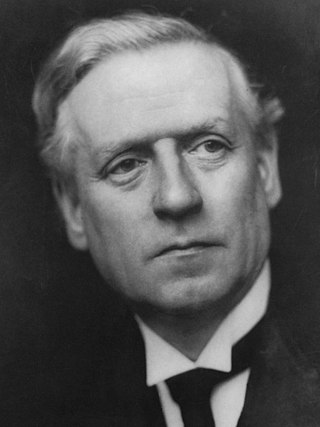
<span class="mw-page-title-main">December 1910 United Kingdom general election</span>

The December 1910 United Kingdom general election was held from 3 to 19 December. It was the last general election to be held over several days and the last to be held before the First World War.
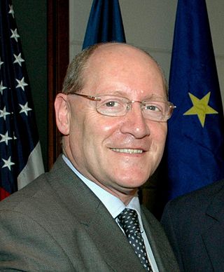
<span class="mw-page-title-main">2004 European Parliament election in the United Kingdom</span> Election

The 2004 European Parliament election was the United Kingdom's part of the wider 2004 European Parliament election which was held between 10 and 13 June 2004 in the 25 member states of the European Union. The United Kingdom's part of this election was held on Thursday 10 June 2004. The election also coincided with the 2004 local elections and the London Assembly and mayoral elections. In total, 78 Members of the European Parliament were elected from the United Kingdom using proportional representation.

<span class="mw-page-title-main">Lists of places in Wales</span>

These are lists of places in Wales.

<span class="mw-page-title-main">Member of Parliament (United Kingdom)</span> Representative in the House of Commons

In the United Kingdom, a member of Parliament (MP) is an individual elected to serve in the House of Commons, the lower house of the Parliament of the United Kingdom.
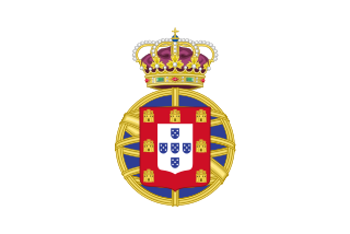
<span class="mw-page-title-main">United Kingdom of Portugal, Brazil and the Algarves</span> Pluricontinental monarchy

The United Kingdom of Portugal, Brazil and the Algarves was a pluricontinental monarchy formed by the elevation of the Portuguese colony named State of Brazil to the status of a kingdom and by the simultaneous union of that Kingdom of Brazil with the Kingdom of Portugal and the Kingdom of the Algarves, constituting a single state consisting of three kingdoms.

<span class="mw-page-title-main">Unitary authorities of England</span> Local government in some parts of England

The unitary authorities of England are a type of local authority responsible for all local government services in an area. They combine the functions of a non-metropolitan county council and a non-metropolitan district council, which elsewhere in England provide two tiers of local government.

<span class="mw-page-title-main">Kingdom of Portugal</span> Kingdom in Southwestern Europe (1139–1910)

The Kingdom of Portugal was a monarchy in the western Iberian Peninsula and the predecessor of the modern Portuguese Republic. Existing to various extents between 1139 and 1910, it was also known as the Kingdom of Portugal and the Algarves after 1415, and as the United Kingdom of Portugal, Brazil and the Algarves between 1815 and 1822. The name is also often applied to the Portuguese Empire, the realm's overseas colonies.

<span class="mw-page-title-main">United Kingdom in the Eurovision Song Contest</span>

The United Kingdom has participated in the Eurovision Song Contest 66 times. Its first participation was at the second contest, in 1957, and it has entered every year since 1959. The British participant broadcaster in the contest is the British Broadcasting Corporation (BBC). The country has won the contest five times: in 1967, with "Puppet on a String" performed by Sandie Shaw; in 1969, with "Boom Bang-a-Bang" by Lulu ; in 1976, with "Save Your Kisses for Me" by Brotherhood of Man; in 1981, with "Making Your Mind Up" by Bucks Fizz; and in 1997, with "Love Shine a Light" by Katrina and the Waves. The UK has also achieved a record sixteen second-place finishes, the first in 1959 and the most recent in 2022.

<span class="mw-page-title-main">New Zealand–United Kingdom relations</span> Bilateral relations

New Zealand–United Kingdom relations are the bilateral relations between New Zealand and the United Kingdom. New Zealand has maintained a close relationship with Britain, since gaining independence from the United Kingdom.

<span class="mw-page-title-main">Countries of the United Kingdom</span> Component parts of the UK since 1922

Since 1922, the United Kingdom has been made up of four countries: England, Scotland, Wales and Northern Ireland. The UK Prime Minister's website has used the phrase "countries within a country" to describe the United Kingdom.