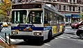
M22 (New York City bus)

Last updated
m22
Madison and Chambers Street Crosstown
(USA-New York) Metropolitan Transportation Authority 9707 NY-MTA-BE3412 M22 2024-06-14.jpg
A 2021 Nova Bus LFS HEV (9707) on the Lower East Side-bound M22 on Broadway in June 2024
Overview
System MTA Regional Bus Operations
Operator New York City Transit Authority
Garage Michael J. Quill Depot
Vehicle New Flyer Xcelsior XD40
New Flyer Xcelsior XE40
Nova Bus LFS HEV
Route
Locale Manhattan, New York City, U.S.
Communities served Battery Park City, Tribeca, Financial District, Civic Center, Two Bridges, Lower East Side
Start Battery Park City  – Vesey St and North End Ave
Via Madison Street and Chambers Street
End Lower East Side  – Grand Street and FDR Drive
Length2.8 miles (4.5 km)
Service
OperatesWeekdays: 5:00 AM- 1:00 AM
Weekends: 7:00 AM - 10:00 PM
[1]
Annual patronage460,006 (2023) [2]
TransfersYes
Timetable M22
  M21  {{{system_nav}}}  M23  

The M22 bus route constitutes a public transit line in Manhattan, New York City. The M22 operates between Battery Park City and the Lower East Side, serving as a crosstown route along Madison Street and Chambers Street. [3]

Contents

Route description

A 2019 New Flyer XD40 (7603) on the Battery Park City-bound M22 at Broadway/Chambers Street in November 2019 Chambers St Bway td (2019-11-26) 09.jpg
A 2019 New Flyer XD40 (7603) on the Battery Park City-bound M22 at Broadway/Chambers Street in November 2019

In the eastbound direction, the M22 bus starts at Vesey Street and North End Avenue in Battery Park City, travelling north along North End Avenue until it turns right onto Chambers Street. The M22 then turns right onto Broadway, and heads east along Park Row and south along Frankfort St. Buses continue northeast along Pearl St and St. James Place before turning east onto Madison Street. The M22 continues east along Madison Street until Madison Street merges with Grand Street and terminates at Grand Street and FDR Drive in the Lower East Side.

In the westbound direction, the M22 starts at Grand Street and FDR Drive in the Lower East Side, heading south along the FDR Drive, west along Cherry Street, north along Jackson Street, and west along Madison Street. The bus continues west along Madison Street until Pike Street, where it turns north and then turns west onto East Broadway. At Bowery, East Broadway becomes Worth Street, and the M22 turns south along Federal Plaza and Centre Street, then west onto Chambers St. The M22 then turns south onto North End Ave, east onto Murray Street, and south along West Street before turning west onto Vesey Street and terminating at Vesey Street and North End Ave in Battery Park City.

History

A 2023 XE40 (4965) on the Lower East Side-bound M22 4965 M22.jpg
A 2023 XE40 (4965) on the Lower East Side-bound M22

On September 21, 1919, the New York Railways Company's Madison and Chambers Streets Line streetcar was replaced by the New York City Department of Plant and Structures' M1 bus route. In 1933, this bus route was taken over by Green Bus Lines, who gave the route to the Comprehensive Omnibus Co. in 1935. In 1948, the New York City government acquired all the Comprehensive Omnibus Co. routes, including the M1. [4] This bus route was renumbered as the M22 on July 1, 1974. [5] On June 27, 2010, overnight bus service on the M22 was discontinued due to a budget crisis. [6]

Related Research Articles

<span class="mw-page-title-main">Houston Street</span> Street in Manhattan, New York

Houston Street is a major east–west thoroughfare in Lower Manhattan in New York City, United States. It runs the full width of the island of Manhattan, from FDR Drive along the East River in the east to the West Side Highway along the Hudson River in the west. The street is divided into west and east sections by Broadway.

<span class="mw-page-title-main">FDR Drive</span> Highway in New York

Franklin D. Roosevelt East River Drive, commonly called FDR Drive for short, is a controlled-access parkway on the east side of the New York City borough of Manhattan. It starts near South and Broad Streets, just north of the Battery Park Underpass, and runs north along the East River to the 125th Street / Robert F. Kennedy Bridge interchange, where it becomes Harlem River Drive. All of FDR Drive is designated New York State Route 907L (NY 907L), an unsigned reference route.

<span class="mw-page-title-main">Battery Park Underpass</span> Tunnel in Manhattan, New York

The Battery Park Underpass is a vehicular tunnel at the southernmost tip of Manhattan, New York City, near the neighborhoods of South Ferry and Battery Park City. The tunnel connects FDR Drive, which runs along the east side of Manhattan Island, with the West Side Highway, which runs along the island's west side. Opened in 1951, it was the second section of FDR Drive to be completed. The underpass crosses beneath the Battery and the approach to the Brooklyn–Battery Tunnel.

<span class="mw-page-title-main">Third Avenue Railway</span> Streetcar system in southern New York (1852–1952)

The Third Avenue Railway System (TARS), founded 1852, was a streetcar system serving the New York City boroughs of Manhattan and the Bronx along with lower Westchester County. For a brief period of time, TARS also operated the Steinway Lines in Long Island City.

<span class="mw-page-title-main">Third and Lexington Avenues Line</span> Bus routes in Manhattan, New York

The Third and Lexington Avenues Line, also known as the Third Avenue Line, is a public transit line in Manhattan, New York City, running from Lower Manhattan to Fort George in Washington Heights. Originally a streetcar line, it now consists of the M98, M101, M102, and M103 bus routes, operated by the New York City Transit Authority. The M98 bus route operates on Third Avenue between East 65th Street and East 127th Street, although it previously continued to 32nd Street. The M101, M102 and M103 bus routes run southbound on Lexington Avenue north of East 24th Street.

The Sixth Avenue Line was a public transit line in Manhattan, New York City, running mostly along Sixth Avenue from Lower Manhattan to Central Park. Originally a streetcar line and later a bus route, it has been absorbed into the M5 bus route, which replaced the Broadway Line, as its northbound direction.

<span class="mw-page-title-main">M10 and M20 buses</span> Bus routes in Manhattan, New York

The Eighth Avenue Line is a public transit line in Manhattan, New York City, running mostly along Eighth Avenue from Lower Manhattan to Harlem. Originally a streetcar line, it is now the M10 bus route and the M20 bus route, operated by the New York City Transit Authority. The M10 bus now only runs north of 57th Street, and the M20 runs south of 66th Street. The whole line was a single route, the M10, until 2000 when the M20 was created.

<span class="mw-page-title-main">M11 (New York City bus)</span> Bus route in Manhattan, New York

The Ninth and Tenth Avenues Line or Ninth Avenue Line is a surface transit line in the New York City borough of Manhattan, running mostly along Ninth Avenue and Amsterdam Avenue from Lower Manhattan to Manhattanville. Originally a streetcar line operated by the Manhattan and Bronx Surface Transit Operating Authority, it is now the M11 bus route operated by the New York City Transit Authority.

<span class="mw-page-title-main">M5 and M55 buses</span> Bus routes in Manhattan, New York

The M5 and M55 bus routes constitute a public transit corridor in Manhattan, New York City, running along the Fifth / Sixth Avenues / Riverside Drive Line as well as the southern portion of the Broadway Line after the discontinuation of the M6. The routes primarily run along Broadway, Fifth and Sixth Avenues, and Riverside Drive from South Ferry, Lower Manhattan to Washington Heights. The M5 covers the northern portion of the route north of 31st Street, while the M55 operates along the southern portion of the route south of 44th Street. The two routes overlap in Midtown Manhattan. The portion along Broadway south of East 8th Street was originally a streetcar line.

<span class="mw-page-title-main">M14 (New York City bus)</span> Bus routes in Manhattan, New York

The 14th Street Crosstown Line is a public transit line in Manhattan, New York City, running primarily along 14th Street from Chelsea or the West Village to the Lower East Side. Originally a streetcar line, it is now the M14 bus route, operated by the New York City Transit Authority. The line's two variants, the M14A SBS and M14D SBS, use Avenue A and Avenue D respectively from 14th Street south into the Lower East Side.

<span class="mw-page-title-main">M66 (New York City bus)</span> Bus route in Manhattan, New York

The M66 constitutes a public transit line in Manhattan. Originally ran by the Comprehensive Omnibus Company, it is now ran by the MTA Regional Bus Operations under the New York City Transit Authority brand, running between the Upper East Side and Upper West Side as one of Manhattan's numerous crosstown bus routes.

<span class="mw-page-title-main">M1, M2, M3, and M4 buses</span> Bus routes in Manhattan, New York

The M1, M2, M3, and M4 are four local bus routes that operate the Fifth and Madison Avenues Lines – along the one-way pair of Madison and Fifth Avenues in the Manhattan borough of New York City. Though the routes also run along other major avenues, the majority of their route is along Madison and Fifth Avenues between Greenwich Village and Harlem.

<span class="mw-page-title-main">Bus lanes in New York City</span> Bus priority system

Since 1963, New York City has been using a system of bus lanes that are intended to give priority to buses, which contain more occupants than passenger and commercial vehicles. Most of these lanes are restricted to buses only at certain days and times, but some bus lanes are restricted 24/7. As of May 2021, there are 138.4 miles (222.7 km) of bus lanes within New York City.

<span class="mw-page-title-main">M86 (New York City bus)</span> Bus route in Manhattan, New York

The 86th Street Crosstown Line is a bus line in Manhattan, New York City, running mostly along 86th Street on the Upper West and Upper East Sides of Manhattan. Originally a streetcar line, it now comprises the M86 Select Bus Service bus line.

<span class="mw-page-title-main">Union Turnpike express buses</span> Express bus routes in Queens and Manhattan, New York

The QM1, QM5, QM6, QM7, QM8, QM31, QM35, and QM36 bus routes constitute a public transit line in New York City, operating express between Northeast Queens and Midtown or Downtown Manhattan. The routes operate primarily on Union Turnpike in Queens, and travel non-stop via Queens Boulevard, the Long Island Expressway, and the Midtown Tunnel or Queensboro Bridge between Queens and Manhattan.

<span class="mw-page-title-main">Hylan Boulevard express buses</span> Bus routes in Staten Island and Manhattan, New York

The SIM1, SIM1C, SIM7,SIM10, and SIM11 bus routes constitute a public transit line in Staten Island and Manhattan, New York. The routes all operate on Richmond Avenue and Hylan Boulevard on Staten Island, but go to three separate terminals in Manhattan.

<span class="mw-page-title-main">M79 (New York City bus)</span> Bus route in Manhattan, New York

The M79 Select Bus Service, formerly the 79th Street Crosstown Line, is a bus line in Manhattan, New York City, running mostly along 79th Street on the Upper West and Upper East Sides of Manhattan. The route was previously owned by the private Green Bus Lines, and is now operated by MTA Regional Bus Operations under the New York City Transit brand.

<span class="mw-page-title-main">M34 and M34A buses</span> Bus routes in Manhattan, New York

The 34th Street Crosstown Line is a surface transit line on 34th Street in Manhattan, New York City, United States. It currently hosts the M34/M34A SBS routes of MTA's Regional Bus Operations. The M34 runs from 12th Avenue to FDR Drive via 34th Street, while the M34A runs from Port Authority Bus Terminal to Waterside Plaza.

<span class="mw-page-title-main">M96 and M106 buses</span> Bus routes in Manhattan, New York

The M96 and M106 constitute a pair of bus routes in Manhattan, running between Upper West Side and primarily on West 96th Street and East 96th Street to the Upper East Side or East 106th Street to East Harlem.

References

  1. "Manhattan Bus Service Guide".
  2. "Subway and bus ridership for 2023".
  3. "M22 Bus Timetable" (PDF).
  4. "New York City Transit Routes - Manhattan".
  5. "2 Borough's Buses Get New Numbers". The New York Times. 20 June 1974.
  6. "2010 NYC Transit Service reductions" (PDF). Archived from the original (PDF) on 2010-12-18.