Mandurah (suburb)

Last updated

Mandurah
Mandurah,  Western Australia
Australia Western Australia location map.svg
Red pog.svg
Mandurah
Mandurah (suburb)
Coordinates 32°31′44″S115°43′23″E / 32.52889°S 115.72306°E / -32.52889; 115.72306 Coordinates: 32°31′44″S115°43′23″E / 32.52889°S 115.72306°E / -32.52889; 115.72306
Population8,804 (SAL 2021) [1]
Postcode(s) 6210
Area7.2 km2 (2.8 sq mi) [2]
Time zone AWST (UTC+8)
LGA(s) City of Mandurah
State electorate(s) Mandurah
Federal division(s) Canning
Suburbs around Mandurah:
Indian Ocean Silver Sands Meadow Springs
Halls Head Mandurah Greenfields
Erskine Dudley Park Coodanup

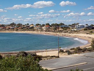
Mandurah is the central suburb of the city of Mandurah in Western Australia's Peel region. At the 2016 census, it had a population of 7,837. [3]

Related Research Articles

<span class="mw-page-title-main">City of Stirling</span> Local government area in Western Australia

The City of Stirling is a local government area in the northern suburbs of the Western Australian capital city of Perth about 10 kilometres (6 mi) north of Perth's central business district. The City covers an area of 105.2 square kilometres (40.6 sq mi) and has a population of over 223,000, making it the largest local government area by population in Western Australia.

<span class="mw-page-title-main">City of Swan</span> Local government area in Western Australia

The City of Swan is a local government area of Western Australia. It is in the eastern metropolitan region of Perth and includes the Swan Valley and 42 suburbs. It is centred approximately 20 km north-east of the Perth central business district. The City covers an area of 1,042 km² and had an estimated population of 155,653 in 2020.

<span class="mw-page-title-main">City of Wanneroo</span> Local government area in Western Australia

The City of Wanneroo is a local government area with city status in the northern suburbs of Perth, Western Australia. It is centred approximately 25 kilometres (15.5 mi) north of Perth's central business district and forms part of the northern boundary of the Perth metropolitan area. Wangara encompasses the federal divisions of Cowan, Moore and Pearce.

<span class="mw-page-title-main">Warnbro, Western Australia</span> Suburb of Perth, Western Australia

Warnbro is a southern outer suburb of Perth, the capital of Western Australia, located on Warnbro Sound within the City of Rockingham. It adjoins Port Kennedy which combines residential with retail and light-industrial land use. The suburb, which is named after Warnbro Sound, was gazetted on 5 April 1974.

Bateman is a suburb of Perth, Western Australia, located within the City of Melville.
<span class="mw-page-title-main">Bertram, Western Australia</span> Suburb of Perth, Western Australia

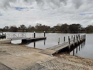
Bertram is a suburb of Perth, Western Australia, located within the City of Kwinana. Bertram derives its name from the family name of a Group Settler of the 1920s who owned land in the area. It was established as a locality name on 17 December 1998.

<span class="mw-page-title-main">Aubin Grove, Western Australia</span> Suburb of Perth, Western Australia

Aubin Grove is a suburb of Perth, Western Australia in the City of Cockburn. The suburb was approved in 2003.

<span class="mw-page-title-main">Secret Harbour, Western Australia</span> Suburb of Perth, Western Australia

Secret Harbour is an outer southern suburb of Perth, the capital city of Western Australia, located within the City of Rockingham on the Indian Ocean coast at Comet Bay. Despite its name, Secret Harbour does not have a harbour. The name results from a failed marina development and was approved in 1984.

<span class="mw-page-title-main">Singleton, Western Australia</span> Suburb of Perth, Western Australia

Singleton is an outer southern suburb of Perth, the capital city of Western Australia, located within the City of Rockingham. It is the southernmost suburb of the Perth Metropolitan Area and is actually closer to the regional city Mandurah than either Perth CBD or Rockingham. The area is under a development near the school, Singleton Primary, and near the main oval, Laurie Stanford Reserve. There is a petrol service station, a small shopping centre, and a school.

Stake Hill is a northeastern rural residential suburb of Mandurah, Western Australia. Its local government area is the Shire of Murray. At the 2011 census, Stake Hill had a population of 494.

Binningup is a town on the coast of the South West region of Western Australia between Mandurah and Bunbury. At the 2016 census, Binningup had a population of 1,227.

<span class="mw-page-title-main">City of Mandurah</span> Local government area in Western Australia

The City of Mandurah is a local government area of Western Australia, covering both Mandurah proper and an additional area reaching down as far south as Lake Clifton. The city has a total area of approximately 174 square kilometres (67 sq mi).

<span class="mw-page-title-main">City of Kalamunda</span> Local government area in Western Australia

The City of Kalamunda is a local government area in the eastern metropolitan region of the Western Australian capital city of Perth about 25 kilometres (16 mi) east of Perth's central business district. The area covers 324 square kilometres (125 sq mi), much of which is state forest rising into the Darling Scarp to the east. In the mid 2010s, the area had a population of 57 thousand people.

<span class="mw-page-title-main">Shire of Mundaring</span> Local government area in Perth, Western Australia

The Shire of Mundaring is a local government area in eastern metropolitan Perth, the capital of Western Australia. The Shire covers an area of 645 square kilometres (249 sq mi) and had a population of approximately 38,000 as at the 2016 Census.

<span class="mw-page-title-main">City of Armadale</span> Local government area in Western Australia

The City of Armadale is a local government area in the southeastern suburbs of the Western Australian capital city of Perth, about 28 kilometres (17.4 mi) southeast of Perth's central business district. The City covers an area of 560 square kilometres (216 sq mi), much of which is state forest rising into the Darling Scarp to the east, and had a population of almost 80,000 as at the 2016 Census.

<span class="mw-page-title-main">City of Rockingham</span> Local government area in Western Australia

The City of Rockingham is a council and local government area, comprising the south coastal suburbs of the Western Australian capital city of Perth.

<span class="mw-page-title-main">Barragup, Western Australia</span> Suburb of Mandurah, Western Australia

Barragup is a locality near Mandurah, Western Australia, located north of Pinjarra Road and east of the Serpentine River within the Shire of Murray. Its postcode is 6209. At the 2016 census, Barragup had a population of 806.

<span class="mw-page-title-main">South Yunderup, Western Australia</span> Town in Western Australia

South Yunderup is a township near Mandurah, Western Australia, located on the south bank of the Murray River within the Shire of Murray. Its postcode is 6208, and in the 2011 Census, it had a population of 2,235 with a median age of 50. South Yunderup is also the second-largest township in the Shire of Murray after the main town, Pinjarra.

<span class="mw-page-title-main">Furnissdale, Western Australia</span> Suburb of Mandurah, Western Australia

Furnissdale is a locality near Mandurah, Western Australia, to the south of Pinjarra Road and near the Serpentine River entrance into the Peel Inlet within the Shire of Murray. Its postcode is 6209. At the 2011 census, Furnissdale had a population of 1,027.

<span class="mw-page-title-main">Clifton, Western Australia</span> Town in Western Australia

Clifton is a small uninhabited locality located in the Peel region of Western Australia, between Mandurah and Bunbury. Adjoining the nearby suburb of Herron. It lies on a narrow strip between Lake Clifton and Yalgorup National Park to the east, and the Indian Ocean to the west.

References

  1. Australian Bureau of Statistics (28 June 2022). "Mandurah (Suburb and Locality)". Australian Census 2021 QuickStats. Retrieved 28 June 2022.  OOjs UI icon edit-ltr-progressive.svg
  2. Australian Bureau of Statistics (27 June 2017). "2016 Community Profiles: Mandurah (state suburb)". 2016 Census of Population and Housing. Retrieved 5 January 2022. OOjs UI icon edit-ltr-progressive.svg
  3. Australian Bureau of Statistics (27 June 2017). "Mandurah". 2016 Census QuickStats. Retrieved 5 January 2022. OOjs UI icon edit-ltr-progressive.svg