Meander Valley Council, Tasmania

Last updated

Meander Valley Council
Tasmania
Map showing the Meander Valley local government area.
Coordinates 41°37′36″S146°29′06″E / 41.6267°S 146.4849°E / -41.6267; 146.4849 Coordinates: 41°37′36″S146°29′06″E / 41.6267°S 146.4849°E / -41.6267; 146.4849
Population19,572 (2017) [1]
 • Density5.8/km2 (15/sq mi)
Established2 April 1993 [2]
Area3,821 km2 (1,475.3 sq mi)
MayorCraig Perkins [3]
Council seat Westbury
Region Great Western Tiers
State electorate(s) Lyons, Bass
Federal Division(s) Lyons, Bass
Meander Valley Council Logo.jpg
Website Meander Valley Council
LGAs around Meander Valley Council:
Kentish Latrobe West Tamar
West Coast Meander Valley Council Launceston
Central Highlands Central Highlands Northern Midlands
Meander Valley LGA Tasmania locator map.svg

Meander Valley Council is a local government body in northern Tasmania. It covers the western outskirts of Launceston, and further westward along the Meander River. Meander Valley Council is classified as a rural local government area and has a population of 19,572. [1] Major towns and localities of the region include Elizabeth Town, Mole Creek, Westbury and the principal town of Deloraine.

Local government in Australia is the third tier of government in Australia administered by the states and territories, which in turn are beneath the federal tier. Local government is not mentioned in the Constitution of Australia and two referenda in the 1970s and 1980s to alter the Constitution relating to local government were unsuccessful. Every state government recognises local government in their respective constitutions. Unlike Canada or the United States, there is only one level of local government in each state, with no distinction such as cities and counties.

Tasmania island state of Australia

Tasmania is an island state of Australia. It is located 240 km (150 mi) to the south of the Australian mainland, separated by Bass Strait. The state encompasses the main island of Tasmania, the 26th-largest island in the world, and the surrounding 334 islands. The state has a population of around 526,700 as of March 2018. Just over forty percent of the population resides in the Greater Hobart precinct, which forms the metropolitan area of the state capital and largest city, Hobart.

Launceston, Tasmania City in Tasmania, Australia

Launceston is a city in the north of Tasmania, Australia at the junction of the North Esk and South Esk rivers where they become the Tamar River (Kanamaluka). Launceston is the second largest city in Tasmania after Hobart and the thirteenth-largest non-capital city in Australia.

Contents

History and attributes

On 2 April 1993, the municipalities of Deloraine and Westbury were amalgamated to form the Meander Valley Council. [2] [4] Meander Valley is classified as rural, agricultural and very large (RAV) under the Australian Classification of Local Governments. [5]

Localities

The municipality includes the localities of Bracknell, Carrick, Chudleigh, Hagley, Meander, Mole Creek, Westbury, Elizabeth Town, Caveside, Exton and Travellers Rest. It also includes the outer western suburbs of Launceston including Blackstone Heights and Prospect Vale, and the satellite town of Hadspen.

Bracknell, Tasmania Town in Tasmania, Australia

Bracknell is a small rural town in northern Tasmania, Australia that was established to serve the needs of the forestry industry but is now a centre for the local farming community.

Carrick, Tasmania Town in Tasmania, Australia

Carrick is a small historic village 17 kilometres (11 mi) west of Launceston, Tasmania, Australia, on the banks of the Liffey River. The Meander Valley Highway passes through the town's centre; this road was formerly the main road from Launceston to Deloraine and Devonport. Carrick has a well-preserved 19th-century heritage; fifteen of its colonial buildings are listed on the Tasmanian Heritage Register including Carrick House (1840), St Andrew's Church (1848), the Old Watch house (1837), Monds Roller Mill (1846) and the Carrick Hotel (1833).

Chudleigh, Tasmania Town in Tasmania, Australia

Chudleigh is a small rural village 64 kilometres (40 mi) west of Launceston in northern Tasmania, Australia. The town is in the Chudleigh Valley, between the Gog range and the Great Western Tiers. The area is primarily used for farming, though timber and lime production have been significant industries. The fertile flats of the valley are of alluvial origin, from the Permian era. The Chudleigh show, run by the Agricultural and Horticultural society, is an agricultural show held each February. Since 1889 the show has been held 125 times, and it is one of the state's oldest such events.

A majority of the Great Western Tiers mountain range is within the Meander Valley municipal area.

Great Western Tiers mountain range

The Great Western Tiers are a collection of mountain bluffs that form the northern edge of the Central Highlands plateau in Tasmania, Australia. The bluffs are contained within the Tasmanian Wilderness World Heritage Site.

Localities and suburbs

List of localities and suburbs. [6] [7]

LocalitiesCensus population 2011Reason
Kimberley 436Includes Weegena, Moltema, Dunorlan
WeegenaIncl. in Kimberley
MoltemaIncl. in Kimberley
DunorlanIncl. in Kimberley
Elizabeth Town 420Includes Parkham
ParkhamIncl. in Elizabeth Town
Reedy Marsh309
Birralee 362Includes Rosevale, Selbourne
RosevaleIncl. in Birralee
SelbourneIncl. in Birralee
WestwoodIncl. in Carrick
Blackstone Heights 1,294
Travellers Rest 244
Prospect Vale 5,021
Hadspen 2,063
Quamby BendIncl. in Westbury
Quamby BrookIncl. in Golden Valley
Westbury 2,104Includes Quamby Bend, Osmaston
OsmastonIncl. in Westbury
Carrick 870Includes Westwood, Oaks
Hagley 330
Whitemore 236Includes Cluan
OaksIncl. in Carrick
CluanIncl. in Whitemore
MontanaIncl. in Meander
Bracknell 375
Liffey 259
Golden Valley290Includes Quamby Brook
Jackeys MarshIncl. in Meander
Meander 415Includes Jackeys Marsh
Western CreekIncl. in Caveside
Lake McKenzieIncl. in Mersey Forest
RowallanIncl. in Mersey Forest
Mersey Forest0Includes Lake McKenzie, Rowallan, Parangana, Lemonthyme, Cradle Mountain
Parangana Incl. in Mersey Forest
LemonthymeIncl. in Mersey Forest
Cradle Mountain Incl. in Mersey Forest, Staverton (Kentish)
LienaIncl. in Mole Creek
MayberryIncl. in Mole Creek
Mole Creek 609Includes Mayberry, Liena
Caveside 318Includes Western Creek, Dairy Plains
Chudleigh Includes Needles, Red Hills, Lemana Junction
NeedlesIncl. in Chudleigh
Red HillsIncl. in Chudleigh
Lemana JunctionIncl. in Chudleigh
Deloraine 2,741
Exton Incl. in Reedy Marsh
Total19,031
(143)Variance
Local government total18,888Gazetted Central Coast Local Government Area

Missing from the above list

See also

Related Research Articles

Councils of Tasmania are the 29 administrative districts of the Australian state of Tasmania. Local government areas (LGAs), more generally known as councils, are the tier of government responsible for the management of local duties such as road maintenance, town planning and waste management.

Derwent Valley Council Local government area in Tasmania, Australia

Derwent Valley Council is a local government body situated in southern-central Tasmania, west of Hobart. Derwent Valley is classified as a rural local government area and has a population of 10,021, it includes the localities of Bushy Park, Maydena and Strathgordon, with New Norfolk the major, principal town.

West Tamar Council is a local government body in Tasmania, situated along the western side of the Tamar River in the north of the state. West Tamar is classified as an urban local government area and has a population of 22,718, it extends from the outer reaches of north-west Launceston and includes the towns and localities of Beaconsfield, Beauty Point and Legana.

Northern Midlands Council Local government area in Tasmania, Australia

Northern Midlands Council is a local government body in Tasmania, extending south of Launceston into the northern region of the Tasmanian central midlands. Northern Midlands is classified as a rural local government area and has a population of 12,822, the major population centres and localities of the region include Campbell Town, Evandale, Longford, and Perth.

Deloraine, Tasmania Town in Tasmania, Australia

Deloraine is a town on the Meander River, in the central north of Tasmania, Australia. It is 50 km west of Launceston and 52 km south of Devonport along the Bass Highway. It is part of the Meander Valley Council. As of 2011, the town of Deloraine had a population of 2,745

Bass Highway, Tasmania highway in Tasmania

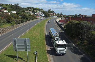
The Bass Highway is a highway in Tasmania, Australia. It is a part of the National Highway, designated as National Highway 1 and connects the major cities across the north of the state - Burnie, Devonport and Launceston. The road was named due to its proximity to the Bass Strait.

Westbury, Tasmania Town in Tasmania, Australia

Westbury is a town in the central north of Tasmania, Australia. It lies 30 km west of Launceston on the Bass Highway, and at the 2016 census had a population of approximately 2,000. It is part of, and the headquarters of, the Meander Valley Council area.

Meander, Tasmania Town in Tasmania, Australia

Meander is a rural town in the Meander Valley Council area of northern Tasmania, Australia. In 2001 it had a population of 415, forty percent of whom worked directly in agriculture, many in the dominant industries of grazing of sheep and cattle, and the dairy industry. The surrounding land has been modified by the original Indigenous inhabitants, who turned forest into grassland, and the later settlers, who have created extensive channels for irrigation and drainage. The town is 24 kilometres (15 mi) south of the town of Deloraine, Tasmania and is bisected by the Meander River. It sits between Quamby Bluff and Mother Cummings Peak of the Great Western Tiers mountain range.

Caveside Town in Tasmania, Australia

Caveside is a rural locality in Northern Tasmania, lying between the Great Western Tiers to the south and Mole Creek to the north.

Mole Creek Town in Tasmania, Australia

Mole Creek is a town in the upper Mersey Valley, in the central north of Tasmania, Australia. Mole Creek is well known for its honey and accounts for about 35 percent of Tasmania's honey production.

George Town Council is a local government body in northern Tasmania, situated north of Launceston. The George Town local government area is classified as rural and has a population of 6,754, it encompasses the principal town, George Town, and the nearby localities including Hillwood, Low Head and Pipers River.

City of Launceston Local government area in Tasmania, Australia

Launceston City Council is a local government body in Tasmania, located in the city and surrounds of Launceston in the north of the state. The Launceston local government area is classified as urban and has a population of 65,274, which also encompasses the localities including Lilydale, Targa and through to Swan Bay on the eastern side of the Tamar River.

Hagley, Tasmania Town in Tasmania, Australia

Hagley is a town in Northern Tasmania, Australia, 22 kilometres (14 mi) southwest of Launceston on the Meander Valley Highway. The area was used by the Port Dalrymple—an early name for George Town in Northern Tasmania—Aboriginal Tasmanians until they were driven from their lands by European settlement. Land grants from the 1820s, to William Thomas Lyttleton, William Bryan and Sir Richard Dry, led to the first buildings, and later gazetting of the town in April 1866. Lyttleton was associated with Hagley Hall in England; his naming of his estate led to the town's name, and he is believed to have bequeathed the town's land. Hagley is an agricultural centre sited on largely alluvial soil near the Meander River. As of 2011, the town had a population of 330, most of whom were Australian born. Hagley is remembered as the first site of coursing in Tasmania, which started at Quamby Estate in 1878. The town has had cricket and Australian rules football teams, but it no longer fields teams.

Birralee, Tasmania Town in Tasmania, Australia

Birralee is a locality and small rural settlement in the local government area of Meander Valley, in the Launceston region of Tasmania. It is located about 20 kilometres (12 mi) north of the town of Westbury. Black Sugarloaf Creek, a tributary of the Meander River, forms part of the southern boundary, and part of the eastern boundary runs parallel to Four Springs Creek. The 2016 census determined a population of 182 for the state suburb of Birralee.

Weetah, Tasmania Town in Tasmania, Australia

Weetah is a locality and small rural community in the local government area of Meander Valley, in the Launceston region of Tasmania. It is located about 11 kilometres (6.8 mi) north of the town of Deloraine. The 2016 census determined a population of 44 for the state suburb of Weetah.

Red Hills, Tasmania Town in Tasmania, Australia

Red Hills is a locality and suburb in the local government area of Meander Valley, in the Launceston region of Tasmania. It is located about 7 kilometres (4.3 mi) west of the town of Deloraine. The Meander River forms part of the south-eastern boundary, while its tributary Western Creek forms the remainder. The railway tracks of the Western line pass through the north-eastern corner of the locality, crossing the B12 route at Lemana Junction. The 2016 census determined a population of 120 for the state suburb of Red Hills.

Parkham, Tasmania Town in Tasmania, Australia

Parkham is a locality and small rural community in the local government area of Meander Valley, in the Launceston region of Tasmania. It is located about 24 kilometres (15 mi) north of the town of Deloraine. The 2016 census determined a population of 129 for the state suburb of Parkham.

Bridgenorth, Tasmania Town in Tasmania, Australia

Bridgenorth is a locality and small rural community in the local government area of West Tamar, in the Western Tamar Valley region of Tasmania. It is located about 22 kilometres (14 mi) north-west of the town of Launceston. A small part of the locality is in the Meander Valley Council area. The 2016 census determined a population of 373 for the state suburb of Bridgenorth.

References

  1. 1 2 "3218.0 – Regional Population Growth, Australia, 2016-17: Population Estimates by Local Government Area (ASGS 2017), 2016 to 2017 - Revised". Australian Bureau of Statistics. Australian Bureau of Statistics. 31 August 2018. Retrieved 15 October 2018. Estimated resident population, 30 June 2017.
  2. 1 2 "Agency Details: Meander Valley Council". search.archives.tas.gov.au. Tasmanian Government. Retrieved 11 June 2018.
  3. "Your Council". Meander Valley Council. Retrieved 30 May 2012.
  4. "Council Profile". Meander Valley Council. Retrieved 30 May 2012.
  5. "Local government national report 2014-2015". regional.gov.au. Australian Government. Retrieved 8 June 2018.
  6. Not all localities are suburbs
  7. Australian Bureau of Statistics. "2011 Census QuickStats" . Retrieved 5 April 2016.