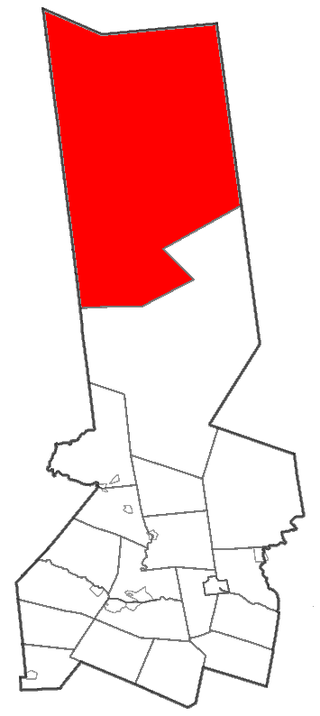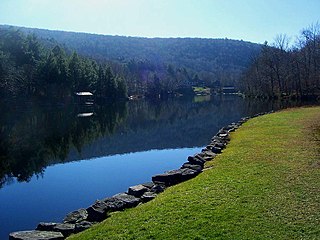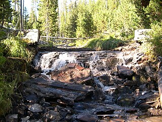
Flathead County is a county located in the U.S. state of Montana. At the 2020 census, its population was 104,357, making it the state's fourth most populous county. Its county seat is Kalispell. Its numerical designation is 7. Its northern border is on the state's north border, making it contiguous with the Canada–US border, facing British Columbia.

Harris County is a county located in the west-central portion of the U.S. state of Georgia; its western border with the state of Alabama is formed by the Chattahoochee River. As of the 2020 census, the population was 34,668. The county seat is Hamilton. The largest city in the county is Pine Mountain, a resort town that is home to the Franklin D. Roosevelt State Park. Harris County was created on December 14, 1827, and named for Charles Harris, a Georgia judge and attorney. Harris County is part of the Columbus, GA-AL metropolitan area and has become a popular suburban and exurban destination of residence for families relocating from Columbus. Because of this, Harris has become the sixth-wealthiest county in Georgia in terms of per capita income and the wealthiest in the state outside of Metro Atlanta.

The Midwestern United States is one of the four census regions defined by the United States Census Bureau. It occupies the northern central part of the United States. It was officially named the North Central Region by the U.S. Census Bureau until 1984. It is between the Northeastern United States and the Western United States, with Canada to the north and the Southern United States to the south.

Evergreen is an unincorporated town, a post office, and a census-designated place (CDP) located in and governed by Jefferson County, Colorado, U.S. The CDP is a part of the Denver–Aurora–Lakewood, CO Metropolitan Statistical Area. The Evergreen post office has the ZIP Codes 80439 and 80437. At the 2020 census, the population of the Evergreen CDP was 9,307. The Evergreen Metropolitan District provides services.

Indian Lake is a town in Hamilton County, New York, United States. The population was 1,352 at the 2010 census. The name is from a lake of the same name that is largely inside the town. There are no permanent stop lights in the town. Law enforcement is provided by New York State Troopers and Hamilton County Sheriff's Office.

Webb is the northernmost town in Herkimer County, New York, United States. As of the 2020 Census it had a population of 1,797.

The Feather River is the principal tributary of the Sacramento River, in the Sacramento Valley of Northern California. The river's main stem is about 73 miles (117 km) long. Its length to its most distant headwater tributary is just over 210 miles (340 km). The main stem Feather River begins in Lake Oroville, where its four long tributary forks join—the South Fork, Middle Fork, North Fork, and West Branch Feather Rivers. These and other tributaries drain part of the northern Sierra Nevada, and the extreme southern Cascades, as well as a small portion of the Sacramento Valley. The total drainage basin is about 6,200 square miles (16,000 km2), with approximately 3,604 square miles (9,330 km2) above Lake Oroville.

Winnisook Lake is an artificial lake located in Oliverea, New York, United States. It is the source of Esopus Creek and the highest lake in the Catskill Mountains at 2,664 feet (812 m) above sea level.

The Fremont–Winema National Forest is a United States National Forest formed from the 2002 merger of the Fremont and Winema National Forests. They cover territory in southern Oregon from the crest of the Cascade Range on the west past the city of Lakeview to the east. The northern end of the forests is bounded by U.S. Route 97 on the west and Oregon Route 31 on the east. To the south, the state border with California forms the boundary of the forests. Klamath Falls is the only city of significant size in the vicinity. The forests are managed by the United States Forest Service, and the national forest headquarters are located in Lakeview.

Umpqua National Forest, in southern Oregon's Cascade Range, covers an area of 983,129 acres (3,978.58 km2) in Douglas, Lane, and Jackson counties, and borders the Crater Lake National Park in Southern Oregon. The four ranger districts for the forest are the Cottage Grove, Diamond Lake, North Umpqua, and Tiller ranger districts. The national forest is managed by the United States Forest Service, headquartered in Roseburg, Oregon in the Pacific Northwest region of the Western United States.
Turtle Mountain Indian Reservation is a reservation located in northern North Dakota, United States. It is the land base for the Turtle Mountain Band of Chippewa Indians. The population of the Turtle Mountain Indian Reservation consists of Plains Ojibwe and Métis peoples; the reservation was established in 1882.

Moneta is a census-designated place (CDP) in southern Bedford County, Virginia, United States. The community is located along Route 122 between the towns of Bedford and Rocky Mount. It is part of the Lynchburg Metropolitan Statistical Area.

The Cedar River is a 38.5-mile-long (62.0 km) river in the central Adirondacks, in Hamilton County, New York. It rises at the outlet of Cedar Lake in the Town of Arietta and flows northeast into the Town of Lake Pleasant, where it passes through the Cedar River Flow. Continuing northeast and east, it passes through the Town of Indian Lake and remote corners of the Towns of Minerva and Newcomb to join the Hudson River northeast of the hamlet of Indian Lake. The Northville-Placid Trail goes past the Cedar Lakes and along the Cedar River to the flow.

Wallface Mountain is a mountain located in Essex County, New York, United States. The mountain is named after the cliff on its southeastern side. Wallface is flanked to the west by MacNaughton Mountain, and faces Mount Marshall to the southeast across Indian Pass.
Indian Mountain Lake is a census-designated place (CDP) in Carbon County and Monroe County, Pennsylvania. It is part of Northeastern Pennsylvania.

Vanderwhacker Mountain is a 3,389-foot-tall (1,033 m) mountain in the Adirondack Mountains region of New York. It is located northeast of Indian Lake and southeast of Newcomb in Essex County. The Vanderwhacker Mountain Fire Observation Station is located on top of the mountain. In May 1911, the Conservation Commission built a wooden fire observation tower on the mountain which was replaced in 1918, with a 35-foot-tall (11 m) metal tower. The tower stopped fire watching operations at the end of the 1988 season.

Rum Hill is a mountain located in Central New York Region of New York northwest of the Hamlet of Pierstown. Red House Hill is located southeast, Metcalf Hill is located south, Allen Lake and Mohegan Hill are located north-northwest and Otsego Lake is located east of Rum Hill.

Dun Brook Mountain is a mountain located in Adirondack Mountains of New York located in the town of Indian Lake east-northeast of Blue Mountain Lake. Tirrell Mountain is located west and Tirrel Pond is located west-southwest of Dun Brook Mountain.
Bell Mountain is a mountain located in Adirondack Mountains of New York located in the Town of Indian Lake east of Indian Lake.

Utsayantha Mountain is a 3,209-foot-tall (978 m) mountain in the Catskill Mountains of New York. It is located east-southeast of Stamford in Delaware County. Variant names include Utsayanthe Mountain, Utsayanthia Mountain, Utsayantho Mountain, and Utsyantha Mountain. McGregor Mountain is located southeast of Utsayantha Mountain and Churchill Mountain is located southwest. Utsayantha Mountain is named after Utsayantha, the daughter of Chief Ubiwacha, chief of the Lenape Indians.


