Millville, Utah

Last updated
Millville, Utah
Cache County Utah incorporated and unincorporated areas Millville highlighted.svg
Location in Cache County and the state of Utah
Coordinates: 41°41′3″N111°49′4″W / 41.68417°N 111.81778°W / 41.68417; -111.81778 Coordinates: 41°41′3″N111°49′4″W / 41.68417°N 111.81778°W / 41.68417; -111.81778
Country United States
State Utah
County Cache
Established1860
Founded byGeorge White Pitkin
Named for A sawmill
Area
[1]
  Total2.51 sq mi (6.49 km2)
  Land2.51 sq mi (6.49 km2)
  Water0.00 sq mi (0.00 km2)
Elevation
[2]
4,616 ft (1,407 m)
Population
 (2020)
  Total2,222
  Estimate 
(2022)
2,300
  Density885.26/sq mi (342.37/km2)
Time zone UTC-7 (Mountain (MST))
  Summer (DST) UTC-6 (MDT)
ZIP code
84326
Area code 435
FIPS code 49-50370 [3]
GNIS feature ID1443496 [2]
Website millvillecity.org

Millville is a city in Cache County, Utah, United States. The population was 2,222 at the 2020 census, [4] with an estimated population of 2,300 in 2022. [5] It is included in the Logan, Utah-Idaho Metropolitan Statistical Area.

Contents

Geography

Millville is located on the southeast side of Cache Valley in northern Utah and is bordered by Providence to the north, Logan to the northwest, and Nibley to the southwest. According to the United States Census Bureau, Millville has a total area of 2.1 square miles (5.5 km2), all land. [4]

Climate

The climate in this area has mild differences between highs and lows, and there is adequate rainfall year-round. According to the Köppen Climate Classification system, Millville has a marine west coast climate, abbreviated "CFB" on climate maps. [6]

History

George White Pitkin built the first log home in Millville, before the settlement was organized or named. He and his sons, Ammon Paul Pitkin and George Orrin Pitkin, built the home in 1859. The family moved into it in late spring 1860. The present location of the home is 136 W. 100 South, in Millville. It became the Pitkin homestead. Church and school were held there. As George White Pitkin was an educated man, he taught until a "proper" church and school were built. Later, the Pitkin family built a two-story rock home with walls 2 feet (0.61 m) thick. George died at the age of 72 on November 26, 1873, and is buried in the Millville cemetery.

Demographics

2020 census

As of the 2020 census, [7] there were 2,326 people, 663 households, and 553 families residing in the city.

2000 census

At the 2000 census, there were 1,507 people, 395 households and 361 families residing in the city. The population density was 642.3 inhabitants per square mile (248.0/km2). There were 405 housing units at an average density of 172.6 per square mile (66.6/km2). The racial makeup of the city was 96.75% White, 0.40% Native American, 0.33% Asian, 1.59% from other races, and 0.93% from two or more races. Hispanic or Latino of any race were 2.12% of the population.

Historical population
CensusPop.Note
1870 402
1880 53934.1%
1890 67926.0%
1900 509−25.0%
1910 62522.8%
1920 409−34.6%
1930 403−1.5%
1940 4398.9%
1950 401−8.7%
1960 364−9.2%
1970 44121.2%
1980 84892.3%
1990 1,20241.7%
2000 1,50725.4%
2010 1,82921.4%
2020 2,22221.5%
2022 (est.)2,3003.5%
U.S. Decennial Census [8]

There were 395 households, of which 59.5% had children under the age of 18 living with them, 83.5% were married couples living together, 6.3% had a female householder with no husband present, and 8.4% were non-families. 7.6% of all households were made up of individuals, and 2.8% had someone living alone who was 65 years of age or older. The average household size was 3.82 and the average family size was 4.02.

39.2% of the population were under the age of 18, 12.8% from 18 to 24, 25.3% from 25 to 44, 18.2% from 45 to 64, and 4.6% who were 65 years of age or older. The median age was 23 years. For every 100 females, there were 102.3 males. For every 100 females age 18 and over, there were 103.3 males.

The median household income was $51,513 and the median family income was $52,813. Males had a median income of $32,969 and females $22,500. The per capita income was $13,977. About 2.7% of families and 3.1% of the population were below the poverty line, including 2.2% of those under age 18 and 6.8% of those age 65 or over.

Notable people

Related Research Articles

<span class="mw-page-title-main">Dayton, Idaho</span> City in Idaho, United States

Dayton is a city in Franklin County, Idaho, United States. The population was 463 at the 2010 census. It is part of the Logan, Utah-Idaho Metropolitan Statistical Area.

<span class="mw-page-title-main">Millville, Iowa</span> Unincorporated in Iowa, United States

Millville is an unincorporated town and former city in Clayton County, Iowa, United States. The population was 30 at the 2010 census, up from 23 in the 2000 census, before it became unincorporated.

<span class="mw-page-title-main">Amalga, Utah</span> Town in the state of Utah, United States

Amalga is a town in Cache County, Utah, United States. The population was 488 at the 2010 census. It is included in the Logan, Utah-Idaho (partial) Metropolitan Statistical Area.

<span class="mw-page-title-main">Hyde Park, Utah</span> City in Utah, United States

Hyde Park is a city in north-central Cache County, Utah, United States. The population was 3,833 at the 2010 census, with an estimated population of 4,700 in 2018. It is included in the Logan, Utah-Idaho Metropolitan Statistical Area.

<span class="mw-page-title-main">Hyrum, Utah</span> City in Utah, United States

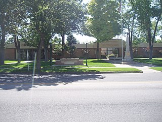
Hyrum is a city in Cache County, Utah. The population was 7,609 at the time of the 2010 census, with an estimated population of 8,403 in 2018. It is included in the Logan metropolitan area.

<span class="mw-page-title-main">Lewiston, Utah</span> City in Utah, United States

Lewiston is a city in Cache County, Utah, United States. It is situated at the northern Utah border and borders the state of Idaho. The population was 1,766 at the 2010 census. It is included in the Logan, Utah-Idaho (partial) Metropolitan Statistical Area.

<span class="mw-page-title-main">Mendon, Utah</span> City in Utah, United States

Mendon is a city in Cache County, Utah, United States. The population was 1,282 at the 2010 census. It is included in the Logan, Utah-Idaho Metropolitan Statistical Area.

<span class="mw-page-title-main">Newton, Utah</span> Town in the state of Utah, United States

Newton is a town in Cache County, Utah, United States. It was founded in 1869 by pioneers of the Church of Jesus Christ of Latter-day Saints. The population was 789 at the 2010 census. It is included in the Logan, Utah-Idaho Metropolitan Statistical Area.

<span class="mw-page-title-main">Nibley, Utah</span> City in Utah, United States

Nibley is a city in Cache County, Utah, United States. Incorporated in 1935, it was named after Charles W. Nibley, a leader in the Church of Jesus Christ of Latter-day Saints. The population was 5,438 at the 2010 census. It is included in the Logan, Utah-Idaho (partial) Metropolitan Statistical Area and is a suburb or 'bedroom' community of Logan.

<span class="mw-page-title-main">River Heights, Utah</span> City in Utah, United States

River Heights is a city in Cache County, Utah, United States. The population was 1,734 at the 2010 census. It is included in the Logan, Utah-Idaho (partial) Metropolitan Statistical Area.

<span class="mw-page-title-main">Smithfield, Utah</span> City in Utah, United States

Smithfield is a city in Cache County, Utah, United States. The population was 9,495 at the 2010 United States Census, with an estimated population of 12,025 in 2019. It is included in the Logan, Utah-Idaho Metropolitan Statistical Area, and is the second largest city in the area after Logan, the county seat. Smithfield is home to one public high school and three public elementary schools.

<span class="mw-page-title-main">Trenton, Utah</span> Town in Utah, United States

Trenton is a town in Cache County, Utah, United States. The population was 464 at the 2010 census. It is included in the Logan, Utah-Idaho (partial) Metropolitan Statistical Area.

<span class="mw-page-title-main">Wellsville, Utah</span> City in Utah, United States

Wellsville is a city in Cache County, Utah, United States. The population was 3,432 at the 2010 census, with an estimated population of 3,849 in 2018. It is included in the Logan, Utah-Idaho Metropolitan Statistical Area.

<span class="mw-page-title-main">Hinckley, Utah</span> Town in the state of Utah, United States

Hinckley is a town in Millard County, Utah, United States, in the middle of the Sevier Desert. Irrigation water from the Sevier River, passing nearby, has been used to turn Hinckley into a farming oasis. The mountains that are common in Utah are seen only in the distance, and beyond the reach of the river, a severe desert prevails. The population was 696 at the 2010 census.

<span class="mw-page-title-main">Scipio, Utah</span> Town in the state of Utah, United States

Scipio is a town on the eastern edge of Millard County, Utah, United States. The population was 290 at the 2000 census.

<span class="mw-page-title-main">Moroni, Utah</span> City in Utah, United States

Moroni is a city in Sanpete County, Utah, United States. The population was 1,423 at the 2010 census.
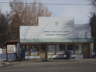
<span class="mw-page-title-main">Hildale, Utah</span> City in Utah, United States

Hildale is a city in Washington County, Utah, United States. The population was 1,127 at the 2020 census.

<span class="mw-page-title-main">La Verkin, Utah</span> City in Utah, United States

La Verkin is a city in Washington County, Utah, United States. The population was 4,060 as of 2010, an increase from 3,392 in 2000. La Verkin is within walking distance of Hurricane, and the two cities have historically had close ties.

<span class="mw-page-title-main">New Harmony, Utah</span> Town in the state of Utah, United States

New Harmony is a town in northern Washington County, Utah, United States. The population was 207 at the 2010 census.

<span class="mw-page-title-main">Rockville, Utah</span> Town in the state of Utah, United States

Rockville is a town in Washington County, Utah, United States. It is located along the Virgin River near the mouth of Zion Canyon. The city lies just outside the park boundary for Zion National Park; the park entrance is located approximately 5 miles (8 km) northeast of the town.
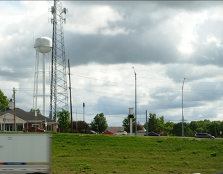
References

  1. "2019 U.S. Gazetteer Files". United States Census Bureau. Retrieved August 7, 2020.
  2. 1 2 U.S. Geological Survey Geographic Names Information System: Millville
  3. "U.S. Census website". United States Census Bureau . Retrieved January 31, 2008.
  4. 1 2 "Geographic Identifiers: 2010 Census Summary File 1 (G001): Millville city, Utah". U.S. Census Bureau, American Factfinder. Archived from the original on February 13, 2020. Retrieved August 7, 2015.
  5. "Population and Housing Unit Estimates" . Retrieved December 31, 2019.
  6. Climate Summary for Millville, Utah
  7. Bureau, US Census. "Census.gov". Census.gov. Retrieved 2023-04-25.
  8. "Census of Population and Housing". Census.gov. Retrieved June 4, 2015.