
Indian Lake is a town in Hamilton County, New York, United States. The population was 1,352 at the 2010 census. The name is from a lake of the same name that is largely inside the town. There are no permanent stop lights in the town. Law enforcement is provided by New York State Troopers and Hamilton County Sheriff's Office.

Morehouse is a town in Hamilton County, New York, United States. The population was 92 at the 2020 census. The name is that of an early developer, Andrew K. Morehouse.

Webb is the northernmost town in Herkimer County, New York, United States. As of the 2020 Census it had a population of 1,797.

Moosehead Lake is a deep, coldwater lake located in Piscataquis County in Northwestern Maine. It is the largest lake in Maine and the largest lake wholly within New England, the second-largest lake in New England after Lake Champlain, and the largest mountain lake in the eastern United States. Situated in the mostly undeveloped Longfellow Mountains, the lake is the source of the Kennebec River. Several rural Townships border the lake. Greenville is by far the largest town on the lake, with a small downtown area that has banks, shops, and restaurants. There are over 80 islands in the lake, the largest being Sugar Island and Deer Island to the west being the second largest.
The Bighorn National Forest is a U.S. National Forest located in northern Wyoming, United States and consists of over 1.1 million acres (4,500 km2). Created as a US Forest Reserve in 1897, it is one of the oldest government-protected forest lands in the U.S. The forest is well east of the continental divide and extends from the Montana border for a distance of 80 miles (130 km) along the spine of the Bighorn Mountains, an outlying mountain range separated from the rest of the Rocky Mountains by Bighorn Basin. Elevations range from 5,000 feet (1,500 m) along the sagebrush and grass-covered lowlands at the foot of the mountains, to 13,189 feet (4,020 m) on top of Cloud Peak, the highest point in the Bighorn Mountains. Around 99% of the land is above 1,500 metres (4,900 ft). The forest is named after the Bighorn River, which is partially fed by streams found in the forest. Streams in the range are fed primarily by snowmelt and snowmelt mixed with driving rainfall.

Treaty 2 was entered in to on 21 August 1872 at Manitoba House, Rupertsland, with representatives of the Queen of Great Britain and Ireland. The original Anishinaabe, who were present, constitute Treaty 2 today. It is known that many of the chiefs and leaders within the territory were at the early gathering and after the treaty was agreed to. Those who were not present were represented through Metis until they indicated where they wished their farming reserves to be established. The treaty reaffirmed the inherent rights that the Anishinaabe had prior to European contact, located where southwestern Manitoba is today and a small part of southeastern Saskatchewan.
Highway 2 is a provincial highway in the Canadian province of Saskatchewan. It is the longest highway in Saskatchewan at 809 km (503 mi). The highway has a few divided sections but is mostly undivided. However, only about 18 kilometres (11 mi) near Moose Jaw, 11 kilometres (7 mi) near Chamberlain, and 21 kilometres (13 mi) near Prince Albert are divided highway. Highway 2 is a major north-south route beginning at the Canada–US border at the Port of West Poplar River and Opheim, Montana customs checkpoints. Montana Highway 24 continues south. It passes through the major cities of Moose Jaw in the south and Prince Albert in the north. Highway 2 overlaps Highway 11 between the towns of Chamberlain and Findlater. This 11 kilometres (7 mi) section of road is a wrong-way concurrency. The highway ends at La Ronge, where it becomes Highway 102.

The Umatilla National Forest, in the Blue Mountains of northeast Oregon and southeast Washington, covers an area of 1.4 million acres (5,700 km2). In descending order of land area the forest is located in parts of Umatilla, Grant, Columbia, Morrow, Wallowa, Union, Garfield, Asotin, Wheeler, and Walla Walla counties. More than three-quarters of the forest lies in the state of Oregon. Forest headquarters are located in Pendleton, Oregon. There are local ranger district offices in Heppner and Ukiah in Oregon, and in Pomeroy and Walla Walla in Washington.
Big Moose Mountain, previously named Big Squaw Mountain, is a mountain located in Piscataquis County, Maine. Big Moose Mountain is flanked to the southeast by Little Moose Mountain.
The West Canada Lake Wilderness Area is an Adirondack Park Forest Preserve management unit in the State of New York, USA.
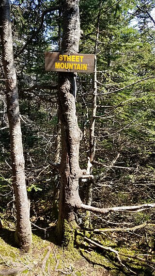
Street Mountain is a mountain located in Essex County, New York, named after Alfred Billings Street (1811–1881), a poet and New York State Librarian. The mountain is the high point of the Street Range of the Adirondack Mountains. Street's northeast ridge is Nye Mountain.

The Moose River Plains Wild Forest is a 64,322-acre tract in the Adirondack Park in Hamilton and Herkimer counties in the state of New York in the United States of America; it is designated as Wild Forest by the New York State Department of Environmental Conservation.
Indian Lake is a 12-mile (19 km) long, 4,255-acre (1,722 ha) reservoir with a southwest to northeast orientation in the towns of Indian Lake and Lake Pleasant in Hamilton County, in the Adirondack Park of New York State, in the United States. The hamlet of Indian Lake is located 2 miles (3.2 km) north of the north end of Indian Lake. New York State Route 30 runs along the west shore of the lake. Most of the shore is part of the Forest Preserve. Indian Lake is fed by the Jessup River, and drains through the Indian River into Lake Abanakee, and from there through the Indian River to the Hudson River.

Bear Lake National Wildlife Refuge is located in southeast Idaho, seven miles (11 km) south of Montpelier. Surrounded by mountains, it lies in Bear Lake Valley at an elevation ranging from 5,925 feet (1,806 m) on the marsh to 6,800 feet (2,100 m) on the rocky slopes of Merkley Mountain. The refuge office is located in Montpelier.

Grays Lake National Wildlife Refuge is a National Wildlife Refuge of the United States located in southeastern Idaho. It has the largest hardstem bulrush marsh in North America. Located in a high mountain valley near Soda Springs, the refuge and surrounding mountains offer scenic vistas, wildflowers, and fall foliage displays. Lands adjacent to the 19,400-acre (79 km2) refuge are primarily wet meadows and grasslands. The refuge provides breeding habitat for species of mammals including moose, elk, mule deer, muskrat, badger, and weasel.

Moose Mountain is an 8-mile (13 km)-long ridge located in the eastern part of the town of Hanover in Grafton County, New Hampshire. The mountain is flanked to the north by Holts Ledge, at 2,110 feet (640 m), and to the south by Shaker Mountain, at 1,690 feet (520 m). It is traversed by the Appalachian Trail, a 2,170-mile (3,490 km) National Scenic Trail from Georgia to Maine. Moose Mountain is outside the White Mountain National Forest, but the trail runs through a narrow corridor along the ridge which is administered by the U.S. Forest Service. The trail can be accessed from the south along Three Mile Road in Hanover, and from the north along Goose Pond Road in Lyme, New Hampshire.
Deer Mountain Campground is located on U.S. Route 3 in 1,648-acre (6.67 km2) Connecticut Lakes State Forest in Pittsburg, New Hampshire. Activities include camping, picnicking, canoeing and fishing. The campground is adjacent to the Connecticut River between Second and Third Connecticut Lakes and is just five minutes south of the Canadian border. There are 25 primitive sites. The area is known for moose watching.
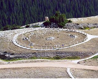
Bell Mountain is a mountain located in Adirondack Mountains of New York located in the Town of Indian Lake east of Indian Lake.
Moose Mountain Upland, Moose Mountain Uplands, or commonly Moose Mountain, is a hilly plateau located in the south-east corner of the Canadian province of Saskatchewan, that covers an area of about 13,000 square kilometres (5,000 sq mi). The upland rises about 200 metres (660 ft) above the broad, flat prairie which is about 600 metres (2,000 ft) above sea level. The highest peak is "Moose Mountain" at 830 metres (2,720 ft) above sea level. The upland was named Moose Mountain because of the large number of moose that lived in the area. When it was originally used by fur traders, Métis, and the Indigenous peoples, the plateau was called Montagne a la Bosse, which is French for "The Mountain of the Bump or Knob".

Moose Mountain Creek is a river in the Canadian province of Saskatchewan. Its source is the Chapleau Lakes near Montmartre and it is a tributary of the Souris River, which, in turn, is a tributary of the Assiniboine River. The whole system is part of the Red River watershed, which is part of the Hudson Bay drainage basin and in a region called the Prairie Pothole Region of North America, which extends throughout three Canadian provinces and five U.S. states. It is also within Palliser's Triangle and the Great Plains ecoregion.

