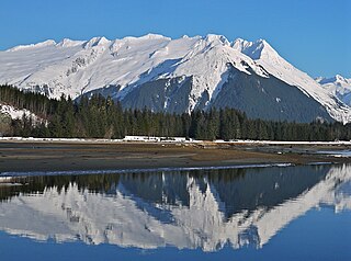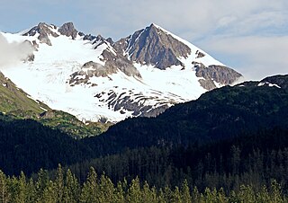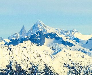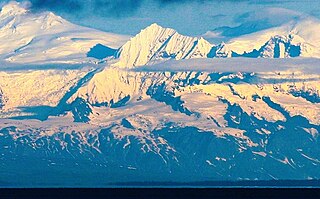
Mount Foresta is an 11,000+ ft multi-peak massif located in Wrangell–St. Elias National Park, in the Saint Elias Mountains of Alaska in the United States. Rising high above the lower western margin of the Hubbard Glacier, the summit of Mount Foresta is just over nine miles (14 km) from tidewater at Disenchantment Bay, 12 mi (19 km) northwest of Mount Seattle, 14.5 mi (23 km) southeast of Mount Vancouver, and 46 mi (74 km) north of Yakutat.

Mount Alice is a 5,318-foot (1,621 m) mountain summit in the U.S. state of Alaska.

Mount Bayard is a 1,999-metre (6,558 ft) glaciated mountain located in the Boundary Ranges on the international boundary line of Alaska and British Columbia. It is situated 22 kilometres (14 mi) north-northwest of Stewart, 10 km (6 mi) southeast of Mount White-Fraser, and 3.4 km (2 mi) east of Mount Lindeborg, which is its nearest higher peak. Precipitation runoff from the peak and meltwater from the Boundary and Salmon Glaciers that surround the peak drains into the Salmon River. Weather permitting, the mountain can be seen from the gravel Granduc Mine Road at Hyder, Alaska.

Mount La Perouse is a 10,728-foot glaciated mountain summit located in the Fairweather Range of the Saint Elias Mountains, in southeast Alaska, United States. The peak is situated in Glacier Bay National Park, 4 mi (6 km) southeast of Mount Dagelet, 7.6 mi (12 km) south-southeast of Mount Crillon which is the nearest higher peak, and 28.6 mi (46 km) southeast of Mount Fairweather, which is the highest peak in the Fairweather Range. Topographic relief is significant as the mountain rises up from tidewater in less than nine miles. The mountain was named in 1874 by William Healey Dall of the U.S. Geological Survey, for Jean-François de Galaup, comte de Lapérouse (1741–1788), a French navigator who explored this coastal area in 1786. The first ascent of the peak was made in 1953 by USGS party consisting of James Seitz, Karl Stauffer, Rowland Tabor, Rolland Reid, and Paul Bowen. On February 16, 2014, a colossal 68 million ton landslide broke free from the flanks of Mt. La Perouse and flowed nearly 4.6 miles from where it originated. The months May through June offer the most favorable weather for climbing and viewing.

Mount Bertha is a 10,204-foot (3,110-meter) glaciated mountain summit located in the Fairweather Range of the Saint Elias Mountains, in southeast Alaska, United States.

Mount Ernest Gruening is a 6,015+ ft glaciated mountain summit located in the Boundary Ranges of the Coast Mountains, in the U.S. state of Alaska. The long ridge-like mountain is situated between the Herbert Glacier and Eagle Glacier at the west edge of the Juneau Icefield, 20 mi (32 km) northwest of Juneau, Alaska, and 8 mi (13 km) east of Favorite Channel, on land managed by Tongass National Forest. Although modest in elevation, relief is significant since the east face of the mountain rises over 3,500 feet above the Herbert Glacier in less than one mile, and the west aspect rises 5,800 feet above the Eagle River valley in two miles.

Mount Huxley is a 12,216-foot glaciated mountain summit located in the Saint Elias Mountains of Wrangell-St. Elias National Park and Preserve, in the U.S. state of Alaska. The remote peak is situated 75 mi (121 km) northwest of Yakutat, and 8.7 mi (14 km) west-northwest of Mount Saint Elias. The peak rises above the Columbus Glacier and Bagley Icefield to its north, the Tyndall Glacier to the south, and the Yahtse Glacier to the west. Precipitation runoff from the mountain drains into the Gulf of Alaska. The mountain was named in 1886 by English mountaineer Harold Ward Topham for Thomas Henry Huxley (1825-1895), an English biologist. The mountain was officially named Huxley Peak in 1917, but the name was officially changed to Mount Huxley in 1968 by the U.S. Board on Geographic Names. The first ascent of the peak was made June 9, 1996 by Paul Claus who landed his plane at 11,500 feet elevation on the western flank and climbed the remaining distance to the summit. The second ascent of Mt. Huxley, and first complete ascent from base to summit, was made in June 2018 by Scott Peters, Andrew Peter, and Ben Iwrey starting from the Columbus Glacier.

Phoenix Peak is a 5,187-foot (1,581 m) mountain summit located in the Kenai Mountains, on the Kenai Peninsula, in the U.S. state of Alaska. The peak is situated in Kenai Fjords National Park, 2 mi (3 km) southwest of Mount Benson, 1.1 mi (2 km) northwest of Marathon Mountain, and 3.5 mi (6 km) west of Seward, Alaska. Precipitation runoff from the mountain and meltwater from its glaciers drains into tributaries of the Resurrection River. The first ascent of the peak was made July 23, 1964, by Don Stockard of the Mountaineering Club of Alaska. The peak was named in 1965 by the Mountaineering Club of Alaska for the first ship ever built in Russian America, the Phoenix, which was constructed in 1794 by Russians in nearby Resurrection Bay. The mountain's toponym was officially adopted in 1966 by the United States Geological Survey.

Mount Stepo is a 3,828-foot-elevation (1,167-meter) mountain summit in Alaska.

Mount Emmerich is a 6,877-foot-elevation (2,096-meter) mountain summit in Alaska.

Mount Eva is a 5,019-foot-elevation (1,530-meter) mountain summit in Alaska, United States.

Mount Burkett is a 9,730-foot-elevation (2,966-meter) mountain summit in Alaska, United States.

Mount Gerdine is an 11,258-foot-elevation (3,431-meter) mountain summit in Alaska.

The Rowel is a 9,806-foot-elevation (2,989-meter) mountain summit in Alaska.

Mount Chichantna is a 10,893-foot-elevation (3,320-meter) mountain summit in Alaska.

Mount Skarland is a 10,375-foot-elevation (3,162-meter) mountain summit in Alaska, United States.

Mount Geist is a 10,716-foot-elevation (3,266-meter) mountain summit in Alaska, United States.

Mount Adolph Knopf is a 6,200-foot-elevation (1,890-meter) glaciated mountain summit located in the Boundary Ranges of the Coast Mountains, in the U.S. state of Alaska. It is situated 28 miles (45 km) north-northwest of Juneau to the western side of the Juneau Icefield, on land managed by Tongass National Forest. Topographic relief is significant as the summit rises 2,200 feet (670 m) above the Eagle Glacier in 0.5 mi (0.80 km) and 3,800 feet (1,158 m) above the Thiel Glacier in 1.25 mi (2.01 km). Precipitation runoff from the mountain's slopes drains to Lynn Canal.
Mount Ogilvie is a 7,867-foot-elevation (2,398-meter) mountain summit located on, and in part defining, the international border between Alaska, United States, and British Columbia, Canada.

Mount Leland is a 7,810-foot-elevation (2,380-meter) glaciated mountain summit located in the Boundary Ranges of the Coast Mountains, in the U.S. state of Alaska. It is situated 27 miles (43 km) southeast of Skagway along the western edge of the Juneau Icefield, on land managed by Tongass National Forest. Topographic relief is significant as the summit rises 4,400 feet (1,340 m) above the Meade Glacier in 1.25 mi (2.01 km). Precipitation runoff and glacial meltwater from the mountain drains to Lynn Canal via the Katzehin River. Mount Leland's toponym was officially adopted in 1972 by the U.S. Board on Geographic Names to commemorate surveyor Ora Miner Leland (1876–1962), who led the International Boundary Commission Party of 1907. The peak rises a little over four miles (6.4 km) from the US–Canada boundary.


