
The Santa Rita Mountains, located about 65 km (40 mi) southeast of Tucson, Arizona, extend 42 km (26 mi) from north to south, then trending southeast. They merge again southeastwards into the Patagonia Mountains, trending northwest by southeast. The highest point in the range, and the highest point in the Tucson area, is Mount Wrightson, with an elevation of 9,453 feet, The range contains Madera Canyon, one of the world's premier birding areas. The Smithsonian Institution's Fred Lawrence Whipple Observatory is located on Mount Hopkins. The range is one of the Madrean sky islands.
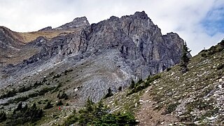
Mount Cory is a mountain located in the Bow River Valley in southeast Banff National Park, just north of Banff, Alberta, Canada. The mountain was named in 1923 after William Wallace Cory, deputy minister of the Interior from 1905 to 1930.

Mount Frissell, 2,454 feet (748 m), which straddles the border of southwest Massachusetts and northwest Connecticut, is a prominent peak of the Taconic Range.
Mount Moriah is a mountain located in Coos County, New Hampshire. The mountain is part of the Carter-Moriah Range of the White Mountains, which runs along the northern east side of Pinkham Notch. The summit is approximately 5 miles (8 km) southeast of the center of the town of Gorham. Mount Moriah is flanked to the northeast by Middle Moriah Mountain and to the southwest by Imp Mountain. The summit is located on the Appalachian Trail and affords views in all directions.

Mount Tom is a mountain located in Grafton County, New Hampshire, about 1.5 miles (2.4 km) southwest of the height of land of Crawford Notch.

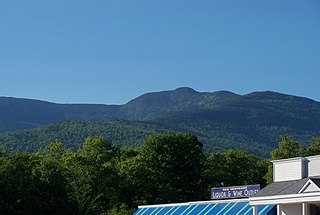
Mount Nonotuck, 827 feet (252 m), is the northernmost peak of the Mount Tom Range of traprock mountains located in the Connecticut River Valley of Massachusetts and part of the larger Metacomet Ridge which stretches from Long Island Sound to nearly the Vermont border. Rugged and considered scenic, the peak rises steeply from the river valley 700 feet (210 m) below. It is located within the town of Holyoke.
Mount Sherrill is a mountain located in Greene County, New York, and is named after Eliakim Sherrill, and is part of the Catskill Mountains. Mount Sherrill is flanked to the east by North Dome, and to the west by Balsam Mountain.
White Rock, 2,550 feet (780 m), is the high point on a 7 mi (11 km) ridgeline in the Taconic Mountains. The ridge is located in the tri-state corner of New York, Massachusetts, and Vermont in the towns of Petersburgh, Williamstown, and Pownal. The ridge has several distinct knobs; those with names are, from south to north: White Rocks, 2,365 feet (721 m); Smith Hill, 2,330 feet (710 m); White Rock, the high point 2,550 feet (780 m); and Bald Mountain 2,485 feet (757 m). The Snow Hole, located along the ridgeline between Bald Mountain and the White Rock, is a crevasse in which snow can be found well into the summer.

Wallface Mountain is a mountain located in Essex County, New York. The mountain is named after the cliff on its southeastern side. Wallface is flanked to the west by MacNaughton Mountain, and faces Mount Marshall to the southeast across Indian Pass.

Mount Sarbach is a mountain located in Banff National Park between Mistaya River and Howse River and is visible from the Icefields Parkway. The mountain is named after Peter Sarbach, a mountain guide from Switzerland, who guided the first ascent by J. Norman Collie and G.P. Baker in 1897. Mount Sarbach is situated south of Saskatchewan River Crossing, where the Icefields Parkway intersects with the David Thompson Highway.

Mount Tantalus is a 2,608-metre (8,556-foot) mountain in southwestern British Columbia, Canada, located 24 km (15 mi) southeast of Falk Lake and 134 km (83 mi) south of Monmouth Mountain. It is the highest mountain in the Tantalus Range of the Pacific Ranges and is famous for its snow-covered face.

Mount Thomlinson is a mountain in the Babine Range of the Skeena Mountains in northern British Columbia, Canada, located at the head of Thomlinson Creek, southeast of the junction of Babine River and Skeena River and north of Hazelton. It has a prominence of 1,661 m (5,449 ft), created by the Babine-Stuart Pass, thus making it one of Canada's many Ultra peaks. Thomlinson is one of the most isolated mountains of Canada.

The Moccasin Mountains is an 11-mile-long (18 km) mountain range located at the Arizona–Utah border in Mohave County, Arizona, and a small north section in Kane County, Utah.

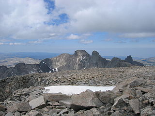
Mount Herard is a high and prominent mountain summit in the Sangre de Cristo Range of the Rocky Mountains of North America. The 13,345-foot (4,068 m) thirteener is located in the Sangre de Cristo Wilderness of Great Sand Dunes National Preserve, 15.0 miles (24.1 km) southeast of the Town of Crestone in Saguache County, Colorado, United States.
Mount Woolsey is located in the Bighorn Mountains in the U.S. state of Wyoming. The peak is the third highest in the range after Cloud Peak, which is only 1.3 miles (2.1 km) to the south, and the summit is located in the Cloud Peak Wilderness of Bighorn National Forest. Black Tooth Mountain, the second highest mountain in the Bighorns, is an adjacent summit only .20 mi (0.32 km) to the northwest. Mount Woolsey is on a knife-like ridge known as an arête and is connected to both Black Tooth Mountain and Cloud Peak by this ridge. Along the arête is another mountain peak known as The Innominate. A small glacier lies below the arête to the southeast of Mount Woolsey.

Mount Markham is a mountain in the Central New York region of New York. It is located southeast of Unadilla Forks, New York. On 1903 topographic maps it appears as "Fork Mountain", due to its proximity to the fork of the Unadilla River.
Mount Tom is a mountain in the Central New York region of New York. It is located north of Springfield Four Corners, New York.
Mount Pisgah is a mountain located in the Catskill Mountains of New York north of Windham. Steenburg Mountain is located northwest, Richtmyer Peak is located west, and Mount Nebo is located southeast of Mount Pisgah.

Mount Lougheed is a 3,107-metre (10,194-foot) triple-peak mountain located between Spray Lakes Reservoir and the Wind Valley of Kananaskis Country in the Canadian Rockies of Alberta, Canada. The highest summit is known as Peak 2. Peak 1 to the northwest is 3080 metres. Peak 3 to the southeast is 3010 metres. The nearest higher peak is Wind Mountain, 2.0 km (1.2 mi) to the southeast. Mount Lougheed is a conspicuous landmark that can be seen from Highway 1, the Trans-Canada Highway at Dead Man's Flats which is east of Canmore.

Mount Tom White is a prominent 11,191-foot glaciated mountain summit located in the Chugach Mountains, in the U.S. state of Alaska. The remote peak is situated on land managed by Chugach National Forest, 72 mi (116 km) northeast of Cordova, and 20 mi (32 km) north of the Bering Glacier, North America's largest glacier. The mountain lies within the Copper River drainage basin, and is the eighth-highest major peak in the Chugach Mountains. Topographic relief is significant as it ranks 17th in prominence for all peaks in Alaska, and 52nd for all North America peaks.. The first ascent of the mountain was made in 1973 by Story Clark, Chris Hall, Tom Kizzia, William Resor, Sarah Robey, and Don White.

