The Western Maine Lakes and Mountains region spans most of Maine's western border with New Hampshire. A small part of the scenic White Mountain National Forest is located in this area. The region consists of Oxford County, Androscoggin County, Franklin County, as well as northern York and interior Cumberland Counties. The largest cities in the region are Lewiston and Auburn. Notable towns include Bethel, Bridgton, Oxford, Rangeley, and Rumford. Many of the state's highest peaks are located in the region, although the highest, Mount Katahdin, is not.
Sugarloaf Mountain is a small mountain and park about 10 miles (16 km) south of Frederick, Maryland, USA. The closest village is Barnesville, located just over one mile from the foot of the mountain. The peak of this relatively low mountain is approximately 800 feet higher than the surrounding farmland. It is visible from many parts of northern Montgomery County and southern Frederick County, notably from I-270 north of the town of Germantown. Because of its geological and natural history interest, it was designated a National Natural Landmark in 1969. It is a notable example of an admission-free, privately owned scenic park.

The Hudson Highlands are mountains on both sides of the Hudson River in New York state lying primarily in Putnam County on its east bank and Orange County on its west. They continue somewhat to the south in Westchester County and Rockland County, respectively.

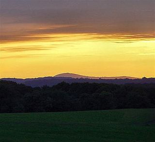
Sugarloaf Mountain is a ski mountain located in Carrabassett Valley, Franklin County, Maine. It is the third highest peak in the state, after Mount Katahdin's Baxter and Hamlin peaks. Sugarloaf is flanked to the south by Spaulding Mountain.

Perky is a ghost town in Monroe County, Florida, United States. It is located in the lower Florida Keys on Lower Sugarloaf Key near mile marker 17 on US 1.

Sugarloaf Hill is a 785 ft (239 m) peak along the Hudson River in Putnam County, New York, part of the Hudson Highlands. It was named by the Dutch for its resemblance in outline to a sugarloaf when sailing up the river towards it.

Sugarloaf Ridge State Park is a state park in Northern California, U.S.A.. Located in the Mayacamas Mountains north of Kenwood, the park straddles the boundary between Sonoma and Napa counties. The park contains the 2,729-foot (832 m) Bald Mountain and the headwaters of Sonoma Creek including a 25-foot (8 m) tall seasonal waterfall. The park is also home to the volunteer-run Robert Ferguson Observatory. Camping, picnicking, horseback riding, mountain biking, stargazing, fishing and hiking are common attractions of Sugarloaf. The park boasts 25 miles of trails with trails ranging from less than a mile to 8.8 miles, and elevation gains reaching 2,500 feet.

Sugarloaf Mountain or Mount Sugarloaf, is a butte-like mountain located in South Deerfield, Massachusetts, United States, with two summits, North Sugarloaf Mountain 791 ft (241 m) and its more popular knee, South Sugarloaf Mountain 652 ft (199 m). Its cliffs, made of arkose sandstone, are a very prominent landscape feature visible for miles. Despite low elevations relative to the Berkshire Mountains to the west, dramatic cliff faces and a rise of 500 feet (150 m) to 600 feet (180 m) from the nearby Connecticut River make the mountain a popular tourist and hiking destination. Sugarloaf Mountain is the southern terminus of the Pocumtuck Range.
A sugarloaf is refined sugar in the form of a rounded cone, the most common way of distributing sugar until the late 19th century.

Twin Mountain is a mountain located in Greene County, New York. Twin gets its name from its two summits; the lower, 3,590-ft (1,090 m) peak is about .5 miles (0.8 km) to the southeast of the higher. The mountain is part of the Devil's Path range of the Catskill Mountains. To the northwest, Twin Mtn. is separated from Sugarloaf Mountain by Pecoy Notch; to the southeast, Twin Mtn. is separated from Indian Head Mountain by Jimmy Dolan Notch.

Sugarloaf Mountain is a mountain located in Greene County, New York. The mountain is part of the Devil's Path range of the Catskill Mountains. To the northwest, Sugarloaf is separated from Plateau Mountain by Mink Hollow Notch; to the southeast, Sugarloaf is separated from Twin Mountain by Pecoy Notch.

Plateau Mountain is located in the town of Hunter in Greene County, New York, United States. It is part of the Devil's Path range of the Catskill Mountains. Plateau has a two-mile-long (3.2 km) summit ridge above 3,500 feet (1,100 m). The highest point, at least 3,840 feet (1,170 m), is at the southeast end, facing Sugarloaf Mountain to the east across Mink Hollow Notch. It is the 12th-highest peak in the range Devils Tombstone is located west of Plateau Mountain. The northwest end faces Hunter Mountain to the west across 1,400-foot deep (430 m) Stony Clove Notch.

Sugarloaf Mountain is a 1,348-foot (411 m) mountain located in Rowan County, Kentucky, just outside the City of Morehead, Kentucky.
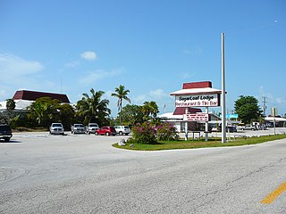
Sugarloaf Shores is an unincorporated community in Monroe County, Florida, United States, located in the lower Florida Keys on Lower Sugarloaf Key near mile marker 17 on US 1.

Sugarloaf Mills, formerly Discover Mills, is a 1,183,000-square-foot (109,900 m2) single story shopping mall in suburban Atlanta, located in Gwinnett County, Georgia. Opened in 2001, it is the largest outlet mall in Georgia. The mall features 13 anchors, over 150 specialty retailers as well as a variety of theme restaurants, casual dining and entertainment venues.

Sugarloaf Mountain is a 900-foot (270 m) peak located in the town of Fishkill near the Hudson River and Breakneck Ridge. One of several similarly named mountains in the U.S. state of New York, it is part of the Hudson Highlands, located entirely within Hudson Highlands State Park.

Sugarloaf Mountain is a summit located in Central New York Region of New York located in the Town of Ohio in Herkimer County, north of Atwell.
Sugarloaf Mountain is a summit located in Central New York Region of New York located in the Town of Webb in Herkimer County, northeast of Old Forge.

Sugarloaf Mountain is a mountain in Sullivan County, New York. It is located northeast of Grahamsville. Denman Mountain is located west-northwest, Kalonymus Escarpment is located south-southeast, and South Hill is located south-southwest of Sugarloaf Mountain.

