National Register of Historic Places listings in Valley County, Idaho

Last updated

Location of Valley County in Idaho Map of Idaho highlighting Valley County.svg
Location of Valley County in Idaho

This is a list of the National Register of Historic Places listings in Valley County, Idaho.

Contents

This is intended to be a complete list of the properties and districts on the National Register of Historic Places in Valley County, Idaho, United States. Latitude and longitude coordinates are provided for many National Register properties and districts; these locations may be seen together in a map. [1]

There are 26 properties and districts listed on the National Register in the county. More may be added; properties and districts nationwide are added to the Register weekly. [2]


    This National Park Service list is complete through NPS recent listings posted October 13, 2023. [3]

Map all coordinates using: OpenStreetMap

Current listings

[4] Name on the Register [5] ImageDate listed [6] Location City or townDescription
1 Big Creek Commissary April 21, 2000
(#00000327)
Yellow Pine in the Payette National Forest
45°08′16″N115°19′08″W / 45.137778°N 115.318889°W / 45.137778; -115.318889 (Big Creek Commissary)
Yellow Pine
2 Braddock Gold Mining and Milling Company Log Building and Forge Ruins September 12, 1985
(#85002157)
Off Pack Trail near Suicide Rock
44°59′21″N115°08′09″W / 44.989167°N 115.135833°W / 44.989167; -115.135833 (Braddock Gold Mining and Milling Company Log Building and Forge Ruins)
Thunder City
3 Cabin Creek Ranch June 27, 1990
(#90000890)
Cabin Creek at its confluence with Big Creek in the Payette National Forest
45°08′14″N114°56′01″W / 45.137222°N 114.933611°W / 45.137222; -114.933611 (Cabin Creek Ranch)
Black Butte
4 Elo School
Elo School Elo School.jpg
Elo School
July 26, 1982
(#82002515)
Southeast of State Highway 55 on Farm to Market Rd.
44°53′10″N116°03′34″W / 44.886111°N 116.059444°W / 44.886111; -116.059444 (Elo School)
McCall
5 Matt N. Hill Homestead Barn
Matt N. Hill Homestead Barn Matt N. Hill Homestead Barn3 NRHP 82000362 Valley County, ID.jpg
Matt N. Hill Homestead Barn
November 17, 1982
(#82000362)
Southeast of McCall
44°53′02″N116°03′26″W / 44.883889°N 116.057222°W / 44.883889; -116.057222 (Matt N. Hill Homestead Barn)
McCall
6 Thomas Jarvi Homestead November 17, 1982
(#82000363)
East of Lake Fork on Finn Rd.
44°49′58″N116°04′49″W / 44.832778°N 116.080278°W / 44.832778; -116.080278 (Thomas Jarvi Homestead)
Lake Fork
7 Johnson Flying Service Hangar
Johnson Flying Service Hangar Johnson Flying Service Hangar2 NRHP 100004675 Valley County, ID.jpg
Johnson Flying Service Hangar
November 20, 2019
(#100004675)
103 S. 3rd St.
44°53′51″N116°05′47″W / 44.8976°N 116.0965°W / 44.8976; -116.0965 (Johnson Flying Service Hangar)
McCall
8 John G. Johnson (Rintakangas) Homestead
John G. Johnson (Rintakangas) Homestead John G. Johnson Homestead (site) NRHP 82000364 Valley County, ID.jpg
John G. Johnson (Rintakangas) Homestead
November 17, 1982
(#82000364)
Northeast of Lake Fork off Pearson Rd.
44°52′01″N116°02′56″W / 44.866944°N 116.048889°W / 44.866944; -116.048889 (John G. Johnson (Rintakangas) Homestead)
Lake Fork
9 John S. Johnson (Sampila) Homestead
John S. Johnson (Sampila) Homestead John S. Johnson (Sampila) Homestead.JPG
John S. Johnson (Sampila) Homestead
November 17, 1982
(#82000365)
Northeast of Lake Fork off Pearson Rd.
44°51′40″N116°03′33″W / 44.861111°N 116.059167°W / 44.861111; -116.059167 (John S. Johnson (Sampila) Homestead)
Lake Fork
10 John Korvola Homestead
John Korvola Homestead JOHN KORVOLA HOMESTEAD, VALLEY COUNTY, IDAHO.jpg
John Korvola Homestead
November 17, 1982
(#82000366)
Roseberry Rd. and Farm to Market Rd.
44°44′12″N116°04′20″W / 44.736667°N 116.072222°W / 44.736667; -116.072222 (John Korvola Homestead)
Donnelly
11 Charles Koski Homestead
Charles Koski Homestead Charles Koski- Lizzie Koski Maki.jpg
Charles Koski Homestead
November 17, 1982
(#82000367)
Southeast of McCall
44°53′16″N116°05′03″W / 44.887778°N 116.084167°W / 44.887778; -116.084167 (Charles Koski Homestead)
McCall
12 Krassel Ranger Station November 19, 1992
(#92000688)
Along the South Fork of the Salmon River, 11 miles west of Yellow Pine, in the Payette National Forest
44°58′14″N115°43′53″W / 44.970556°N 115.731389°W / 44.970556; -115.731389 (Krassel Ranger Station)
Yellow Pine
13 Gust Laituri Homestead
Gust Laituri Homestead Gust Laituri Homestead (2).JPG
Gust Laituri Homestead
November 17, 1982
(#82000368)
Northeast of Lake Fork off Pearson Rd.
44°51′40″N116°04′41″W / 44.861111°N 116.078056°W / 44.861111; -116.078056 (Gust Laituri Homestead)
Lake Fork
14 Long Valley Finnish Church
Long Valley Finnish Church Finnish Church Lakefork Id.jpg
Long Valley Finnish Church
May 27, 1980
(#80001336)
Southeast of Lake Fork
44°49′05″N116°02′46″W / 44.818056°N 116.046111°W / 44.818056; -116.046111 (Long Valley Finnish Church)
Lake Fork
15 Jacob and Herman Mahala Homestead
Jacob and Herman Mahala Homestead Jacob & Herman Mahala Homestead (1).JPG
Jacob and Herman Mahala Homestead
November 17, 1982
(#82000369)
North of Donnelly
44°43′55″N116°02′42″W / 44.731944°N 116.045°W / 44.731944; -116.045 (Jacob and Herman Mahala Homestead)
Donnelly
16 Jacob Maki Homestead
Jacob Maki Homestead Jacob Maki Homestead NRHP 82001053 Valley County, ID.jpg
Jacob Maki Homestead
November 17, 1982
(#82001053)
Off State Highway 55
44°49′19″N116°05′53″W / 44.821944°N 116.098056°W / 44.821944; -116.098056 (Jacob Maki Homestead)
Donnelly
17 McCall District Administrative Site
McCall District Administrative Site McCall District Administrative Site4 91001892 Valley County, ID.jpg
McCall District Administrative Site
December 30, 1991
(#91001892)
Junction of W. Lake and Mission Sts.
44°54′35″N116°06′21″W / 44.909722°N 116.105833°W / 44.909722; -116.105833 (McCall District Administrative Site)
McCall
18 North Fork Payette River Bridge
North Fork Payette River Bridge North Fork Payette River Bridge (Rainbow Bridge).jpg
North Fork Payette River Bridge
April 2, 1999
(#99000416)
State Highway 55, approximately 2.5 miles north of Smiths Ferry
44°19′32″N116°03′30″W / 44.325556°N 116.058333°W / 44.325556; -116.058333 (North Fork Payette River Bridge)
Smiths Ferry
19 Herman Ojala Homestead November 17, 1982
(#82000370)
Northeast of Lake Fork off Pearson Rd.
44°51′58″N116°04′48″W / 44.866111°N 116.08°W / 44.866111; -116.08 (Herman Ojala Homestead)
Lake Fork
20 Payette Lakes Club
Payette Lakes Club Payette Lakes Club NRHP 100000905 Valley County, ID.jpg
Payette Lakes Club
April 24, 2017
(#100000905)
1858 Warren Wagon Rd.
44°55′26″N116°07′40″W / 44.923953°N 116.127688°W / 44.923953; -116.127688 (Payette Lakes Club)
McCall
21 Rice Meetinghouse
Rice Meetinghouse Rice Meetinghouse2 NRHP 80001337 Valley County, ID.jpg
Rice Meetinghouse
April 9, 1980
(#80001337)
Northeast of McCall
44°55′46″N116°03′50″W / 44.929444°N 116.063889°W / 44.929444; -116.063889 (Rice Meetinghouse)
McCall
22 Matt Ruatsale Homestead
Matt Ruatsale Homestead Matt Ruatsale Homestead (2).JPG
Matt Ruatsale Homestead
November 17, 1982
(#82000371)
North of Kantola Lane
44°49′42″N116°02′44″W / 44.828333°N 116.045556°W / 44.828333; -116.045556 (Matt Ruatsale Homestead)
Lake Fork
23 Southern Idaho Timber Protective Association (SITPA) Buildings
Southern Idaho Timber Protective Association (SITPA) Buildings THE SOUTHERN IDAHO TIIMBER PROTECTION ASSOCIATION BUILDING , VALLEY COUNTY.jpg
Southern Idaho Timber Protective Association (SITPA) Buildings
May 2, 1990
(#90000680)
1001 State St.
44°54′35″N116°06′29″W / 44.909722°N 116.108056°W / 44.909722; -116.108056 (Southern Idaho Timber Protective Association (SITPA) Buildings)
McCall
24 Southern Idaho Timber Protective Association (SITPA) Buildings
Southern Idaho Timber Protective Association (SITPA) Buildings SOUTHERN IDAHO TIMBER PROTECTIVE ASSOCIATION BUILDINGS; VALLEY COUNTY;.jpg
Southern Idaho Timber Protective Association (SITPA) Buildings
May 2, 1990
(#90000681)
State Highway 55
44°18′04″N116°05′21″W / 44.301111°N 116.089167°W / 44.301111; -116.089167 (Southern Idaho Timber Protective Association (SITPA) Buildings)
Smiths Ferry
25 Stibnite Historic District
Stibnite Historic District Stibnite Historic District in 1942.jpg
Stibnite Historic District
July 19, 1987
(#87001186)
United States Forest Service Road 412
44°54′39″N115°20′17″W / 44.910833°N 115.338056°W / 44.910833; -115.338056 (Stibnite Historic District)
Yellow Pine
26 Nickolai Wargelin Homestead
Nickolai Wargelin Homestead Nickolai Wargelin Homestead.jpg
Nickolai Wargelin Homestead
November 17, 1982
(#82000372)
Southeast of McCall
44°53′03″N116°04′05″W / 44.884167°N 116.068056°W / 44.884167; -116.068056 (Nickolai Wargelin Homestead)
McCall

Former listings

[4] Name on the RegisterImageDate listedDate removedLocationCity or townDescription
1 Brown Tie and Lumber Company Mill and Burner December 20, 1978
(#78001103)
January 31, 1986Off ID 55 at Payette Lake
McCall Destroyed by fire.

See also

Related Research Articles

<span class="mw-page-title-main">National Register of Historic Places listings in Adams County, Idaho</span>

This is a list of the National Register of Historic Places listings in Adams County, Idaho.

<span class="mw-page-title-main">National Register of Historic Places listings in Boise County, Idaho</span>

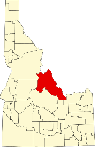
This is a list of the National Register of Historic Places listings in Boise County, Idaho.

<span class="mw-page-title-main">National Register of Historic Places listings in Bear Lake County, Idaho</span>

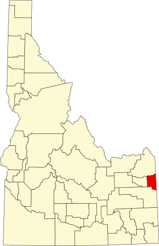
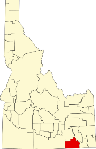
This is a list of the National Register of Historic Places listings in Bear Lake County, Idaho.

<span class="mw-page-title-main">National Register of Historic Places listings in Bannock County, Idaho</span>

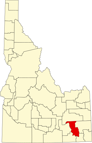
This is a list of the National Register of Historic Places listings in Bannock County, Idaho.

<span class="mw-page-title-main">National Register of Historic Places listings in Bonner County, Idaho</span>

This is a list of the National Register of Historic Places listings in Bonner County, Idaho.

<span class="mw-page-title-main">National Register of Historic Places listings in Butte County, Idaho</span>

This is a list of the National Register of Historic Places listings in Butte County, Idaho.

<span class="mw-page-title-main">National Register of Historic Places listings in Cassia County, Idaho</span>

This is a list of the National Register of Historic Places listings in Cassia County, Idaho.

<span class="mw-page-title-main">National Register of Historic Places listings in Clark County, Idaho</span>

This is a list of the National Register of Historic Places listings in Clark County, Idaho.

<span class="mw-page-title-main">National Register of Historic Places listings in Fremont County, Idaho</span>

This is a list of the National Register of Historic Places listings in Fremont County, Idaho.

<span class="mw-page-title-main">National Register of Historic Places listings in Gem County, Idaho</span>

This is a list of the National Register of Historic Places listings in Gem County, Idaho.

<span class="mw-page-title-main">National Register of Historic Places listings in Jefferson County, Idaho</span>

This is a list of the National Register of Historic Places listings in Jefferson County, Idaho.

<span class="mw-page-title-main">National Register of Historic Places listings in Jerome County, Idaho</span>

This is a list of the National Register of Historic Places listings in Jerome County, Idaho.

<span class="mw-page-title-main">National Register of Historic Places listings in Kootenai County, Idaho</span>

This is a list of the National Register of Historic Places listings in Kootenai County, Idaho.

<span class="mw-page-title-main">National Register of Historic Places listings in Lemhi County, Idaho</span>

This is a list of the National Register of Historic Places listings in Lemhi County, Idaho.

<span class="mw-page-title-main">National Register of Historic Places listings in Lincoln County, Idaho</span>

This is a list of the National Register of Historic Places listings in Lincoln County, Idaho.

<span class="mw-page-title-main">National Register of Historic Places listings in Washington County, Idaho</span>

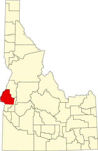
This is a list of the National Register of Historic Places listings in Washington County, Idaho.

<span class="mw-page-title-main">National Register of Historic Places listings in Payette County, Idaho</span>

This is a list of the National Register of Historic Places listings in Payette County, Idaho.

<span class="mw-page-title-main">National Register of Historic Places listings in Teton County, Idaho</span>

This is a list of the National Register of Historic Places listings in Teton County, Idaho.

<span class="mw-page-title-main">National Register of Historic Places listings in Oneida County, Idaho</span>

This is a list of the National Register of Historic Places listings in Oneida County, Idaho.

<span class="mw-page-title-main">National Register of Historic Places listings in Minidoka County, Idaho</span>

This is a list of the National Register of Historic Places listings in Minidoka County, Idaho.

References

  1. The latitude and longitude information provided in this table was derived originally from the National Register Information System, which has been found to be fairly accurate for about 99% of listings. Some locations in this table may have been corrected to current GPS standards.
  2. "National Register of Historic Places: Weekly List Actions". National Park Service . Retrieved March 29, 2009.
  3. National Park Service, United States Department of the Interior, "National Register of Historic Places: Weekly List Actions", retrieved October 13, 2023.
  4. 1 2 Numbers represent an alphabetical ordering by significant words. Various colorings, defined here, differentiate National Historic Landmarks and historic districts from other NRHP buildings, structures, sites or objects.
  5. "National Register Information System". National Register of Historic Places . National Park Service. April 24, 2008.
  6. The eight-digit number below each date is the number assigned to each location in the National Register Information System database, which can be viewed by clicking the number.