Old Natchez Trace segments listed on the National Register of Historic Places

Last updated

Seven segments of the historic Natchez Trace are listed on the National Register of Historic Places (NRHP). Also there are additional NRHP-listed structures and other sites along the Natchez Trace, which served the travelers of the trace and survive from the era of its active use.

Natchez Trace highway in the southern United States

The Natchez Trace, also known as the "Old Natchez Trace", is a historic forest trail within the United States which extends roughly 440 miles (710 km) from Nashville, Tennessee, to Natchez, Mississippi, linking the Cumberland, Tennessee, and Mississippi rivers.

National Register of Historic Places federal list of historic sites in the United States

The National Register of Historic Places (NRHP) is the United States federal government's official list of districts, sites, buildings, structures, and objects deemed worthy of preservation for their historical significance. A property listed in the National Register, or located within a National Register Historic District, may qualify for tax incentives derived from the total value of expenses incurred preserving the property.

Contents

Map all coordinates using: OpenStreetMap  ·  Google Maps
Download coordinates as: KML  ·  GPX

Segments

One segment within Tennessee is named simply "Old Natchez Trace". Additionally, several segments in Mississippi and Alabama are listed with the name "Old Natchez Trace", followed by a secondary identifier in parentheses or by an additional name. These listings are:

Mississippi State of the United States of America

Mississippi is a state located in the southeastern region of the United States. Mississippi is the 32nd most extensive and 34th most populous of the 50 United States. It is bordered by Tennessee to the north, Alabama to the east, the Gulf of Mexico and Louisiana to the south, and Arkansas and Louisiana to the west. The state's western boundary is largely defined by the Mississippi River. Jackson, with a population of approximately 167,000 people, is both the state's capital and largest city.

Alabama State of the United States of America

Alabama is a state in the southeastern region of the United States. It is bordered by Tennessee to the north, Georgia to the east, Florida and the Gulf of Mexico to the south, and Mississippi to the west. Alabama is the 30th largest by area and the 24th-most populous of the U.S. states. With a total of 1,500 miles (2,400 km) of inland waterways, Alabama has among the most of any state.

Old Natchez Trace in Tennessee

Old Natchez Trace
Area 2,800 acres (1,100 ha)
NRHP reference # 75002125 [1]
Added to NRHP May 30, 1975
Old Town (Franklin, Tennessee) archaeological site in Williamson County, Tennessee near Franklin

Old Town is an archaeological site in Williamson County, Tennessee near Franklin. The site includes the remnants of a Native American village and mound complex of the Mississippian culture, and is listed on the National Register of Historic Places (NRHP) as Old Town Archaeological Site (40WM2).

Lawrence County, Tennessee County in the United States

Lawrence County is a county located in the U.S. state of Tennessee. As of the 2010 census, the population was 41,869. Its county seat and largest city is Lawrenceburg.

Hickman County, Tennessee County in the United States

Hickman County is a county located in the U.S. state of Tennessee. As of the 2010 census, the population was 24,690. Its county seat is Centerville.

Old Natchez Trace (132-3T)

Old Natchez Trace (132-3T)
Old Natchez Trace-596.JPG
Nearest city Port Gibson, Mississippi
Coordinates 32°0′10″N90°53′46″W / 32.00278°N 90.89611°W / 32.00278; -90.89611 (Old Natchez Trace (132-3T))
Area 0.89 acres (0.36 ha)
Built 1801
NRHP reference # 76000161 [1]
Added to NRHP November 7, 1976

Old Natchez Trace (132-3T), located northeast of Port Gibson in Claiborne County, Mississippi, about 0.7 miles north of the Mangum Mound Site at milepost 45.7. The site is also known as the Grindstone Ford. It is an original segment of the Natchez Trace. [3]

Port Gibson, Mississippi City in Mississippi, United States

Port Gibson is a city in Claiborne County, Mississippi, United States. The population was 1,567 at the 2010 census. Port Gibson is the county seat of Claiborne County, which is bordered on the west by the Mississippi River. It is the site of the Claiborne County Courthouse.

Claiborne County, Mississippi County in the United States

Claiborne County is a county located in the U.S. state of Mississippi. As of the 2010 census, the population was 9,604. Its county seat is Port Gibson. The county is named after William Claiborne, the second governor of the Mississippi Territory.

Mangum Mound Site

Mangum Mound Site is an archaeological site of the Plaquemine culture in Claiborne County, Mississippi. It is located at milepost 45.7 on the Natchez Trace Parkway. Two very rare Mississippian culture repoussé copper plates have been discovered during excavations of the site. The site was used as a burial mound during the Foster Phase of the culture and is believed to have been abandoned before the 1540 expedition of Hernando de Soto.

The presence of the Natchez Road figured in the May 1, 1863 Battle of Port Gibson. In that battle, Union forces under General Ulysses S. Grant's command, having crossed from the Louisiana side of the Mississippi, below Vicksburg, fought their way through a determined resistance by Confederate forces which at first bottled them up. The Natchez Road was not located by the Union forces early in the battle. Confederate General Bowen was concerned throughout the day's battle that Union forces would locate the Natchez Road and march directly upon Port Gibson, around Bowen's flank. Bowen committed forces to attack the much larger Union forces in order to prevent them from finding it. [4] :27, other Eventually increasing numbers of Union troops threatened to overwhelm the Confederate forces and retreat was ordered, apparently without any flanking action along the Natchez Road taking place. The Union troops occupied Port Gibson on May 2. [4]

The Battle of Port Gibson was fought near Port Gibson, Mississippi, on May 1, 1863, between Union and Confederate forces during the Vicksburg Campaign of the American Civil War. The Union Army was led by Maj. Gen. Ulysses S. Grant, and was victorious.

Ulysses S. Grant 18th president of the United States

Ulysses S. Grant was an American soldier, politician, and international statesman, who served as the 18th president of the United States from 1869 to 1877. During the American Civil War, General Grant, with President Abraham Lincoln, led the Union Army to victory over the Confederacy. During the Reconstruction Era, President Grant led the Republicans in their efforts to remove the vestiges of Confederate nationalism, racism, and slavery.

Old Natchez Trace (170-30)

Old Natchez Trace (170-30)
Nearest city Ridgeland, Mississippi
Coordinates 32°25′27″N90°5′19″W / 32.42417°N 90.08861°W / 32.42417; -90.08861 (Old Natchez Trace (170-30))
Area 0.41 acres (0.17 ha)
Built 1801
NRHP reference # 76000160 [1]
Added to NRHP November 7, 1976

Old Natchez Trace (170-30), a 0.4-acre (0.16 ha) area listed in 1976. It preserves two separate remnants of the old Trace near milepost 104.5 and includes the site of Brashears' Stand, an inn operated by Turner Brashears from 1806 on. [5] It is located just outside the eastern city limits of Ridgeland, Mississippi.

Ridgeland, Mississippi City in Mississippi, United States

Ridgeland is a city in Madison County, Mississippi. The population was 24,047 at the 2010 census. It is part of the Jackson Metropolitan Statistical Area.

Old Natchez Trace (212-3K 213-3K)

Old Natchez Trace (212-3K 213-3K)
Nearest city Kosciusko, Mississippi
Coordinates 33°12′46″N89°27′11″W / 33.21278°N 89.45306°W / 33.21278; -89.45306 (Old Natchez Trace (212-3K 213-3K))
Area 1.1 acres (0.45 ha)
Built 1735
NRHP reference # 76000203 [1]
Added to NRHP November 7, 1976

Old Natchez Trace (212-3K 213-3K), located northeast of Kosciusko in Attala County, Mississippi, near milepost 174.

Old Natchez Trace (230-3H)

Old Natchez Trace (230-3H)
Nearest city Mathiston, Mississippi
Coordinates 33°28′32″N89°12′4″W / 33.47556°N 89.20111°W / 33.47556; -89.20111 (Old Natchez Trace (230-3H))
Area 1.03 acres (0.42 ha)
Built 1801
NRHP reference # 76000159 [1]
Added to NRHP November 7, 1976

Old Natchez Trace (230-3H), located southwest of Mathiston in Choctaw County, Mississippi, near milepost 199. It is located south of Mathiston at Natchez Trace Parkway milepost 198. It is a segment of the Natchez Trace located at a Natchez Trace Parkway interpretive stop. [6]

Old Natchez Trace (310-2A)

Old Natchez Trace (310-2A)
Nearest city Florence, Alabama
Coordinates 34°55′31″N87°50′40″W / 34.92528°N 87.84444°W / 34.92528; -87.84444 (Old Natchez Trace (310-2A))
Area 0.86 acres (0.35 ha)
Built 1801
NRHP reference # 76000156 [1]
Added to NRHP November 7, 1976
Paved portion of site 310-2A, along the left OldNatchezTrace nearThreetAlabama.jpg
Paved portion of site 310-2A, along the left

Old Natchez Trace (310-2A), a 0.86-acre (0.35 ha) area listed in 1976 [7] located 15 miles northwest of Florence, Alabama, off Alabama State Route 20 near milepost 336. It preserves a 400-foot section of the old Natchez Trace that had not been paved as of the mid-1970s, and an 850-foot section that has been paved. [8] The paved portion is part of Lauderdale County's County Route 5. The location is near to, and just southeast of, the Little Zion Church and the Cloverdale School, which in turn are south of the hamlet of Threet, Alabama. Beyond the listed segment, the construction of Highway 20 "obliterated" evidence of the historic Natchez Trace. [8]

Old Natchez Trace and Choctaw Agency Site

Old Natchez Trace and Choctaw Agency Site
Nearest city Ridgeland, Mississippi
Coordinates 32°25′36″N90°10′37″W / 32.42667°N 90.17694°W / 32.42667; -90.17694 (Old Natchez Trace and Choctaw Agency Site)
Area 47 acres (19 ha)
Built 1801
NRHP reference # 94001579 [1]
Added to NRHP December 15, 1994

Old Natchez Trace and Choctaw Agency Site, in Ridgeland, Mississippi located at milepost 100.7. This is located between Interstate 55 and Livingston Rd., west of Ridgeland, in Madison County, Mississippi. It includes a 3.3-mile segment of the Natchez Trace (partially in the Natchez Trace Parkway right of way) and an archeological investigation site at the location that from 1811 to 1823 housed a government agency to the Choctaw. [9]

Also there are additional NRHP-listed structures and other sites along the Natchez Trace. These include:

Boyd Mounds Site Boyd Mounds Site.jpg
Boyd Mounds Site


See also

Related Research Articles

Tipton County, Tennessee County in the United States

Tipton County is a county located on the western end of the U.S. state of Tennessee, in the Mississippi Delta region. As of the 2010 census, the population was 61,081. Its county seat is Covington.

Tishomingo County, Mississippi County in the United States

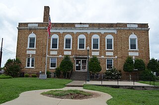
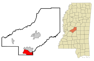
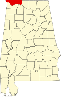
Tishomingo County is a county located in the northeast corner of the U.S. state of Mississippi. As of the 2010 census, the population was 19,593. Its county seat is Iuka.

Chickasaw Campaign of 1736 battle

The Chickasaw Campaign of 1736 consisted of two pitched battles by the French and allies against Chickasaw fortified villages in present-day Northeast Mississippi. Under the overall direction of the governor of Louisiana, Jean-Baptiste Le Moyne de Bienville, a force from Upper Louisiana attacked Ogoula Tchetoka on March 25, 1736. A second force from Lower Louisiana attacked Ackia on May 26, 1736. Both attacks were bloodily repulsed.

Natchez Trace Parkway highway in the United States

The Natchez Trace Parkway is a National Parkway in the southeastern United States that commemorates the historic Old Natchez Trace and preserves sections of the original trail. Its central feature is a two-lane parkway road that extends 444 miles (715 km) from Natchez, Mississippi, to Nashville, Tennessee. Access to the parkway is limited, with more than fifty access points in the states of Mississippi, Alabama, and Tennessee. The southern end of the route is in Natchez at an intersection with Liberty Road, and the northern end is northeast of Fairview, Tennessee, in the suburban community of Pasquo, Tennessee, at an intersection with Tennessee State Route 100. In addition to Natchez and Nashville, the larger cities along the route include Jackson and Tupelo, Mississippi, and Florence, Alabama.

Natchez Trace Trail

The Natchez Trace Trail is a designated National Scenic Trail in the United States, whose route generally follows sections of the 444-mile (715 km) Natchez Trace Parkway through the states of Tennessee, Alabama, and Mississippi. The Natchez Trace Trail is not envisioned as a long, continuous footpath, as is the case with other national scenic trails ; rather, only a limited number of trail segments along the route, currently over 60 miles (97 km) of trail, have been developed for hiking and horseback riding. Moreover, the Natchez Trace Trail, unlike many others that rely heavily on volunteers for trail construction and maintenance, is managed and maintained by the National Park Service. Sections of the trail follow along the Natchez Trace Parkway road shoulder, and cross county and state roads.

John Coffee United States general

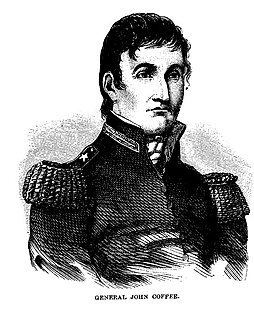
John R. Coffee was an American planter and state militia general in Tennessee. He commanded troops under General Andrew Jackson during the Creek Wars (1813–14) and during the Battle of New Orleans in the War of 1812.

This is a list of properties and districts in Mississippi that are listed on the National Register of Historic Places. There are 1,407 sites distributed among all of Mississippi's 82 counties.

National Register of Historic Places listings in Lauderdale County, Alabama Wikimedia list article

This is a list of the National Register of Historic Places listings in Lauderdale County, Alabama.

Emerald Mound Site archaeological site near Stanton, Mississippi, United States

The Emerald Mound Site, also known as the Selsertown site, is a Plaquemine culture Mississippian period archaeological site located on the Natchez Trace Parkway near Stanton, Mississippi, United States. The site dates from the period between 1200 and 1730 CE. It is the type site for the Emerald Phase of the Natchez Bluffs Plaquemine culture chronology and was still in use by the later historic Natchez people for their main ceremonial center. The platform mound is the second-largest Pre-Columbian earthwork in the country, after Monk's Mound at Cahokia, Illinois.

Buzzard Roost, Alabama Unincorporated community in Alabama, United States

Buzzard Roost is an unincorporated community in Colbert County, Alabama. Buzzard Roost had a post office in the 1850s, but it no longer exists.

National Register of Historic Places listings in Claiborne County, Mississippi Wikimedia list article

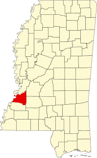
This is a list of the National Register of Historic Places listings in Claiborne County, Mississippi.

National Register of Historic Places listings in Madison County, Mississippi Wikimedia list article

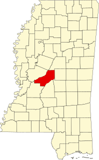
This is a list of the National Register of Historic Places listings in Madison County, Mississippi.

Boyd Mounds Site

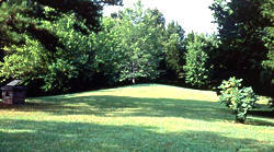
The Boyd Mounds Site (22MD512) is an archaeological site from the Late Woodland and Early Mississippian period located in Madison County, Mississippi near Ridgeland. Many of the mounds were excavated by The National Park Service in 1964. It is located at mile 106.9 on the old Natchez Trace, now the Natchez Trace Parkway. It was added to the NRHP on July 14, 1989 as NRIS number 89000784.

Col. James Drane House

The Col. James Drane House is a frontier I-house built in 1846. It is located on the historic Natchez Trace, at mile marker 180.7 on the modern Natchez Trace Parkway in Mississippi, USA.

John Gordon House

The John Gordon House is a historic brick home located along the Old Natchez Trace near Williamsport, Tennessee, within the boundaries of the Natchez Trace Parkway, a National Park Service unit.

Pharr Mounds

Pharr Mounds is a Middle Woodland period archaeological site located near Tupelo in parts of Itawamba and Prentiss County in northern Mississippi.

Bynum Mound and Village Site

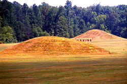
The Bynum Mound and Village Site (22CS501) is a Middle Woodland period archaeological site located near Houston in Chickasaw County, Mississippi. The complex of six burial mounds was in use during the Miller 1 and Miller 2 phases of the Miller culture and was built between 100 BC and 100 AD. It was listed on the National Register of Historic Places in 1989 as part of the Natchez Trace Parkway at milepost 232.4.

Mazique Archeological Site

The Mazique Archeological Site, also known as White Apple Village, is a prehistoric Coles Creek culture archaeological site located in Adams County, Mississippi. It is also the location of the historic White Apple Village of the Natchez people and the Mazique Plantation. It was added to the NRHP on October 23, 1991, as NRIS number 91001529.

References

  1. 1 2 3 4 5 6 7 8 National Park Service (2010-07-09). "National Register Information System". National Register of Historic Places . National Park Service.
  2. Williamson County MRA
  3. William E. Cox (September 9, 1974). "National Register of Historic Places Inventory-Nomination: Old Natchez Trace (No. 132-3T) / Path to Choctaw Nation, Chickasaw Trace, Natchez Trace". National Park Service. (prepared September 9, 1974; received March 25, 1976; entered November 7, 1976) and Accompanying 4 photos, from 1972 and undated
  4. 1 2 Audra Bellmore (1999), National Historic Landmark Nomination: Battle of Port Gibson / Battle of Thompson's Hill / Battle of Magnolia Hills (pdf), National Park Service
  5. William E. Cox (November 9, 1974). "National Register of Historic Places Inventory-Nomination: Old Natchez Trace (No. 170-30) / Path to Choctaw Nation, Chickasaw Trace, Natchez Trace". National Park Service. and Accompanying photo from 1974
  6. Old Natchez Trace (No. 230-3H) (Alternate names: Path to Choctaw Nation, Chickasaw Trace, Natchez Trace), National Register of Historic Places Inventory Nomination Form for Federal Properties, prepared October 1, 1974; received March 25, 1976; entered November 7, 1976
  7. National Park Service (2009-03-13). "National Register Information System". National Register of Historic Places . National Park Service.
  8. 1 2 William E. Cox (October 1, 1974). "National Register of Historic Places Inventory-Nomination: Old Natchez Trace (No. 310-2A) / Road from Natchez to Nashville, Path to Chickasaw Nation, Path to Choctaw Nation, Natchez Trace". National Park Service. and Accompanying photo from 1976, and map
  9. Old Natchez Trace and Choctaw Agency site (Other names: Natchez Trace Section 3P; Old Agency Road; and Choctaw Agency Site 22Md645), National Register of Historic Places Registration Form, November 22, 1994
  10. "Indian Mounds of Mississippi : Boyd Mounds Site". NPS.GOV.