Paulus Hook, Jersey City

Last updated
Essex St in Paulus Hook PaulusHook.JPG
Essex St in Paulus Hook
Downtown Manhattan seen from Paulus Hook NYC Downtown Manhattan Skyline seen from Paulus Hook 2020-02-03 IMG 7987 FRD.jpg
Downtown Manhattan seen from Paulus Hook
Manhattan seen from a skyscraper at Paulus Hook NYC Downtown Manhattan Skyline seen from Paulus Hook 2019-12-20 IMG 7347 FRD.jpg
Manhattan seen from a skyscraper at Paulus Hook

Paulus Hook is a community on the Hudson River waterfront in Jersey City, New Jersey, located one mile across the river from Manhattan. The name Hook comes from the Dutch word "hoeck" which translates into "point of land." This "point of land" has been described as an elevated area, the location of which is today bounded by Montgomery, Hudson, Dudley and Van Vorst Streets. The neighborhood's main street is the north- and south-running Washington Street. The waterfront of Paulus Hook is along the basin of the Morris Canal in a park with a segment of Liberty State Park. The Hudson-Bergen Light Rail has a Paulus Hook stop at Essex Street and the Liberty Water Taxi at Warren Street. The introduction of the light rail and development of office buildings on the Hudson Waterfront have brought more businesses to Morris Street including a number of restaurants with outdoor seating and small neighborhood shops.

Contents

History

Originally the location was called Arressick or Arisheck Island by the earliest settlers after a corrupted Lenape term, possibly from Kaniskeck meaning a long, grassy marsh or meadow. [1]

Colonization

The location was originally part of a tract of land purchased by Michael Pauw, [2] an Amsterdam Burgomaster and Lord of Achttienhoven in 1630 as part of Pavonia. The first settlement at Paulus Hook was in 1633 [3] when the area was an island at high tide. In 1638 it was granted to Pauw's agent, a man named Micheal Paulez (Pauluson, Powles [4] ) who operated an occasional ferry and traded with the local Lenape population. Paulez's name eventually became "Paulus," the name given to the hook jutting into the river and bay. [5] By permission of the Director of New Netherland, Willem Kieft, the land at Paulus Hook was acquired by Abraham Isaacsen Verplanck on May 1, 1638. [6] The Manatus Map of 1639 depicts land holdings in the nascent province; number 31 is described as the "plantations at Paulus Hook", [7]

On February 25, 1643, 100 Native American Indians were massacred at or in the vicinity of Paulus Hook (the Pavonia Massacre). [8]

Until the American Revolution, the Dutch and then the English governed the site. In 1664, an expedition sailed from England to seize Dutch colonies in the New World. The colony of New Netherland's Director-General Peter Stuyvesant surrendered its capital to the English forces on September 8, 1664, so New Amsterdam became New York (although the Dutch recaptured it briefly). This was a trigger event for the Second Anglo-Dutch War in which the Dutch lost their North American territories. Charles II of England awarded territories to his brother James, Duke of York (who later became King James II), and the region between New England and Maryland became proprietary colonies (as opposed to a royal colony). James then granted the land between the Hudson River and the Delaware River (the land that would become New Jersey) to two friends who had been loyal through the English Civil War: John Berkeley and George Carteret, who had been with the Duke in exile on Jersey in the Channel Islands. So the name "New Jersey" was chosen, and today the communities of Carteret and Berkeley Heights are also named for the two friends, Elizabeth is named for Carteret's wife, and the Duke of York is himself the namesake of New York.

In 1672, the Third Anglo-Dutch War broke out, and in July 1673, the Dutch reoccupied New York City, renaming it New Orange. Peace was achieved in 1674 under terms of the Treaty of Westminster, and England recovered New York until the American Revolution.

American Revolution

In 1776, patriot colonists built several forts to defend the western banks of the Hudson, one of which was located at Paulus Hook. After suffering defeats in New York City, the rebels abandoned Paulus Hook and the British occupied it. The fort was a naturally defensible position that guarded the gateway to New Jersey.

In mid-summer 1779, a flamboyant 23-year-old Princeton University graduate, Major Henry Lee, recommended to General George Washington a daring plan to attack the fort, in what became known as the Battle of Paulus Hook. The assault was planned to begin shortly after midnight on August 19, 1779. Lee led a force of about 300 men, some of whom got lost during the march, through the swampy, marshy land. The attack was late in getting started but the main contingent of the force was able to reach the fort's gate without being challenged. It is believed that the British mistook the approaching force for Hessian allies returning from patrol but this is not documented. The attacking Patriots succeeded in damaging the fort and took 158 prisoners, but were unable to destroy the fort and spike its cannons. [9] As daytime arrived, Lee decided that prudent action demanded that the Patriots withdraw before the British forces from New York could cross the river. Paulus Hook remained in British hands until after the war but the battle was a small strategic victory for the forces of independence as it forced the British to abandon their plans for taking rebel positions in the New York area.

On November 22, 1783, the British evacuated Paulus Hook and sailed home. [10] This was three days before they left New York on Evacuation Day, November 25, 1783.

While the battle occupies only a small portion of U.S. Revolutionary history, it is an important part of the history of New Jersey and holds an even more important place in the history of the neighborhood. A monument was erected in 1903 to memorialize the battle.

Transportation hub

In July 1764 [11] a ferry began operating from Paulus Hook to Mesier's dock which was located at the foot of Courtland Street (where Cortland Street Ferry Depot would be built) [12] and where Battery Park City Ferry Terminal is located today. Paulus Hook subsequently became a major road and rail head for traffic along the Northeast Corridor and in 1836 a railroad station linking the area to Newark was opened. The Jersey City Ferry, as the original ferry became known, and later the Desbrosses Street Ferry and a ferry to West 34th Street in Manhattan would open and serve the Pennsylvania Railroad's Exchange Place Station. During the mid-20th century the Pennsylvania Railroad's operations shifted to Newark and New York Penn stations and ferry services to Manhattan were discontinued.

Today

Ferry dock NYC Downtown Manhattan Skyline seen from Paulus Hook 2019-10-30 IMG 6738 FRD.jpg
Ferry dock
Post Office, in the Paulus Hook Historic District JC Post Office jeh.jpg
Post Office, in the Paulus Hook Historic District

During the 21st century the arrival of the Hudson–Bergen Light Rail, a construction boom following the attacks of September 11th, [13] investments in Liberty State Park and the expansion of the area's ferry connections to lower Manhattan all helped to propel a process of gentrification.

Today, real estate prices in Paulus Hook are generally higher than in surrounding neighborhoods, which include Liberty Harbor, the Financial District, WALDO, and Hamilton Park.[ citation needed ] Morris Street and Washington Street have become the "restaurant rows" of the neighborhood,[ citation needed ] which is mainly residential.

On October 29, 2012, Paulus Hook was devastated during Hurricane Sandy, with significant flooding occurring throughout the neighborhood. [14]

See also

Related Research Articles

North River (Hudson River) Section of the Hudson River between New York City and New Jersey

North River is an alternative name for the southernmost portion of the Hudson River in the vicinity of New York City and northeastern New Jersey in the United States. The entire watercourse was known as the North River by the Dutch in the early seventeenth century; the term fell out of general use for most of the river's 300+ mile course during the early 1900s. However the name remains in very limited use as an artifact among history-inclined local mariners and others and on some nautical charts and maps. The term is also used for infrastructure on and under the river, such as the North River piers, North River Tunnels, and the North River Wastewater Treatment Plant.

Peach Tree War conflict

The Peach Tree War, also known as the Peach War, was a large-scale attack on September 15, 1655 by the Susquehannock Indians and allied tribes on several New Netherland settlements along the Hudson River in New York.

Exchange Place station (Pennsylvania Railroad)

The Pennsylvania Railroad Station was the intermodal passenger terminal for the Pennsylvania Railroad's (PRR) vast holdings on the Hudson River and Upper New York Bay in Jersey City, New Jersey. By the 1920s the station was called Exchange Place. The rail terminal and its ferry slips were the main New York City station for the railroad until the opening in 1910 of New York Pennsylvania Station, made possible by the construction of the North River Tunnels. It was one of the busiest stations in the world for much of the 19th century.

Downtown Jersey City human settlement in Jersey City, New Jersey, United States of America

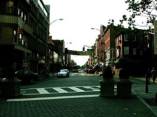
Downtown is an area of Jersey City, New Jersey, United States, which includes the Historic Downtown and the Waterfront. Historic Downtown can be further broken down into the neighborhoods of Harsimus Cove, The Village, Van Vorst Park, Grove Street, Hamilton Park and Boyle Plaza. The Waterfront includes the Powerhouse Arts District/WALDO, Newport, the Harborside Financial Center and Paulus Hook. Historic Downtown is the area west of Marin Boulevard, while the Waterfront lies to the east. Many of the names of Jersey City's downtown neighborhoods come from Dutch words or Dutch names from the early inhabitants along the Hudson.

Pavonia, New Netherland human settlement in New Jersey, United States of America

Pavonia was the first European settlement on the west bank of the North River that was part of the seventeenth-century province of New Netherland in what would become the present Hudson County, New Jersey.

Bergen, New Netherland

Bergen was a part of the 17th century province of New Netherland, in the area in northeastern New Jersey along the Hudson and Hackensack Rivers that would become contemporary Hudson and Bergen Counties. Though it only officially existed as an independent municipality from 1661, with the founding of a village at Bergen Square, Bergen began as a factorij at Communipaw circa 1615 and was first settled in 1630 as Pavonia. These early settlements were along the banks of the North River across from New Amsterdam, under whose jurisdiction they fell.

Oratam was sagamore, or sachem, of the Hackensack Indians living in northeastern New Jersey during the period of early European colonization in the 17th century. Documentation shows that he lived an unusually long life and was quite influential among indigenous and immigrant populations.

Communipaw Unincorporated community in New Jersey, United States

Communipaw is an unincorporated community and neighborhood located within Jersey City in Hudson County, New Jersey, United States. It is located west of Liberty State Park and east of Bergen Hill, and the site of one of the earliest European settlements in North America. It gives its name to the historic avenue which runs from its eastern end near Liberty State Park Station through the neighborhoods of Bergen-Lafayette and the West Side that then becomes the Lincoln Highway. Communipaw Junction, or simply, The Junction, is an intersection where Communipaw, Summit Avenue, Garfield Avenue, and Grand Street meet, and where the toll house for the Bergen Point Plank Road was situated. Communipaw Cove at Upper New York Bay, is part of the 36-acre (150,000 m2) state nature preserve in the park and one of the few remaining tidal salt marshes in the Hudson River estuary.

Michael Reyniersz Pauw Dutch businessman

Knight Michiel Reiniersz Pauw was a burgemeester of Amsterdam and a director of the Dutch West India Company (WIC).

New Netherland settlements Colonial American settlements

New Netherland was the 17th century colonial province of the Republic of the Seven United Netherlands on the northeastern coast of North America. The claimed territory was the land from the Delmarva Peninsula to southern Cape Cod. The settled areas are now part of the Mid-Atlantic states of New York, New Jersey, and Delaware, with small outposts in Connecticut and Pennsylvania. Its capital of New Amsterdam was located at the southern tip of the island of Manhattan on the Upper New York Bay.

Harsimus United States historic place

Harsimus is a neighborhood within Downtown Jersey City, Hudson County, New Jersey, United States. The neighborhood stretches from the Harsimus Stem Embankment on the north to Christopher Columbus Drive on the south between Coles Street and Grove Street or more broadly, to Marin Boulevard. It borders the neighborhoods of Hamilton Park to the north, Van Vorst Park to the south, the Village to the west, and the Powerhouse Arts District to the east. Newark Avenue has traditionally been its main street. The name is from the Lenape, used by the Hackensack Indians who inhabited the region and could be translated as Crow’s Marsh. From many years, the neighborhood was part of the "Horseshoe", a political delineation created by its position between the converging rail lines and political gerrymandering.

Van Vorst Park United States historic place

Van Vorst Park is an upper income neighborhood in the Historic Downtown of Jersey City, Hudson County, New Jersey, United States, centered on a park sharing the same name. The neighborhood is located west of Paulus Hook and Marin Boulevard, north of Grand Street, east of the Turnpike Extension, and south of The Village and Christopher Columbus Drive. Much of it is included in the Van Vorst Park Historical District.

Jan Everts Bout American settler

Jan Evertsz Bout, was an early and prominent Dutch settler in the 17th century colonial province of New Netherland.

Hudson Waterfront Place in Hudson and Bergen

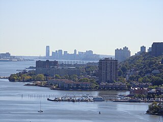
The Hudson Waterfront is an urban area of northeastern New Jersey along the lower reaches of the Hudson River, the Upper New York Bay and the Kill van Kull. Though the term can specifically mean the shoreline, it often used to mean the contiguous urban area between the Bayonne Bridge and the George Washington Bridge that is approximately 19 miles (31 km) long. Historically, the region has been known as Bergen Neck, the lower peninsula, and Bergen Hill, lower Hudson Palisades. It has sometimes been called the Gold Coast.

Bulls Ferry human settlement in New Jersey, United States of America

Bulls Ferry is an area along the Hudson River, just north of Weehawken Port Imperial in the towns of West New York, Guttenberg and North Bergen in New Jersey. It takes its name from a pre-Revolutionary settlement belonging to the Bull family, who operated a row-and-sail ferry to the burgeoning city of New York across the river.

Newkirk House Dutch Colonial building in Jersey City, New Jersey

The Newkirk House, also known as the Summit House, located at 510 Summit Avenue is the oldest surviving structure in Jersey City, New Jersey. The two-story Dutch Colonial building, composed of sandstone, brick, and clapboard dates to 1690.

Maryn Adriansen was an early settler to New Netherland. Originally emigrating under an Indenture agreement he later become a prominent member of society. His conflict with the governor at the time led to accusations and, eventually, acquittal. He owned property in New Amsterdam and a large plantation at Awiehaken.

Abraham Isaacsen Verplanck (1606–1690), also known as Abraham Isaacse Ver Planck, was an early and prominent settler in New Netherlands. A land developer and speculator, he was the progenitor of an extensive Verplanck family in the United States. Immigrating circa 1633, he received a land grant at Paulus Hook in 1638.

References

  1. "Proceedings of the New York State Historical Association" Volume 6. The Association, 1906
  2. Perhaps at Paulus Hook, in what is now Jersey City, or else at Castle Point, the trading station of Hobokan Hackingh (now Hoboken). From either one of these places, runners may have made their way to what is now Elizabeth, and thence followed an Indian trail to the bend in the Delaware River near Trenton. (See R. P. Bolton, Indian Paths in the Great Metropolis in the series of Indian Notes and Monographs published by the Museum of the American Indian, Heye Foundation], pp. 198-99, and map of eastern New Jersey of 1747 in the same volume.) De Vries says that when Michiel Pauw, in 1630, discovered that other directors of the Dutch West India Company had appropriated the land at Fort Orange for themselves, he "immediately had the land below, opposite Fort Amsterdam, where the Indians are compelled to cross to the fort with their beavers, registered for himself, and called it Pavonia." (J. F. Jameson, Narratives of New Netherland, p. 210.)
  3. Free Public Library of Jersey City (1909). From canoe to tunnel   Wikisource-logo.svg . A. J. Doan. p.  15   [scan]   Wikisource-logo.svg .
  4. A Map of that part of the Town of Jersey, Commonly called Powles Hook   [scan]   Wikisource-logo.svg (Map). P. Desobry's Lith. 1804.
  5. NJCU: Jersey City A to Z/Paulus Hook
  6. "Jersey City History - Old Bergen - Chapter VIII". www.cityofjerseycity.org. Retrieved 24 June 2017.
  7. "Earliest known Manhattan map made in 1639" (PDF). The New York Times. March 25, 1917. Retrieved 25 May 2017.
  8. p. 21, Whitcomb, Royden Page. First History of Bayonne, New Jersey. Bayonne, NJ: R. P. Whticomb, 1904.
  9. "Recalling Paulus Hook; Jersey City's Revolutionary Battle. Major Harry Lee's Dashing Exploit One Hundred Years Ago--His Attack Upon And Capture Of A British Garrison--Yesterday's Commemorative Exercises" (PDF). The New York Times. August 20, 1879.
  10. Farrier, George H. (August 19, 1879). Memorial of the centennial celebration of the battle of Paulus Hook. M. Mullone, printer. p.  58.
  11. History of the County of Hudson, New Jersey: From Its Earliest Settlement to the Present Time, Charles Hardenburg Winfield, pg. 243-246, Kennard & Hay Stationery M'fg and Print. Company, 1874
  12. Railroad Ferries of the Hudson: And Stories of a Deckhand, by, Raymond J. Baxter, Arthur G. Adams, pg. 64 ,1999, Fordham University Press, 978-0823219544
  13. Gelsi, Steve (9 February 2002). "Wall Street moves west". Market Watch. Retrieved 21 May 2013.
  14. http://www.capitalnewyork.com/article/culture/2012/11/6538938/jersey-citys-paulus-hook-once-coveted-brownstone-garden-apartments-a

Coordinates: 40°43′01″N74°02′16″W / 40.71685°N 74.03789°W / 40.71685; -74.03789