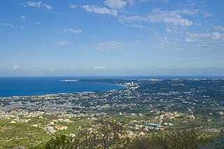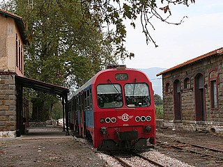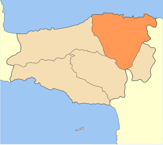
Ialysos is a town and a former municipality on the island of Rhodes, in the Dodecanese, Greece. Since the 2011 local government reform it is part of the municipality Rhodes, of which it is a municipal unit. The municipal unit has an area of 16,7 km2. It is the second-largest town on the island of Rhodes. It has a population of approximately 11,300, and is located eight kilometres west of the town of Rhodes, the island's capital, on the island's northwestern coast.

Sapes is a town and a former municipality in the Rhodope regional unit, East Macedonia and Thrace, Greece. Since the 2011 local government reform it is part of the municipality Maroneia-Sapes, of which it is the seat and a municipal unit. The municipal unit has an area of 354.596 km2. The population is 8,383 (2011).
The municipalities of Greece are the lowest level of government within the organizational structure of that country. Since the 2011 Kallikratis reform, there are 325 municipalities. Thirteen regions form the largest unit of government beneath the State. Within these regions are 74 second-level areas called regional units. Regional units are then divided into municipalities. The new municipalities can be subdivided into municipal units, which are subdivided into municipal communities or local communities.

Paliki is a peninsula and a former municipality on the island of Kefalonia, Ionian Islands, Greece. Since the 2011 local government reform it is part of the municipality Kefalonia, of which it is a municipal unit. The municipal unit has an area of 119.341 km2. The name comes from the ancient town of Pale/Pali, which was north of Lixouri and is now an archaeological site. The peninsula is the westernmost part of Kefalonia. The seat of the municipality was the town Lixouri (3.752).

Perivoli is an alpine village and a former community in Grevena regional unit, West Macedonia, Greece. Since the 2011 local government reform it is part of the municipality Grevena, of which it is a municipal unit. Its population was 21 inhabitants as of 2011. The municipal unit has an area of 137.210 km2. It was the sixth-least densely populated municipality or community in all of Greece. The village is inhabited during winter by only 10-20 people due to extreme snow. However, the population rises to 4,000 people during the summer. There are many restored houses, inns, restaurants and cafes in the village. The inhabitants are mainly native Aromanians.

Smixi is an Aromanian (Vlach) village and a former community in Grevena regional unit, West Macedonia, Greece. Since the 2011 local government reform it is part of the municipality Grevena, of which it is a municipal unit. Smixi had a population of 454 people as of 2011. The municipal unit of Smixi covers an area of 25.292 km2.

Temenos is a former municipality in the Heraklion Regional Unit, Crete, Greece. Since the 2011 local government reform it is part of the municipality Heraklion, of which it is a municipal unit. The municipal unit has an area of 56.608 km2. Population 3,260 (2011). The seat of the municipality was in Profitis Ilias.

Sagiada is a village and a former municipality in Thesprotia, Epirus, Greece. Since the 2011 local government reform it is part of the municipality Filiates, of which it is a municipal unit. The municipal unit has an area of 87.803 km2. In 2011 its population was 594 for the village and 1,740 for the municipal unit. The seat of the municipality was in Asprokklisi. Sagiada stretches between the Ionian Sea to the west and Albania to the north. It is the westernmost point of mainland Greece. The river Thyamis flows into sea 4 km south of the village Sagiada. There are plains in the southern part of the municipal unit, and mountains on the Albanian border. The village Sagiada is 10 km west of Filiates, 15 km northwest of the capital of Thesprotia, Igoumenitsa, and 4 km south of the Albanian town of Konispol.

Pangaio is a municipality in the Kavala regional unit, Greece, named after the Pangaion hills. The seat of the municipality is in Eleftheroupoli.

Sami is a town and a former municipality on the island of Cephalonia, Ionian Islands, Greece. Since the 2011 local government reform it is part of the municipality Cephalonia, of which it is a municipal unit. It is located on the central east coast of the island, and has a land area of 129.326 km². Its population was 2,341 at the 2011 census. Its municipal seat was the town of Sámi. Its next largest towns are Karavomylos (385), Grizáta (362) and Digaleto (316).

Agia is a village and a municipality in the Larissa regional unit, Thessaly, Greece. Agia is located east of Larissa and south of Melivoia. The Mavrovouni mountains dominate the south and the Aegean Sea lies to the east.

Olympos is a former municipality in the Larissa regional unit, Thessaly, Greece. Since the 2011 local government reform it is part of the municipality Elassona, of which it is a municipal unit. Population 3,164 (2011). The municipal unit has an area of 303.964 km2. The seat of the municipality was in Kallithea. The municipality was named after the nation's highest point, Mount Olympus.

Moudros is a town and a former municipality on the island of Lemnos, North Aegean, Greece. Since the 2011 local government reform it is part of the municipality Lemnos, of which it is a municipal unit. It covers the entire eastern peninsula of the island, with a land area of 185.127 km², covering 38.8% of the island's territory. The municipal seat was the town of Moúdros. Its next largest town is Kontopoúli (623). The municipal unit's total population was 3,925 in the 2011 census.

Fanari is a former municipality in the Preveza regional unit, Epirus, Greece. Since the 2011 local government reform it is part of the municipality Parga, of which it is a municipal unit. The municipal unit has an area of 205.893 km2. Population 7,962 (2011). The seat of the municipality was in Kanallaki.

Visaltia is a municipality in the Serres regional unit, Greece. The seat of the municipality is in Nigrita. It was named after the ancient region Bisaltia. The ancient city of Berge is located here.

Gortynia is a municipality in the Arcadia regional unit, Peloponnese, Greece. The seat of the municipality is the town Dimitsana. The municipality has an area of 1,050.882 km2.

Messini is a municipal unit and seat (edra) of the municipality (dimos) of Messini within the regional unit of Messenia in the region (perifereia) of Peloponnese, one of 13 regions into which Greece has been divided. Before 2011 the same hierarchy prevailed, according to Law 2539 of 1997, the Kapodistrias Plan, except that Messenia was a nomos and the Municipal unit was a locality. The dimos existed under both laws, but not with the same constituents.

Following the implementation on 1 January 2011 of the Kallikratis Plan, the administrative divisions of Greece consist of two main levels: the regions and the municipalities. In addition, a number of decentralized administrations overseeing the regions exist as part of the Ministry of the Interior, but are not entities of local government. The old prefectures were either abolished and split up or transformed into regional units in 2011. The administrative regions are divided into regional units which are further subdivided into municipalities.The Eastern Orthodox monastic community on Mount Athos is an autonomous self-governing entity.

Paionia is a municipality in the Kilkis regional unit of Central Macedonia, Greece. The seat of the municipality is the town Polykastro. The municipality is named after the ancient region of Paeonia. It has an area of 919.276 km2.

Mylopotamos is a municipality in Rethymno regional unit, on Crete, southern Greece. The seat of the municipality is the village Perama. The municipal unit has an area of 360.703 km2 (139.268 sq mi).


