Soufli (Greek : Σουφλί, romanized: Souflí) is a town in the Evros regional unit, Greece, notable for the silk industry that flourished there in the 19th century. The town stands on the eastern slope of the twin hill of Prophet Elias, one of the easternmost spurs on the Rhodope Mountains. It is situated in the center of the Evros regional unit, 65 km north of Alexandroupoli and 50 km southwest of Orestiada, on Greek National Road 51/E85 which links Alexandroupoli with Edirne and the Bulgarian border at Ormenio. The town center is only 500m from the Evros River. Soufli is the seat of the municipality of Soufli.
Archaeological finds and tombs discovered in the area confirm that a settlement stood on the site during the Hellenistic period. The first recorded mention of Soufli date to ca. 1667, when the Ottoman traveler Evliya Çelebi reported that it was a large village free from taxation. He refers to it by its Turkish name 'Sofulu,' an appellation that probably derives from a nearby dervish monastery. Another version, however, attributes the origins of the name to a Byzantine landowner called 'Souflis'. Beginning in the 19th century, Soufli became an administrative center of a rich province of almost 60,000 inhabitants, extending on both sides of the Evros valley. As one of the few population centers in the region, Soufli became an important trading center. From the records of the Greek Consulate in Adrianople state that in 1858 there was a mutual teaching school in Soufli for which the community put up 6,500 piastres to pay for teachers. Between 1870 and 1880, Soufli developed significantly. The construction of the railway and of the railway station (1872) contributed to its economic development. At the same time, the discovery of a method to fight against the diseases of cocoons by Louis Pasteur contributed to the fast development of sericulture. In 1877, the number of the inhabitants of Soufli is estimated to be around 4,680. By 1900, the population had risen to 10,000 inhabitants, and in 1908 to 12,000–13,000 inhabitants. Together with its importance as a trading center, Soufli was also recognized as an important craft center. The city's cartwrights who provided the whole region of Thrace with ox-carts, famous for their exceptional stability. The second most important industry in Soufli, next to sericulture, was viniculture. Wine production in Soufli during the 19th century was just under 2,000,000L. However, the development of sericulture and the diffusion of the cultivation of mulberry trees that followed, resulted in the reduction of the land devoted to vines. But sericulture, although popular, was not the only occupation. It was considered to be more of a side-line and seasonal occupation. It had entered every house in Soufli, and during the two months of May and June it occupied farmers, merchants and craftsmen and provided significant income.
Known as the Town of Silk, Soufli is also famous for its wine, tsipouro (a local strong alcoholic drink), and cooked meats.
Together with economic development there came socio-cultural flourishing and the intellectual level of the inhabitants was raised. Before the middle of the 19th century, the two churches of Saint George and Saint Athanassios were already built and are still standing as real jewels of the town. Around 1860, we have the creation of the Civil School (today it is the town's Second Elementary School), and in 1880–82 the Girls School of Soufli is built and comes into operation (today's First Elementary School). In 1878, the ´Dramatic society of Soufli´ was already in existence, and in 1905–10 another 'Dramatic society' comes forward. Music has been taught in the Civil School since 1900.
The Balkan wars, and, subsequently World War I after that transformed the region of Thrace into a seat of war operations, resulting in the crisis of sericulture and the general downgrading of the region until 1920. In addition, the incorporation of Soufli in Greece after 1922 has indicated its economic decline. The loss of the inland on the eastern riverside of Evros and the subsequent decrease in population of what was now the Greek province of Soufli resulted in the dwindling of the local market and, consequently, the restriction of the trading and craft activities of the town. That is how Soufli, from the transit and trading center it used to be, was transformed into borderland, with all the subsequent disadvantages. Moreover, the partition of Thrace deprived Soufli from a large part of its estates in the eastern riverside of Evros, which now passed into Turkish possession. In particular, in 1922, 2,250 acres (9.1 km2) of mulberry trees and 625 acres (2.53 km2) of fields remained in the possession of Soufli, while the vineyards were completely destroyed by vine louse. During the new period beginning with the incorporation of Soufli in Greece, sericulture remained as the most important source of income for the inhabitants of Soufli. The cultivation of wheat, corn and rye provided the town with self-sufficiency as far as nutrition was concerned, and the inhabitants made use of the empty space among mulberry trees and planted mainly legumes and other early or late cereals (multi-culture).
With World War II and the German occupation, every trading or intellectual activity is stopped. Life is only vestigial. With the withdrawal of the Germans in August 1944 and the beginning of the civil war, Soufli is once more full of life. The inhabitants of the nearby villages gather in Soufli for safety, and they stay there until the end of 1948.
The invention of synthetic silk and the fall of the prices of cocoons have led to the decline of sericulture. Mulberry trees are becoming fewer and fewer, and after the re-allotment of land they have almost vanished. The decline of sericulture, in combination with the lack of industrial units, has forced the population to move towards urban areas or even abroad.
Soufli was affected by flooding in its low-lying areas in the 1960s, 1998, 2005 and 2006.
Climate data for Soufli, Greece | |||||||||||||
---|---|---|---|---|---|---|---|---|---|---|---|---|---|
Month | Jan | Feb | Mar | Apr | May | Jun | Jul | Aug | Sep | Oct | Nov | Dec | Year |
Mean daily maximum °F (°C) | 46 (8) | 50 (10) | 55 (13) | 63 (17) | 72 (22) | 81 (27) | 88 (31) | 90 (32) | 81 (27) | 68 (20) | 59 (15) | 50 (10) | 66 (19) |
Mean daily minimum °F (°C) | 37 (3) | 39 (4) | 43 (6) | 48 (9) | 55 (13) | 63 (17) | 68 (20) | 68 (20) | 63 (17) | 55 (13) | 50 (10) | 43 (6) | 46 (8) |
Source: <World Weather Online= > "Soufli Monthly Climate Averages". Soufli Monthly Climate Average, Greece. World Weather Online. 2016. Retrieved 13 September 2016. |
The older Silk Museum in Soufli (Thrace) belongs to the Museum Network of the Piraeus Bank Group Cultural Foundation (PIOP). It is housed in the Kourtidis Mansion (1883) and was set up in 1990. The purpose of the permanent exhibition housed on the ground floor of the Kourtidis Mansion is to show the pre-industrial techniques by which silkworms were bred (sericulture) and silk was woven. It also deals with the socio-economic significance of these activities for Soufli and the surrounding area. The exhibition is arranged as four units with 46 separate sets of exhibits of two -dimensional documentation and information material (texts, photographs, drawings, maps) and items traditionally associated with sericulture and silk-weaving.
The first exhibition unit relates the history of silk over time, beginning with China, continuing through Greek and Roman antiquity and Byzantium and covering both the West and the Ottoman period. The second exhibition unit has as its theme the stages in the breeding of silkworms from the production of the "silk-seed" to the suffocation of the cocoons. The third exhibition unit is devoted to the manufacturing of silk, from the cleaning and sorting of the cocoons to the weaving of the fine silks which Soufli once produced. The fourth exhibition unit deals with the broader socio-economic background against which silk-weaving developed in Greece and the rest of Europe in the nineteenth and twentieth centuries, with particular emphasis on the rise and decline of the silk industry in Soufli and its contribution to the development of the town. The printed matter on the Silk Museum consists of a leaflet/poster and a monograph entitled Sericulture in Soufli. An educational programme entitled "Unwinding a cocoon ..., addressed to the first classes of primary scholl and covering traditional sericulture and silk-weaving, has been prepared as part of the MELINA project (Ministry of Culture, Benaki Museum).
A more recent addition to the silk museums in Soufli is the Art of Silk Museum belonging to the Tsiakiris Family Silkmills. Opened in September 2008 in a renovated Neoclassical building (1886) on the main thoroughfare of the town, it displays the full sequence of sericulture (with live silkworms on show most of the year) and shows the more industrial side of silk manufacture and weaving incorporating fully functional machinery and exhibits from the Tsiakiri factory and videos of the various stages and methods of production. It features both live and electronically assisted guided tours (available in several languages).
The municipality Soufli was formed at the 2011 local government reform by the merger of the following 3 former municipalities, that became municipal units: [2]
The municipality has an area of 1325.721 km2, the municipal unit 462.044 km2. [3]
The municipal unit of Soufli comprises the following communities and settlements (population numbers as of the 2021 census): [1]
The province of Soufli (Greek : Επαρχία Σουφλίου) was one of the provinces of the Evros Prefecture. Its territory corresponded with that of the current municipal units Soufli and Tychero, and the villages Peplos and Trifylli. [4] It was abolished in 2006.
The town is located on Greek National Road 51/E85.
The town is served by Soufli railway station on the Alexandroupoli–Svilengrad line. Historically the town was on the İstanbul Sirkeci-Svilengrad line, since 1971 a parallel railway line that runs exclusively over Turkish territory so that the Soufli station is now touched only by regional traffic.
Evros is one of the regional units of Greece. It is part of the region of East Macedonia and Thrace. Its name is derived from the river Evros, which appears to have been a Thracian hydronym. Evros is the northernmost regional unit. It borders Turkey to the east, across the river Evros, and it borders Bulgaria to the north and the northwest.
Didymoteicho is a town located on the eastern edge of the Evros regional unit of Eastern Macedonia and Thrace, in northeastern Greece. It is the seat of the municipality of the same name. The town sits on a plain and located south east of Svilengrad, south of Edirne, Turkey and Orestiada, west of Uzunköprü, Turkey, about 20 km north of Soufli and about 90 km north of Alexandroupoli. The municipality of Didymóteicho has a land area of 565.4 km2 and a population of 16,060 inhabitants.
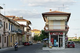
Kastanies is a town located in northern part of the regional unit of Evros, Greece, and is part of the municipal unit of Vyssa. It is situated at the border with Turkey.
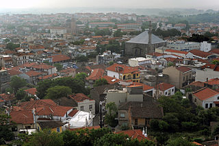
Alexandroupolis or Alexandroupoli is a city in Greece and the capital of the Evros regional unit. It is the largest city in Greek Thrace and the region of Eastern Macedonia and Thrace, with a population of 71,751, and is an important port and commercial center for northeastern Greece.
Amorio is a village in the municipal unit of Orfeas, northeastern Evros, Greece. It is situated at 2 km from the right bank of the river Evros, that forms the border with Turkey here. Amorio is 6 km northeast of Lavara, 7 km southwest of Didymoteicho and 21 km west of Uzunköprü (Turkey). The Greek National Road 51/E85 and the railway from Alexandroupoli to Didymoteicho pass through the village.
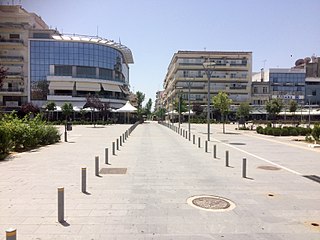
Orestiada, is the northeasternmost, northernmost and newest city of Greece and the second largest town of the Evros regional unit of Thrace. Founded by Greek refugees from Edirne after the Treaty of Lausanne when the population exchange occurred between Turkey and Greece, in which the river Evros became the new border between the two countries. The population is around 20,000.
Orfeas, named after the mythical musician Orpheus, is a former municipality in the Evros regional unit, East Macedonia and Thrace, Greece. Since the 2011 local government reform it is part of the municipality Soufli, of which it is a municipal unit. Its land area is 643.266 km2 (248.366 sq mi). It is located in the north-central part of Evros, and borders both southeastern Bulgaria and northwestern Turkey. The seat of the municipality was in Lavara. Much of the land is mountainous and forested to the west, extending up to the Rhodope regional unit. It is linked with GR-51. The town of Lávara sits on a plain. It is located SE of Svilengrad, S of Edirne, Turkey and Orestiada, and 13 km N of Soufli and 78 km N of Alexandroupoli. The municipality's next largest towns are Agriani, Mega Dereio and Amorio.
Tycheró is a town and a former municipality in the Evros regional unit, East Macedonia and Thrace, Greece. Since the 2011 local government reform it is part of the municipality Soufli, of which it is a municipal unit. The municipal unit has an area of 220.411 km2. Tychero is situated near the river Evros, which forms the border with Turkey here.
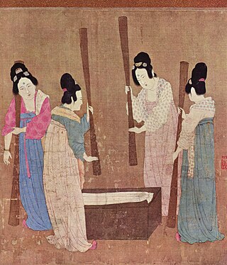
The production of silk originated in Neolithic China within the Yangshao culture. Though it would later reach other places in the world, the art of silk production remained confined to China until the Silk Road opened at 114 BC. Even after trade opened, China maintained a virtual monopoly over silk production for another thousand years. The use of silk within China was not confined to clothing alone, and silk was used for a number of applications, such as writing. Within clothing, the color of silk worn also held social importance, and formed an important guide of social class during the Tang dynasty of China.
Thai silk is produced from the cocoons of Thai silkworms. Thailand's silkworm farmers cultivate both types of the domesticated silkworms that produce commercial silk: Samia ricini, commonly known as the eri silkworm, which produces matte eri silk, and the Bombyx mori, producer of the better known, glossy mulberry silk. The latter is by far the larger silk producer of the two.
Thourio is a village in the northern part of the Evros regional unit, in Greece. Thourio belongs to the municipality of Orestiada. It is located between Orestiada to the north and Didymoteicho to the south, about 4 km west of the river Evros, that forms the border with Turkey here. The nearest villages are Neo Cheimonio to the north and Sofiko to the south. Thourio lies 30 metres above sea level and is a lowland village with a fertile plain.
Dadia is a village and a community in the northwestern part of the Evros regional unit, Eastern Macedonia and Thrace, Greece. Dadia is in the municipality of Soufli. Its population in 2021 was 409 for the community, including the village Kotronia. It is located southwest of Soufli and north of Feres. The name originates from a resinous pine wood which in the past was used for lighting.
Ptelea is a village in the northern part of the Evros regional unit, Greece. It is part of the municipal unit of Trigono. It is located on the right bank of the river Evros, where it forms the border with Bulgaria. It is bypassed by the Greek National Road 51/E85. The town was formerly known as Karagatsoudi (Καραγατσούδι) and El-Karakas (Ελ-Καράκας), its Turkish name was Karaagaç. The nearest villages are Dikaia to its east, and Ormenio to its northwest.
Ormenio is the northernmost place in all of Greece. It is part of the municipal unit of Trigono in the Evros regional unit of Thrace. It is situated near the right bank of the river Evros, which forms the border with Bulgaria here. On the other side of the Evros, 6 km to the north, lies the Bulgarian town Svilengrad. Nearby villages in Greece are Ptelea to its southeast and Petrota to its southwest.
Dikaia is a village in the northern part of the Evros regional unit in Greece. Dikaia was the seat of the former municipality of Trigono, and is part of the municipality Orestiada since 2011. In 2021, its population was 557 for the community, which includes the villages Dilofos, Krios and Palli. It is located on the right bank of the river Evros, where it forms the border with Bulgaria. It is about 15 km southeast of Svilengrad, Bulgaria, and 25 km west of Edirne, Turkey.
Marasia is a village in the northern part of the Evros regional unit in Greece. Marasia is part of the municipal unit of Trigono. It is situated between the rivers Evros and Ardas, close to their confluence. The Evros forms the border with Turkey here, and the Turkish city Edirne is 7 km to its east. Marasia is bypassed by the Greek National Road 51/E85.
Greek National Road 51 is a predominantly single carriageway road in the Evros regional unit of Greece. The road is a branch of the EO2 from Alexandroupolis and runs almost parallel to the Evros river from Ardani in the south to Kastanies in the north, before meeting the D.100 road at the Greece–Turkey border towards Edirne. The EO51 is about 128 km long, and forms part of the European route E85.
Neo Cheimonio is a village in the municipality of Orestiada in the northern part of the Evros regional unit in Greece. It is 6 km south of the centre of Orestiada. Neo Cheimonio is situated on the Greek National Road 51, and has a station on the Ormenio - Didymoteicho railway. It is about 5 km west of the river Evros, that forms the border with Turkey here. The nearest village is Thourio to the south. It was annexed by Greece in 1920, prior it was ruled by the Ottomans.
Tussar silk is produced from larvae of several species of silkworms belonging to the moth genus Antheraea, including A. assamensis, A. paphia, A. pernyi, A. roylei, and A. yamamai. These silkworms live in the wild forests in trees belonging to Terminalia species and Shorea robusta, as well as other food plants such as jamun and oak found in South Asia, eating the leaves of the trees on which they live. Tussar silk is valued for its rich texture and natural, deep-gold colour, and varieties are produced in many countries, including China, India, Japan, and Sri Lanka.
Peplos is a town and a community of Feres municipal unit, Evros regional unit, East Macedonia and Thrace, Greece. Since the 2011 local government reform it is a part of the municipality Alexandroupoli. The town's population is around 1,000 people.