D or d is the fourth letter of the modern English alphabet and the ISO basic Latin alphabet. Its name in English is dee, plural dees.

K is the eleventh letter of the modern English alphabet and the ISO basic Latin alphabet. Its name in English is kay, plural kays. The letter K usually represents the voiceless velar plosive.

P or p is the 16th letter of the modern English alphabet and the ISO basic Latin alphabet. Its name in English is pee, plural pees.

S or s is the 19th letter in the Modern English alphabet and the ISO basic Latin alphabet. Its name in English is ess, plural esses.

T or t is the 20th letter in the modern English alphabet and the ISO basic Latin alphabet. Its name in English is tee, plural tees. It is derived from the Semitic letter taw via the Greek letter tau. In English, it is most commonly used to represent the voiceless alveolar plosive, a sound it also denotes in the International Phonetic Alphabet. It is the most commonly used consonant and the second most common letter in English-language texts.

Central Macedonia is one of the thirteen administrative regions of Greece, consisting of the central part of the geographical and historical region of Macedonia. With a population of almost 1.9 million, it is the second most populous in Greece after Attica.

The National and Kapodistrian University of Athens, usually referred to simply as the University of Athens (UoA), is a public university in Zografou, Athens, Greece.

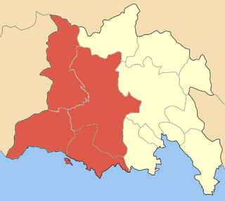
Dorida is a municipality in the Phocis regional unit, Central Greece, Greece. The seat of the municipality is the town Lidoriki. The municipality has an area of 998.893 km2.

Agia is a village and a municipality in the Larissa regional unit, Thessaly, Greece. Agia is located east of Larissa and south of Melivoia. The Mavrovouni mountains dominate the south and the Aegean Sea lies to the east.

Domokos, the ancient Thaumacus or Thaumace, is a town and a municipality in Phthiotis, Greece. The town Domokos is the seat of the municipality of Domokos and of the former Domokos Province. The town is built on a mountain slope overlooking the plain of Thessaly, 38km from the city of Lamia.
This article deals with the phonology and phonetics of Standard Modern Greek. For phonological characteristics of other varieties, see varieties of Modern Greek, and for Cypriot, specifically, see Cypriot Greek § Phonology.

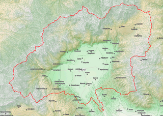
Almopia, or Enotia, also known in the Middle Ages as Moglena, is a municipality and a former province (επαρχία) of the Pella regional unit in Macedonia, Greece. The seat of the municipality is the town Aridaia. The municipality has an area of 985.817 km2.

Gortynia is a municipality in the Arcadia regional unit, Peloponnese, Greece. The seat of the municipality is the town Dimitsana. The municipality has an area of 1,050.882 km2.

International Federation of the Phonographic Industry Greece, or simply IFPI Greece, is the Greek branch of the International Federation of the Phonographic Industry (IFPI) and is the official charts provider and recording sales certification body for Greece. The association publishes a Top-75 combined repertoire albums sales chart is compiled. The charts is published by IFPI Greece and sponsored by Cyta Hellas.

The Ionian Islands Region is one of the thirteen administrative regions of Greece. The administrative region does not include all of the Ionian Islands; the island of Kythera, which historically was part of the island group, was separated and integrated to the Attica Region.

Kos is one of the regional units of Greece. It is part of the region of South Aegean. The regional unit covers the islands of Kos, Nisyros and several smaller islands in the Aegean Sea.

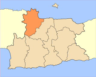
Malevizi is a municipality in Heraklion regional unit, Crete, Greece. The seat of the municipality is the village Gazi. The municipality has an area of 291.907 km2 (112.706 sq mi).

Amari is a village and a municipality in Rethymno regional unit, Crete, Greece. The seat of the municipality is the village Agia Foteini. The municipal unit has an area of 277.285 km2 (107.060 sq mi). One of the major geographic features of Amari is the Amari Valley, a landform of high elevation known for olive cultivation. It is thought that Monastiraki was developed by Phaistos inhabitants founding a satellite center as they pushed out into the Amari Valley.

Agios Vasileios is a village and a municipality in Rethymno regional unit, Crete, Greece. The seat of the municipality is the village Spili. The municipality has an area of 359.171 km2 (138.677 sq mi).

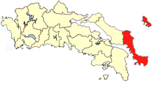
Ermionida is a municipality in the Argolis regional unit, Peloponnese, Greece. The seat of the municipality is the town Kranidi. The municipality has an area of 421.118 km2.


