
Palamas is a town and a municipality in the Karditsa regional unit, Greece. Palamas is located south-southwest of Larissa, the capital of Thessaly, northwest of Lamia, north of Sofades, east-northeast of Karditsa and east-southeast of Trikala. Palamas is linked with the road linking Karditsa and Larissa. It also serves roads with the GR-6 and Sofades. The Pineios River is to the north as well as the Trikala regional unit.
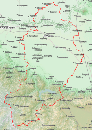
Sofades is a town and municipality in Thessaly, central Greece belonging to the regional unit of Karditsa. Its 2011 census population was 6,056 people and 18,864 for the municipality, including a large Romani community. Its elevation is around 120 m above sea level, and the economy is mainly agricultural. Sofades is located south of Palamas, southwest of Larissa, the capital of Thessaly, northwest of Lamia and southeast of Karditsa and Trikala. The native Greek inhabitants of the region are commonly known as Karagounides (Καραγκούνηδες).
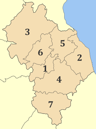
Larissa is one of the regional units of Greece. It is part of the region of Thessaly. Its capital is the city of Larissa. Total population 268,963 (2021).

Velventos is a town and municipality in Kozani regional unit, Western Macedonia, Greece. The 2021 census recorded 2,949 people in the community of Velventos and 3,057 in the municipality. The municipality has an area of 126.516 km2, the community 54.573 km2.

Elassona is a town and a municipality in the Larissa regional unit in Greece. During antiquity Elassona was called Oloosson (Ὀλοοσσών) and was a town of the Perrhaebi tribe. It is situated at the foot of Mount Olympus. Elassona is bypassed by the GR-3.

Sellana is a former municipality in the Karditsa regional unit, Thessaly, Greece, named after the ancient city of "Sellana" or "Silàna". Since the 2011 local government reform it is part of the municipality Palamas, of which it is a municipal unit. The municipal unit has an area of 89.490 km2. The seat of the municipality was in Proastio, which has 1,434 inhabitants (2021). Other communities in the municipal unit are those of Marathea, Agia Triada (548), Pedino (505) and Kalogriana (475).

Gonnoi is a former municipality in the Larissa regional unit, Thessaly, Greece. Since the 2011 local government reform it is part of the municipality Tempi, of which it is a municipal unit. The municipal unit has an area of 113.333 km2. The municipality was created under the Kapodistrias Law in 1997 out of the former communes of Gonnoi, Kallipefki, Itea and Elaia. About 2 kilometres (1.2 mi) southeast of the town lies the site of the ancient city of Gonnus, after which the present town is named.

Evrymenes is a former municipality in the Larissa regional unit, Thessaly, Greece. Since the 2011 local government reform it is part of the municipality Agia, of which it is a municipal unit. The municipal unit has an area of 95.284 km 2. The seat of the municipality was in Stomio. It was named after the ancient city Eurymenae.
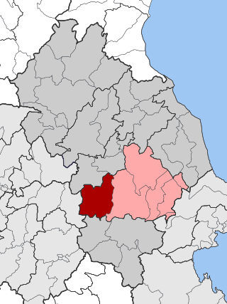
Krannonas is a village and a former municipality in the Larissa regional unit, Thessaly, Greece. Since the 2011 local government reform it is part of the municipality Kileler, of which it is a municipal unit. It is located southwest of the regional capital Larissa. In 2021 its population was 127 for the community and 2,007 for the municipal unit. The municipal unit has an area of 205.242 km2. The seat of the municipality was Agioi Anargyroi. It is located north of Farsala and NNE of Palamas and Karditsa.

Lakereia is a former municipality in the Larissa regional unit, Thessaly, Greece. It was named after the ancient city of "Lakèreia". Since the 2011 local government reform it is part of the municipality Agia, of which it is a municipal unit. Population 1,278 (2021). The seat of the municipality was in Dimitra. The municipal unit has an area of 179.386 km2.

Livadi or Leivadi is a village and a former municipality in the Larissa regional unit, Thessaly, Greece. Since the 2011 local government reform it is part of the municipality Elassona, of which it is a municipal unit.
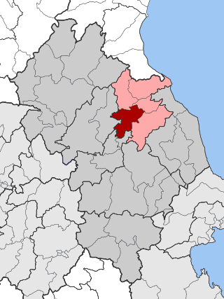
Makrychori is a former municipality in the Larissa regional unit, Thessaly, Greece. Since the 2011 local government reform it has been part of the municipality Tempi, of which it is a municipal unit. The municipal unit has an area of 107.767 km2. The municipality was created under the Kapodistrias Law in 1997 out of the former communes of Elateia, Evangelismos, Gyrtoni and Parapotamos.
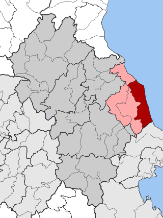
Melivoia is a town and a former municipality in the Larissa regional unit, Thessaly, Greece. Since the 2011 local government reform it is part of the municipality Agia, of which it is a municipal unit. The municipal unit has an area of 197.633 km2. The seat of the municipality was in Kato Sotiritsa. Melivoia is located east of Larissa, the capital of the regional unit and Thessaly, and a few kilometers north of Agia. The municipal unit stretches along the Aegean Sea coast, at the foot of Mount Ossa. It was named after the ancient city Meliboea. The municipal unit borders on Magnesia to the southeast.

Sarantaporo is a village and a former municipality in the Larissa regional unit, Thessaly, Greece. Since the 2011 local government reform it is part of the municipality Elassona, of which it is a municipal unit. The municipal unit has an area of 150.902 km2, and the community has an area of 26.958 km2. The town is between the mountains of Kamvounia to the northwest and the Pierian Mountains to the northeast. The river Sarantaporos flows through the municipality. Sarantaporo is on the Greek National Road 3. It is located west-southwest of Katerini, northwest of Elassona and Larissa, east of Grevena and south-southeast of Kozani.

Tyrnavos is a municipality in the Larissa regional unit, of the Thessaly region of Greece. It is the second-largest town of the Larissa regional unit, after Larissa. The town is near the mountains and the Thessalian Plain. The river Titarisios, a tributary of the Pineios, flows through the town. Tyrnavos is bypassed by the Greek National Road 3. Tyrnavos is located south-southwest of Thessaloniki and Katerini, northwest of Larissa, east-northeast of Trikala and south-southeast of Elassona and Kozani. Here live an important community of Aromanians (Vlachs).

Oichalia Greek: Οιχαλία, before 1981: Νεοχώρι - Neochori) is a town and a former municipality in the Trikala regional unit, Thessaly, Greece. Since the 2011 local government reform it is part of the municipality Farkadona, of which it is a municipal unit. The municipal unit has an area of 85.628 km2. Oichalia is located 8 km west of Farkadona centre, and 20 km east of the city of Trikala. It is situated on the edge of the Thessalian Plain near the ancient city of Oechalia. The Greek National Road 6 passes south of Oichalia.

Farkadona is a municipality in the southeastern Trikala regional unit, part of Thessaly in Greece. It is located about halfway between the cities Larissa to the east, and Trikala to the west, at about 30 km from both. It is situated in the Thessalian Plain, near the river Pineios. Farkadona is on the Greek National Road 6.

Aspropotamos is a former community in the Trikala regional unit, Thessaly, Greece. Since the 2011 local government reform it is part of the municipality Meteora, of which it is a municipal unit. The 2021 census recorded 218 residents in the municipal unit. The seat of the community was in Kallirroi.
Sklithro is a village in Thessaly, Greece, not far from Larissa and Volos. It is part of the Melivoia municipal unit within the Agia municipality.
Potamia is a village and a community of the Agia municipality. The community of Potamia covers an area of 32.899 km2.


