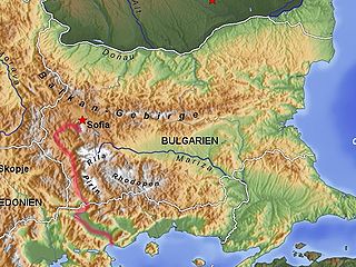
The Struma or Strymónas is a river in Bulgaria and Greece. Its ancient name was Strymṓn. Its drainage area is 17,330 km2 (6,690 sq mi), of which 10,797 km2 (4,169 sq mi) in Bulgaria, 6,295 km2 (2,431 sq mi) in Greece and the rest in the Republic of Macedonia. It takes its source from the Vitosha Mountain in Bulgaria, runs first westward, then southward, forming a number of gorges, enters Greek territory at the Kula village. In Greece it is the main waterway feeding and exiting from Lake Kerkini, a significant centre for migratory wildfowl. The river flows into the Strymonian Gulf in Aegean Sea, near Amphipolis in the Serres regional unit. The river's length is 415 kilometres.

Central Macedonia is one of the thirteen administrative regions of Greece, consisting of the central part of the geographical and historical region of Macedonia. With a population of almost 1.9 million, it is the second most populous in Greece after Attica.
Chryso or Chrisso may refer to several places in Greece:

Thessaloniki is one of the regional units of Greece. It is part of the Region of Central Macedonia and its capital is the city of Thessaloniki.

Serres is one of the regional units of Greece. It is part of the Region of Central Macedonia. Its capital is the town of Serres. The total population reaches just over 175,000.

Drama is one of the regional units of Greece. It is part of the Region of East Macedonia and Thrace. Its capital is the town of Drama. The regional unit is the northernmost within the geographical region of Macedonia and the westernmost in the administrative region of East Macedonia and Thrace. The northern border with Bulgaria is formed by the Rhodope Mountains.

Nigrita is a town and a former municipality in the Serres regional unit, Greece. Since the 2011 local government reform it is part of the municipality Visaltia, of which it is the seat and a municipal unit. The municipal unit has an area of 160.888 km2. It is situated in the wide plain south of the river Strymonas, at the northern foot of the Kerdylio mountains, in the southern part of the Serres regional unit. Nigrita is located 20 km south of Serres, and 56 km northeast of Thessaloniki.

Visaltia is a municipality in the Serres regional unit, Greece. The seat of the municipality is in Nigrita. It was named after the ancient region Bisaltia. The ancient city of Berge is located here.
Kapetan Mitrousi is a former municipality in the Serres regional unit, Greece. Since the 2011 local government reform it is part of the municipality Serres, of which it is a municipal unit. It is located in the west-central part of the Serres regional unit and has a population of 5,325 inhabitants and a land area of 87.485 km². The seat of the municipality was the town of Provatas. Its other towns are Mitroúsi, Anagénnisis (752), Áno Kamíla (682), Vamvakiá (530), Káto Mitroúsi (472), and Monokklisia (311).
Lefkonas is a village and a former municipality in the Serres regional unit, Greece. Since the 2011 local government reform it is part of the municipality Serres, of which it is a municipal unit. The municipal unit has an area of 68.247 km2. Population 3,905 (2011).

Nea Zichni is a municipality in the Serres regional unit, of Central Macedonia region, Greece. Population 12,397 (2011). Nea Zichni is also the name of the administrative seat of the municipality, population 2,530 (2011).
Skoutari is a village and a former municipality in the Serres regional unit, Greece. Since the 2011 local government reform it is part of the municipality Serres, of which it is a municipal unit. The municipal unit has an area of 90.159 km2. Population 5,621 (2011). The first villagers arrived from Minor Asia as refugees in October 1922. On 15th of August 1924, the day of The Assumption of Mary into Heaven, refugees from Skoutari from Northern Thrace began, and finally settled in the region of today's village. That way the village took its name.
Ano Vrontou is a remote mountain village and a former community in the northern Serres regional unit, Greece. Since the 2011 local government reform it is part of the municipality Serres, of which it is a municipal unit. The municipal unit has an area of 47.306 km2. In 2011 its population was 199. Ano Vrontou is situated in the northeastern part of the Vrontous mountains, at about 1060 m elevation. It borders on the Drama regional unit to the north and east. Ano Vrontou is 6 km northwest of Kato Vrontou, 12 km east of Achladochori, 13 km northeast of Oreini, 16 km southwest of Kato Nevrokopi and 26 km northeast of Serres.

Oreini is a village and a former community in the Serres regional unit, Greece. Since the 2011 local government reform it is part of the municipality Serres, of which it is a municipal unit. The municipal unit has an area of 54.309 km2. Population 742 (2011).

Panserraikos Football Club, the All-Serres Football Club, is a football club, based in Serres in Central Macedonia, Greece. Panserraikos is one of the most important and well-supported clubs in northern Greece and had a near-continuous presence in the First Division in the 1960s and 70s.
Sintiki is a municipality in the Serres regional unit, Central Macedonia, Greece. The seat of the municipality is the town Sidirokastro. The municipality has an area of 1,103.431 km2.
Fyllida was one of the four provinces of Serres Prefecture, Greece. Its territory corresponded with that of the current municipalities Amfipoli and Nea Zichni. It was abolished in 2006.
Kamenikia is the name of a neighborhood in the city of Serres, Greece today.

Amphipolis is a municipality in the Serres regional unit of Greece. The municipality is named after the ancient city of the same name. The seat of the municipality is Rodolivos.


