Penn Laird, Virginia

Last updated

Penn Laird, Virginia
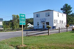
Unincorporated community
Penn Laird VA.JPG
USA Virginia location map.svg
Red pog.svg
Penn Laird, Virginia
Usa edcp location map.svg
Red pog.svg
Penn Laird, Virginia
Coordinates: 38°23′08″N78°48′09″W / 38.38556°N 78.80250°W / 38.38556; -78.80250
Country United States
State Virginia
County Rockingham
Elevation
1,204 ft (367 m)
Time zone UTC-5 (Eastern (EST))
  Summer (DST) UTC-4 (EDT)
ZIP code
22846
Area code 540
GNIS feature ID1496071 [1]

Penn Laird is an unincorporated community in Rockingham County, Virginia, United States.

Contents

Geography

Penn Laird is located on U.S. Route 33 5.7 miles (9.2 km) southeast of Harrisonburg.

Rockingham County VA location map.svg
Red pog.svg
Penn Laird
Location of Penn Laird within the Rockingham County

History

Penn Laird has a post office with ZIP code 22846, which opened on July 18, 1896. [2] [3] Ruth Kathleen Funkhouser Armstrong states the name Penn Laird came from the two middle names of Harold Roudabush's father, William Penn Roudabush and Harold's Wife father, whose middle name was Laird.

References

  1. "Penn Laird". Geographic Names Information System . United States Geological Survey, United States Department of the Interior.
  2. United States Postal Service (2012). "USPS - Look Up a ZIP Code" . Retrieved February 15, 2012.
  3. "Postmaster Finder - Post Offices by ZIP Code". United States Postal Service . Retrieved May 30, 2012.