Pevely, Missouri

Last updated
Pevely, Missouri
Jefferson County Missouri Incorporated and Unincorporated areas Pevely Highlighted.svg
Location of Pevely, Missouri
Coordinates: 38°17′14″N90°23′57″W / 38.28722°N 90.39917°W / 38.28722; -90.39917 Coordinates: 38°17′14″N90°23′57″W / 38.28722°N 90.39917°W / 38.28722; -90.39917
Country United States
State Missouri
County Jefferson
Incorporated 1953
Government
   Mayor Stephanie Haas
Area
[1]
  Total4.96 sq mi (12.85 km2)
  Land4.91 sq mi (12.72 km2)
  Water0.05 sq mi (0.13 km2)
Elevation
[2]
449 ft (137 m)
Population
 (2020)
  Total6,026
  Density1,227.29/sq mi (473.83/km2)
Time zone UTC-6 (Central (CST))
  Summer (DST) UTC-5 (CDT)
ZIP code
63070
Area code 636
FIPS code 29-57278 [3]
GNIS feature ID2396196 [2]
Website http://www.cityofpevely.org

Pevely is a city in Jefferson County, Missouri, United States, and is also a suburb of St. Louis. The population was 6,107, at the 2020 United States Census.

Contents

History

Pevely was platted in 1860. [4] A post office called Pevely has been in operation since 1858. [5]

The Gustave Greystone-Meissner House was listed on the National Register of Historic Places in 1974. [6]

Geography

According to the United States Census Bureau, the city has a total area of 4.69 square miles (12.15 km2), of which 4.54 square miles (11.76 km2) is land and 0.15 square miles (0.39 km2) is water. [7]

Demographics

Historical population
CensusPop.Note
1920 167
1930 27464.1%
1940 31113.5%
1950 41633.8%
1960 4160.0%
1970 51724.3%
1980 2,732428.4%
1990 2,8313.6%
2000 3,76833.1%
2010 5,48445.5%
2020 6,0269.9%
U.S. Decennial Census [8]

2010 census

As of the census [9] of 2010, there were 5,484 people, 2,128 households, and 1,493 families living in the city. The population density was 1,207.9 inhabitants per square mile (466.4/km2). There were 2,318 housing units at an average density of 510.6 per square mile (197.1/km2). The racial makeup of the city was 96.2% White, 1.0% African American, 0.3% Native American, 0.3% Asian, 0.1% from other races, and 2.0% from two or more races. Hispanic or Latino of any race were 1.2% of the population.

There were 2,128 households, of which 41.2% had children under the age of 18 living with them, 46.2% were married couples living together, 17.2% had a female householder with no husband present, 6.8% had a male householder with no wife present, and 29.8% were non-families. 23.6% of all households were made up of individuals, and 6.3% had someone living alone who was 65 years of age or older. The average household size was 2.57 and the average family size was 3.00.

The median age in the city was 31.5 years. 28.6% of residents were under the age of 18; 10% were between the ages of 18 and 24; 28.8% were from 25 to 44; 23.8% were from 45 to 64; and 8.8% were 65 years of age or older. The gender makeup of the city was 48.2% male and 51.8% female.

2000 census

As of the census [3] of 2000, there were 3,768 people, 1,411 households, and 1,008 families living in the city. As of 2006, the city boasts almost 4,400 in population. The population density was 1,133.7 inhabitants per square mile (437.7/km2). There were 1,482 housing units at an average density of 445.9 per square mile (172.2/km2). The racial makeup of the city was 95.89% White, 1.59% African American, 0.37% Native American, 0.45% Asian, 0.29% from other races, and 1.41% from two or more races. Hispanic or Latino of any race were 0.93% of the population.

There were 1,411 households, out of which 40.5% had children under the age of 18 living with them, 48.1% were married couples living together, 16.7% had a female householder with no husband present, and 28.5% were non-families. 23.4% of all households were made up of individuals, and 8.6% had someone living alone who was 65 years of age or older. The average household size was 2.67 and the average family size was 3.12.

In the city the population was spread out, with 30.1% under the age of 18, 10.5% from 18 to 24, 30.4% from 25 to 44, 20.3% from 45 to 64, and 8.6% who were 65 years of age or older. The median age was 31 years. For every 100 females, there were 93.3 males. For every 100 females age 18 and over, there were 90.7 males.

The median income for a household in the city was $34,916, and the median income for a family was $37,288. The per capita income for the city was $14,403. About 19.7% of families and 19.6% of the population were below the poverty line, including 25.7% of those under age 18 and 19.5% of those age 65 or over.

Pevely Homecoming Festival August 25, 2007 Pevely Homecoming Festival,2007.jpg
Pevely Homecoming Festival August 25, 2007

Education

Dunklin R-V School District serves Pevely. [10]

Attractions

I-55 Raceway is a high-banked 1/3 mile high banked dirt oval that features racing on Saturday nights. Ken Schrader is co-owner/promoter of I-55 Raceway with Ray Marler.

Related Research Articles

<span class="mw-page-title-main">Good Hope, Alabama</span> City in Alabama, United States

Good Hope is a city in Cullman County, Alabama, United States. As of the 2010 census, the population of the city was 2,264. It incorporated in April 1962.

<span class="mw-page-title-main">Watertown, Minnesota</span> City in Minnesota, United States

Watertown is a small city in Carver County, Minnesota, United States, along the South Fork of the Crow River, on the outskirts of the Twin Cities metro area. The population was 4,659 at the 2020 census.

<span class="mw-page-title-main">Garfield, Minnesota</span> City in Minnesota, United States

Garfield is a city in Douglas County, Minnesota, United States. The population was 349 at the 2020 census.

<span class="mw-page-title-main">Deer Creek, Minnesota</span> City in Minnesota, United States

Deer Creek is a city in Otter Tail County, Minnesota, United States. The population was 330 at the 2020 census.

<span class="mw-page-title-main">Arbyrd, Missouri</span> City in Missouri, United States

Arbyrd is a small town in southeast Dunklin County, Missouri, United States. The population was 404 at the 2020 census. The town was officially incorporated in 1919.

<span class="mw-page-title-main">Campbell, Missouri</span> City in Missouri, United States

Campbell is a city in northern Dunklin County, Missouri, United States. The population was 1,992 at the 2010 census.

<span class="mw-page-title-main">Cardwell, Missouri</span> City in Missouri, United States

Cardwell is a city in southwest Dunklin County, Missouri, United States. The population was 713 at the 2010 census. The current Mayor of Cardwell is Brandon Cupp and the current aldermen are Harvey Beasley, Mike Clark, and Chuck Walls.

<span class="mw-page-title-main">Clarkton, Missouri</span> City in Missouri, United States

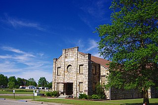
Clarkton is a city in Dunklin County, Missouri, United States. The population was 1,288 at the 2010 census. Clarkton is the oldest city in Dunklin County.

<span class="mw-page-title-main">Holcomb, Missouri</span> City in Missouri, United States

HolcombHAW-kəm is a city in Dunklin County, Missouri, United States. The population was 635 at the 2010 census.

<span class="mw-page-title-main">Rives, Missouri</span> Village in Missouri, United States

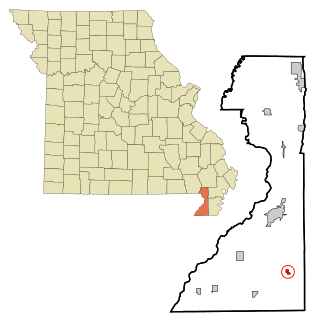
Rives is a town in Dunklin County, Missouri, United States. The population was 63 at the 2010 census.

<span class="mw-page-title-main">Senath, Missouri</span> City in Missouri, United States

Senath is a city in Dunklin County, Missouri, United States. The population was 1,767 at the 2010 census.

<span class="mw-page-title-main">Barnhart, Missouri</span> CDP in Missouri, United States

Barnhart is a census-designated place (CDP) in Jefferson County, Missouri, United States. Barnhart is also a suburb of St. Louis

<span class="mw-page-title-main">Herculaneum, Missouri</span> City in Missouri, United States

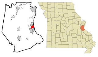
Herculaneum is a city in Jefferson County, Missouri, United States, and is a suburb of St. Louis. The population was 4,273 at the 2020 United States Census. The City of Herculaneum was the first county seat of Jefferson County from January 1, 1819 to 1839. The city celebrated its bicentennial throughout 2008.

<span class="mw-page-title-main">Horine, Missouri</span> Census-designated place in Missouri, United States

Horine is an unincorporated community and census-designated place (CDP) in Jefferson County, Missouri, United States. The population was 821 at the 2010 census, down from 923 in 2000.

<span class="mw-page-title-main">Tallapoosa, Missouri</span> City in Missouri, United States

Tallapoosa is a city in New Madrid County, Missouri, United States. The population was 168 at the 2010 census.

<span class="mw-page-title-main">St. John, Missouri</span> City in Missouri, United States

St. John or Saint John is a city in St. Louis County, Missouri, United States, with its commercial district centered along St. Charles Rock Road. It is a few miles southeast of Lambert-St. Louis International Airport.

<span class="mw-page-title-main">Hornersville, Missouri</span> City in Missouri, United States

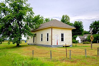
Hornersville is a city in Dunklin County, Missouri, United States, founded in 1840. The population was 537 at the 2020 census.

<span class="mw-page-title-main">Grass Valley, Oregon</span> City in Oregon, United States

Grass Valley is a city in Sherman County, Oregon, United States. The population was 164 at the 2010 census.

<span class="mw-page-title-main">Cameron, West Virginia</span> City in West Virginia

Cameron is a city in Marshall County, West Virginia, United States. It is part of the Wheeling, West Virginia metropolitan area. The population was 849 at the 2020 census.

<span class="mw-page-title-main">Minnesota Lake, Minnesota</span> City in Minnesota, United States

Minnesota Lake is a city in Blue Earth and Faribault counties in the State of Minnesota. The population was 661 at the 2020 census. The bulk of the city is in Faribault County; a small part extends into Blue Earth County.

References

  1. "ArcGIS REST Services Directory". United States Census Bureau. Retrieved August 28, 2022.
  2. 1 2 U.S. Geological Survey Geographic Names Information System: Pevely, Missouri
  3. 1 2 "U.S. Census website". United States Census Bureau . Retrieved 2008-01-31.
  4. "Jefferson County Place Names, 1928–1945 (archived)". The State Historical Society of Missouri. Archived from the original on 24 June 2016. Retrieved 19 October 2016.{{cite web}}: CS1 maint: bot: original URL status unknown (link)
  5. "Post Offices". Jim Forte Postal History. Retrieved 19 October 2016.
  6. "National Register Information System". National Register of Historic Places . National Park Service. July 9, 2010.
  7. "US Gazetteer files 2010". United States Census Bureau. Archived from the original on 2012-01-25. Retrieved 2012-07-08.
  8. "Census of Population and Housing". Census.gov. Retrieved June 4, 2015.
  9. "U.S. Census website". United States Census Bureau . Retrieved 2012-07-08.
  10. "Welcome to Dunklin R-V “Home of the Herculaneum Blackcats”" (Archive). Dunklin R-V School District. Retrieved on June 16, 2014.