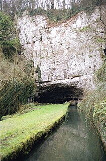
Wookey Hole Caves are a series of limestone caverns, a show cave and tourist attraction in the village of Wookey Hole on the southern edge of the Mendip Hills near Wells in Somerset, England. The River Axe flows through the cave. It is a Site of Special Scientific Interest (SSSI) for both biological and geological reasons. Wookey Hole cave is a "solutional cave", one that is formed by a process of weathering in which the natural acid in groundwater dissolves the rocks. Some water originates as rain that flows into streams on impervious rocks on the plateau before sinking at the limestone boundary into cave systems such as Swildon's Hole, Eastwater Cavern and St Cuthbert's Swallet; the rest is rain that percolates directly through the limestone. The temperature in the caves is a constant 11 °C (52 °F).

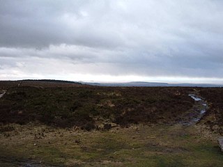
The Mendip Hills is a range of limestone hills to the south of Bristol and Bath in Somerset, England. Running from Weston-super-Mare and the Bristol Channel in the west to the Frome valley in the east, the hills overlook the Somerset Levels to the south and the Chew Valley and other tributaries of the Avon to the north. The hills give their name to the local government district of Mendip, which administers most of the area. The higher, western part of the hills, covering 198 km2 (76 sq mi) has been designated an Area of Outstanding Natural Beauty (AONB), which gives it a level of protection comparable to a national park.

Swildon's Hole is an extensive cave in Priddy, Somerset. At 9,144 metres (30,000 ft) in length, it is the longest cave on the Mendip Hills. It has been found to be connected to Priddy Green Sink and forms part of the Priddy Caves Site of Special Scientific Interest (SSSI).

Burrington Combe is a Carboniferous Limestone gorge near the village of Burrington, on the north side of the Mendip Hills Area of Outstanding Natural Beauty, in North Somerset, England.
Black Down is the highest hill in the Mendip Hills, Somerset, in south-western England. Black Down lies just a few miles eastward of the Bristol Channel at Weston-super-Mare, and provides a view over the Chew Valley. The summit is marked with an Ordnance Survey trig point, the base of which has been rebuilt by the Mendip Hills AONB authority.
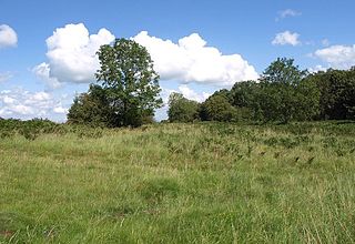
Thrupe Lane Swallet is a 0.5 hectares geological Site of Special Scientific Interest in Somerset, notified in 1992. It is also a Geological Conservation Review site.
The caves of the Mendip Hills are formed by the particular geology of the Mendip Hills: large areas of limestone worn away by water makes it a national centre for caving. The hills conceal the largest underground river system in Britain.
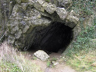
Aveline's Hole is a cave at Burrington Combe in the limestone of the Mendip Hills, in Somerset, England.

Eastwater Cavern is a cave near Priddy in the limestone of the Mendip Hills, in Somerset, England. It is also known as Eastwater Swallet. It was first excavated in April 1902 by a team led by Herbert E. Balch composed of paid labourers and volunteers from the Wells Natural History Society. Progress was initially slow, but by February 1903 Balch and Willcox had discovered substantial passage, following the streamway down to the bottom of the cave. Dolphin Pot was dug in 1940 by the Wessex Cave Club, with Primrose Pot following in 1950. West End series was the most recent significant discovery, in 1983.

Goatchurch Cavern is a cave on the edge of Burrington Combe in the limestone of the Mendip Hills, in Somerset, England.

St Cuthbert's Swallet is the second longest, and most complex, cave on the Mendip Hills, in Somerset, England. It forms a major part of the Priddy Caves system and water entering this swallet re-emerges at Wookey Hole. St Cuthbert's Swallet is part of, and lies underneath, the Priddy Pools Site of Special Scientific Interest.
Sidcot Swallet is a cave near Burrington Combe, in the Carboniferous Limestone of the Mendip Hills, in Somerset, England.
Rod's Pot is a limestone cave above Burrington Combe in the Mendip Hills, in Somerset, England.
William Talbot Aveline (1822–1903) was a British geologist and archaeologist.
Burrington Camp, also known as Burrington Ham, is an Iron Age hill fort in the North Somerset district of Somerset, England. The hill fort is situated in the Mendip Hills approximately 0.6 miles (0.97 km) south from the village of Burrington.
Read's Cavern is a cave at Burrington Combe, Somerset, England, in which traces of Iron Age occupation have been found. It lies under Dolbury Hill. Its large main chamber has a boulder ruckle floor and is parallel to a cliff face. The cave was excavated by the University of Bristol Spelæological Society (UBSS) in the 1920s, when relics of Iron Age occupation were found.
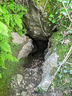
Bos Swallet is a karst cave in Burrington Combe on the Mendip Hills in Somerset, England.

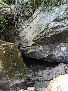
Drunkard's Hole is a karst cave in Burrington Combe on the Mendip Hills in Somerset, England.

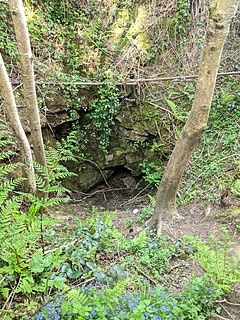
East Twin Swallet also known as Upper Twin Swallet is a karst cave in Burrington Combe on the Mendip Hills in Somerset, England.

Bath Swallet is a karst cave in Burrington Combe on the Mendip Hills in Somerset, England.

