Platea, Pennsylvania

Last updated

Platea, Pennsylvania
Platea, PA Community Park, June 2024.jpg
Borough hall and Community Park
Erie County Pennsylvania incorporated and unincorporated areas Platea highlighted.svg
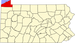
Location in Erie County and the U.S. state of Pennsylvania.
Coordinates: 41°57′4″N80°19′31″W / 41.95111°N 80.32528°W / 41.95111; -80.32528
CountryUnited States
State Pennsylvania
County Erie
Government
  MayorGreg Allen
Area
[1]
  Total
3.34 sq mi (8.66 km2)
  Land3.34 sq mi (8.66 km2)
  Water0.00 sq mi (0.00 km2)
Elevation
[2] (Borough benchmark)
876 ft (267 m)
Highest elevation
[2] (southeast corner of borough)
990 ft (300 m)
Lowest elevation
[2] (Tributary to Crooked Creek)
780 ft (240 m)
Population
 (2020) [3]
  Total
442
  Density132.22/sq mi (51.05/km2)
Time zone UTC-4 (EST)
  Summer (DST) UTC-5 (EDT)
Area code 814

Platea is a borough in Erie County, Pennsylvania, United States. The population was 443 at the 2020 census. [4]

Contents

Geography

Platea is located in western Erie County at 41°57′4″N80°19′31″W / 41.95111°N 80.32528°W / 41.95111; -80.32528 (41.951078, -80.325143). [5] It is bordered to the west, north, and east by Girard Township, to the south by Elk Creek Township, and at its southwestern corner by Conneaut Township.

According to the United States Census Bureau, the borough has a total area of 3.4 square miles (8.7 km2), all land. [6]

Demographics

Historical population
CensusPop.Note
1890 240
1900 225−6.2%
1910 220−2.2%
1920 2398.6%
1930 2494.2%
1940 28112.9%
1950 2903.2%
1960 35723.1%
1970 354−0.8%
1980 49239.0%
1990 467−5.1%
2000 4741.5%
2010 430−9.3%
2020 4433.0%
2021 (est.)441 [4] −0.5%
Sources: [7] [8] [9]

As of the census [8] of 2000, there were 474 people, 172 households, and 137 families residing in the borough. The population density was 144.0 inhabitants per square mile (55.6/km2). There were 184 housing units at an average density of 55.9 per square mile (21.6/km2). The racial makeup of the borough was 97.89% White, 0.42% African American, 0.84% from other races, and 0.84% from two or more races. Hispanic or Latino of any race were 1.05% of the population.

There were 172 households, out of which 36.6% had children under the age of 18 living with them, 65.7% were married couples living together, 7.6% had a female householder with no husband present, and 20.3% were non-families. 13.4% of all households were made up of individuals, and 5.2% had someone living alone who was 65 years of age or older. The average household size was 2.76 and the average family size was 3.04.

In the borough the population was spread out, with 25.1% under the age of 18, 6.5% from 18 to 24, 32.5% from 25 to 44, 25.9% from 45 to 64, and 9.9% who were 65 years of age or older. The median age was 38 years. For every 100 females there were 101.7 males. For every 100 females age 18 and over, there were 107.6 males.

The median income for a household in the borough was $38,125, and the median income for a family was $39,063. Males had a median income of $30,078 versus $22,500 for females. The per capita income for the borough was $14,555. About 6.8% of families and 12.9% of the population were below the poverty line, including 24.1% of those under age 18 and 7.8% of those age 65 or over.

Education

Platea is part of the Northwestern School District.

Related Research Articles

<span class="mw-page-title-main">Cambridge Township, Crawford County, Pennsylvania</span> Township in Pennsylvania, United States

Cambridge Township is a township in Crawford County, Pennsylvania, United States. The population was 1,447 at the 2020 census.

<span class="mw-page-title-main">Conneautville, Pennsylvania</span> Borough in Pennsylvania, United States

Conneautville is a borough in Crawford County, Pennsylvania, United States, situated along Conneaut Creek. The population was 736 at the 2020 census, down from 774 at the 2010 census.

<span class="mw-page-title-main">Hayfield Township, Crawford County, Pennsylvania</span> Township in Pennsylvania, United States

Hayfield Township is a township in Crawford County, Pennsylvania, United States. The population was 2,774 at the 2020 census, down from 2,940 at the 2010 census.

<span class="mw-page-title-main">Saegertown, Pennsylvania</span> Borough in Pennsylvania, United States

Saegertown is a borough in Crawford County, Pennsylvania. The population was 869 at the time of the 2020 census, down from 997 at the 2010 census. It was established in 1824.

<span class="mw-page-title-main">Sparta Township, Pennsylvania</span> Township in Pennsylvania, United States

Sparta Township is a township in Crawford County, Pennsylvania, United States. The population was 1,912 at the 2020 census, up from 1,832 at the 2010 census. The Township surrounds Spartansburg, a borough of a few hundred people.

<span class="mw-page-title-main">Spring Township, Crawford County, Pennsylvania</span> Township in Pennsylvania, United States

Spring Township is a township in Crawford County, Pennsylvania, United States. The population was 1,409 at the 2020 census, down from 1,548 at the 2010 census.

<span class="mw-page-title-main">Springboro, Pennsylvania</span> Borough in Pennsylvania, United States

Springboro is a borough in Crawford County, Pennsylvania, United States, located 35 miles southwest of Erie. The population was 376 at the 2020 census, down from 477 at the 2010 census.

<span class="mw-page-title-main">Summerhill Township, Crawford County, Pennsylvania</span> Township in Pennsylvania, United States

Summerhill Township is a township in Crawford County, Pennsylvania, United States. The population was 1,204 at the 2020 census, down from 1,236 at the 2010 census.

<span class="mw-page-title-main">Venango Township, Crawford County, Pennsylvania</span> Township in Pennsylvania, United States

Venango Township is a township in Crawford County, Pennsylvania, United States. The population was 941 at the 2020 census, down from 997 at the 2010 census.

<span class="mw-page-title-main">Conneaut Township, Erie County, Pennsylvania</span> Township in Pennsylvania, United States

Conneaut Township is a township in Erie County, Pennsylvania, United States. The population was 4,190 at the 2020 census, down from 4,290 at the 2010 census, up from 3,908 in 2000.

<span class="mw-page-title-main">Elgin, Pennsylvania</span> Borough in Pennsylvania, United States

Elgin is a borough in Erie County, Pennsylvania, United States. The population was 204 at the 2020 census. It is part of the Erie Metropolitan Statistical Area. Places of recreation include Elgin Community Park. Elgin is home to the oldest borough building in Erie County.

<span class="mw-page-title-main">Franklin Township, Erie County, Pennsylvania</span> Township in Pennsylvania, United States

Franklin Township is a township in Erie County, Pennsylvania, United States. As of the 2020 census, the township population was 1,509, which is down from the population of 1,633 in 2010.

<span class="mw-page-title-main">Girard, Pennsylvania</span> Borough in Pennsylvania, United States

Girard is a borough in Erie County, Pennsylvania, United States. The population was 2,994 at the 2020 census. It is part of the Erie Metropolitan Statistical Area.

<span class="mw-page-title-main">Girard Township, Erie County, Pennsylvania</span> Township in Pennsylvania, United States

Girard Township is a township in Erie County, Pennsylvania, United States. The population was 4,874 at the 2020 census, down from the population of 5,102 at the 2010 census.

<span class="mw-page-title-main">Harborcreek Township, Pennsylvania</span> Township in Pennsylvania, United States

Harborcreek Township is a township in Erie County, Pennsylvania, United States. The population was 16,630 at the 2020 census, down from 17,234 at the 2010 census, up from 15,178 in 2000. It is part of the Erie Metropolitan Statistical Area.

<span class="mw-page-title-main">LeBoeuf Township, Pennsylvania</span> Township in Pennsylvania, United States

LeBoeuf Township is a township in Erie County, Pennsylvania, United States. The population was 1,658 at the 2020 census, down from 1,698 at the 2010 census.

<span class="mw-page-title-main">McKean, Pennsylvania</span> Borough in Pennsylvania, United States

McKean is a borough in Erie County, Pennsylvania. The population was 475 at the time of the 2020 census. It is part of the Erie–Meadville combined statistical area. McKean was known as "Middleboro" until it officially changed its name in 1970.

<span class="mw-page-title-main">McKean Township, Pennsylvania</span> Township in Pennsylvania, United States

McKean Township is a township in Erie County, Pennsylvania, United States. The population was 4,437 at the 2020 census, up from 4,409 at the 2010 census, down from 4,619 in 2000.

<span class="mw-page-title-main">Mill Village, Pennsylvania</span> Borough in Pennsylvania, United States

Mill Village is a borough in Erie County, Pennsylvania, United States. The population was 394 at the 2020 census, down from 412 during the 2010 census. It is part of the Erie Metropolitan Statistical Area.

<span class="mw-page-title-main">Springfield Township, Erie County, Pennsylvania</span> Township in Pennsylvania, United States

Springfield Township is a township in Erie County, Pennsylvania, United States. The population was 3,077 at the 2020 census, down from 3,425 at the 2010 census.

References

  1. "ArcGIS REST Services Directory". United States Census Bureau. Retrieved October 16, 2022.
  2. 1 2 3 "Platea Topo Map, Erie County PA (Albion Area)". TopoZone. Locality, LLC. Retrieved September 2, 2019.
  3. "Census Population API". United States Census Bureau. Retrieved October 12, 2022.
  4. 1 2 "City and Town Population Totals: 2020—2021". Census.gov. US Census Bureau. Retrieved July 24, 2022.
  5. "US Gazetteer files: 2010, 2000, and 1990". United States Census Bureau. February 12, 2011. Retrieved April 23, 2011.
  6. "Geographic Identifiers: 2010 Demographic Profile Data (G001): Platea borough, Pennsylvania". American Factfinder. U.S. Census Bureau. Archived from the original on February 13, 2020. Retrieved March 16, 2016.
  7. "Census of Population and Housing". U.S. Census Bureau. Retrieved December 11, 2013.
  8. 1 2 "U.S. Census website". United States Census Bureau . Retrieved January 31, 2008.
  9. "Incorporated Places and Minor Civil Divisions Datasets: Subcounty Resident Population Estimates: April 1, 2010 to July 1, 2012". Population Estimates. U.S. Census Bureau. Archived from the original on June 11, 2013. Retrieved December 11, 2013.