
Scotch Plains is a township in Union County, in the U.S. state of New Jersey. The township is located on a ridge in northern-central New Jersey, within the Raritan Valley and Rahway Valley regions in the New York metropolitan area. As of the 2020 United States census, the township's population was 24,968, an increase of 1,458 (+6.2%) from the 2010 census count of 23,510, which in turn reflected an increase of 778 (+3.4%) from the 22,732 counted in the 2000 census.

Hershey is an unincorporated community and census-designated place (CDP) in Derry Township, Dauphin County, Pennsylvania, United States. It is home to the Hershey Company, which was founded by candy magnate Milton S. Hershey, and Hersheypark, an amusement park.

Palmyra is a borough in Lebanon County, Pennsylvania, United States. It is part of the Lebanon, Pennsylvania Metropolitan Statistical Area. The population was 7,807 at the 2020 census.

Walhalla is a city in the foothills of the Blue Ridge Mountains in Oconee County, South Carolina, United States. Designated in 1868 as the county seat, it lies within the area of the Blue Ridge Escarpment, an area of transition between mountains and piedmont, and contains numerous waterfalls. It is located 16 miles (26 km) from Clemson University in Clemson, South Carolina.

Ryegate is a town in Caledonia County, Vermont, United States. The population was 1,165 at the 2020 census. The town contains the villages of South Ryegate, East Ryegate, and Ryegate Corner.
Scotch-Irish Americans are American descendants of primarily Ulster Scots people who emigrated from Ulster to the United States during the 18th and 19th centuries. Their ancestors had originally migrated to Ulster, mainly from the Scottish Lowlands and Northern England in the 17th century. In the 2017 American Community Survey, 5.39 million reported Scottish ancestry, an additional 3 million identified more specifically with Scotch-Irish ancestry, and many people who claim "American ancestry" may actually be of Scotch-Irish ancestry.
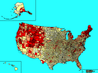
Scottish Americans or Scots Americans are Americans whose ancestry originates wholly or partly in Scotland. Scottish Americans are closely related to Scotch-Irish Americans, descendants of Ulster Scots, and communities emphasize and celebrate a common heritage. The majority of Scotch-Irish Americans originally came from Lowland Scotland and Northern England before migrating to the province of Ulster in Ireland and thence, beginning about five generations later, to North America in large numbers during the eighteenth century. The number of Scottish Americans is believed to be around 25 million, and celebrations of Scottish identity can be seen through Tartan Day parades, Burns Night celebrations, and Tartan Kirking ceremonies.

The Dalwhinnie distillery, situated in the Highland village of Dalwhinnie in Scotland, produces single malt Scotch whisky. The Dalwhinnie distillery is located in the Badenoch and Strathspey ward of the Highland Council and therefore is in the Speyside region. Under SWA regulations the full Speyside region falls within the boundaries of the Highlands and so can be labelled as such. The distillery is owned by Diageo.
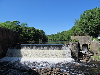
Beaver Brook is a 30.7-mile-long (49.4 km) river located in New Hampshire and Massachusetts in the United States. It is a tributary of the Merrimack River, part of the Gulf of Maine watershed.

The Old Scotch Church, also known as the Tualatin Plains Presbyterian Church, is a church and national historic site located in an unincorporated part of Washington County, Oregon, near Hillsboro, Oregon, United States. The church dates to 1873 while the church structure with an eight-sided steeple dates to 1878. A cemetery on the church grounds holds the graves of church members and local pioneer settlers of the Tualatin Plains, including Joseph Meek.

Nehalem Bay State Park is a state park in the United States located on the Oregon Coast, near the communities of Nehalem and Manzanita on the Nehalem Spit, a sand spit west of Nehalem Bay.
Scotch Grove is an unincorporated community in Jones County, Iowa, United States. Scotch Grove is located on Iowa Highway 38, southeast of Monticello and north of Center Junction. The townsite was listed as a historic district on the National Register of Historic Places in 2014.
Scotch Hill is a community that is located in Clarion County, Pennsylvania, United States. It was founded in the nineteenth century by James J. Scotch and William F. Hill.
Scotch Hill is an unincorporated community located in Preston County, West Virginia, United States.
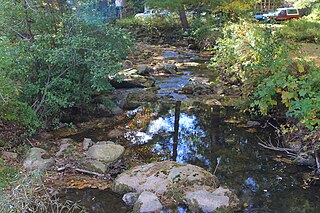
Scotch Run is one of the main tributaries of Catawissa Creek in Columbia County, Pennsylvania, in the United States. It is approximately 7.8 miles (12.6 km) long and flows through Beaver Township and Main Township. The stream's watershed has an area of 9.10 square miles (23.6 km2). The stream is infertile and acidic. It is 7.2 feet (2.2 m) wide in its upper reaches and 17.0 feet (5.2 m) wide in its lower reaches. The main rock formations in the watershed include the Mauch Chunk Formation, the Pocono Formation, the Pottsville Formation, and the Spechty Kopf Formation. The main soils include Leck Kill soil and Hazleton soil. It flows between Nescopeck Mountain and McCauley Mountain.
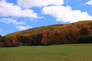
McCauley Mountain is a mountain in Columbia County, Pennsylvania, in the United States. Its official elevation is 1,571 feet (479 m) above sea level. The mountain is a synclinal mountain. Main rock formations on and near it include the Mauch Chunk Formation and the Pottsville Formation. There are also coal deposits on it. The coal deposits were discovered in 1826 and mining of them began in the 1850s. However, coal mining on the east side of the mountain proved to be a commercial failure. There are a number of ponds on the mountain, some of which were created during the mining. However, others are natural vernal pools. Some of the ponds are surrounded by hemlocks and deciduous trees. Major streams near the mountain include Scotch Run, Beaver Run, and Catawissa Creek. The mountain is named after Alexander McCauley, who settled there in 1774.
Scotch Run (also known as Scotch Run Creek is a tributary of Black Creek in Luzerne County, Pennsylvania, in the United States. It is approximately 1.6 miles long and flows through Black Creek Township. The stream is fed by springs and is located at the base of Nescopeck Mountain. It has not been assessed by the Pennsylvania Fish and Boat Commission.

Farm River is a south-flowing river located entirely within the U.S. state of Connecticut. Because it begins as freshwater in its northern reaches and flows into tidal salt water at Long Island Sound, Farm River is by definition an estuary. The river is 16.5 miles (26.6 km) long.
Craig Hill is a mountain located in the Catskill Mountains of New York east-southeast of Delhi. Calhoun Hill is located east, Bryden Mountain is located north, and Scotch Mountain is located west-northwest of Craig Hill.

Scotch Bonnet Mountain is a 10,385-foot (3,165-metre) summit in Park County, Montana, United States.

