Shawan Savan | |
|---|---|
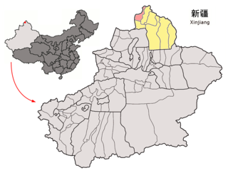
 Location of Shawan County (red) within Tacheng Prefecture (yellow) and Xinjiang | |
| Coordinates: 44°21′N85°37′E / 44.350°N 85.617°E | |
| Country | China |
| Autonomous region | Xinjiang |
| Prefecture | Tacheng |
| Municipal seat | Sadawkhuza (Sandaohezi) |
| Area | |
| • Total | 12,458.16 km2 (4,810.12 sq mi) |
| Population (2020) [1] | |
| • Total | 301,046 |
| • Density | 24/km2 (63/sq mi) |
| Time zone | UTC+8 (China Standard [lower-alpha 1] ) |
| Website | www |
- ↑ Locals in Xinjiang frequently observe UTC+6 (Xinjiang Time), 2 hours behind Beijing.
Related Research Articles
Altay or Aletai is a county-level city in Altay Prefecture within Ili Kazakh Autonomous Prefecture, in far Northern Xinjiang, China. The city centre is located on the banks of Kelan River.

Bole, also known by its Mongolian name Bortala, is a county-level city in Xinjiang, China. It is the seat of Bortala Mongol Autonomous Prefecture, which borders Kazakhstan. The city covers an area of 7,517 square kilometres (2,902 sq mi) and has a total population of 270,000 as of 2015. The Northern Xinjiang Railway runs through the city, as do highways to Ürümqi.
Usu as the official romanized name and transliterated from Mongolian, also known as Wusu, is a county-level city with more than 100,000 residents in Xinjiang, China. It is a part of Tacheng Prefecture of Ili Kazakh Autonomous Prefecture. Oil production is a major part of the economy while the county is an oasis in the Dzungarian Basin. Wusu lies between the major cities of Bole and Shihezi in Northern Xinjiang and west of Ürümqi and Kuitun, south of Karamay.

Tacheng, also known as Tarbagatay, Chuguchak or Qoqek, is a county-level city and the administrative seat of Tacheng Prefecture, in northern Ili Kazakh Autonomous Prefecture, Xinjiang. The Chinese name "Tacheng" is an abbreviation of "Tarbagatay City", a reference to the Tarbagatay Mountains. Tacheng is located in the Dzungarian Basin, some 10 km (6.2 mi) from the Chinese border with Kazakhstan. For a long time it has been a major center for trade with Central Asia because it is an agricultural hub. Its industries include food processing, textiles, and utilities.

Qapqal Xibe Autonomous County in Ili Kazakh Autonomous Prefecture in Northern Xinjiang, is the only Xibe autonomous county of China, bordering Kazakhstan's Almaty Region to the west. It has an area of 4,430 square kilometers and a population 160,000 (2000). Qapqal means "the granary" in the Xibe language.
Fuhai County as the official romanized name, also transliterated from Uyghur as Burultokay County, is a county in the Xinjiang Uyghur Autonomous Region and is under the administration of the Altay Prefecture. It has an area of 33,319.38 km2 (12,864.68 sq mi) with a population of 65,600. The county's postcode is 836400.
Habahe County as the official romanized name, also transliterated from Uyghur as Kaba County, is a county situated in the far north of the Xinjiang Uyghur Autonomous Region and is under the administration of the Altay Prefecture. It has an area of 8,179 km2 (3,158 sq mi) with a population of 80,000. The Postcode is 836700.

Jeminay County or Jimunai County, is a county situated in the north of the Xinjiang Uyghur Autonomous Region and is under the administration of the Altay Prefecture.

Yumin County as the official romanized name, also transliterated from Mongolian as Qagantokay County, is a county situated in the Xinjiang Uyghur Autonomous Region and is under the administration of the Tacheng Prefecture, bordering Kazakhstan's regions of East Kazakhstan and Almaty. It has an area of 6,090 km2 (2,350 sq mi) with a population of 50,000. The Postcode is 834800.

Toli County is a county situated in the north of the Xinjiang Uyghur Autonomous Region and is under the administration of the Tacheng Prefecture. It has an area of 19,982 km2 (7,715 sq mi) with a population of 90,000. The Postcode is 834500.

Emin County, the official romanized name, also transliterated from Mongolian as Dörbiljin County, is a county situated in the north of the Xinjiang Uyghur Autonomous Region and is under the administration of the Tacheng Prefecture, bordering Kazakhstan's districts of Tarbagatay and Zaysan. It has an area of 9,092 km2 (3,510 sq mi) with a population of 200,000. The Postcode is 834600.

Hejing County is located in the central-southern part of the Tian Shan mountains of Xinjiang, in the north-west of Bayingolin Mongol Autonomous Prefecture. The northernmost county-level division of Bayingolin, it borders Ürümqi City to the north, from which it is 190 km (120 mi) as the crow flies, and Korla City to the south, which is 80 km (50 mi) away. It borders 15 cities and counties and is the most bordered county in the world.
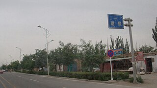
Yuli County as the official Romanized name, also transliterated from Mongolian as Lopnur County, is a county in the Xinjiang Uyghur Autonomous Region and is under the administration of the Bayin'gholin Mongol Autonomous Prefecture. It contains an area of 59,399 km2 (22,934 sq mi). According to the 2002 census, it has a population of 100,000.

Bohu County as the official romanized name, also transliterated from Uyghur as Bagrax County, is a county in the central part of the Xinjiang Uyghur Autonomous Region and is under the administration of the Bayin'gholin Mongol Autonomous Prefecture. It contains an area of 3,603 km2 (1,391 sq mi). According to the 2002 census, it has a population of 60,000.

Jinghe County as the official romanized name, also transliterated from Uyghur as Jing County, is a county of the Xinjiang Uyghur Autonomous Region and is under the administration of the Börtala Mongol Autonomous Prefecture. It contains an area of 11,181 square kilometres (4,317 sq mi). According to the 2002 census, it has a population of 120,000.
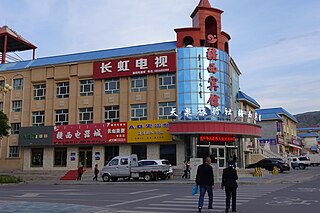
Wenquan County as the official romanized name, also transliterated from Mongolian as Arixang County, is a county in the northwest of the Xinjiang Uyghur Autonomous Region and is under the administration of the Börtala Mongol Autonomous Prefecture, bordering Kazakhstan's Almaty Region to the north and west. It contains an area of 5,900 km2 (2,300 sq mi). According to the 2020 census, it has a population of 49,696.

Hoboksar, sometimes referred with the historic name Hefeng County, is an autonomous county for Mongol people in the middle north of Xinjiang Uyghur Autonomous Region, Western China, it is under the administration of Tacheng Prefecture. The county has an area of 28,784 km2 (11,114 sq mi) with a population of 62,100. It has eight towns and townships and seven farms, Hoboksar Town is its county seat.

Yining County as the official romanized name, also transliterated from Uyghur as Gulja County, is a county within the Ili Kazakh Autonomous Prefecture of the Xinjiang Uyghur Autonomous Region of China. The county seat is in the town of Jëlilyüzi.

Zhaosu County, also known as Mongolküre County, is a county in northwestern Xinjiang, China. It is under the administration of Ili Kazakh Autonomous Prefecture and shares a border with Kazakhstan's Almaty Region to the west. It covers an area of 10,455 km2 (4,037 sq mi). According to the 2012 census, it had a population of 189,102.

Tekes County is a county within the Xinjiang Uyghur Autonomous Region and is under the administration of the Ili Kazakh Autonomous Prefecture. It contains an area of 8,067 km2. According to the 2002 census, it has a population of 150,000.
References
- ↑ Xinjiang: Prefectures, Cities, Districts and Counties
- ↑ 3-7 各地、州、市、县(市)分民族人口数 [3-7 Population by Nationality by Prefecture, State, City and County (City)]. tjj.xinjiang.gov.cn (in Chinese). Statistical Bureau of Xinjiang Uyghur Autonomous Region. 2020-06-10. Archived from the original on 2020-11-01. Retrieved 2021-06-11.
- ↑ 2022年统计用区划代码和城乡划分代码:沙湾市. National Bureau of Statistics of China.
- 1 2 中国气象数据网 – WeatherBk Data (in Simplified Chinese). China Meteorological Administration . Retrieved 10 October 2023.
- ↑ 中国气象数据网 (in Simplified Chinese). China Meteorological Administration . Retrieved 10 October 2023.
- ↑ 中国气象数据网 (in Simplified Chinese). China Meteorological Administration . Retrieved 10 October 2023.
| Shawan, Xinjiang | |||||||||
|---|---|---|---|---|---|---|---|---|---|
| Chinese name | |||||||||
| Simplified Chinese | 沙湾市 | ||||||||
| Traditional Chinese | 沙灣市 | ||||||||
| |||||||||
| |||||||||


