Shirleysburg, Pennsylvania

Last updated
Shirleysburg, Pennsylvania
Borough
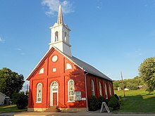
Benjamin B. Leas House.jpg
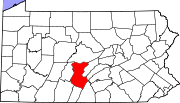
Huntingdon County Pennsylvania Incorporated and Unincorporated areas Shirleysburg Highlighted.svg
Location of Shirleysburg in Huntingdon County, Pennsylvania.
USA Pennsylvania location map.svg
Red pog.svg
Shirleysburg
Usa edcp location map.svg
Red pog.svg
Shirleysburg
Coordinates: 40°17′51″N77°52′31″W / 40.29750°N 77.87528°W / 40.29750; -77.87528
Country United States
State Pennsylvania
County Huntingdon
Government
  TypeBorough Council
Area
[1]
  Total0.16 sq mi (0.41 km2)
  Land0.16 sq mi (0.41 km2)
  Water0.00 sq mi (0.00 km2)
Elevation
[2]
584 ft (178 m)
Population
 (2010)
  Total150
  Estimate 
(2019) [3]
139
  Density868.75/sq mi (335.98/km2)
Time zone UTC-5 (Eastern (EST))
  Summer (DST) UTC-4 (EDT)
ZIP code
17260
Area code 814
FIPS code 42-70408
GNIS feature ID 1215280 [2]
Local phone exchanges: 447, 448

Shirleysburg is a borough in Huntingdon County, Pennsylvania, United States. The population was 150 at the 2010 census. [4]

Contents

History

Shirleysburg was originally the site of, and takes its name from Fort Shirley, a French and Indian War fort. In 1754 the Oneida chief Monacatoocha (Scarouady) led about 200 pro-British Native Americans (Iroquois, Lenape, and Shawnee) from their village of Logstown on the western frontier, to take refuge at George Croghan's trading post. [5] In 1754, Croghan built a stockaded blockhouse known as "Croghan's Fort." Following General Edward Braddock's defeat in July 1755, Governor Robert Hunter Morris ordered it renamed Fort Shirley and had several other forts built in a defensive line, to protect settlers from Native American attacks. [6] The fort was abandoned in late 1756 because it was considered too difficult to defend. [7]

On April 3, 1837, Shirleysburg was incorporated as a borough. In 1840 the population was 247. [8] :310 The narrow gauge East Broad Top Railroad (EBT) was constructed through Shirleysburg in 1873. It continued to serve the town for 83 years, until it ceased operations in 1956. Since 1960 EBT tourist trains have operated from Rockhill to Colgate Grove, just south of town, where a wye was constructed to turn trains. The inactive tracks pass through the community on their way to Mount Union.

The Benjamin B. Leas House was listed on the National Register of Historic Places in 1984. [9]

Shirleysburg United Methodist Church Shirleysburg PA United Methodist.jpg
Shirleysburg United Methodist Church

Geography

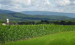
Shirleysburg is located in southeastern Huntingdon County in the valley of Aughwick Creek, between Blacklog Mountain to the east and Jacks Mountain to the west. U.S. Route 522 passes through the borough, leading north 6 miles (10 km) to Mount Union and south 4 miles (6 km) to Orbisonia, next to Rockhill.

According to the United States Census Bureau, Shirleysburg has a total area of 0.4 square kilometres (0.2 sq mi), all land. [4] The western border of the borough follows Aughwick Creek, a northward-flowing tributary of the Juniata River.

Demographics

Historical population
CensusPop.Note
1840 247
1850 36146.2%
1860 354−1.9%
1870 320−9.6%
1880 36714.7%
1890 325−11.4%
1900 230−29.2%
1910 25611.3%
1920 200−21.9%
1930 2178.5%
1940 24211.5%
1950 241−0.4%
1960 170−29.5%
1970 23840.0%
1980 147−38.2%
1990 140−4.8%
2000 1400.0%
2010 1507.1%
2019 (est.)139 [3] −7.3%
Sources: [10] [11] [12]

As of the census [11] of 2000, there were 140 people, 61 households, and 38 families residing in the borough. The population density was 878.5 inhabitants per square mile (339.2/km2). There were 64 housing units at an average density of 401.6 per square mile (155.1/km2). The racial makeup of the borough was 97.86% White, 1.43% Native American, 0.71% from other races. Hispanic or Latino of any race were 0.71% of the population.

There were 61 households, out of which 26.2% had children under the age of 18 living with them, 49.2% were married couples living together, 9.8% had a female householder with no husband present, and 36.1% were non-families. 31.1% of all households were made up of individuals, and 16.4% had someone living alone who was 65 years of age or older. The average household size was 2.30 and the average family size was 2.82.

In the borough the population was spread out, with 25.7% under the age of 18, 5.0% from 18 to 24, 23.6% from 25 to 44, 29.3% from 45 to 64, and 16.4% who were 65 years of age or older. The median age was 42 years. For every 100 females there were 100.0 males. For every 100 females age 18 and over, there were 96.2 males.

The median income for a household in the borough was $26,250, and the median income for a family was $40,625. Males had a median income of $27,083 versus $18,750 for females. The per capita income for the borough was $13,586. There were 5.7% of families and 13.6% of the population living below the poverty line, including 19.4% of under eighteens and 22.2% of those over 64.

Related Research Articles

<span class="mw-page-title-main">Huntingdon County, Pennsylvania</span> County in Pennsylvania, United States

Huntingdon County is a county in the Commonwealth of Pennsylvania. As of the 2020 census, the population was 44,092. Its county seat is Huntingdon. The county was created on September 20, 1787, mainly from the northern part of Bedford County, plus an addition of territory on the east from Cumberland County. The county is part of the Southwest Pennsylvania region of the state.

<span class="mw-page-title-main">Hopewell, Bedford County, Pennsylvania</span> Borough in Pennsylvania, United States

Hopewell is a borough in Bedford County, Pennsylvania, United States. The population was 189 at the 2020 census.

<span class="mw-page-title-main">Saxton, Pennsylvania</span> Borough in Pennsylvania, United States

Saxton is a borough in Bedford County, Pennsylvania, United States. The population was 726 at the 2020 census.

<span class="mw-page-title-main">Fannett Township, Pennsylvania</span> Township in Pennsylvania, United States

Fannett Township is a township in Franklin County, Pennsylvania, United States. The population was 2,483 at the 2020 census. The township derives its name as an older variant spelling of Fanad, County Donegal, from early Irish settlement in the area. It was formed before 1762, and until about 1795 included the area now in Metal Township.

<span class="mw-page-title-main">Coalmont, Pennsylvania</span> Borough in Pennsylvania, United States

Coalmont is a borough in Huntingdon County, Pennsylvania, United States. The population was 91 at the 2020 census.

<span class="mw-page-title-main">Dudley, Pennsylvania</span> Borough in Pennsylvania, United States

Dudley is a borough in Huntingdon County, Pennsylvania, United States. The population was 185 at the 2020 census.
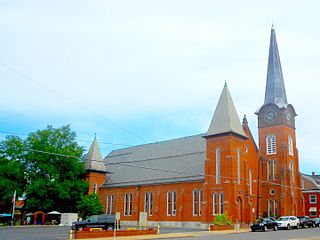
<span class="mw-page-title-main">Mapleton, Pennsylvania</span> Borough in Pennsylvania, United States

Mapleton is a borough in Huntingdon County, Pennsylvania, United States. The population was 441 at the 2010 census. It is located on the Juniata River, which is a tributary of the Susquehanna River.
<span class="mw-page-title-main">Mill Creek, Pennsylvania</span> Borough in Pennsylvania, United States

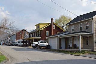
Mill Creek is a borough in Huntingdon County, Pennsylvania, United States. The population was 328 at the 2010 census.

<span class="mw-page-title-main">Mount Union, Pennsylvania</span> Borough in Pennsylvania, United States

Mount Union is a borough in Huntingdon County, Pennsylvania, United States, approximately 44 miles (71 km) southeast of Altoona and 12 miles (19 km) southeast of Huntingdon, on the Juniata River. In the vicinity are found bituminous coal, ganister rock, fire clay, and some timber. A major Easter grass factory is located in the northern quadrant of the borough limits; until May 2007, the facility was owned by Bleyer Industries. The population was 2,447 at the 2010 census.

<span class="mw-page-title-main">Orbisonia, Pennsylvania</span> Borough in Pennsylvania, United States

Orbisonia is a borough in Huntingdon County, Pennsylvania, United States. The population was 428 at the 2010 census.
<span class="mw-page-title-main">Penn Township, Huntingdon County, Pennsylvania</span> Township in Pennsylvania, United States

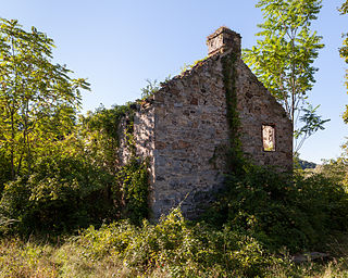
Penn Township is a township in Huntingdon County, Pennsylvania, United States. The population was 1,078 at the 2020 census. The township includes the village of Hesston and the Seven Points Marina of Raystown Lake.

<span class="mw-page-title-main">Petersburg, Pennsylvania</span> Borough in Pennsylvania, United States

Petersburg is a borough in Huntingdon County, Pennsylvania, United States. It was a stop on the former Pennsylvania Railroad Main Line between Tyrone and Huntingdon and the junction point for the Petersburg Branch. The population was 480 at the 2010 census.
<span class="mw-page-title-main">Rockhill, Pennsylvania</span> Borough in Pennsylvania, United States

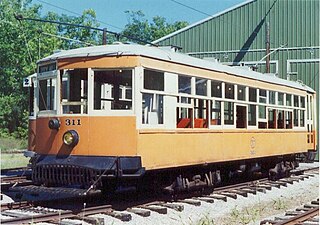
Rockhill or Rockhill Furnace is a borough in Huntingdon County, Pennsylvania, United States. The population was 371 at the 2010 census, down from 414 at the 2000 census. It is the site of the East Broad Top Railroad and the Rockhill Trolley Museum.

<span class="mw-page-title-main">Saltillo, Pennsylvania</span> Borough in Pennsylvania, United States

Saltillo is a borough in Huntingdon County, Pennsylvania, United States. The population was 346 at the 2010 census.

<span class="mw-page-title-main">Shade Gap, Pennsylvania</span> Borough in Pennsylvania, United States

Shade Gap is a borough in Huntingdon County, Pennsylvania, United States. The population was 105 at the 2010 census.

<span class="mw-page-title-main">Shirley Township, Pennsylvania</span> Township in Pennsylvania, United States

Shirley Township is a township in Huntingdon County, Pennsylvania, United States. The population was 2,407 at the 2020 census.

<span class="mw-page-title-main">Three Springs, Pennsylvania</span> Borough in Pennsylvania, United States

Three Springs is a borough in Huntingdon County, Pennsylvania, United States. The population was 444 at the 2010 census.

<span class="mw-page-title-main">Thompsontown, Pennsylvania</span> Borough in Pennsylvania, United States

Thompsontown is a borough in Juniata County, Pennsylvania, United States. The population was 629 at the 2020 census.

<span class="mw-page-title-main">Millerstown, Pennsylvania</span> Borough in Pennsylvania, United States

Millerstown is a borough in northern Perry County, Pennsylvania, United States, located 29 miles (47 km) northwest of Harrisburg and 29 miles (47 km) southwest of Selinsgrove. The population was 688 at the 2020 Census. The borough is part of the Harrisburg–Carlisle Metropolitan Statistical Area.

<span class="mw-page-title-main">Fort Shirley</span> 18th-century fort in colonial Pennsylvania

Fort Shirley was a military fort located in present-day Shirleysburg, Pennsylvania. It was built in 1755 by George Croghan and later maintained by the Province of Pennsylvania during the French and Indian War. Fort Shirley was part of a defensive line of forts built in Pennsylvania during 1755 and 1756, at the start of hostilities with the French and their allied Native Americans. Although two French and Native American war parties were sent to capture it, Fort Shirley was never attacked. The fort served as the launching site for the Kittanning Expedition in September 1756, after which it was abandoned.

References

  1. "2019 U.S. Gazetteer Files". United States Census Bureau. Retrieved July 28, 2020.
  2. 1 2 U.S. Geological Survey Geographic Names Information System: Shirleysburg, Pennsylvania
  3. 1 2 "Population and Housing Unit Estimates". United States Census Bureau. May 24, 2020. Retrieved May 27, 2020.
  4. 1 2 "Geographic Identifiers: 2010 Census Summary File 1 (G001): Shirleysburg borough, Pennsylvania". American Factfinder. U.S. Census Bureau. Archived from the original on February 13, 2020. Retrieved January 23, 2018.
  5. Jonathan A. Burns, "Report from the Fort: A Brief Summary of the 2012 Penn State University Archaeology Field School at Fort Shirley (36HU94)," This Week In Pennsylvania Archaeology, Friday, July 6, 2012
  6. Hanna, Charles Augustus (1911). The Wilderness Trail: Or, The Ventures and Adventures of the Pennsylvania Traders on the Allegheny Path. Vol. 1. Putnam's Sons.
  7. Waddel, Louis M. and Bomberger, Bruce D. 1996. The French and Indian War In Pennsylvania, 1753–1763. Pennsylvania Historical and Museum Commission, Commonwealth of Pennsylvania, Harrisburg PA, 1996. ISBN   0-89271-057-8
  8. J. W. Jordan, A History of the Juniata River Valley in Three Volumes, vol. III. National Historical Association, Harrisburg, PA, 1936
  9. "National Register Information System". National Register of Historic Places . National Park Service. July 9, 2010.
  10. "Census of Population and Housing". U.S. Census Bureau. Retrieved 11 December 2013.
  11. 1 2 "U.S. Census website". United States Census Bureau . Retrieved 2008-01-31.
  12. "Incorporated Places and Minor Civil Divisions Datasets: Subcounty Resident Population Estimates: April 1, 2010 to July 1, 2012". Population Estimates. U.S. Census Bureau. Archived from the original on 11 June 2013. Retrieved 11 December 2013.