
Bowen is a coastal town and locality in the Whitsunday Region on the eastern coast of Queensland, Australia. The locality is a large one, and contains two other towns, Heronvale and Merinda. The Abbot Point coal shipping port is also within the locality. At the 2016 census, Bowen had a population of 10,377.
Strathmore, from the Scottish Gaelic for large valley, can refer to:
Airlie Beach is a coastal locality in the Whitsunday Region of Queensland, Australia. In the 2016 census, Airlie Beach had a population of 1,208 people.

Shute Harbour is a coastal locality and harbour in the Whitsunday Region of Queensland, Australia. In the 2016 census, Shute Harbour had a population of 122 people.

Collinsville is a rural town and locality in the Whitsunday Region, Queensland, Australia. In the 2016 census, Collinsville had a population of 1,248 people.

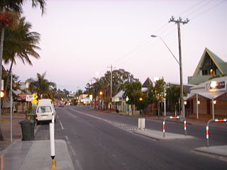
Scottville is a small town and locality in the Whitsunday Region, Queensland, Australia.

Warrill View is a rural town and locality in the Scenic Rim Region, Queensland, Australia. In the 2016 census, Warrill View had a population of 240 people.

Dalveen is a town and a locality in the Southern Downs Region, Queensland, Australia. It borders New South Wales. In the 2016 census, Dalveen had a population of 335 people.
Mount Coolon is a small town and locality in the Whitsunday Region, Queensland, Australia.

Cannonvale is a coastal locality in the Whitsunday Region, Queensland, Australia. In the 2016 census, Cannonvale had a population of 5,716 people.

Gunnawarra is a rural locality in the Tablelands Region, Queensland, Australia. In the 2016 census, Gunnawarra had a population of 13 people.

Strathmore Homestead is a heritage-listed homestead at Strathmore Station on Strathmore Road, Springlands, Whitsunday Region, Queensland, Australia. It was built from the 1860s onward. It is also known as Strathmore Station. It was added to the Queensland Heritage Register on 13 November 2008.

Mount Rooper is a coastal locality in the Whitsunday Region, Queensland, Australia. In the 2016 census, Mount Rooper had no population.

Flametree is a coastal locality in the Whitsunday Region, Queensland, Australia. In the 2016 census, Flametree had a population of 122 people.

Jubilee Pocket is a locality in the Whitsunday Region, Queensland, Australia. In the 2016 census, Jubilee Pocket had a population of 1817 people.
Conway Beach is a coastal locality in the Whitsunday Region, Queensland, Australia. In the 2016 census, Conway Beach had a population of 80 people.
Woodwark is a coastal locality in the Whitsunday Region, Queensland, Australia. In the 2016 census, Woodwark had a population of 374 people.
Hideaway Bay is a coastal town and a locality in the Whitsunday Region, Queensland, Australia. In the 2016 census, Hideaway Bay had a population of 205 people.
Bogie is a rural locality in the Whitsunday Region, Queensland, Australia. In the 2016 census, Bogie had a population of 161 people.
Preston is a rural locality in the Whitsunday Region, Queensland, Australia. In the 2016 census, Preston had a population of 296 people. The town of Bonavista is within the south of the locality.
