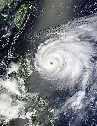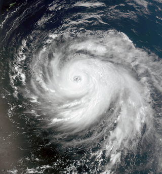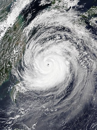
The 2012 Pacific typhoon season was a slightly above average season that produced 25 named storms, fourteen typhoons, and four intense typhoons. It was a destructive and the second consecutive year to be the deadliest season, primarily due to Typhoon Bopha which killed 1,901 people in the Philippines. It was an event in the annual cycle of tropical cyclone formation, in which tropical cyclones form in the western Pacific Ocean. The season ran throughout 2012, though most tropical cyclones typically develop between May and October. The season's first named storm, Pakhar, developed on March 28, while the season's last named storm, Wukong, dissipated on December 29. The season's first typhoon, Guchol, reached typhoon status on June 15, and became the first super typhoon of the year on June 17.

Tropical Storm Etau was the deadliest tropical cyclone to impact Japan since Typhoon Tokage in 2004. Forming on August 8, 2009 from an area of low pressure, the system gradually intensified into a tropical storm. Tracking in a curved path around the edge of a subtropical ridge, Etau continued to intensify as it neared Japan. By August 10, the cyclone reached its peak intensity as a weak tropical storm with winds of 75 km/h and a barometric pressure of 992 hPa (mbar). Shortly after, Etau began to weaken. Increasing wind shear led to the center becoming devoid of convection and the system eventually weakened to a tropical depression on August 13. The remnants of Etau persisted for nearly three days before dissipating early on August 16.

The 2013 Pacific typhoon season was the most active Pacific typhoon season since 2004, and the deadliest since 1975. It featured Typhoon Haiyan, one of the most powerful storms and one of the strongest landfalling tropical cyclones in history. It was an above-average season with 31 named storms, 13 typhoons, and five super typhoons. The season's first named storm, Sonamu, developed on January 4 while the season's last named storm, Podul, dissipated on November 15. Despite the activity, most of the first seventeen named storms before mid-September were relatively weak, as only two of them reached typhoon intensity. Total damage amounted to at least $26.41 billion (USD), making it at the time the costliest Pacific typhoon season on record; it is currently the fourth costliest, behind the 2018, 2019 and 2023 seasons.

The 2015 Pacific typhoon season was a slightly above average season that produced twenty-seven tropical storms, eighteen typhoons, and nine super typhoons. The season ran throughout 2015, though most tropical cyclones typically develop between May and November. The season's first named storm, Mekkhala, developed on January 15, while the season's last named storm, Melor, dissipated on December 17. The season saw at least one named tropical system forming in each of every month, the first time since 1965. Similar to the previous season, this season saw a high number of super typhoons. Accumulated cyclone energy (ACE) during 2015 was extremely high, the third highest since 1970, and the 2015 ACE has been attributed in part to anthropogenic warming, and also the 2014-16 El Niño event, that led to similarly high ACE values in the East Pacific.

The 2018 Pacific typhoon season was at the time, the costliest Pacific typhoon season on record, until the record was beaten by the following year. The season was well above-average, producing twenty-nine storms, thirteen typhoons, seven super typhoons and six Category 5 tropical cyclones. The season ran throughout 2018, though most tropical cyclones typically develop between May and October. The season's first named storm, Bolaven, developed on January 3, while the season's last named storm, Man-yi, dissipated on November 28. The season's first typhoon, Jelawat, reached typhoon status on March 29, and became the first super typhoon of the year on the next day.

Typhoon Nanmadol, known in the Philippines as Super Typhoon Mina, was the strongest tropical cyclone in 2011 to hit the Philippines and also the second most intense tropical cyclone worldwide in 2011, and the first of the year to directly impact Taiwan and the rest of the Republic of China (ROC). Becoming the eleventh named storm, the seventh severe tropical storm and the fourth typhoon of the 2011 Pacific typhoon season, Nanmadol made a total of three landfalls killing 26, and causing widespread damage worth US$26,464,591. The area of low pressure that was about to become Nanmadol formed on August 19. It drifted north and became a tropical depression on August 21, a tropical storm on August 23 and a typhoon on the same night. Nanmadol reached peak strength with winds of 105 knots and 140 knots threatening the Philippines with heavy rain and flash flooding.

Typhoon Tembin, known in the Philippines as Typhoon Igme, was an intense tropical cyclone in the Western Pacific Ocean that had an unusual trajectory, approaching Taiwan twice. Tembin, which means balancing scale or Libra in Japanese, was the eighth typhoon and the fourteenth named storm of the 2012 Pacific typhoon season. After making landfall over the southern tip of Taiwan late on August 23, Tembin weakened but regained strength in the South China Sea, looping before making a second landfall on southern Taiwan as a tropical storm on August 27; however, the system did not restrengthen in the East China Sea, and made landfall over South Korea on August 30 before becoming extratropical.

Typhoon Soulik, known in the Philippines as Super Typhoon Huaning, was a powerful tropical cyclone that caused widespread damage in Taiwan and East China in July 2013. The storm originated from an upper-level cold-core low well to the northeast of Guam on July 6. Gaining tropical characteristics, the system soon developed a surface low and became a tropical depression early on July 7. Tracking generally westward, a motion it would retain for its entire existence, the depression underwent a period of rapid intensification starting on July 8 that culminated in Soulik attaining its peak strength early on July 10. At that time, the system had sustained winds estimated at 185 km/h (115 mph) and barometric pressure of 925 mbar. Thereafter, an eyewall replacement cycle and cooler waters weakened the system. Though it passed over the warm waters of the Kuroshio Current the following day, dry air soon impinged upon the typhoon. Soulik later made landfall late on July 12 in northern Taiwan before degrading to a tropical storm. Briefly emerging over the Taiwan Strait, the storm moved onshore for a second time in Fujian on July 13. The system was last noted as a tropical depression early on July 14.

Typhoon Usagi, known in the Philippines as Super Typhoon Odette, was a violent tropical cyclone which affected Taiwan, the Philippines, China, and Hong Kong in September 2013. Usagi, or which means the constellation Lepus in Japanese, was the fourth typhoon and the nineteenth tropical storm in the basin. Developing into a tropical storm east of the Philippines late on September 16, Usagi began explosive intensification on September 19 and ultimately became a violent and large typhoon. Afterwards, the system weakened slowly, crossed the Bashi Channel on September 21, and made landfall over Guangdong, China on September 22.

Typhoon Fitow, known in the Philippines as Typhoon Quedan, was the strongest typhoon to make landfall in Mainland China during October since 1949. The 21st named storm of the 2013 Pacific typhoon season, Fitow developed on September 29 to the east of the Philippines. It initially tracked north-northwestward, gradually intensifying into a tropical storm and later to typhoon status, or with winds of at least 120 km/h (75 mph). Fitow later turned more to the west-northwest due to an intensifying ridge to the east, bringing the typhoon over the Ryukyu Islands with peak winds of 140 km/h (87 mph) on October 5. The next day, the typhoon struck China at Fuding in Fujian province. Fitow quickly weakened over land, dissipating on October 7.

Typhoon Matmo, known in the Philippines as Typhoon Henry, was the first tropical cyclone to impact Taiwan in 2014. It was the tenth named storm and the fourth typhoon of the 2014 Pacific typhoon season. The typhoon is believed to be one of the main reasons behind the crash of TransAsia Airways Flight 222, which occurred a day after it made landfall. There were fifty-four passengers on board and a crew of four, of whom 48 were killed. Taiwan News reported that "first suspicions hinted" the accident might be related to Matmo. The typhoon developed from a cluster of thundershowers consolidating around an area of low pressure in the doldrums. It initially followed a westward track, then made a sharp northwest turn before making landfall on Taiwan, and then China. After moving further inland, Matmo slowly curved back northeastwards and became extratropical before its remnants affected the Korean Peninsula.

Typhoon Chan-hom, known in the Philippines as Typhoon Falcon, was a large, powerful and long-lived tropical cyclone that affected most countries in the western Pacific basin. The ninth named storm of the 2015 Pacific typhoon season, Chan-hom developed on June 29 from a westerly wind burst that also spawned Tropical Cyclone Raquel in the southern hemisphere. Chan-hom slowly developed while moving to the northwest, aided by warm waters but disrupted by wind shear. The storm meandered near the Northern Marianas Islands, passing over the island of Rota before beginning a steady northwest track. While near the island, the storm dropped heavy rainfall on neighboring Guam, causing flooding and minor power outages. Chan-hom intensified into a typhoon on July 7, and two days later passed between the Japanese islands of Okinawa and Miyako-jima. There, strong winds left 42,000 people without power, while 27 people were injured. Around that time, the storm caused a surge in the monsoon trough, in conjunction with Tropical Storm Linfa, which caused flooding and killed 16 people in the Philippines.

Severe Tropical Storm Linfa, known in the Philippines as Severe Tropical Storm Egay, was a tropical cyclone that affected the northern Philippines, Taiwan and southern China in early July 2015. The tenth named storm of the annual typhoon season, Linfa developed on July 1 over in the Philippine Sea. It moved erratically westward toward the Philippines, eventually striking the island of Luzon on July 4. Linfa weakened across the island, but reorganized over the South China Sea. It turned northward and strengthened to near typhoon intensity, or winds of 120 km/h (75 mph), but weakened as it curved to the northwest toward southern China. On July 9, the storm made landfall along the Chinese province of Guangdong, dissipating the next day west of Hong Kong.

Typhoon Dujuan, known in the Philippines as Super Typhoon Jenny, was the second most intense tropical cyclone of the Northwest Pacific Ocean in 2015 in terms of ten-minute maximum sustained winds, tied with Noul. The twenty-first named storm and the thirteenth typhoon of the 2015 Pacific typhoon season, Dujuan brought extremely powerful winds throughout the Yaeyama Islands and Taiwan in late September, causing 3 deaths in Taiwan. The typhoon also caused over ¥2.5 billion (US$392.9 million) damage in East China.

Typhoon Meranti, known in the Philippines as Super Typhoon Ferdie, was one of the most intense tropical cyclones on record. Impacting the Batanes in the Philippines, Taiwan, as well as Fujian Province in September 2016, Meranti formed as a tropical depression on September 8 near the island of Guam. Tracking to the west northwest, Meranti gradually intensified until September 11, at which point it began a period of rapid intensification. Continuing to rapidly intensify, it became a super typhoon early on September 12, as it passed through the Luzon Strait, ultimately reaching its peak intensity on September 13 with 1-minute sustained winds of 315 km/h (195 mph). Shortly afterwards, it passed directly over the island of Itbayat. Meranti passed to the south of Taiwan as a super typhoon, and began weakening steadily as a result of land interaction. By September 15, it struck Fujian Province as a Category 2-equivalent typhoon, becoming the strongest typhoon on record to impact the province. Upon moving inland, rapid weakening ensued and Meranti became extratropical the next day, dissipating shortly afterwards after it passed to the south of the Korean Peninsula.

Typhoon Megi, known in the Philippines as Typhoon Helen, was a large and powerful tropical cyclone which affected Taiwan and eastern China in late September 2016. It is the seventeenth named storm and the seventh typhoon of the annual typhoon season. Megi started as a tropical disturbance in the northeast of Pohnpei. On September 21, JMA upgraded the disturbance to a tropical depression. The depression was immediately named Megi by the JMA as it was classified as a tropical storm. It was later then designated by JTWC as a newly formed Tropical Depression 20W. Moving northwestwards, Megi was trying to form an eye which prompted the agencies to upgrade into a typhoon. Megi later entered PAR, attaining the name Helen as it continued to intensify. Favorable conditions and low vertical wind shear allow Megi to perform an eyewall replacement cycle as it approaches Taiwan.

Typhoon Nesat, known in the Philippines as Typhoon Gorio, was a strong tropical cyclone that impacted Taiwan and Fujian, China. It was the ninth named storm and the second typhoon of the annual typhoon season. After consolidating slowly for several days, Tropical Storm Nesat developed east of the Philippines on July 25. While experiencing favorable environmental conditions such as very warm sea surface temperatures and low wind shear, Nesat strengthened into a typhoon and reached its peak intensity on July 28. On July 29, the typhoon made landfall near the Taiwanese city of Yilan, before weakening to a severe tropical storm and making landfall again near Fuqing on China's east coast late the same day. Moving into July 30, Nesat continued to weaken under the effects of land interaction.

Typhoon Kong-rey, known in the Philippines as Super Typhoon Queenie, was a large and powerful typhoon that was tied with Typhoon Yutu as the most powerful tropical cyclone worldwide in 2018. The twenty-fifth tropical storm, eleventh typhoon and 6th super typhoon of the 2018 Pacific typhoon season, Kong-rey originated from a tropical disturbance in the open Pacific. For a couple days, it went westward, organizing into a tropical depression on September 27. Then it intensified into a powerful Category 5 super typhoon early on October 2. Kong-rey underwent an eyewall replacement cycle after its peak intensity, causing it to weaken into a Category 3 typhoon under unfavorable conditions. Kong-rey then struck South Korea on October 6 as a tropical storm. Kong-rey transitioned into an extratropical cyclone later that day while impacting Japan.

Typhoon Lekima, known in the Philippines as Super Typhoon Hanna, was the third costliest typhoon in Chinese history. The ninth named storm of the 2019 Pacific typhoon season, Lekima originated from a tropical depression that formed east of the Philippines on 30 July. It gradually organized, became a tropical storm, and was named on 4 August. Lekima intensified under favorable environmental conditions and peaked as a Category 4–equivalent Super typhoon. However, an eyewall replacement cycle caused the typhoon to weaken before it made landfall in Zhejiang early on 10 August, as a Category 2–equivalent typhoon. Lekima weakened subsequently while moving across Eastern China, and made its second landfall in Shandong on 11 August.

Typhoon Maysak, known in the Philippines as Typhoon Julian, was a deadly, damaging and powerful tropical cyclone that struck the Ryukyu Islands and the Korean Peninsula in September 2020. The third typhoon of the 2020 Pacific typhoon season, Maysak formed from a tropical disturbance. The disturbance gradually organized, receiving the name Julian from PAGASA as it became a tropical depression. As the depression strengthened, the JMA subsequently named the system Maysak. Maysak rapidly intensified into a strong typhoon before weakening and making landfall in South Korea.


