Wangsa Maju LRT station

Last updated
 KJ3  Wangsa Maju
Rapid KL Logo.svg | LRT station
Wangsa Maju LRT Station (211031).jpg
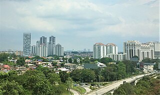
Wangsa Maju LRT station from pedestrian walkway with pink colour Feeder Bus stop at the station
General information
Other names旺沙玛珠 (Chinese)
வாங்கச மாசு (Tamil)
LocationJalan 1/27A and Jalan 16/27B
Section 2, Wangsa Maju
53300, Kuala Lumpur, Malaysia
Coordinates 3°12′20″N101°43′53″E / 3.20556°N 101.73139°E / 3.20556; 101.73139
Owned by Prasarana Malaysia
Operated by Rapid Rail
Line(s) 5 Kelana Jaya Line
Platforms2 Island platform
Tracks2
Construction
Structure typeElevated
ParkingAvailable with payment, under DBKL.259 parking bays.100 motorcycle bays
AccessibleAvailable
Other information
Station code KJ3 
History
Opened1 June 1999;25 years ago (1999-06-01)
Services
Preceding station Rapid KL Logo.svg Following station
Taman Melati
towards Gombak
Kelana Jaya Line Sri Rampai
towards Putra Heights

Wangsa Maju LRT station is an elevated rapid transit station in Wangsa Maju, Kuala Lumpur, Malaysia, forming part of the Kelana Jaya line (formerly known as PUTRA). The station opened on 1 June 1999, as part of the line's second segment encompassing 12 stations between Kelana Jaya station and Terminal PUTRA and an underground line.

Contents

Location

Wangsa Maju station is the third last station northwards to Gombak.

The station is situated directly within the northern Kuala Lumpur suburb of Wangsa Maju . The station, located along the main thoroughfare of Jalan 1/27A (Malay; English: 1/27A Road) running from the northwest to the southeast, is wedged between two residential estates: Section 1 of Wangsa Maju to the southwest and Desa Setapak (Setapak Countryside) to the northwest, with Section 2 of Wangsa Maju located further northwest. In addition to accessibility from Jalan 1/27A, the station is also connected via Jalan 16/27B (16/27B Road), Desa Setapak's residential road.

Due to its proximity to various shopping centres, Alpha Angle and Aeon Big, and two higher education institutions - which are TARC and UTAR - in the region, the station is usually busy during the weekdays.

Connections

Kumpool Vanpool ride-sharing service to Wangsa Maju LRT station also available here.

Buses

Route No.ViaConnecting toReachable
Bus-logo-white.svg T250  Jalan Malinja
Jalan Genting Klang
Jalan Taman Ibu Kota
Jalan Langkawi
Jalan Danau Saujana
222
250
T203
Setapak Central
AEON Wangsa Maju Alpha Angle
Bazaria Wangsa Maju
PV12
PV128
AEON BiG Danau Kota
Genting Klang Entrepreneur Plaza
Wangsa Maju Section 2 Wet market and Hawker Center
Columbia Asia Hospital Taman Danau Kota
Tuanku Mizan Military Hospital
Danau Kota Lake Park
Tunku Abdul Rahman University of Management & Technology
SK Danau Kota
Taman Bunga Raya Mosque
Al-Amin Mosque (Taman Setapak Indah)
Al-Falah Mosque (Danau Kota)
Usamah Bin Zaid Mosque
Bus-logo-white.svg 222  Jalan Taman Melawati
Kuala Lumpur Middle Ring Road 2 (MRR2)
Jalan 1/27A
 KJ3  Wangsa Maju LRT station
Jalan Malinja
Jalan Genting Klang
Jalan Pahang
Jalan Ipoh
201
251
254
302
402
852
GOKL (Red Line)
GOKL (Blue Line)
AEON Wangsa Maju Alpha Angle
Melawati Mall
Taman Melawati Commercial Area
Dataran Wangsa Maju
Usamah Bin Zaid Mosque
Sekolah Kebangsaan Taman Melawati 2
SMK Taman Melawati
SJK(T) Taman Melawati
SA Rakyat Taman Melawati
International School of Kuala Lumpur (Melawati Campus)
Bus-logo-white.svg 250  Jalan 1/27A
 KJ3  Wangsa Maju LRT station
Jalan Malinja
Jalan Genting Klang
Jalan Pahang
Jalan Tuanku Abdul Rahman
Jalan Raja
Lebuh Pasar Besar
Jalan Tun Tan Siew Sin
100
103
104
107
120
121
122
150
151
152
170
171
172
173
180
190
191
200
202
220
252
300
303
Setapak Central
AEON Wangsa Maju Alpha Angle
Wangsa Maju Section 2 Wet market and Hawker Center
PV128
Star Parc Point Commercial Centre
Genting Klang Commercial Area
Giant Hypermarket Setapak
COURTS Setapak
JPJ Kuala Lumpur (Wangsa Maju branch)
Columbia Asia Hospital Taman Danau Kota
Tuanku Mizan Military Hospital
Tunku Abdul Rahman University of Management & Technology
Vocational College Kuala Lumpur
SJK(C) Wangsa Maju
Usamah Bin Zaid Mosque
Taman Bunga Raya Mosque
Christ Lutheran Church (LCM)
Seven Fairies Temple Setapak
Bus-logo-white.svg 253  Jalan 1/27A
Kuala Lumpur Middle Ring Road 2 (MRR2)
Jalan AU3/1
Jalan 3/56
Jalan 1/56
Jalan 10/56
Jalan AU3/1
Kuala Lumpur Middle Ring Road 2 (MRR2)
Jalan Mamanda 9
Jalan Ampang
221
300
303
T300
T301
T302
Melawati Mall
AEON Wangsa Maju Alpha Angle
Dataran Wangsa Maju National Zoo of Malaysia
Tunku Abdul Rahman University of Management & Technology
Saudi Schools In Kuala Lumpur
SK Wangsa Jaya

Incident

Robbery

On June 3, 2007, two men wearing full face motorcycle helmets and wielding parangs robbed the Wangsa Maju station at 10:10 pm (MST) and relieved RM7,000 from its ticket counter. No injuries were reported. [1] The robbery, having taken place at a mass transit station, is the first of its kind in the country.

See also

Related Research Articles

<span class="mw-page-title-main">Petaling Jaya</span> City in Selangor, Malaysia

Petaling Jaya, colloquially referred to as "PJ", is a city in Petaling District, in the state of Selangor, Malaysia. Originally developed as a satellite township for Kuala Lumpur, the capital of Malaysia, it is part of the Greater Kuala Lumpur area. Petaling Jaya was granted city status on 20 June 2006. It has an area of approximately 97.2 square kilometres (37.5 sq mi).

<span class="mw-page-title-main">Rapid KL</span> Public transportation system in Malaysia

Rapid KL is a public transportation system owned by Prasarana Malaysia and operated by its subsidiaries Rapid Rail and Rapid Bus. The acronym stands for Rangkaian Pengangkutan Integrasi Deras Kuala Lumpur, which translates to Kuala Lumpur Rapid Integrated Transport Network in the Malay language. Rapid KL, with its 204.1 km (126.8 mi) of metro railway and 5.6 km (3.5 mi) of BRT carriageway, is part of the Klang Valley Integrated Transit System, operating throughout Kuala Lumpur and Selangor's satellite cities in the Klang Valley area.

<span class="mw-page-title-main">Ampang, Kuala Lumpur</span> Place in Federal Territory of Kuala Lumpur, Malaysia

Ampang, or Ampang Hilir, is a ward and city district, in the eastern part of Kuala Lumpur (KL) in the Titiwangsa constituency. Its area in Kuala Lumpur can be identified as being along the Ampang Road and Ampang Hilir.

<span class="mw-page-title-main">Puchong</span> Town in Selangor, Malaysia

Puchong is a major town and a parliamentary constituency in the Petaling District, Selangor, Malaysia.

<span class="mw-page-title-main">Wangsa Maju</span> Township in Federal Territory of Kuala Lumpur, Malaysia

Wangsa Maju is a township and a constituency in Kuala Lumpur, Malaysia. This area is surrounded by Setapak, Taman Melati and Gombak district in Selangor. Wangsa Maju is one of the major suburbs in Kuala Lumpur.

<span class="mw-page-title-main">Setapak</span>

Setapak is a town and mukim straddling both norteastern Kuala Lumpur and Gombak District of Selangor, Malaysia.

Jalan Ampang or Ampang Road is a major road in the Klang Valley region, Selangor and the Federal Territory of Kuala Lumpur, Malaysia. Built in the 1880s, it is one of the oldest roads in the Klang Valley. It is a main road to Ampang Jaya and is easily accessible from Jalan Tun Razak or Jalan Ulu Klang from the Hulu Kelang or Setapak direction. It is also accessible from Cheras through Jalan Shamelin, from Jalan Tun Razak through Jalan Kampung Pandan via Taman Cempaka, from Kampung Pandan through Jalan Kampung Pandan Dalam via Taman Nirwana, from the Kuala Lumpur Middle Ring Road 2 via Pandan Indah and Taman Kencana and from Hulu Langat town through the mountain pass. Wangsa Maju, Setapak, central Kuala Lumpur, Ampang Park and Salak South surround Ampang. Jalan Ampang became the backbone of the road system linking Ampang to Kuala Lumpur before being surpassed by the Ampang–Kuala Lumpur Elevated Highway (AKLEH) in 2001.
<span class="mw-page-title-main">Masjid Jamek LRT station</span> LRT station in Kuala Lumpur, Malaysia

Masjid Jamek LRT station is a rapid transit station in Kuala Lumpur, Malaysia. It is the interchange station between two of Rapid KL's light rapid transit (LRT) systems, namely the LRT Ampang and Sri Petaling Lines and the LRT Kelana Jaya Line. The station is one of only two stations integrating the LRT lines, the other being Putra Heights station. The station is situated near and named after the Masjid Jamek in central Kuala Lumpur.

Sri Rampai LRT station is a rapid transit station in northern Kuala Lumpur, Malaysia, forming part of the Kelana Jaya line. The station, named after the nearby Taman Sri Rampai housing estate to the west, is located along the border between Taman Sri Rampai and Wangsa Maju to the east.

<span class="mw-page-title-main">Dang Wangi LRT station</span> Railway station in Kuala Lumpur, Malaysia

Dang Wangi LRT station is an underground metro station, in Kuala Lumpur, Malaysia, part of the Kelana Jaya line. The station was opened on 1 June 1999, as part of the line's second and latest extension, which includes the addition of 12 stations, and an underground line that the Dang Wangi station is connected to. The Dang Wangi station is one of only five underground stations in the Kelana Jaya Line.

<span class="mw-page-title-main">Asia Jaya LRT station</span> Railway station in Petaling Jaya, Malaysia

Asia Jaya LRT station is an elevated rapid transit station in Petaling Jaya, Selangor, Malaysia, forming part of the Kelana Jaya Line. The station was opened on September 1, 1998, as part of the line's first segment encompassing 10 elevated stations between Kelana Jaya station and Pasar Seni station, and the line's maintenance depot in Lembah Subang.

Transport in Greater Kuala Lumpur includes a road network, a railway network, airports, and other modes of public transport. Greater Kuala Lumpur is conterminous with the Klang Valley, an urban conglomeration consisting of the city of Kuala Lumpur, as well as surrounding towns and cities in the state of Selangor. The Klang Valley has the country's largest airport, the Kuala Lumpur International Airport (KLIA), as well as the country's largest intermodal transport hub and railway station, Kuala Lumpur Sentral.

<span class="mw-page-title-main">Pasar Seni station</span> LRT and MRT interchange in Kuala Lumpur, Malaysia

The Pasar Seni station is an integrated rapid transit station in Kuala Lumpur that is served by the LRT Kelana Jaya Line and the MRT Kajang Line. The station is named after the nearby Central Market and is located near Petaling Street and the area known as the Chinatown of Kuala Lumpur.

<span class="mw-page-title-main">Damai LRT station (Malaysia)</span> Elevated rapid transit station in Kuala Lumpur, Malaysia

Damai LRT station is an elevated rapid transit station in Kuala Lumpur, Malaysia, forming part of the Kelana Jaya line. The station was opened on 1 June 1999, as part of the line's second segment from Pasar Seni to Gombak. It is one of the 13 stations between Masjid Jamek and Gombak.

<span class="mw-page-title-main">Taman Melati LRT station</span>

Taman Melati LRT station is an elevated rapid transit station in northern Kuala Lumpur, Malaysia, part of the Kelana Jaya Line. The station was opened on 1 June 1999, as part of the line's second segment encompassing 12 stations between Masjid Jamek station and Terminal PUTRA and an underground line.

<span class="mw-page-title-main">Abdullah Hukum station</span> LRT and KTM integrate in Kuala Lumpur, Malaysia

Abdullah Hukum station is an integrated rapid transit station in Kuala Lumpur, Malaysia, served by both the LRT Kelana Jaya Line and the KTM Komuter Port Klang Line.

Taman Melati is a Malay majority township in Wangsa Maju, Kuala Lumpur, Malaysia. It is located between Gombak, Klang Gates, Wangsa Maju city centre and Taman Melawati. The 5 Kelana Jaya Line's  KJ2  Taman Melati LRT station is situated in this area.

<span class="mw-page-title-main">Setapak Central</span> Shopping mall in Kuala Lumpur, Malaysia

Setapak Central, previously known as KL Festival City, is a shopping mall located along Jalan Genting Klang in Kuala Lumpur, Malaysia. It is situated in Danau Kota, a township in Setapak.

Gombak is a locality in the mukim of Setapak in the coterminous Gombak District, Selangor, Malaysia.

<span class="mw-page-title-main">Taman Putra Perdana</span> Town in Sepang, Selangor, Malaysia

Taman Putra Perdana is a township in Dengkil sub-district, Sepang District, Selangor, Malaysia. Although the township's postcode is 47100 / 47120 / 47130, which gives it Puchong postal address, it is actually in the Sepang constituency of Selangor, administered by the Sepang Municipal Council (MPSepang). The township was developed by Kenshine Corporation in 1997.

References

  1. "LRT station robbed of RM7,000". The Star Online . 2007-06-03. Retrieved 2007-10-29.