
Abbottabad District is a district in the Khyber Pakhtunkhwa province of Pakistan. It is part of the Hazara Division and Hazara region covers an area of 1,969 km2, with the city of Abbottabad being the principal town. Neighbouring districts include Mansehra to the north and Haripur to the west in Khyber Pakhtunkhwa, Muzaffarabad to the east in Azad Jammu and Kashmir and Rawalpindi to the south in the Punjab province.

Bannu District is a district in the Bannu Division of the Khyber Pakhtunkhwa province of Pakistan. Its status as a district was formally recorded in 1861 during the British Raj.

North Waziristan District is a district of Khyber Pakhtunkhwa province in Pakistan. It is the northern part of Waziristan, a mountainous region of northwest Pakistan, bordering Afghanistan and covering 4,707 square kilometres (1,817 sq mi). The capital city of North Waziristan is Miranshah.

Orakzai District is a district in the Kohat Division of the Khyber Pakhtunkhwa province of Pakistan. Before 1973, it was part of FR Kohat. Up until 2018, it was an agency within the erstwhile Federally Administered Tribal Areas. However, with the merger of the FATA with Khyber Pakhtunkhwa, it attained the status of a district.

South Waziristan District was a district in the Dera Ismail Khan Division of the Khyber Pakhtunkhwa province of Pakistan, before splitting into the Lower South Waziristan District and the Upper South Waziristan District on 13 April 2022. It covers around 11,585 km2 (4,473 mi2). Waziristan is located in the southwest of Khyber Pakhtunkhwa. It is situated between two rivers, the Tochi River to the north and the Gomal River to the south. The region was an independent tribal territory from 1893, separated from both Afghanistan and the British-ruled empire in the subcontinent. Raiding the tribal areas was a constant problem for the British, requiring frequent punitive expeditions between 1860 and 1945. Troops of the British Raj coined a name for this region "Hell's Door Knocker" in recognition of the fearsome reputation of the local fighters and inhospitable terrain. The district headquarter of the South Waziristan district is Wanna. South Waziristan is divided into three administrative subdivisions of Ladha, Sarwakai, and Wanna. These three subdivisions are further divided into eight Tehsils: Ladha, Makin, Sararogha, Sarwakai, Tiarza, Wanna, Barmal, and Toi Khula.
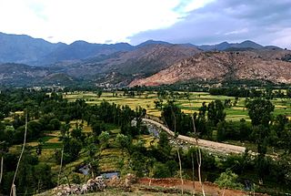
Bajaur District, formerly Bajaur Agency, is a district in the Malakand Division of Khyber Pakhtunkhwa Province, Pakistan. Prior to 2018, Bajaur Agency was the northernmost component of the Federally Administered Tribal Areas (FATA), a semi-autonomous region along the Afghanistan–Pakistan border. In May 2018, FATA was merged into the larger Khyber Pakhtunkhwa Province (KPK) in an attempt to bring stability to the region, redesignating Bajaur Agency to Bajaur District.

Tank District is a district in the Dera Ismail Khan Division of the Khyber Pakhtunkhwa province of Pakistan.
Kohat Division is one of the seven divisions in the Khyber Pakhtunkhwa province of Pakistan. It consists of five districts: Hangu, Karak, Kohat, Kurram, and Orakzai. The division borders Bannu Division to the south and west, Peshawar Division to the north and east, the province of Punjab to the east, and Afghanistan to the northwest. CNIC code of Kohat Division is 14.

Bannu Division is one of seven divisions in Pakistan's Khyber Pakhtunkhwa province. It consists of three districts: Bannu, Lakki Marwat, and North Waziristan. The division borders Dera Ismail Khan Division to the south and west, Kohat Division to the north and east, and the province of Punjab, Pakistan to its east. CNIC code of Bannu Division is 11.

The Frontier Regions of Pakistan were a group of small administrative units in the Federally Administered Tribal Areas (FATA), lying immediately to the east of the seven main tribal agencies and west of the settled districts of Khyber Pakhtunkhwa. Each of the Frontier Regions was named after an adjoining settled district and was administered by the district coordination officer (DCO) of that adjacent district. The overall administration of the Frontier Regions was carried out by the FATA Secretariat based in Peshawar, the capital of Khyber Pakhtunkhwa. The six Frontier Regions were:

Bettani Tehsil is an administrative subdivision (tehsil) of Lakki Marwat District in Khyber Pakhtunkhwa province of Pakistan. This subdivision shares its boundary on the north with Bannu Subdivision, on the west with Jandola Tehsil, to the west with North and South Waziristan and to the northeast with the district of Lakki Marwat. Its total area is 132 square kilometers.

Drazanda Tehsil is an administrative subdivision (tehsil) of Dera Ismail Khan District in Khyber Pakhtunkhwa province of Pakistan. It borders South Waziristan to the north, Dera Ghazi Khan and Musa Khel to the south and Zhob to the west. The capital is the town of Drazanda.
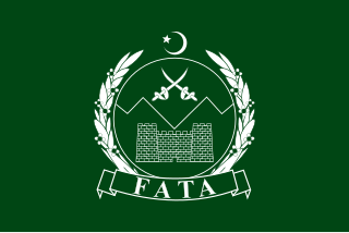
The Federally Administered Tribal Areas, commonly known as FATA, was a semi-autonomous tribal region in north-western Pakistan that existed from 1947 until being merged with the neighbouring province of Khyber Pakhtunkhwa in 2018 through the Twenty-fifth amendment to the constitution of Pakistan. It consisted of seven tribal agencies (districts) and six frontier regions, and were directly governed by the federal government through a special set of laws called the Frontier Crimes Regulations.
Jandola Tehsil is an administrative subdivision (tehsil) of Tank District in Khyber Pakhtunkhwa province of Pakistan. The subdivision borders South Waziristan to the north, south and west and Lakki Marwat District to the north-east.
Hassan Khel Tehsil is an administrative subdivision (tehsil) of Peshawar District in Khyber Pakhtunkhwa province of Pakistan. This subdivision borders Nowshera District to the east and Kohat Subdivision to the south.
Dara Adam Khel Tehsil is an administrative subdivision (tehsil) of Kohat District in Khyber Pakhtunkhwa province of Pakistan. This subdivision shares its boundary with Peshawar District to the north, Nowshera District to the east and Orakzai District to the west.
Tank is a tehsil located in Tank District, Khyber Pakhtunkhwa, Pakistan.
On 31 May 2018, with the application of 25th Amendment, Federally Administrated Tribal Areas ceased to exist, and stood merged into neighbouring province of Khyber Pakhtunkhwa.

Hinduism is a minority religion in the Khyber Pakhtunkhwa province followed by 0.02% of the population of the province as per 2023 Census.
