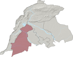
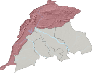
Bannu District is a district in the Bannu Division of the Khyber Pakhtunkhwa province of Pakistan. Its status as a district was formally recorded in 1861 during the British Raj.

Lakki Marwat is a district in the Bannu Division of the Khyber Pakhtunkhwa province of Pakistan. It was created as an administrative district on July 1, 1992, prior to which it was a tehsil of Bannu District.
Bazar Ahmed Khan is a town and union council of Bannu District in Khyber Pakhtunkhwa province of Pakistan. It is located at 32°59'6N 70°38'32E and has an altitude of 344 metres.
Bizenkhel is a town and union council of Bannu District in the Khyber Pakhtunkhwa Province of Pakistan. It is located at 33°1'20N 70°41'55E and has an altitude of 346 metres.
Hind Khel Wazir or Hindi Khel is a town and union council of Bannu District in Khyber Pakhtunkhwa province of Pakistan. It is located at 32°47'38N 70°30'29E and has an altitude of 327 metres (1076 feet).
Janikhel, also spelled Jani Khel or Zonikhel (ځونيخېل) is a town and union council in the Bannu District of Khyber Pakhtunkhwa, Pakistan. It is located at 32°47'55N 70°30'23E and has an elevation of 336 metres.
Jandikhel or Jando Khel is a town and union council of Bannu District in Khyber Pakhtunkhwa province of Pakistan. It is located 32°57'12N 70°42'53E and has an elevation of 307 metres.
Kakki 1 is a town and union council of Bannu District in Khyber Pakhtunkhwa province of Pakistan. It is located at 32°52'11N 70°40'12E and has an altitude of 308 metres (1,010 ft).
Khojari is a town and union council in Bannu District of Khyber Pakhtunkhwa.
Lalozai is a town and union council of Bannu District in Khyber Pakhtunkhwa province of Pakistan. It is located at 33°1'17N 70°36'5E and has an altitude of 372 metres (1223).
Mandan is a town and union council in Bannu District of Khyber Pakhtunkhwa. It is located at 32°56'46N 70°36'29E and has an altitude of 348 metres.
Mirakhel or Mira Khel is a town and union council in Bannu District of Khyber-Pakhtunkhwa. It is located at 32°51'9N 70°38'39E and has an altitude of 314 metres.
Mita Khel is a town and union council in Bannu District of Khyber-Pakhtunkhwa. It is located at 33°0'59N 70°54'12E and has an altitude of 372 metres (1223).
Muhammad Khel is a town and union council in Bannu District of Khyber-Pakhtunkhwa. It is located at 32°58'60N 70°31'60E and has an altitude of 369 metres.
Nurar is a town and union council in Bannu District of Khyber-Pakhtunkhwa. It is located at 32°54'9N 70°32'3E and has an altitude of 345 metres.
Shahbaz Azmat Khel is a town and union council in Bannu District of Khyber-Pakhtunkhwa.
Shamshi Khel is a town and union council in Bannu District of Khyber-Pakhtunkhwa. It is located at 32°55'24N 70°44'46E and has an altitude of 287 metres.
Wazir Tehsil is an administrative subdivision (tehsil) of Bannu District, Bannu Division, Khyber Pakhtunkhwa Province, Pakistan. The total population, according to the 1998 census, was 19,600, 98.1% of which have Pashto as a first language, and the remaining 1.9% speak Punjabi.
Kot Qalandar is a town and union council in Bannu District of Khyber-Pakhtunkhwa. Its major principal tribe is Hakim Khel branch of Mughal Khel. Mughal Khel are Yousafzai Pashtuns settled in southern parts of District Bannu, with Ghoriwala as their principal center.
Koti Sadat is a town and union council in Bannu District of Khyber-Pakhtunkhwa.