West Union, Minnesota | |
---|---|
Coordinates: 45°48′03″N95°05′01″W / 45.80083°N 95.08361°W | |
Country | United States |
State | Minnesota |
County | Todd |
Organized | March 12, 1867 |
Platted | June 1881 |
Incorporated | 1900 |
Government | |
• Mayor | Roger Engle |
Area | |
• Total | 0.480 sq mi (1.240 km2) |
• Land | 0.444 sq mi (1.151 km2) |
• Water | 0.033 sq mi (0.086 km2) |
Elevation | 1,335 ft (407 m) |
Population | |
• Total | 92 |
• Estimate (2022) [4] | 92 |
• Density | 207.21/sq mi (79.94/km2) |
Time zone | UTC–6 (Central (CST)) |
• Summer (DST) | UTC–5 (CDT) |
ZIP Code | 56389 |
Area code | 320 |
FIPS code | 27-69736 |
GNIS feature ID | 2397276 [2] |
Sales tax | 7.375% [5] |
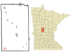
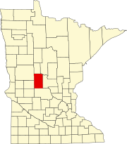
West Union is a city in Todd County, Minnesota, United States. The population was 92 at the 2020 census. [3]
West Union was platted in 1881 and incorporated in 1900. [6] The West Union post office closed in 1996. It had been open since 1860. The village had a Great Northern Railway station in section 21 of West Union township. [7]
According to the United States Census Bureau, the city has a total area of 0.444 square miles (1.15 km2), all land. [1] West Union Lake borders the western boundary of the village. [8]
Interstate 94/U.S. Highway 52 serves as the main route to the community.
Census | Pop. | Note | %± |
---|---|---|---|
1910 | 161 | — | |
1920 | 169 | 5.0% | |
1930 | 132 | −21.9% | |
1940 | 78 | −40.9% | |
1950 | 100 | 28.2% | |
1960 | 83 | −17.0% | |
1970 | 71 | −14.5% | |
1980 | 74 | 4.2% | |
1990 | 54 | −27.0% | |
2000 | 87 | 61.1% | |
2010 | 111 | 27.6% | |
2020 | 92 | −17.1% | |
2022 (est.) | 92 | [4] | 0.0% |
U.S. Decennial Census [9] 2020 Census [3] |
As of the 2010 census, there were 111 people, 42 households, and 31 families living in the city. The population density was 264.3 inhabitants per square mile (102.0/km2). There were 43 housing units at an average density of 102.4 per square mile (39.5/km2). The racial makeup of the city was 99.1% White and 0.9% from two or more races.
There were 42 households, of which 35.7% had children under the age of 18 living with them, 54.8% were married couples living together, 9.5% had a female householder with no husband present, 9.5% had a male householder with no wife present, and 26.2% were non-families. 23.8% of all households were made up of individuals, and 4.8% had someone living alone who was 65 years of age or older. The average household size was 2.64 and the average family size was 3.10.
The median age in the city was 35.8 years. 24.3% of residents were under the age of 18; 12.6% were between the ages of 18 and 24; 20.7% were from 25 to 44; 33.3% were from 45 to 64; and 9% were 65 years of age or older. The gender makeup of the city was 51.4% male and 48.6% female.
As of the 2000 census, there were 87 people, 31 households, and 19 families living in the city. The population density was 252.8 inhabitants per square mile (97.6/km2). There were 32 housing units at an average density of 93.0 per square mile (35.9/km2). The racial makeup of the city was 100.00% White.
There were 31 households, out of which 41.9% had children under the age of 18 living with them, 51.6% were married couples living together, 3.2% had a female householder with no husband present, and 35.5% were non-families. 32.3% of all households were made up of individuals, and 6.5% had someone living alone who was 65 years of age or older. The average household size was 2.81 and the average family size was 3.70.
In the city, the population was spread out, with 40.2% under the age of 18, 3.4% from 18 to 24, 31.0% from 25 to 44, 9.2% from 45 to 64, and 16.1% who were 65 years of age or older. The median age was 32 years. For every 100 females, there were 112.2 males. For every 100 females age 18 and over, there were 116.7 males.
The median income for a household in the city was $24,643, and the median income for a family was $39,375. Males had a median income of $24,167 versus $19,375 for females. The per capita income for the city was $10,441. There were 15.8% of families and 23.1% of the population living below the poverty line, including 36.4% of under eighteens and 15.0% of those over 64.
Solway is a city in Beltrami County, Minnesota, United States. The population was 96 at the 2010 census. Solway serves as a bedroom community for nearby Bemidji.
Cromwell is a city in Carlton County, Minnesota, United States. The population was 240 at the 2020 census.
Wright is a city in Carlton County, Minnesota, United States. The population was 168 at the 2020 census.
Chickamaw Beach is a city in Cass County, Minnesota, United States. The population was 128 at the 2020 census. It is part of the Brainerd Micropolitan Statistical Area.
Sunburg is a city in Kandiyohi County, Minnesota, United States. The population was 94 at the 2020 census.
Stewart is a city in McLeod County, Minnesota, United States. The population was 489 at the 2020 census, down from 571 in 2010.
Elmdale is a city in Morrison County, Minnesota, United States. The population was 114 at the 2020 census.
Harding is a city in Morrison County, Minnesota, United States. The population was 123 at the 2020 census. There’s also a parade in winter called the Harding Horse parade and have Harding days around the Fourth of July, which attracts a few thousand people especially The rodeo
Hillman is a city in Morrison County, Minnesota, United States. The population was 23 at the 2020 census.
Sargeant is a city in Mower County, Minnesota, United States. The population was 63 at the 2020 census.
Dovray is a city in Murray County, Minnesota, United States. The population was 58 at the 2020 census.
Deer Creek is a city in Otter Tail County, Minnesota, United States. The population was 330 at the 2020 census.
Henning is a city in Otter Tail County, Minnesota, United States. The population was 854 at the 2020 census.
Vergas is a city in northern Otter Tail County, Minnesota, United States. The population was 348 at the 2020 census.
Leonidas is a city in Saint Louis County, Minnesota, United States. The population was 50 at the 2020 census.
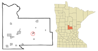
Genola is a city in Morrison County, Minnesota, United States. The population was 70 at the 2020 census.
Meire Grove is a city in Stearns County, Minnesota, United States. The population was 179 at the 2010 census. It is part of the St. Cloud Metropolitan Statistical Area.
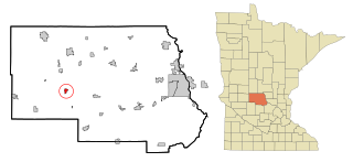
Spring Hill is a city in Stearns County, Minnesota, United States. The population was 85 at the 2010 census. It is part of the St. Cloud Metropolitan Statistical Area.
Oliver is a village in Douglas County, Wisconsin, United States. The population was 423 at the 2020 census.
Minnesota Lake is a city in Blue Earth and Faribault counties in the State of Minnesota. The population was 661 at the 2020 census. The bulk of the city is in Faribault County; a small part extends into Blue Earth County.