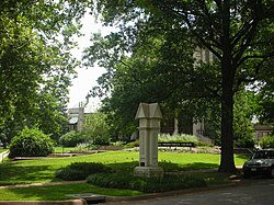
Clayton is a city in and the county seat of St. Louis County, Missouri, and borders the independent city of St. Louis. The population was 17,355 at the 2020 census. Organized in 1877, the city was named after Ralph Clayton, who donated the land for the St. Louis County courthouse.
The Ville is a historic African-American neighborhood located in North St. Louis, Missouri. It has had a long history of African-American businesses and residents.

Clifton Heights is a neighborhood of St. Louis, Missouri, US, located along the southwest border of the city and highlighted by a park — Clifton Park (38.6143°N 90.2916°W) — with a playground and a lake.

North Point is a neighborhood of St. Louis, Missouri, US. It is bounded by Goodfellow on the North, Northcrest, West Florissant on the Southwest, and Riverview Boulevard on the East and Northeast.
Fairground is a neighborhood of St. Louis, Missouri. The neighborhood's boundaries are defined as Glasgow Avenue on the east, west and North Florissant Avenues on the north, Warne on the west, and Fairground Park and Natural Bridge Avenue on the south.

Forest Park Southeast (FPSE) is a neighborhood of St. Louis, Missouri. It is bordered by Interstate 64 (U.S. Route 40) to the north, Vandeventer Avenue to the east, Interstate 44 to the south, and Kingshighway Boulevard and Forest Park to the west. Adjoining neighborhoods include Kings Oak and The Hill to the west, Southwest Garden to the south, Botanical Heights to the southeast, Midtown to the east, and the Central West End to the north.

Fox Park is a neighborhood of St. Louis, Missouri. The neighborhood borders are Jefferson Avenue to the east, Interstate 44 to the north, Gravois Avenue to the south and Nebraska Avenue to the west. Surrounding neighborhoods include the Gate District, Compton Heights, Tower Grove East, Benton Park West and McKinley Heights.

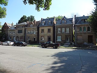
Franz Park is a neighborhood of St. Louis, Missouri.
Hi-Pointe is a neighborhood of St. Louis, Missouri, within a section known as Dogtown. It is bounded by Clayton Avenue and Oakland Avenue on the north, City Limits on the west, Dale Avenue on the south, and Louisville Avenue on the east. It is bordered by the Skinker-DeBaliviere neighborhood and Forest Park on the north, the Clayton-Tamm neighborhood on the east, the Franz Park neighborhood on the south and the city of Richmond Heights, part of St. Louis County on the west.

Hyde Park is a neighborhood of St. Louis, Missouri. A historic North St. Louis neighborhood, Hyde Park is bound by Ferry to the North, I-70 to the East, Palm Street and Natural Bridge Avenue to the South, and Glasgow to the West.

Skinker DeBaliviere is a neighborhood of St. Louis, Missouri, located directly north of Forest Park. In addition to the park, its boundaries are Delmar Boulevard to the north, DeBaliviere Avenue to the east, and the western city limits near Skinker Boulevard. It is home to The Pageant, Pin-up Bowl, and all the other establishments of the Delmar Loop east of University City. It also includes the west end of the Forest Park – DeBaliviere and the entire Skinker MetroLink stations. The Delmar Loop station is just outside of its north boundary. In 1978, the neighborhood was designated a Local Historic District by the City of St. Louis, and the private subdivision of Parkview is listed in the National Register of Historic Places.

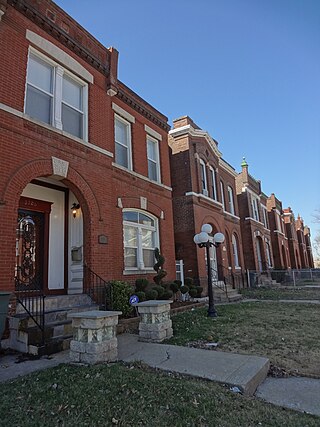
Botanical Heights is a neighborhood of St. Louis, Missouri. Its former name was McRee Town. The Botanical Heights neighborhood is defined by Chouteau Avenue on the North, Interstate 44 on the South, 39th Street on the East and Vandeventer Avenue on the West. This near Southside neighborhood is located just north of the Shaw neighborhood.

Mark Twain is a neighborhood of St. Louis, Missouri named after author and Missouri native Mark Twain. It is located between Interstate 70 and Bellefontaine Cemetery.

North Hampton is a neighborhood of St. Louis, Missouri. Located in Southwest City, North Hampton is bounded by Scanlan and Connecticut to the north, South Kingshighway Boulevard to the east, Chippewa Street to the south, and Hampton Avenue to the west.

Patch is a neighborhood of St. Louis, Missouri. The Patch neighborhood forms the southern tip of the Carondelet neighborhood. It is defined by Robert Avenue on the north, the City Limits to the south, Alabama Avenue to the west, and by the Mississippi River to the east.

Penrose is a neighborhood of St. Louis, Missouri. The Penrose neighborhood is split with half of it in the city's 21st Ward and the other half in the city's 1st Ward. The neighborhood is located on the north side of the city just south of Interstate 70 and west of O’Fallon Park. It is bounded by Florissant Avenue and I-70 on the north, Natural Bridge on the south, North Newstead and Pope Avenue on the east, and Kingshighway Boulevard on the west.

Riverview is a neighborhood of St. Louis, Missouri. Riverview comprises the extreme northern section of the city, bounded by the Mississippi River to the east, the city limits to the west, and Chain of Rocks Road to the south, with the northern boundary lying a third of a mile north of I-270. The only major road running through the neighborhood is Riverview Drive.

Tiffany is a neighborhood of St. Louis, Missouri. It is located on the western side of Grand Boulevard along the section containing St. Louis University's Medical Complex. The neighborhood is defined by Chouteau Avenue on the North, Interstate 44 on the South, Grand Boulevard on the East, and 39th Street on the West.
Vandeventer is a neighborhood of St. Louis, Missouri. The area is bounded by Dr. Martin Luther King Drive on the North, Delmar Boulevard on the South, Vandeventer Avenue on the East, and Newstead Avenue on the West.

Visitation Park is a neighborhood in St. Louis, Missouri. The neighborhood is defined by Maple Avenue on the North, Delmar Boulevard on the South, Union Boulevard on the East, and Belt Avenue on the West. Visitation Park is a small neighborhood nestled southeast of the West End neighborhood, just north of DeBaliviere Place.