Ryder, North Dakota

Last updated

Ryder, North Dakota
Ryder, North Dakota 7-17-2009.jpg
Business district of Ryder
ND Ward County Ryder.svg
Location of Ryder, North Dakota
Coordinates: 47°55′16″N101°40′10″W / 47.92111°N 101.66944°W / 47.92111; -101.66944
CountryUnited States
State North Dakota
County Ward
Founded1906
Area
[1]
  Total0.68 sq mi (1.76 km2)
  Land0.52 sq mi (1.36 km2)
  Water0.16 sq mi (0.41 km2)
Elevation
[2]
2,100 ft (600 m)
Population
 (2020)
  Total108
  Density206.11/sq mi (79.54/km2)
Time zone UTC-6 (CST)
  Summer (DST) UTC-5 (CDT)
ZIP code
58779
Area code 701
FIPS code 38-69460
GNIS feature ID1036250 [2]
Website rydernd.com

Ryder is a city in Ward County, North Dakota, United States. The population was 108 at the 2020 census. [3] It is part of the Minot Micropolitan Statistical Area. Ryder was founded in 1906.

Contents

History

North Dakota's first oil strike occurred in Ryder in 1908 when oil began seeping into a water well dug by meat market proprietor Joe Wustner in 1906. [4] Wustner kept quiet about his discovery and used the substance to fuel his kerosene lamps. [4] Finally in 1909 he admitted publicly that he had struck oil. [4]

Geography

According to the United States Census Bureau, the city has a total area of 0.34 square miles (0.88 km2), of which 0.33 square miles (0.85 km2) is land and 0.01 square miles (0.03 km2) is water. [5]

Demographics

Historical population
CensusPop.Note
1910 338
1920 48342.9%
1930 457−5.4%
1940 4672.2%
1950 330−29.3%
1960 264−20.0%
1970 211−20.1%
1980 158−25.1%
1990 121−23.4%
2000 92−24.0%
2010 85−7.6%
2020 10827.1%
2021 (est.)105 [6] −2.8%
U.S. Decennial Census [7]
2020 Census [3]

2010 census

As of the census of 2010, there were 85 people, 42 households, and 22 families residing in the city. The population density was 257.6 inhabitants per square mile (99.5/km2). There were 62 housing units at an average density of 187.9 per square mile (72.5/km2). The racial makeup of the city was 96.5% White and 3.5% Native American.

There were 42 households, of which 26.2% had children under the age of 18 living with them, 42.9% were married couples living together, 2.4% had a female householder with no husband present, 7.1% had a male householder with no wife present, and 47.6% were non-families. 47.6% of all households were made up of individuals, and 23.8% had someone living alone who was 65 years of age or older. The average household size was 2.02 and the average family size was 2.82.

The median age in the city was 48.5 years. 18.8% of residents were under the age of 18; 6% were between the ages of 18 and 24; 21.2% were from 25 to 44; 25.9% were from 45 to 64; and 28.2% were 65 years of age or older. The gender makeup of the city was 58.8% male and 41.2% female.

2000 census

As of the census of 2000, there were 92 people, 44 households, and 23 families residing in the city. The population density was 282.9 inhabitants per square mile (109.2/km2). There were 67 housing units at an average density of 206.1 per square mile (79.6/km2). The racial makeup of the city was 97.83% White, 1.09% Native American and 1.09% Asian.

There were 44 households, out of which 25.0% had children under the age of 18 living with them, 45.5% were married couples living together, 6.8% had a female householder with no husband present, and 45.5% were non-families. 43.2% of all households were made up of individuals, and 13.6% had someone living alone who was 65 years of age or older. The average household size was 2.09 and the average family size was 2.83.

In the city, the population was spread out, with 22.8% under the age of 18, 3.3% from 18 to 24, 18.5% from 25 to 44, 44.6% from 45 to 64, and 10.9% who were 65 years of age or older. The median age was 46 years. For every 100 females, there were 130.0 males. For every 100 females age 18 and over, there were 115.2 males.

The median income for a household in the city was $26,875, and the median income for a family was $27,188. Males had a median income of $26,250 versus $14,792 for females. The per capita income for the city was $16,497. There were 18.5% of families and 30.1% of the population living below the poverty line, including 55.6% of under eighteens and 28.6% of those over 64.

Climate

This climatic region is typified by large seasonal temperature differences, with warm to hot (and often humid) summers and cold (sometimes severely cold) winters. According to the Köppen Climate Classification system, Ryder has a humid continental climate, abbreviated "Dfb" on climate maps. [8]

Education

Ryder is divided between the Lewis and Clark School District and the Max Public School District 50. [9] Lewis and Clark formed in 2003 when three school districts merged. [10]

Related Research Articles

<span class="mw-page-title-main">Brinsmade, North Dakota</span> City in North Dakota, United States

For people with the surname, see Brinsmade (surname).

<span class="mw-page-title-main">Landa, North Dakota</span> City in North Dakota, United States

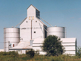
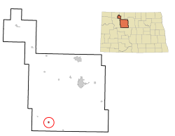
Landa is a city in Bottineau County, North Dakota, United States. The population was 41 at the 2020 census. Landa was founded in 1904.

<span class="mw-page-title-main">Powers Lake, North Dakota</span> City in North Dakota, United States

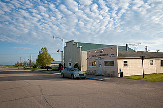
Powers Lake is a city in Burke County, North Dakota, United States. The population was 385 at the 2020 census. Powers Lake was founded in 1909.

<span class="mw-page-title-main">North River, North Dakota</span> City in North Dakota, United States

North River is a city in Cass County, North Dakota, United States. The population was 55 at the 2020 census. North River was founded in 1973. It is a suburb/bedroom community directly adjacent to the city of Fargo.

<span class="mw-page-title-main">Oxbow, North Dakota</span> City in North Dakota, United States

Oxbow is a city in Cass County, North Dakota, United States. The population was 381 at the 2020 census. It is an upscale bedroom community located 15 miles (24 km) south of Fargo. It was incorporated as a city October 25, 1988.

<span class="mw-page-title-main">Inkster, North Dakota</span> Village in North Dakota, United States

Inkster is a small village in Grand Forks County, North Dakota, United States, with a population of 38 as of the 2020 census. Inkster was founded in 1884, in an area that had been settled by George T. Inkster in 1878.

<span class="mw-page-title-main">Gackle, North Dakota</span> City in North Dakota, United States

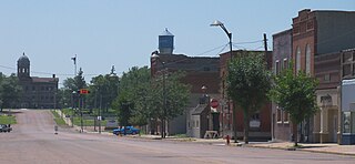
Gackle is a town in Logan County, North Dakota, United States. The population was 281 at the 2020 census.

<span class="mw-page-title-main">Pekin, North Dakota</span> City in North Dakota, United States

Pekin is a city in Nelson County, North Dakota, United States. The population was 75 at the 2020 census. The first European settlers immigrated to the area in the mid-19th century and Pekin was founded in 1906.

<span class="mw-page-title-main">Hankinson, North Dakota</span> City in North Dakota, United States

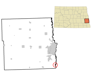
Hankinson is a city in Richland County, North Dakota, United States. The population was 921 at the 2020 census. Hankinson was founded in 1886. It is part of the Wahpeton, ND–MN Micropolitan Statistical Area.

<span class="mw-page-title-main">Woodworth, North Dakota</span> City in North Dakota, United States

Woodworth is a city in Stutsman County, North Dakota, United States. The population was 44 at the 2020 census.

<span class="mw-page-title-main">Clifford, North Dakota</span> City in North Dakota, United States

Clifford is a city in Traill County, North Dakota, United States. The population was 44 at the 2010 census. Clifford was founded in 1883.

<span class="mw-page-title-main">Alamo, North Dakota</span> City in North Dakota, United States

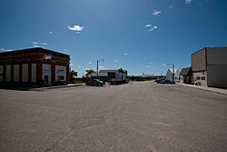
Alamo is a city in Williams County, North Dakota, United States. The population was 57 at the 2010 census. Alamo was founded in 1916.

<span class="mw-page-title-main">Mound City, South Dakota</span> Town in South Dakota, United States

Mound City is a town in and the county seat of Campbell County, South Dakota, United States. The population was 69 at the 2020 census.

<span class="mw-page-title-main">Lennox, South Dakota</span> City in South Dakota, United States

Lennox is a city in Lincoln County, South Dakota, United States, located 20 miles (32 km) southwest of Sioux Falls. The population was 2,423 at the 2020 census.

<span class="mw-page-title-main">Presho, South Dakota</span> City in South Dakota, United States

Presho is a small city in Lyman County, South Dakota, United States. The population was 472 at the 2020 census.

<span class="mw-page-title-main">Crooks, South Dakota</span> City in South Dakota, United States

Crooks is a city in Minnehaha County, South Dakota, United States and is a suburb of Sioux Falls. The population was 1,362 at the 2020 census. Crooks was named New Hope until 1904. The town's present name honors W. A. Crooks, a local politician.

<span class="mw-page-title-main">Mellette, South Dakota</span> City in South Dakota, United States

Mellette is a city in Spink County, South Dakota, United States. The population was 199 at the 2020 census.

<span class="mw-page-title-main">Mission, South Dakota</span> City in South Dakota, United States

Mission is a city on the Rosebud Indian Reservation in northern Todd County, South Dakota, United States. The population was 1,156 at the 2020 census.

<span class="mw-page-title-main">Parker, South Dakota</span> City in South Dakota, U.S.

Parker is a city in Turner County, South Dakota, United States. The population was 1,194 at the 2020 census. It is the county seat of Turner County. Parker is bordered on its eastern side by South Dakota State Highway 19. Its northern side is bordered by South Dakota State Highway 44. Parker is located approximately 8 miles (13 km) northwest of Chancellor, 42 miles (68 km) east of Parkston and 41 miles (66 km) south of Madison.

<span class="mw-page-title-main">Iroquois, South Dakota</span> City in South Dakota, United States

Iroquois is a city on the border of Beadle and Kingsbury counties in South Dakota, United States. The population was 292 at the 2020 census. The school building is located in Kingsbury County, while the school parking lot is located in Beadle County. Highway 14 runs directly through Iroquois.

References

  1. "ArcGIS REST Services Directory". United States Census Bureau. Retrieved September 20, 2022.
  2. 1 2 U.S. Geological Survey Geographic Names Information System: Ryder, North Dakota
  3. 1 2 "Explore Census Data". United States Census Bureau . Retrieved May 22, 2022.
  4. 1 2 3 Jackson, William (2008). Almanac of North Dakota mysteries & oddities, 2009-2010. Valley Star Books. p. 23. ISBN   9780967734989. OCLC   259419005.
  5. "US Gazetteer files 2010". United States Census Bureau. Archived from the original on January 25, 2012. Retrieved June 14, 2012.
  6. "City and Town Population Totals: 2020-2021". United States Census Bureau. July 10, 2022. Retrieved July 10, 2022.
  7. United States Census Bureau. "Census of Population and Housing" . Retrieved October 23, 2013.
  8. Climate Summary for Ryder, North Dakota
  9. "2020 CENSUS - SCHOOL DISTRICT REFERENCE MAP: Ward County, ND" (PDF). United States Census Bureau . Retrieved August 15, 2021. - Ryder is on page 35 (PDF p. 36/39).
  10. "More school districts merging". Bismarck Tribune . Bismarck, North Dakota. November 21, 2002. p. 2B. - Clipping from Newspapers.com.