On October 17, 1989, at local time, the Loma Prieta earthquake occurred at the Central Coast of California. The shock was centered in The Forest of Nisene Marks State Park in Santa Cruz County, approximately 10 mi (16 km) northeast of Santa Cruz on a section of the San Andreas Fault System and was named for the nearby Loma Prieta Peak in the Santa Cruz Mountains. With an magnitude of 6.9 and a maximum Modified Mercalli intensity of IX (Violent), the shock was responsible for 63 deaths and 3,757 injuries. The Loma Prieta segment of the San Andreas Fault System had been relatively inactive since the 1906 San Francisco earthquake until two moderate foreshocks occurred in June 1988 and again in August 1989.

The 1994 Northridge earthquake affected the Los Angeles area of California on January 17, 1994, at 04:30:55 PST. The epicenter of the moment magnitude 6.7 blind thrust earthquake was beneath the San Fernando Valley. Lasting approximately 8 seconds and achieving the largest peak ground acceleration of over 1.7 g, it was the largest earthquake in the area since 1971. Shaking was felt as far away as San Diego, Turlock, Las Vegas, Richfield, Phoenix, and Ensenada. Fifty-seven people died and more than 9,000 were injured. In addition, property damage was estimated to be $13–50 billion, making it among the costliest natural disasters in U.S. history.

The Napa River is a river approximately 55 miles (89 km) long in the U.S. state of California. It drains a famous wine-growing region called the Napa Valley, in the mountains north of the San Francisco Bay. Milliken Creek and Mt. Veeder watersheds are a few of its many tributaries. The river mouth is at Vallejo, where the intertidal zone of fresh and salt waters flow into the Carquinez Strait and the San Pablo Bay.
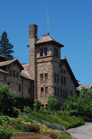
The Culinary Institute of America at Greystone is a branch campus of the private culinary college the Culinary Institute of America. The Greystone campus, located on State Route 29/128 in St. Helena, California, offers associate degrees and two certificate programs in culinary arts and baking and pastry arts. The CIA at Greystone and the Culinary Institute of America at Copia make up the school's California branch.

The Napa Valley Opera House is a theatre in Napa, California, it opened on February 13, 1880, with a production of Gilbert and Sullivan's HMS Pinafore.

Trefethen Family Vineyards is a winery in Napa Valley. It was established in 1968.
The 2007 Alum Rock earthquake occurred on in Alum Rock Park in San Jose, in the U.S. state of California. It measured 5.6 on the moment magnitude scale and had a maximum Mercalli intensity of VI (Strong). The event was then the largest in the San Francisco Bay Area since the 1989 Loma Prieta earthquake, which measured 6.9 on the moment magnitude scale, but was later surpassed by the 2014 South Napa earthquake. Ground shaking from the Alum Rock quake reached San Francisco and Oakland and other points further north. Sixty thousand felt reports existed far beyond Santa Rosa, as far north as Eugene, Oregon.

American Canyon High School is a public comprehensive high school located in American Canyon, California. It is operated by the Napa Valley Unified School District.
Shipyard Acres was an unincorporated community in Napa County, California. It lies at an elevation of 33 feet. Shipyard Acres is located 2.5 miles (4.0 km) south-southeast of Napa.

Charles Krug (1825–1892) was among the pioneers of winemaking in the Napa Valley, California, and was the founder of the Charles Krug Winery.

First Presbyterian Church is a historic church at 1333 3rd Street in Napa, California.

The Goodman Library is a historic library located at 1219 1st St. in Napa, California. Built in 1901, the library was paid for by George E. Goodman and built on land donated by Goodman. Architect Luther M. Turton designed the building in the Richardson Romanesque style, which can be seen in its use of rusticated stone, round arch windows, and massive scale. The design represented a shift in Napa architecture, which was mainly Victorian prior to the library's construction.

The U.S. Post Office, also known as the Napa Franklin Station, served the 94559 zip code area of Napa, California. The post office was built in 1933 with funding from the Public Works Administration. Architect William H. Corlett designed the Art Deco building. The front facade of the building has three sections; the central section has six bays divided by piers with terra cotta capitals. A terra cotta cornice adorned with ram and cow heads tops the central section. The side sections, which contain the building's two entrances, feature panels with decorative eagle designs above the doorways and urn-shaped bronze light fixtures on either side. The post office's lobby features a painted bas-relief plastic ceiling, unusual in federally constructed post offices, and a terrazzo floor.

The West Napa Fault is a 57 km (35 mi) long geologic fault in Napa County, in the North Bay region of the San Francisco Bay Area in northern California. It is believed to be the northern extension of the Calaveras Fault in the East Bay region.
The 2000 Yountville earthquake occurred with a moment magnitude of 5 on a previously unmapped fault, about 3 miles (4.8 km) south southwest of Yountville, California in the Mayacamas Mountain Range under Mount Veeder and about 9 miles (14 km) south northwest of Napa, California. It occurred at 01:36 PDT on September 3.

The Napa County Courthouse Plaza is a complex in Napa, California, which consists of the Napa County Courthouse and the Hall of Records. The two buildings occupy an entire city block, which includes open areas and landscaping to create the site's plaza setting. The High Victorian Italianate courthouse was built in 1878 to replace the original 1856 courthouse. The courthouse continues to serve as the seat of Napa County government. The 1916 Hall of Records is a federally sponsored records building designed by William H. Corlett. The Renaissance Revival building represents an early use of reinforced concrete as a building material; the material became popular nationwide in the 1920s.
The Uptown Theatre is an entertainment venue located in Napa, California, United States. The theater is in an Art Deco style building that originally opened to the public in 1937. As of 2023 it is utilized as a concert and entertainment venue with a seating capacity of 863.

ShakeAlert is an earthquake early warning system (EEW) in the United States, developed and operated by the United States Geological Survey (USGS) and its partners. As of 2021, the system issues alerts for the country's West Coast. It is expected that the system will be expanded to other seismically active areas of the United States in the future. ShakeAlert is one of two EEW systems available in the United States, with Google's Android Earthquake Alerts System being the other.
The 2019 Ridgecrest earthquakes of July 4 and 5 occurred north and northeast of the town of Ridgecrest, California, located in Kern County and west of Searles Valley. They included three initial main shocks of magnitudes 6.4, 5.4, and 7.1, and many perceptible aftershocks, mainly within the area of the Naval Air Weapons Station China Lake. Eleven months later, a Mw 5.5 aftershock took place to the east of Ridgecrest. The first main shock occurred on Thursday, July 4 at 10:33 a.m. PDT, approximately 18 km (11.2 mi) ENE of Ridgecrest, and 13 km (8.1 mi) WSW of Trona, on a previously unnoticed NE-SW trending fault where it intersects the NW-SE trending Little Lake Fault Zone. This quake was preceded by several smaller earthquakes, and was followed by more than 1,400 detected aftershocks. The M 5.4 and M 7.1 quakes struck on Friday, July 5 at 4:08 a.m. and 8:19 p.m. PDT approximately 10 km (6 miles) to the northwest. The latter, now considered the mainshock, was the most powerful earthquake to occur in the state in 20 years. Subsequent aftershocks extended approximately 50 km (~30 miles) along the Little Lake Fault Zone.
On December 20, 2022, a magnitude 6.4 earthquake struck Ferndale, California in Humboldt County, United States at 10:34:25 UTC, or 2:34 a.m. PST.