Wells is a town in Hamilton County, New York, United States. The population was 674 at the 2010 census. The town is named after Joshua Wells, a land agent, who built the first mills in the area. It is in the Adirondack Park and on the eastern border of the county. It is northwest of Schenectady.

Ohio is a town in Herkimer County, New York, United States. The population was 1,002 at the 2010 census. The town is named after the state of Ohio. The town is in the northern part of the county and northeast of Utica. Part of Ohio is within the Adirondack Park.

Walton is a town in Delaware County, New York, United States. The population was 5,270 at the 2020 census. The town is in the west-central part of the county and contains the village of Walton. The town claims to be the "Scarecrow Capital of the World."

Chino Hills State Park is a state park of California, in the United States. It is located in the Chino Hills, foothills of the Santa Ana Mountains. It is a critical link in the Chino–Puente Hills wildlife corridor, and a major botanical habitat reserve for resident and migrating wildlife.

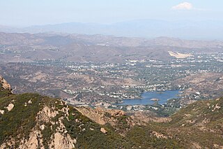
The Conejo Valley is a region spanning both southeastern Ventura County and northwestern Los Angeles County in Southern California, United States. It is located in the northwestern part of the Greater Los Angeles Area.
Woodland Hills Mall is a 1+ million square foot, super regional shopping mall located at 7021 S. Memorial Drive in Tulsa, Oklahoma, United States. It was originally developed jointly by Dayton-Hudson Corporation and Homart Development Company, and opened in August 1976. Woodland Hills Mall features 148 specialty shops and restaurants, 80 of which are unique to the Tulsa area. The anchor stores are JCPenney, Macy's, Dillard's, and Scheels.

Vly Mountain is a mountain located in the town of Halcott, New York, United States in Greene County. The mountain is part of the Catskill Mountains. Vly Mountain is flanked to the northwest by Bearpen Mountain, to the east by Vinegar Hill, to the northeast by Kipp Hill, and to the southeast by Beech Ridge.

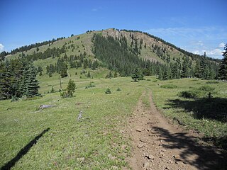
The Cochetopa Hills are a mountain range on the Continental Divide in Saguache County, Colorado, United States. The Cochetopa Hills are a sub-range of the San Juan Mountains and are located in the Gunnison National Forest and Rio Grande National Forest. The range extends from Marshall Pass southwest 50 miles (80 km) along the winding crest of the divide to Saguache Park. The high point of the Cochetopa Hills is Long Branch Baldy at an elevation of 11,974 feet (3,650 m).

Seminole Hot Springs is an unincorporated community in Los Angeles County, California, United States. Seminole Hot Springs is located in the Santa Monica Mountains near Cornell, 3.6 miles (5.8 km) south-southeast of Agoura Hills at an elevation of 932 feet (284 m).

Fortification Hill is a prominence adjacent to Lake Mead in the Lake Mead National Recreation Area; it is located at the northwest terminus region of the Black Mountains (Arizona), and specifically the north region of the Black Mountains. It is near a southern section of Lake Mead, and just northeast of Hoover Dam. It can easily be seen eastward across Las Vegas Bay or from the two northern mountain terminuses of Eldorado Mountains (Nevada), or the Black Mountains (Arizona).
Gifford Hill is a small mountain chain in the Central New York Region of New York. It is located northeast of Oneonta, New York. It is made of three main peaks the highest being 1928 feet. Gifford Hill is named for the Gifford Family who moved to the area in 1803 and settled along the Oneonta Creek on what is now called Gifford Hill.
McCarty Hill is a mountain in the Southern Tier of New York. It is located in Cattaraugus County, mostly in Little Valley and Great Valley, with portions in Ellicottville and Mansfield. In 1940, an 82-foot-6-inch-tall (25.15 m) steel fire lookout tower was built on the mountain. The tower ceased fire lookout operations and then officially closed in early 1989. In 1993, the tower was dismantled and removed and replaced with a free-standing communications tower.
Jersey Hill is a 2,251-foot-long (686 m) mountain in the Southern Tier of New York. It is located Wells northeast of the hamlet of Allegany County. In 1935, a 79-foot-6-inch-long (24.23 m) steel fire lookout tower was built on the mountain. The Jersey Hill tower was only staffed on an as-needed basis by the Division of Lands and Forests. Due to increased use of aerial fire detection, the tower ceased fire lookout operations and was removed in August 1987.
Red Hill is a mountain located in the Catskill Mountains of New York east-south of Frost Valley. Woodhull Mountain is located northeast of Red Hill.
Tonshi Mountain is a mountain located in the Catskill Mountains of New York southeast of Phoenicia. Acorn Hill is located northeast, Ohayo Mountain is located east-northeast, and Little Tonshi Mountain is located west-southwest of Tonshi Mountain.
Ohayo Mountain is a mountain located in the Catskill Mountains of New York southeast of Wittenberg. Acorn Hill is located northwest, Ashokan Ridge is located south, and Mount Guardian is located north of Ohayo Mountain.
Beetree Hill is a mountain located in the Catskill Mountains of New York north-northeast of Wittenberg. Johns Mountain is located east, and Acorn Hill is located south-southeast of Beetree Hill.
Morgan Hill is a mountain in the central part of the state of New York. It is located north-northeast of Truxton in Cortland County with a small portion in Onondaga County. The portion of the mountain within Onondaga County is the highest point in the county.
Gallis Hill is a 794-foot-tall (242 m) mountain in the Catskill Mountains region of New York. It is located northwest of Kingston in Ulster County. Jockey Hill is located north-northeast, and Morgan Hill is located west of Gallis Hill. In 1927, the Conservation Department built a steel fire lookout tower on the mountain. In 1950, the tower was closed and disassembled then moved to Overlook Mountain, where it still remains today.


