Administrative divisions of Liberia

Last updated
A map of Liberia, showing Liberian counties and major cities Un-liberia.png
A map of Liberia, showing Liberian counties and major cities

Liberia is divided into fifteen first-level administrative divisions called counties, which, in turn, are subdivided into a total of 90 second-level administrative divisions called districts and further subdivided into third-level administrative divisions called clans .

Contents

After its independence in 1847, and over the course of the nineteenth century, Liberia's administrative divisions grew from the original three counties — Montserrado, Grand Bassa, and Sinoe — to the addition of Maryland and Grand Cape Mount, extending along the windward coast between Cape Mount and Cape Palmas. [1] Under President Arthur Barclay's administration (1904–1912), a new system was established in response to British and French demands that the Liberian government effectively occupy the territory Liberia had claimed. Three inland provinces were created — Western, Central, and Eastern — and each province was divided into several districts. The administrative districts were further sub-divided into clans. The districts were administered by the newly created office of district commissioner and the clans by the newly created office of paramount chief, all appointed by the president. In 1964, under President William Tubman's 'Unification' policy, the three inland provinces were disestablished, and the inland administrative divisions were reconstituted into four new counties: Grand Gedeh, Nimba, Bong, and Lofa, administered by superintendents who were appointed by the president.

In 1984, under President Samuel Doe, Grand Kru and Bomi counties were established. In 1985, two more counties were created: Margibi and Rivercess. The last two current counties were created under President Charles Taylor: River Gee in 2000 and Gbarpolu in 2001.

Governance

The fifteen counties are administered by superintendents, and the districts by commissioners, all appointed by the president. The cabinet office with responsibility for the management of the superintendents, commissioners and chiefs is the Minister of Internal Affairs. The 1985 Constitution calls for the election of various chiefs at the county and local level. These elections have not taken place since 1985 due to war and financial constraints. [2]

Counties

There are 15 counties in Liberia.

Map #CountyDate
Created
CapitalArea
(mi2) [3]
Population
(2022 Census) [4]
1Flag of Bomi County.svg Bomi 1984 Tubmanburg 749 sq mi (1,940 km2)133,668
2Flag of Bong County.svg Bong 1964 Gbarnga 3,386 sq mi (8,770 km2)467,502
3Flag of Gbarpolu County.svg Gbarpolu 2001 Bopolu 3,740 sq mi (9,700 km2)95,995
4Flag of Grand Bassa County.svg Grand Bassa 1839 Buchanan 3,064 sq mi (7,940 km2)293,557
5Flag of Grand Cape Mount County.svg Grand Cape Mount 1844 Robertsport 1,993 sq mi (5,160 km2)178,798
6Flag of Grand Gedeh County.svg Grand Gedeh 1964 Zwedru 4,047 sq mi (10,480 km2)216,692
7Flag of Grand Kru County.svg Grand Kru 1984 Barclayville 1,503 sq mi (3,890 km2)109,342
8Flag of Lofa County.svg Lofa 1964 Voinjama 3,854 sq mi (9,980 km2)367,376
9Flag of Margibi County.svg Margibi 1985 Kakata 1,010 sq mi (2,600 km2)304,946
10Flag of Maryland County.svg Maryland 1857 Harper 886 sq mi (2,290 km2)172,202
11Flag of Montserrado County.svg Montserrado 1839 Bensonville 737 sq mi (1,910 km2)1,920,914
12Flag of Nimba County.svg Nimba 1964 Sanniquellie 4,459 sq mi (11,550 km2)621,841
13Flag of Rivercess County.svg Rivercess 1985 River Cess 2,159 sq mi (5,590 km2)90,777
14Flag of River Gee County.svg River Gee 2000 Fish Town 1,974 sq mi (5,110 km2)124,653
15Flag of Sinoe County.svg Sinoe 1843 Greenville 3,913 sq mi (10,130 km2)150,358

Districts

Clans

Clans of Liberia Liberia clans.png
Clans of Liberia

The Clans of Liberia were local political units created by the central government as part of its efforts to extend its authority and influence into the interior of the country. [5] As the tier of administrative government beneath the districts of Liberia, the clan structure only loosely corresponded to historic local political entities. Clans were legally recognized through legislation in 1905 and 1912. [6] In a number of cases the clans, each under a chief, were combined under larger units called chiefdoms and headed by a paramount chief. [5] Clans and chiefdoms were in some cases parts of a limited number of officially-recognized tribes. [5] Under that system, indigenous Africans were regarded as corporate members of their respective groups rather than as individual citizens of Liberia. Clan land was owned communally and could be alienated only with the agreement of the chiefs. [5] Over time, the units of clans and chiefdoms gradually merged into the state. The County Council, affirmed in the Budget Act of 2012, has now replaced informal town hall meetings and includes a broad representation of citizen groups, districts, chiefdoms and clans. [6]

See also

Related Research Articles

A county is a geographic region of a country used for administrative or other purposes in some nations. The term is derived from the Old French comté denoting a jurisdiction under the sovereignty of a count (earl) or a viscount. Literal equivalents in other languages, derived from the equivalent of "count", are now seldom used officially, including comté, contea, contado, comtat, condado, Grafschaft, graafschap, and zhupa in Slavic languages; terms equivalent to 'commune' or 'community' are now often instead used.

<span class="mw-page-title-main">Local government</span> Lowest tier of administration within a sovereign state

Local government is a generic term for the lowest tiers of governance or public administration within a particular sovereign state.

<span class="mw-page-title-main">District</span> Administrative division in some countries, managed by a local government

A district is a type of administrative division that in some countries is managed by the local government. Across the world, areas known as "districts" vary greatly in size, spanning regions or counties, several municipalities, subdivisions of municipalities, school district, or political district.

<span class="mw-page-title-main">Prefect</span> Magisterial title

Prefect is a magisterial title of varying definition, but essentially refers to the leader of an administrative area.

Taiwan is divided into multi-layered statutory subdivisions. Due to the complex political status of Taiwan, there is a significant difference in the de jure system set out in the original constitution and the de facto system in use today.

The provinces of Thailand are administrative divisions of the government of Thailand. The country is divided into 76 provinces proper, with one additional special administrative area. They are the primary local government units and act as juristic persons. They are divided into amphoe (districts) which are further divided into tambon, the next lower level of local government.

<span class="mw-page-title-main">Administrative divisions of France</span> Class grouping all types of territorial divisions of France (administrative or electoral)

The administrative divisions of France are concerned with the institutional and territorial organization of French territory. These territories are located in many parts of the world. There are many administrative divisions, which may have political, electoral (districts), or administrative objectives. All the inhabited territories are represented in the National Assembly, Senate and Economic and Social Council and their citizens have French citizenship and elect the President of France.

<span class="mw-page-title-main">Montserrado County</span> County in Liberia

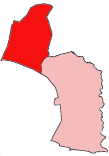
Montserrado County is a county in the northwestern portion of the West African nation of Liberia containing its national capital, Monrovia. One of 15 counties that comprise the first-level of administrative division in the nation, it has 17 sub political districts. As of the 2022 Census, it had a population of 1,920,914, making it the most populous county in Liberia. The area of the county measures 1,912.7 square kilometres (738.5 sq mi), the smallest in the country. Bensonville serves as the capital.

<span class="mw-page-title-main">Grand Cape Mount County</span> County of Liberia

Grand Cape Mount is a county in the northwestern portion of the West African nation of Liberia. One of 15 counties that constitute the first-level of administrative division in the nation, it has five districts. Robertsport serves as the capital with the area of the county measuring 5,162 square kilometres (1,993 sq mi). As of the 2008 Census, it had a population of 129,817, making it the eighth most populous county in Liberia. The county is bordered by Gbarpolu County to the northeast and Bomi County to the southeast. The northern part of Grand Cape Mount borders the nation of Sierra Leone, while to the west lies the Atlantic Ocean.

<span class="mw-page-title-main">Gbarpolu County</span> County of Liberia

Gbarpolu is a county in the northern portion of Liberia. One of 15 counties that comprise the first-level of administrative division in the nation, it has six districts. Bopulu serves as the capital with the area of the county measuring 9,689 square kilometres (3,741 sq mi). As of the 2008 Census, it had a population of 83,758, making it the eleventh-most populous county in Liberia.

<span class="mw-page-title-main">Administrative divisions of Lithuania</span>

Lithuania is now a country in the Baltic region of Europe.

A paramount chief is the English-language designation for the highest-level political leader in a regional or local polity or country administered politically with a chief-based system. This term is used occasionally in anthropological and archaeological theory to refer to the rulers of multiple chiefdoms or the rulers of exceptionally powerful chiefdoms that have subordinated others. Paramount chiefs were identified by English-speakers as existing in Native American confederacies and regional chiefdoms, such as the Powhatan Confederacy and Piscataway Native Americans encountered by European colonists in the Chesapeake Bay region of North America.
<span class="mw-page-title-main">Bomi County</span> County of Liberia

Bomi is a county in the northwestern portion of the West African nation of Liberia. The county was established in 1984. The county's area is 746 square miles (1,900 km2).

<span class="mw-page-title-main">Konobo District</span>

Konobo District is one of three districts located in Grand Gedeh County, Liberia. The administrative seat of the District is Ziah Town. As of 2008, the District had 50,161 people making it the second most populated in Grand Gedeh County next to Gbarzon District. In area, it is about 1,400 square miles.

<span class="mw-page-title-main">Barrobo District</span> District of Liberia

Barrobo District is a district of Liberia, one of the three located in Maryland County.

Jabo is the self-designation of an ethnic group located in the southeastern part of the Republic of Liberia in West Africa. They have also sometimes referred to themselves as Gweabo or Nimiah tribe.

<span class="mw-page-title-main">Subdivisions of Egypt</span> Three-layer hierarchy below the governorate levels

Egypt is divided, for the purpose of public administration, according to a three-layer hierarchy and some districts are further subdivided, creating an occasional fourth layer. It has a centralized system of local government officially called local administration as it is a branch of the Executive.

<span class="mw-page-title-main">Chiefdoms of Sierra Leone</span>

The chiefdoms of Sierra Leone are the third-level units of administration in Sierra Leone. There are 190 chiefdoms in Sierra Leone, as of 2017. Previously, there were 149.

<span class="mw-page-title-main">Administrative divisions of Sri Lanka</span>

Sri Lanka is divided into 9 provinces, which are further subdivided into 25 districts. Districts are further subdivided into Divisional Secretary's Divisions. Each DS Division is divided into Grama Niladhari Divisions.
<span class="mw-page-title-main">Government of Cameroon</span>

The Republic of Cameroon is a decentralized unitary state.

References

  1. "Decentralization Of Political & Administrative Power In Liberia". www.theperspective.org. Retrieved 2017-01-03.
  2. "Liberia cannot afford local polls". BBC News. January 14, 2008.
  3. "2008 National Population and Housing Census: Preliminary Results" (PDF). Government of the Republic of Liberia. 2008. Archived from the original (PDF) on February 13, 2012. Retrieved October 14, 2008.
  4. "Liberia: Counties, Major Cities, Towns & Urban Areas - Population Statistics, Maps, Charts, Weather and Web Information". www.citypopulation.de. Retrieved 2024-01-16.
  5. 1 2 3 4 "Indirect Rule in the Hinterland". GlobalSecurity.org. February 2012. Retrieved 13 June 2012.
  6. 1 2 Nyei, Ibrahim (2014). "Decentralizing the State in Liberia: The Issues, Progress and Challenges". Stability: International Journal of Security & Development. 3. doi: 10.5334/sta.eg .