
Dhubri District (Pron:ˈdʊbri) is an administrative district in the Indian state of Assam. The district headquarters are located at Dhubri town which is situated at ~290 km from Guwahati. This was also the headquarters of erstwhile undivided Goalpara district which was created in 1876 by the British government. In 1983, Goalpara district was divided into four districts and Dhubri is one among those. Dhubri district is one among the many Muslim-majority districts of Assam. In 2016, Dhubri was divided again to form South Salmara-Mankachar District.

Dhubri is an old town and headquarter of Dhubri district in Indian state of Assam. It is an old town on the bank of the Brahmaputra river, with historical significance. In 1883, the town was first constituted as a Municipal Board under the British regime. It is situated about 277.4 kilometres (172 mi) west from Dispur, the state capital of Assam.

Rangia (ৰঙিয়া) is a garden valley town and a municipal board located in the Kamrup Rural district of Assam, India. It serves as the sub-district headquarter of Rangia Sub district of Kamrup Rural District. One of Rangia's significant features is its role as the divisional headquarter of the Northeast Frontier Railway, which is one of the major railway zones in India. Baralia river flows through the heart of the town. Rangiya Junction is the 4th Biggest Railway Station in North East. Additionally, Rangia holds the distinction of being known as the gateway to the Indo-Bhutan border.
Abhayapuri is a town in Bongaigaon district and 21 km away from Bongaigaon city. It is the headquarters of North Salmara sub-division. It is surrounded by natural forests and hills, and is located on the National Highway 31, about 200 km west of Guwahati. Its nearest airport is at Azara,Guwahati and at Rupsi and nearest railway station is Abhayapuri Railway Station.
Bilasipara is a town, sub-division and town area committee in Dhubri district in the state of Assam, India.
Biswanath Chariali is a city and a municipal board in Biswanath district in the state of Assam, India. This city is the district headquarters of Biswanath district, which was created on 15 August 2015. It derives its name from Biswanath Ghat.
Golokganj is a census town in Dhubri district in the Indian state of Assam. Golakganj is one of the historical places of Dhubri district.
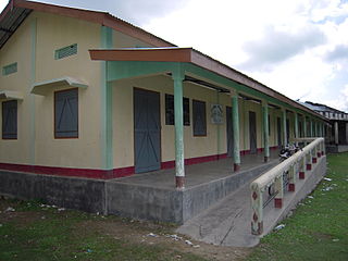
Sapatgram is a town and a Municipality Board Area in Dhubri district in the Indian state of Assam.

Udumalai, also known as Udumalaipettai and Udumalpet, is a town in Tiruppur district in the Indian state of Tamil Nadu. Udumalaipettai is located 535 km south west from the state capital, Chennai and 72 km away from Coimbatore, the second largest city in the state.
Jirania is a small town in the Indian state of Tripura on the banks of river Saidra (Haora). It is a Nagar Panchayat and also the headquarters of Jirania Rural Development Block. It is also the headquarters of Jirania Sub Division. It lies on the National Highway 8 of India. The Zirania market is of great importance for the local business and its sustainance. The Brick factories in and around Jirania are very famous, it serves for the town and its hinterland. There are more than 100 Brick factories in Jirania Block. Jirania is the connecting link with the town of Khumulwng and Mandwi with the National highway. Other nearby towns include Ranirbazar and Champaknagar. One more thing that makes it famous is National Institute of Technology Agartala.

Vidya Bharati is the educational wing of Rashtriya Swayamsevak Sangh (RSS). It runs one of the largest private network of schools in India, operating 12,000 schools with over 3.2 Million students, as of 2016 and has its registered headquarters in Lucknow with a functional headquarters in Delhi and a sub-office in Kurukshetra. In the year 2020, the million lives club selected Vidya Bharati as an official member of Vanguard cohort for its contribution to school education.
Lakhiganj is a village, a small Bazaar (market), a post office and a Gaon Panchayat in the Dhubri district of Assam, around 8 km north from Bilasipara,. It is situated on the Bilasipara-Kokrajhar state highway, around 12 km from Kokrajhar town and 9 km from Fakiragram railway station. The bazaar hosts weekly market on Monday and Friday. It has a small township comprising people of different backgrounds and as such they represent a mixed culture. The people of this Bazzar area basically speak Goalpariya, Assamese, although Marawari, Bihari and Bengalis’ are also there. The people are primarily dependent on small-scale business. However, it is surprising that this the place where Motram Surajmal Dugar first established a small firm in 1906 and now it is a big business house, named "the MS Dugar group of companies" operate all over India.
Kaliabor, a sub-division town in Nagaon district of Assam situated at a distance of 48 km east of Nagaon town. It was the headquarters of Borphukans during the Ahom era. Kaliabor lies in the middle of assam and surrounded in the north by the Brahmaputra, in the south by the hills of Karbi Anglong district, in the east by Kaziranga National Park under Golaghat district and in the west by Samaguri under Nagaon Sadar Sub-Division.
Narayanpur is a town located in Lakhimpur district of the northeastern Indian state Assam. It falls under Bihpuria constituency of Assam Legislative Assembly and under Narayanpur Police Station. Narayanpur is also the name of the development block. It is located between Dholpur and Bihpuria. Narayanpur is famous as birthplace of Madhavdev.
Dudhnoi is a taluk in Goalpara district, Assam, India.

Sukhaamphaa also known as Khora roja (1552–1603) was a king of the Ahom kingdom of medieval Assam. He ruled for a period of fifty one years, the longest in the Ahom dynasty. Very fond of sports, he fell off an elephant soon after his ascension and the injury gave him a limp, and as a result the Buranjis often called him the Khora roja.
Ghilamara is a small town situated in the far east of Lakhimpur district in Assam.
Jamugurihat is a town and a town area committee in Sonitpur district, in the Indian state of Assam. This is a newly planned city area by the Urban Development Authority of Assam. The town is located north of the Brahmaputra River. It is the location of the 200-year-old Baresahariya Bhaona festival.
Harirhat is a small town cum village area and it is also a market place in the Dhubri District (Assam). In addition, it is located in an ancient place called "the Village of Purni." The panchayat office is located at Purni Gaon

Borokalia Nashkara is a revenue village under South Salmara in Dhudri district. There are several other small villages associated with this village. A revenue village consisting of about 10 small villages. This also covered the Nashkara Gaon Panchayat. The distance from Nashkara village to the state capital Dispur is around 177 km. The state capital of Lucknow is different from Nashkara and is 245.5 km. Nearby prosperous capitals include Silong 184.6 km, Gangtok 213.7 km, Agartala 261.9 km.


