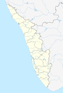
Padiyoor is a small town in Kannur district of Kerala state, India. Padiyoor village is part of Padiyoor-Kalliad Grama Panchayat in Iritty taluk.

Azhikode is a coastal town situated in Kannur district of Kerala, south India. Azhikode town is divided into Azhikode North and Azhikode South. The northern end of the Azhikode North is called Azhikkal. The place is the birthplace of Sukumar Azhikode, an influential thinker and literary critic. It is about 12 km from Kannur city.

Aralam is a village and Grama Panchayat in Kannur district in the Indian state of Kerala.

Ayyankunnu is a village in Kannur district in the Indian state of Kerala.The name ayyankunnu came from the five hills "Anchu Kunnu".

Cheleri is a census town in Kannur district in the Indian state of Kerala.

Ezhome is a census town in Kannur district in the Indian state of Kerala.

Kalliad is a village in Kannur district in the Indian state of Kerala.

Kanichar is a village and Grama Panchayat in Kannur district in the Indian state of Kerala.

Kurumathur is a census town in Taliparamba taluk of Kannur district in Kerala state, India. Kurumathur is located 8 km east of Taliparamba town in SH 36.

Manathana is a village in Kannur district of Kerala, India.

Maniyoor is a census town in Kannur district in the Indian state of Kerala.

Muzhakkunnu is a village in Kannur district in the Indian state of Kerala.

Nuchiyad is a village in Kannur district in the Indian state of Kerala.

Thillenkeri is a village and Grama Panchayat in Iritty taluk of Kannur district in the Indian state of Kerala.

Thimiri is a village in Kannur district in the Indian state of Kerala. An ancient Shiva temple called Thimiri Sree Shiva Kshethra is situated here.

Vayathur is a village in Ulikkal Grama panchayat of Kannur district in the Indian state of Kerala.

Vellora is a village in Kannur district in the Indian state of Kerala. It has state road connectivity, schools, hospitals, post office, and bank dating back to the 1950s.

Vilamana is a village in Kannur district in the Indian state of Kerala.

Eruvessi is a village in Irikkur Block Panchayat, Taliparamba Taluk, Kannur district in Kerala, India. It is located at a distance of around 50 Kilometers from Kannur. There is a famous temple called Padikkutti Devi temple and the festival or Utsav is well known. Eruvessi Sri Padikutty temple is the birthplace of Sree Muthappan. This place was ruled by Mannanar dynasty of Muthedath Aramana and Elayadath Aramana. The ruins of Aramana of the Mananar are still visible on the banks of Eruvessi River.

Kolachery is a census town and Grama Panchayat in Kannur District of Kerala state, India. Kolachery is located 15 kilometres (9.3 mi) north east of Kannur city.


