
St Mary Cray railway station is in St Mary Cray,South East London within the London Borough of Bromley. It is 14 miles 57 chains (23.7 km) down the line from London Victoria. Train services are operated by Southeastern,who manage the station,and Thameslink.

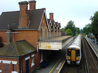
Swanley railway station is on the Chatham Main Line in England,serving the town of Swanley,Kent. It is 17 miles 31 chains (28.0 km) down the line from London Victoria and is situated between St Mary Cray and Farningham Road on the main line. The Maidstone Line branches from the main line south of Swanley and the next station on that route is Eynsford.

Maidstone East railway station is one of three stations in the central area of Maidstone,Kent,England,but currently the only one with a regular direct service to London. The station is on the Maidstone line,39 miles 76 chains (64.3 km) from London Victoria,and is served by trains operated by Southeastern.

Ashford International railway station is a National Rail station in Ashford,Kent,England. It connects several railway lines,including High Speed 1 and the South Eastern Main Line. Services are operated by Southeastern and Southern.

Otford railway station serves Otford in Kent. It is 24 miles 6 chains (38.7 km) down the line from London Victoria. Train services are provided by Southeastern and Thameslink.

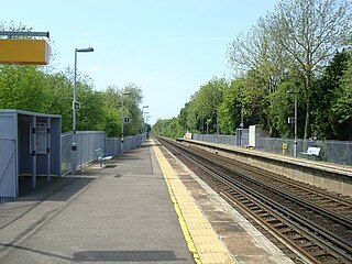
Shoreham railway station serves Shoreham in Kent,England. It is 22 miles 52 chains (36.5 km) down the line from London Victoria and is situated between Eynsford and Otford. Train services are provided by Thameslink.

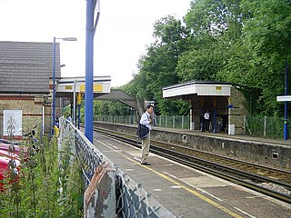
Eynsford railway station serves Eynsford in Kent,England. It is 20 miles 32 chains (32.8 km) down the line from London Victoria and is situated between Swanley and Shoreham. Train services are provided by Thameslink.

Staplehurst railway station is on the South Eastern Main Line in England,serving the village of Staplehurst,Kent. It is 41 miles 70 chains (67.4 km) down the line from London Charing Cross. The station and all trains that serve the station are operated by Southeastern.

Pluckley railway station is on the South Eastern Main Line in England,serving the village of Pluckley,Kent,which is approximately 1.2 miles (2 km) to the north. It is 50 miles 35 chains (81.2 km) down the line from London Charing Cross. The station and all trains that serve the station are operated by Southeastern.

Sandling railway station is on the South Eastern Main Line in England,serving the village of Sandling and the town of Hythe,Kent. It is 65 miles 36 chains (105.3 km) down the line from London Charing Cross. The station and all trains that call are operated by Southeastern.

Charing railway station serves the village of Charing in Kent,England. It is 53 miles 11 chains (85.5 km) down the line from London Victoria. The station,and all trains serving it,is operated by Southeastern.

Lenham railway station serves Lenham in Kent,England. It is 49 miles 11 chains (79.1 km) down the line from London Victoria.

Harrietsham railway station serves Harrietsham in Kent,England. It is 47 miles 36 chains (76.4 km) down the line from London Victoria.
Hollingbourne railway station serves Hollingbourne in Kent,England. It was opened in 1884 and is 45 miles 2 chains (72.5 km) down the line from London Victoria.

Bearsted railway station serves Bearsted in Kent,England. The station and all trains serving it are operated by Southeastern. It is 42 miles 59 chains (68.8 km) down the line from London Victoria via Herne Hill.

East Malling railway station serves the village of East Malling in Kent,and is close to Ditton and Larkfield. It is 35 miles 64 chains (57.6 km) down the line from London Victoria.
West Malling railway station lies to the east of West Malling,Kent,England,and is close to Kings Hill,Larkfield and Leybourne. It is 34 miles 61 chains (55.9 km) down the line from London Victoria.
Kemsing railway station serves Kemsing in Kent,England,although the station is located on the other side of the M26 motorway to the village. It is 26 miles 79 chains (43.4 km) down the line from London Victoria. Train services are provided by Southeastern.

Borough Green &Wrotham railway station is located in Borough Green in Kent,England. It is 29 miles 46 chains (47.6 km) down the line from London Victoria. Train services are provided by Southeastern.

East Farleigh railway station is on the Medway Valley Line in Kent,England,located to the south-west of Maidstone and close to the village of East Farleigh,on the opposite (south) bank of the River Medway,though the station is actually located in Barming parish. It is 42 miles 75 chains (69.1 km) down the line from London Charing Cross via Paddock Wood. The station and all trains that serve the station are operated by Southeastern.

