| Bernese Alps in the wide meaning | |
|---|---|
| German: Berner Alpen i.w.S. French: Alpes Bernoises d.l.s.l. | |
| Aerial view on the Finsteraarhorn (4275m) | |
| Highest point | |
| Peak | Finsteraarhorn [1] |
| Elevation | 4,274 m (14,022 ft) |
| Coordinates | 46°21′15″N8°07′34″E / 46.35417°N 8.12611°E |
| Geography | |
| Country | Switzerland |
| Cantons | Bern, Vaud, Valais, Lucerne, Uri, Nidwalden and Obwalden |
| Parent range | Alps |
| Borders on | Lepontine Alps, Pennine Alps, Graian Alps, Savoy Prealps, Swiss Prealps and Glarus Alps i.t.w.m. |
| Geology | |
| Orogeny | Alpine orogeny |
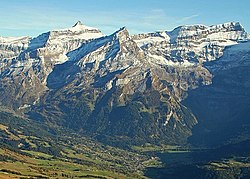
The Bernese Alps in the wide meaning (in German Berner Alpen i.w.S., [2] in French Alpes Bernoises D.l.s.l. [3] ) are a mountain range in the northwestern part of the Alps. They are located in Switzerland.
The range covers parts of several Swiss cantons: Bern, Vaud, Valais, Lucerne, Uri, Nidwalden and Obwalden.
According to SOIUSA (International Standardized Mountain Subdivision of the Alps) the range is an Alpine section, classified in the following way: [4]
The range is divided into three subsections:
Some notable summits of the range are:
| Name | Elevation (m) | Alpine subsection |
|---|---|---|
| Finsteraarhorn | 4,274 | Bernese Alps s.s. |
| Aletschhorn | 4,193 | Bernese Alps s.s. |
| Jungfrau | 4,158 | Bernese Alps s.s. |
| Mönch | 4,105 | Bernese Alps s.s. |
| Schreckhorn | 4,080 | Bernese Alps s.s. |
| Fiescherhorn | 4,049 | Bernese Alps s.s. |
| Grünhorn | 4,043 | Bernese Alps s.s. |
| Lauteraarhorn | 4,042 | Bernese Alps s.s. |
| Gletscherhorn | 3,983 | Bernese Alps s.s. |
| Eiger | 3,967 | Bernese Alps s.s. |
| Äbeni Flue | 3,962 | Bernese Alps s.s. |
| Fiescher Gabelhorn | 3,876 | Bernese Alps s.s. |
| Doldenhorn | 3,643 | Bernese Alps s.s. |
| Dammastock | 3,630 | Urner Alps |
| Galenstock | 3,583 | Urner Alps |
| Sustenhorn | 3,503 | Urner Alps |
| Titlis | 3,238 | Urner Alps |
| Les Diablerets | 3,210 | Vaud Alps |
| Grand Muveran | 3,051 | Vaud Alps |
| Lohner | 3,048 | Bernese Alps s.s. |
| Wendenstöcke | 3,042 | Urner Alps |
| Sparrhorn | 3,021 | Bernese Alps s.s. |
| Torrenthorn | 2,998 | Bernese Alps s.s. |
| Dent de Morcles | 2,980 | Vaud Alps |
| Eggishorn | 2,934 | Bernese Alps s.s. |
Some notable mountain passes of the range are:
| Name | Route (from/to) | Type | Elevation | ||
|---|---|---|---|---|---|
| Furka Pass | Rhône Glacier | Andermatt | Road | 2436 m | 7992 ft |
| Gemmi Pass | Kandersteg | Leukerbad | Bridle path | 2329 m | 7641 ft |
| Mönchjoch | Grindelwald | Eggishorn | Snow | 3560 m | 11,680 ft |
| Jungfraujoch | Wengernalp | Eggishorn | Snow | 3470 m | 11,385 ft |
| Grünhornlücke | Great Aletsch Glacier | Fiescher Glacier | Snow | 3305 m | 10,844 ft |
| Grimsel Pass | Meiringen | Rhone Glacier | Road | 2164 m | 7100 ft |
| Kleine Scheidegg | Grindelwald | Lauterbrunnen | Path, railway | 2064 m | 6772 ft |
| Col de Cheville | Sion | Bex | Bridle path | 2049 m | 6723 ft |
| Grosse Scheidegg | Grindelwald | Meiringen | Road (restricted to bus traffic) | 1967 m | 6454 ft |
| Brünig Pass | Meiringen | Lucerne | Road, railway | 1035 m | 3396 ft |
| Petersgrat | Lauterbrunnen | Lötschental | Snow | 3205 m | 10,516 ft |
| Lötschenlücke | Lötschental | Eggishorn | Snow | 3204 m | 10,512 ft |
| Susten Pass | Meiringen | Wassen | Road | 2262 m | 7422 ft |
| Sanetsch Pass | Sion | Saanen | Bridle path | 2234 m | 7331 ft |