Breamlea, Victoria

Last updated

Breamlea
Victoria
BreamleaBeach1.jpg
Main beach at Breamlea
Australia Victoria Surf Coast Shire location map.svg
Red pog.svg
Breamlea
Coordinates 38°18′S144°23′E / 38.300°S 144.383°E / -38.300; 144.383
Population162 (2016 census) [1]
Postcode(s) 3227
Location
LGA(s)
State electorate(s) South Barwon
Federal division(s) Corangamite
Localities around Breamlea:
Connewarre Connewarre Connewarre
Torquay Breamlea Bass Strait
Bass Strait Bass Strait Bass Strait

Breamlea, Victoria, Australia, is a secluded seaside hamlet located on the south coast of the Bellarine Peninsula, 18 kilometres south of Geelong, and halfway between Barwon Heads and Torquay. It is divided between the City of Greater Geelong and the Surf Coast Shire. In the 2016 census, Breamlea had a permanent population of 162. [1]

Contents

Geography

Breamlea is nestled in the sand dunes between Thomsons Creek and the beach. The nearest township to Breamlea is Connewarre.

Thomsons Creek, also known as Bream Creek, runs through a natural network of reedy canals and widens before it enters Buckleys Bay. At the mouth of the creek is Point Impossible which is a well-known longboard surfing break.

The patrolled surf beach at Breamlea is called Bancoora, and is the closest surf beach to Melbourne. The beach was named after the SS Bancoora, that ran aground there in 1891. [2] Other non-patrolled beaches along this stretch of coast are not heavily used.

History

The area was once populated by the Mon Mart Clan of Wathaurong people. The rock shelves on the coast in the area have always been rich in shellfish, and large middens of discarded shells can be seen on the headland between Buckleys Bay and Stingray Bay. William Buckley lived in the area, and across the road from the caravan park is a well that he is supposed to have used.

The clipper ship Victoria Tower, on its maiden voyage to Melbourne, was wrecked on rocks at Point Impossible in 1869. It had been encountering problems with its compasses during its 85-day voyage to Australia. The wreck is one of many included in Victoria's Underwater Shipwreck Discovery Trail. [3]

On 14 July 1891, the SS Bancoora ran aground on what is now the surf beach. The cargo included a young elephant, a rhinoceros, monkeys and parrots. All were landed safely and taken by lorry to Geelong, although the rhinoceros unfortunately only survived for two days. The Bancoora was re-floated by two steam tugs and assisted by them to the Alfred Graving Dock at Williamstown. [2]

Thomsons Creek attracted campers and fishermen from the 1870s onwards and, by the 1920s, makeshift huts were being built by regular campers. During the Great Depression, squatters constructed more permanent buildings, rate-free, and eked out meals from the creek and the ocean.[ citation needed ]

The existence of the settlement, hitherto known as Bream Creek, was formally acknowledged by the government in October 1941 when it was proclaimed in the Government Gazette and renamed Breamlea, [4] creating a small linear township huddled behind the high, Moonah-covered sand dunes. The proclamation paved the way for the sale of the first freehold land in 1942. A Post Office opened on 1 July 1947. [5] Breamlea was only connected to the electricity grid in the late 1960s.

Breamlea State School opened in the local hall on 27 May 1952 and moved to a standalone site on 31 January 1955. It closed on 14 January 1966. [6]

In 1962, a surf life saving club was formed at Bancoora Beach, with clubrooms being built in 1963. On 8 April 1987, the original clubhouse was gutted by fire. For the next four seasons the club operated from a tin shed, until the present building was opened on 25 October 1992. [7]

Township

Breamlea has around 100 houses nestled in the sand dunes between Thomsons Creek and the beach. The main street, Horwood Drive, is located at the base of the dunes, with Blyth Street above. Houses are located on the south side of Horwood Drive, and the north side of Blyth Street.

There is also a caravan park, and small general store with basic supplies. Halfway along Horwood Drive is a recreation reserve with an oval, children's playground, barbecue facilities and toilet.

The area is underdeveloped and many residents want to keep it that way[ according to whom? ]. The architecture of Breamlea is a mix of fibro-cement beach shacks built in the 1950s and 1960s, and modern, architect-designed houses.

Sewage outfall

Barwon Water's Black Rock sewage treatment plant is located to the north-east of Breamlea, processing effluent from Geelong and surrounding areas. Black Rock was chosen as the ocean outfall for Geelong's sewage in 1912, with the outfall sewer being built during the next three years. [8] Initially, the sewage was left untreated before being discharged into the ocean, increasingly polluting several adjacent beaches. A basic comminutor was installed at the outlet in the 1970s but, in the 1980s, the treatment plant was built, along with a 1.2-kilometre-long ocean outfall. [9] In 1997, the plant was further upgraded, with secondary filtration being provided, and a pipeline was installed to allow recycled water to be used on a flower farm at Torquay. [10]

Bancoora Surf Life Saving Club

The Bancoora Surf Life Saving Club (SLSC) conducts seasonal surf patrols over the summer period, and the beach has lifeguards on duty every day in January. Each summer, a nipper program is run to educate and enhance the surf skills of young members. Bancoora SLSC hosted the Australian Surf Lifesaving Championships during the Easter of 1977. Due to the heavy surf during the championships, many events were relocated to Fisherman's Beach in Torquay.

The club celebrated its fiftieth anniversary in 2013. [11]

Wind generator

Wind generator at Breamlea in 2007 Breamlea-wind-generator.jpg
Wind generator at Breamlea in 2007

A wind generator, located on Black Rock Road, was erected in November 1987 by the State Electricity Commission of Victoria and the Victorian Solar Energy Council (now Energy Victoria), as a demonstration unit. The turbine, atop a 22-metre monopole, was of 60 kW capacity, and was manufactured by Westwind of Western Australia. [12]

As a consequence of the privatisation of electricity supply in Victoria, the generator was sold in 1994 to the Alternative Technology Association of Melbourne. December 1995 saw it sold again, to Michael Gunter, a member of the previous organisation. Electricity production ceased at 1200hrs on 17 May 2003, due to an electrical generator burn-out, caused by moisture, salt, and electrical flash-over. [13]

Local water utility, Barwon Water, bought the turbine the same year, restoring it to service in early 2004. [14] It generates approximately 80,000 kWh per year for the grid, with an estimated 90-95 per cent availability, [14] and produces between 7 kW and 10.3 kW of average power. [15]

Related Research Articles

<span class="mw-page-title-main">Geelong</span> City in Victoria, Australia

Geelong is a port city in Victoria, Australia, located at the eastern end of Corio Bay and the left bank of Barwon River, about 65 km (40 mi) southwest of Melbourne.

<span class="mw-page-title-main">Aireys Inlet</span> Town in Victoria, Australia

Aireys Inlet is a small coastal inlet and town located on the Great Ocean Road, southwest of Melbourne, Victoria, Australia. Aireys Inlet is located between Anglesea and Lorne, and joined with Fairhaven, Moggs Creek, and Eastern View to the west.

<span class="mw-page-title-main">Torquay, Victoria</span> Town in Victoria, Australia

Torquay is a seaside resort in Victoria, Australia, which faces Bass Strait, 21 km south of Geelong and is the gateway to the Great Ocean Road. It is bordered on the west by Spring Creek and its coastal features include Point Danger and Zeally Bay. At the 2021 census, Torquay had a population of 18,534.

<span class="mw-page-title-main">Geelong Airport</span> Former airfield in Victoria, Australia

Geelong Airport was a small airfield specifically for light aircraft located in Mount Duneed, Victoria, Australia. It was primarily used for scenic flights and private aircraft, and was located in the local government area of the City of Greater Geelong.

<span class="mw-page-title-main">Barwon River (Victoria)</span> Perennial river in Victoria, Australia

The Barwon River is a perennial river of the Corangamite catchment, located in The Otways and the Bellarine Peninsula regions of the Australian state of Victoria.

<span class="mw-page-title-main">Grovedale, Victoria</span> Suburb of Geelong, Victoria, Australia

Grovedale is a southern suburb of Geelong, Victoria, Australia. At the 2021 census, Grovedale had a population of 14,869.

<span class="mw-page-title-main">Belmont, Victoria</span> Suburb of Geelong, Victoria, Australia

Belmont is a southern suburb of Geelong, Victoria, Australia. The name means "beautiful hill". Belmont is geographically separated from the Geelong central business district by the Barwon River. The suburb is primarily residential, with some light industry along Barwon Heads Road. The suburb is part of the City of Greater Geelong local government area. At the 2011 census, Belmont had a population of 13,616.

<span class="mw-page-title-main">Barwon Heads, Victoria</span> Suburb of Geelong, Victoria, Australia

Barwon Heads is a coastal township on the Bellarine Peninsula, near Geelong, Victoria, Australia. It is situated on the west bank of the mouth of the Barwon River below Lake Connewarre, while it is bounded to the west by farmland, golf courses and the saline ephemeral wetland of Murtnaghurt Lagoon. At the 2016 census, Barwon Heads had a population of 3,875.

<span class="mw-page-title-main">Jan Juc</span> Town in Victoria, Australia

Jan Juc is a suburb of Torquay, Victoria. At the 2016 census, Jan Juc had a population of 3,683.

<span class="mw-page-title-main">Bellarine Peninsula</span> Peninsula in Victoria, Australia

The Bellarine Peninsula is a peninsula located south-west of Melbourne in Victoria, Australia, surrounded by Port Phillip, Corio Bay and Bass Strait. The peninsula, together with the Mornington Peninsula, separates Port Phillip Bay from Bass Strait. The peninsula itself was originally occupied by Indigenous Australian clans of the Wadawurrung nation, prior to European settlement in the early 19th century. Early European settlements were initially centred on wheat and grain agriculture, before the area became a popular tourist destination with most visitors arriving by paddle steamer on Port Phillip in the late 19th century.

<span class="mw-page-title-main">Surf Life Saving Australia</span>

Surf Life Saving Australia (SLSA) is an Australian not-for-profit community organisation that promotes water safety and provides surf rescue services.

Connewarre is a locality in Victoria, Australia, is located in the City of Greater Geelong and Surf Coast Shire, and is named after Lake Connewarre which is situated immediately to its north-east. Connewarre is a version of "kunuwarra", the name of the black swan in the Wathawurrung language. At the 2016 census, Connewarre and the surrounding area had a population of 788.

<span class="mw-page-title-main">Bellarine Football Netball League</span>

The Bellarine Football Netball League (BFNL) is an Australian rules football and netball competition based in the Bellarine Peninsula region of Victoria, Australia. Established in 1971 as the Bellarine & District Football League, the competition was formed out of the ashes of the Polwarth Football League, which had six of its former teams join.

<span class="mw-page-title-main">City of South Barwon</span> Local government area in Victoria, Australia

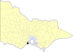
The City of South Barwon was a local government area in Victoria, Australia, which contained a number of Geelong suburbs south of the Barwon River, and extending to Torquay in the south and Barwon Heads to the east. The city covered an area of 165.4 square kilometres (63.9 sq mi), and existed from 1863 until 1994.

<span class="mw-page-title-main">Shire of Barrabool</span> Local government area in Victoria, Australia

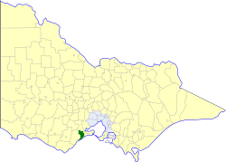
The Shire of Barrabool was a local government area about 100 kilometres (62 mi) southwest of Melbourne, the state capital of Victoria, Australia. The shire covered an area of 575.18 square kilometres (222.1 sq mi), and existed from 1853 until 1994.

<span class="mw-page-title-main">Marine outfall</span> Pipeline or tunnel that discharges wastewater

A marine outfall is a pipeline or tunnel that discharges municipal or industrial wastewater, stormwater, combined sewer overflows (CSOs), cooling water, or brine effluents from water desalination plants to the sea. Usually they discharge under the sea's surface. In the case of municipal wastewater, effluent is often being discharged after having undergone no or only primary treatment, with the intention of using the assimilative capacity of the sea for further treatment. Submarine outfalls are common throughout the world and probably number in the thousands. The light intensity and salinity in natural sea water disinfects the wastewater to ocean outfall system significantly. More than 200 outfalls alone have been listed in a single international database maintained by the Institute for Hydromechanics at Karlsruhe University for the International Association of Hydraulic Engineering and Research (IAHR) / International Water Association (IWA) Committee on Marine Outfall Systems.

<span class="mw-page-title-main">Seaspray, Victoria</span> Town in Victoria, Australia

Seaspray is a small coastal town in Victoria, Australia, in the Gippsland region of the state. The town is located alongside the Ninety Mile Beach about 10 kilometres (6.2 mi) off the South Gippsland Highway in the Shire of Wellington, 242 kilometres (150 mi) east of the state capital, Melbourne.

Surfcoast Highway is a semi-rural highway in Victoria, Australia, connecting the city of Geelong with the coastal town of Torquay. The highway runs through the Armstrong Creek Growth Area, which is the subject of extensive residential development; closer to Torquay, tourist attractions the Narana Creations indigenous centre, Surf Coast Plaza retail centre, and the Surfworld museum are located along the highway.

<span class="mw-page-title-main">Barwon Sewer Aqueduct</span> Bridge in Victoria, Australia

The Barwon Sewer Aqueduct is a heritage-listed aqueduct across the Barwon River at Goat Island, Breakwater, Victoria, Australia. It was designed by engineer E. G. Stone and was erected between 1913-1915. It would appear to be the only one of its kind in Australia in terms of its length and the use of Considère's construction technique. The aqueduct appears to be the last example in Australia of Armand Considère's system of reinforcing for concrete structures. It was added to the Victorian Heritage Register on 23 October 1991.

<span class="mw-page-title-main">Cadel Evans Great Ocean Road Race</span> Cycling race

The Cadel Evans Great Ocean Road Race also known as Great Ocean Road Race or Cadel Road Race is an annual professional one-day road bicycle racing for both men and women starting and finishing in Geelong, Victoria, Australia, and routed along the picturesque Great Ocean Road. The first race was held in 2015, as the farewell race for Cadel Evans—Australia's only Tour de France winner or Road World Champion. The 2017 edition was added to the UCI World Tour for the first time.

References

  1. 1 2 Australian Bureau of Statistics (27 June 2017). "Breamlea (State Suburb)". 2016 Census QuickStats. Retrieved 16 November 2017. OOjs UI icon edit-ltr-progressive.svg
  2. 1 2 "The S.S. Bancoora". The Argus. 24 August 1891. Retrieved 6 September 2022.
  3. "Victoria Tower shipwreck". Department of Transport, Planning and Local Infrastructure. Archived from the original on 4 March 2014. Retrieved 4 March 2014.
  4. "Geelong News". The Argus. 17 October 1941. Retrieved 4 March 2014.
  5. Phoenix Auctions History. "Post Office List" . Retrieved 9 March 2021.
  6. Blake, L. J. (1973). Vision and Realisation: A Centenary History of State Education in Victoria (Volume 2). Education Department of Victoria. p. 1060.
  7. "Bancoora Surf Lifesaving Club History". Archived from the original on 27 September 2007. Retrieved 19 July 2007.
  8. Begg, Peter (1990). Geelong - The First 150 Years. Globe Press. ISBN   0-9592863-5-7.
  9. "EPA - Investigation at Black Rock near Geelong". Archived from the original on 30 August 2007. Retrieved 19 July 2007.
  10. "$46M TREATMENT PLANT OPENED AT BLACK ROCK" . Retrieved 19 July 2007.[ permanent dead link ]
  11. "The Bancoora 50th Anniversary". Bancoora Surf Life Saving Club. Archived from the original on 25 January 2014. Retrieved 4 March 2014.
  12. "The History of Community Windfarms" . Retrieved 19 July 2007.
  13. "Wind and energy data for Breamlea turbine" . Retrieved 19 July 2007.
  14. 1 2 Enhar Sustainable Energy Solutions. "Case Study 3: Breamlea – 60kW community wind project" (PDF). NSW Small Wind Turbine Consumer Guide. NSW Office of Environment and Heritage. Archived from the original (PDF) on 14 January 2012. Retrieved 30 September 2011.
  15. "Michael Gunter - re: Electrical Distribution". Archived from the original on 19 September 2007. Retrieved 19 July 2007.