
North Mountain is a peak in the Catskill Mountains of New York, on the border between the towns of Catskill and Hunter, in Greene County. It is part of the Catskill Escarpment. Cairo Round Top is located northeast and Artists Rock is located southeast of North Mountain.

Blackhead is a mountain located in Greene County, New York.

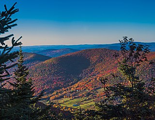
Indian Head Mountain is a 3,573 ft (1,089 m) mountain located in the southeast corner of Greene County, New York. The mountain, named for the appearance of its profile, is part of the Devil's Path range of the Catskill Mountains. To the northwest, Indian Head is separated from Twin Mountain by Jimmy Dolan Notch; to the southeast, Indian Head is flanked by Plattekill Mountain.
Big Indian Mountain is a mountain located in Ulster County, New York. The mountain is part of the Catskill Mountains. It is flanked to the northwest by Eagle Mountain, to the southeast by Fir Mountain, and to the southwest by Doubletop Mountain.

Eagle Mountain is a mountain located in Ulster County, New York. The mountain is part of the Catskill Mountains. Eagle Mountain is flanked to the north by Haynes Mountain, to the southwest by Doubletop Mountain and Graham Mountain, and to the southeast by Big Indian Mountain.
Lone Mountain is a mountain located in Ulster County, New York. The mountain is part of the Catskill Mountains. Lone Mountain is flanked to the southwest by Table Mountain, and to the east by Rocky Mountain.

Sugarloaf Mountain is a 900-foot (270 m) peak located in the town of Fishkill near the Hudson River and Breakneck Ridge. One of several similarly named mountains in the U.S. state of New York, it is part of the Hudson Highlands, located entirely within Hudson Highlands State Park.

North Lake is a lake located by Atwell, New York and is the source of the Black River. North Lake is one of several lakes in Herkimer County that has a medium acid content, and is therefore not a big fish producer. The fish species present are tiger muskie, white sucker, perch, and bullhead. Boating is permitted, limited to a small gravel based boat launch in Atwell.
Evergreen Mountain is a mountain located in Greene County, New York north of Spruceton, New York. Herdman Brook drains the southeastern portion of the mountain and flows south before converging with West Kill. West Kill flows westwards, south of Evergreen Mountain and the Schoharie Creek flows eastwards, north of the mountain.
Irish Mountain is a mountain located in the Catskill Mountains of New York southwest of Grand Gorge. Irish Mountain is located southeast of Moresville Range and north of Schultice Mountain.
Twadell Mountain is a 2,293-foot-high (699 m) mountain in the Catskill Mountains of New York. It is located north-northeast of East Branch in Delaware County. Rock Rift Mountain is located north-northwest, and Baxter Mountain is located east of Twadell Mountain. In May 1910, a 45-foot-tall (14 m) modified windmill tower was built on the mountain for fire lookout purposes. In 1919, the windmill tower was replaced with a 47-foot-tall (14 m) steel lookout tower. The tower ceased fire lookout operations at the end of the 1972 fire lookout season. The tower still remains but is closed to the public.
Gallis Hill is a 794-foot-tall (242 m) mountain in the Catskill Mountains region of New York. It is located northwest of Kingston in Ulster County. Jockey Hill is located north-northeast, and Morgan Hill is located west of Gallis Hill. In 1927, the Conservation Department built a steel fire lookout tower on the mountain. In 1950, the tower was closed and disassembled then moved to Overlook Mountain, where it still remains today.

Huntersfield Mountain is a mountain located in the Catskill Mountains of New York north-northwest of Ashland. Ashland Pinnacle is located east, and Tower Mountain is located south-southeast of Huntersfield Mountain. It is the highest point in Schoharie County and it is ranked 9 of 62 on the list of New York County High Points.
Richmond Mountain is a mountain located in the Catskill Mountains of New York east-northeast of Hunter. Richtmyer Peak is located northeast, Bump Mountain is located south, Steenburg Mountain is located north, and Ashland Pinnacle is located west-southwest of Richmond Mountain.
Bump Mountain is a mountain located in the Catskill Mountains of New York northeast of Ashland. Richtmyer Peak is located north-northeast, The Knob is located west, and Ashland Pinnacle is located west-southwest of Bump Mountain.
Mount Pisgah is a mountain located in the Catskill Mountains of New York north of Windham. Steenburg Mountain is located northwest, Richtmyer Peak is located west, and Mount Nebo is located southeast of Mount Pisgah.
Mount Electra is a 2,260-foot-tall (690 m) mountain in the Adirondack Mountains of New York. It is located north-northeast of Little Rapids in the Town of Webb in Herkimer County. Deer Mountain is located north-northwest of Mount Electra. The mountain was previously known as Rock Lake Mountain. Around 1920, a 60-foot-tall (18 m) steel fire lookout tower was built on the mountain. The tower was dismantled in 1989 and left at the mountain top.
The Knob is a mountain in Greene County, New York. It is located in the Catskill Mountains north-northeast of Ashland. Ashland Pinnacle is located north, and Huntersfield Mountain is located northwest of The Knob. The mountain has an elevation of 2,638 feet.

Swede Mountain is a mountain in the Adirondack Mountains region of New York. It is located southwest of Ticonderoga and north of Glens Falls in Warren County. The Swede Mountain Fire Observation Station is located on top of the mountain.

Belfry Mountain is a mountain in the Adirondack Mountains region of New York. It is located north-northwest of Witherbee in Essex County. The Belfry Mountain Fire Observation Station is located on top of the mountain.

