
Carroll County is a county located in the U.S. state of Illinois. As of the 2020 census, the population was 15,702. Its county seat is Mount Carroll.

Paulding County is a county located in the northwestern part of the U.S. state of Georgia. Part of Metro Atlanta, it had an estimated population of 168,661 in 2020. The county seat is Dallas.

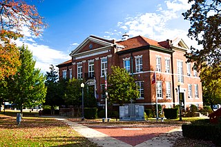
Douglas County is a county located in the north central portion of the U.S. state of Georgia. As of the 2020 U.S. Census, the population was 144,237, having more than doubled since 1990. The county seat is Douglasville. The city of Villa Rica, and a small portion of Austell are both also located in Douglas County. Douglas County is included in Metro Atlanta. It has attracted new residents as jobs have increased in the Atlanta area.
Boone County is a county located in the U.S. state of Arkansas, along the Missouri border. As of the 2020 census, the population was 37,373. The county seat is Harrison. It is Arkansas's 62nd county, formed on April 9, 1869.

North Conway is a census-designated place (CDP) and village in eastern Carroll County, New Hampshire, United States. The population was 2,116 at the 2020 census. A year-round resort area, North Conway is the second-largest village within the town of Conway, after the village of Conway proper. North Conway maintains its own fire station, post office and public library, sharing its other services with Conway. The White Mountain National Forest is to the west and north. The area is home to Cathedral Ledge, Echo Lake State Park, and Cranmore Mountain Resort. North Conway is known for its large number of outlet shops.

Tamworth is a town in Carroll County, New Hampshire, United States. The population was 2,812 at the 2020 census. Tamworth includes the villages of Chocorua, South Tamworth, Wonalancet, and Whittier. The White Mountain National Forest is to the north. The town is home to Hemenway State Forest in the north and White Lake State Park in the southeast.

Conway is a town in Carroll County, New Hampshire, United States. It is the most populous community in the county, with a population of 9,822 at the 2020 census, down from 10,115 at the 2010 census. The town is on the southeastern edge of the White Mountain National Forest. There are five villages in the town: Conway, North Conway, Center Conway, Redstone and Kearsarge. Additionally, it shares a portion of the village of Intervale with the neighboring town of Bartlett.

The Boston Mountains is a Level III ecoregion designated by the Environmental Protection Agency (EPA) in the U.S. states of Arkansas and Oklahoma. Part of the Ozarks, the Boston Mountains are a deeply dissected plateau. The ecoregion is steeper than the adjacent Springfield Plateau to the north, and bordered on the south by the Arkansas Valley. The Oklahoma portion of the range is locally referred to as the Cookson Hills. There are several theories of how the mountains were named, though apparently none are related to the Massachusetts city.

Bretton Woods is an area within the town of Carroll, New Hampshire, United States, whose principal points of interest are three leisure and recreation facilities. Being virtually surrounded by the White Mountain National Forest, the vista from Bretton Woods toward Mount Washington and the Presidential Range includes no significant artificial structures other than the Mount Washington Cog Railway and the Mount Washington Hotel.
Lake Kanasatka is a 371-acre (150 ha) lake located in Carroll County in the Lakes Region of central New Hampshire, United States, in the town of Moultonborough. Early maps refer to the lake, which is long and narrow, as "Long Pond", "Quinebarge Pond" or "Lake Quinebarge". The lake is located one-half mile north of and nine vertical feet higher than Lake Winnipesaukee. Lake Kanasatka lies at the base of Red Hill and is largely fed by its rain and snow runoff.

Northwestern Illinois is a geographic region of the state of Illinois within the USA.

Twin Mountain is an unincorporated community within the town of Carroll in the White Mountains of New Hampshire, United States. It is named for two prominent summits which rise to the south of the village, North Twin Mountain and South Twin Mountain.

Mount Doublehead is a twin-peaked mountain in eastern New Hampshire, United States. It is located in the town of Jackson, Carroll County, in the eastern White Mountains. North Doublehead has an elevation of 3,053 feet (930.5 m) above sea level, while South Doublehead has an elevation of 2,939 ft (895.8 m).

Samuel Sprigg "Red" Carroll was a career officer in the United States Army who rose to the rank of brigadier general of the Union during the American Civil War. The Maryland native was most known for his service as the commander of the famed "Gibraltar Brigade", an infantry brigade in the Army of the Potomac that played a key role in the defense of Cemetery Hill during the Battle of Gettysburg, as well as in repulsing a portion of Pickett's Charge.

Blackjack Mountain is a scenic landmark, located in the very southwest corner of Carroll County, Georgia on the Georgia-Alabama border and Heard County line. The nearest city is Ephesus, Georgia, 2.2 miles (3.5 km) to the south.

Carroll County is a United States county located in the southwestern part of the Commonwealth of Virginia. Roughly one fifth of the county lies in the Virginia Piedmont region, while the rest is part of the Appalachian Mountains. The county seat and only town is Hillsville.

Eastman Mountain is a mountain at the southern end of the Baldface-Royce Range, located in Carroll County, New Hampshire. It is accessed by the Eastman Mountain Trail. Its summit is partially open and provides good views.
Red Hill is a mountain located in the Catskill Mountains of New York east-south of Frost Valley. Woodhull Mountain is located northeast of Red Hill.
Gallis Hill is a 794-foot-tall (242 m) mountain in the Catskill Mountains region of New York. It is located northwest of Kingston in Ulster County. Jockey Hill is located north-northeast, and Morgan Hill is located west of Gallis Hill. In 1927, the Conservation Department built a steel fire lookout tower on the mountain. In 1950, the tower was closed and disassembled then moved to Overlook Mountain, where it still remains today.

