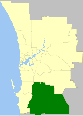
The Shire of Serpentine-Jarrahdale is a local government area in the outer southeastern metropolitan area of Perth, the capital of Western Australia, and has an area of 905 square kilometres (349 sq mi) and a population of 32,173 as at the 2021 Census. Despite being named after two towns in the area, neither Serpentine nor Jarrahdale function as either the Shire's largest settlement (Byford) or the seat of government (Mundijong).

The Shire of Ngaanyatjarraku is a remote local government area in Western Australia near the Northern Territory/South Australian border. It is 1,542 km (958 mi) from Perth.

The Shire of Westonia is a local government area in the eastern Wheatbelt region of Western Australia, about 310 kilometres (193 mi) east of Perth, the state capital. Its seat of government is the small town of Westonia.

The Shire of Dundas is a local government area in the Goldfields-Esperance region of Western Australia. The shire covers an area of 93,179 square kilometres (35,977 sq mi) and its seat of government is the town of Norseman. Its territory lies between Norseman and the border with South Australia, and is between 700 and 1,500 kilometres east of the state capital, Perth.

The Shire of Corrigin is a local government area in the Wheatbelt region of Western Australia, about 230 kilometres (143 mi) east of the state capital, Perth. Its seat of government is the town of Corrigin. The shire covers an area of 3,095 square kilometres (1,195 sq mi) and the economy, worth approximately $50 million per year to the state economy, is based on agriculture - predominantly cereal grains and sheep, with some supporting industries including a flour mill.

The Shire of Mukinbudin is a local government area in the Wheatbelt region of Western Australia, about 80 kilometres (50 mi) north of Merredin and about 300 kilometres (186 mi) east of the state capital, Perth. The Shire covers an area of 3,437 square kilometres (1,327 sq mi), and its seat of government is the town of Mukinbudin.

The Shire of Tammin is a local government area in the Wheatbelt region of Western Australia. Its seat of government is the town of Tammin, about 80 kilometres (50 mi) west of Merredin and about 180 kilometres (112 mi) east of Perth, the state capital.
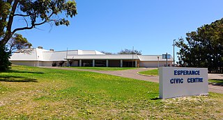
The Shire of Esperance is a local government area in the Goldfields-Esperance region of Western Australia, about 400 kilometres (250 mi) south of the town of Kalgoorlie and about 720 kilometres (450 mi) east-southeast of the state capital, Perth. The Shire covers an area of 42,547 square kilometres (16,427 sq mi), and its seat of government is the town of Esperance, where about three-quarters of the Shire's population resides.

The Shire of Laverton is a local government area in the Goldfields-Esperance region of Western Australia, about 370 kilometres (230 mi) northeast of the city of Kalgoorlie and about 950 kilometres (590 mi) east-northeast of the state capital, Perth. The Shire covers an area of 179,798 square kilometres (69,420 sq mi), and its seat of government is the town of Laverton.

The Shire of Leonora is a local government area in the Goldfields-Esperance region of Western Australia, about 240 kilometres (149 mi) north of the city of Kalgoorlie and about 830 kilometres (516 mi) northeast of the state capital, Perth. The Shire covers an area of 32,189 square kilometres (12,428 sq mi), and its seat of government is the town of Leonora.
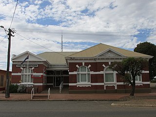
The Shire of Ravensthorpe is a local government area in the southern Goldfields-Esperance region of Western Australia, about halfway between the city of Albany and the town of Esperance and about 530 kilometres (329 mi) southeast of the state capital, Perth. The Shire covers an area of 13,551 square kilometres (5,232 sq mi), and its seat of government is the town of Ravensthorpe.
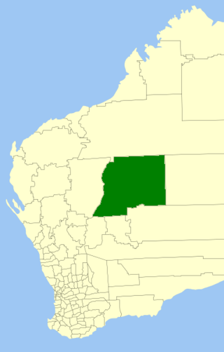
The Shire of Wiluna is a local government area in the Goldfields-Esperance region of Western Australia, about 950 kilometres (590 mi) northeast of the state capital, Perth. The Shire covers an area of 182,155 square kilometres (70,330 sq mi), and its seat of government is the town of Wiluna.
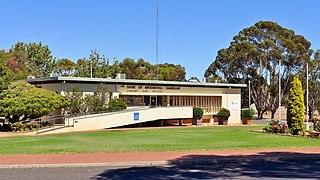
The Shire of Broomehill-Tambellup is a local government area in the Great Southern region of Western Australia, 320 kilometres (200 mi) south-southeast of the state capital, Perth. The Shire covers an area of 2,609.1 square kilometres (1,007.4 sq mi), and its seat of government is the town of Tambellup. It came into existence in 2008 through the amalgamation of the former Shire of Broomehill and Shire of Tambellup.

Bandy Creek is a north-eastern suburb of Esperance, a town in south-eastern Western Australia. Its local government area is the Shire of Esperance, and it is located 6 kilometres (4 mi) northeast of Esperance's central business district. The east and north of Bandy Creek are covered by the Mullet Lake Nature Reserve while, in the south, it borders the Southern Ocean.
Nulsen is a western suburb of Esperance, a town in south-eastern Western Australia. Its local government area is the Shire of Esperance.

Chadwick is a northern suburb of Esperance, a town in south-eastern Western Australia. Its local government area is the Shire of Esperance. The eastern terminus of the South Coast Highway is located in Chadwick.

West Beach is a suburb of Esperance, a town in south-eastern Western Australia south of Esperance's central business district, extending southwesterly for several kilometres along the southern coast. Its local government area is the Shire of Esperance.

Condingup is a town in the Goldfields–Esperance region of Western Australia, in the Shire of Esperance local government area, 782 kilometres (486 mi) southeast of the state capital, Perth. A small section of the locality is situated on the Southern Ocean, at the Duke of Orleans Bay, while the townsite itself is at the intersection of Fisheries Road and Orleans Bay Road. Condingup borders Cape Le Grand National Park in the south. The Coolinup Nature Reserve is located in the west of Condingup.
Cascade is a small town in Western Australia located 677 kilometres (421 mi) east of Perth along the South Coast between Ravensthorpe and Esperance in the Goldfields-Esperance region of Western Australia. The Griffiths, Fields and Cascade Nature Reserves are located within Cascade.

Coomalbidgup is a town and locality of the Shire of Esperance in the Goldfields-Esperance region of Western Australia. It is located on the South Coast Highway and the Southern Ocean. Almost the entire coast of the locality is covered by protected area, with the Stokes Inlet and the Stokes National Park in the west and two unnamed nature reserves in the east.


