Chandanakampara

Last updated

Chandanakampara
Village
LITTLE FLOWER LPS.jpg
Little Flower School
India Kerala location map.svg
Red pog.svg
Chandanakampara
Location in Kerala, India
India location map.svg
Red pog.svg
Chandanakampara
Chandanakampara (India)
Coordinates: 12°06′28″N75°36′33″E / 12.1078498°N 75.6092355°E / 12.1078498; 75.6092355 Coordinates: 12°06′28″N75°36′33″E / 12.1078498°N 75.6092355°E / 12.1078498; 75.6092355
CountryFlag of India.svg  India
State Kerala
District kannur district
Languages
  Official Malayalam, English
Time zone UTC+5:30 (IST)
PIN
670633
Telephone code0460-2214&2215
ISO 3166 code IN-KL
Nearest cityPayyavoor
Lok Sabha constituencyKannur
Vidhan Sabha constituency Irikkur

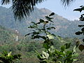
Chandanakampara is a village in Kannur district in the Indian state of Kerala. This village is part of Western Ghats.

Kannur City in Kerala, India

Kannur is a city and a Municipal Corporation in Kannur district, state of Kerala, India. It is the administrative headquarters of the Kannur District and situated 518 km north of the state capital Thiruvananthapuram. During British rule in India, Kannur was known as Cannanore, a name that is still in use by the Indian Railways. Kannur is the largest city of North Malabar region. As of 2011 census population of Kannur was 232,486. Kannur is one of the million-plus urban agglomerations in India with a population of 1,642,892 in 2011.

Kerala State in southern India

Kerala is a state on the southwestern Malabar Coast of India. It was formed on 1 November 1956, following passage of the States Reorganisation Act, by combining Malayalam-speaking regions. Spread over 38,863 km2 (15,005 sq mi), Kerala is the twenty-third largest Indian state by area. It is bordered by Karnataka to the north and northeast, Tamil Nadu to the east and south, and the Lakshadweep Sea to the west. With 33,387,677 inhabitants as per the 2011 Census, Kerala is the thirteenth-largest Indian state by population. It is divided into 14 districts with the capital being Thiruvananthapuram. Malayalam is the most widely spoken language and is also the official language of the state.

Western Ghats mountain range running parallel to the western coast of India

The Western Ghats, also known as Sahyadri, are a mountain range that covers an area of 140,000 square kilometres (54,000 sq mi) in a stretch of 1,600 kilometres (990 mi) parallel to the western coast of the Indian peninsula, traversing the states of Kerala, Tamil Nadu, Karnataka, Goa, Maharashtra and Gujarat. It is a UNESCO World Heritage Site and is one of the eight "hottest hot-spots" of biological diversity in the world. It is sometimes called the Great Escarpment of India. It contains a large proportion of the country's flora and fauna, many of which are only found in India and nowhere else in the world. According to UNESCO, the Western Ghats are older than the Himalayas. They influence Indian monsoon weather patterns by intercepting the rain-laden monsoon winds that sweep in from the south-west during late summer. The range runs north to south along the western edge of the Deccan Plateau, and separates the plateau from a narrow coastal plain, called Konkan, along the Arabian Sea. A total of thirty-nine areas in the Western Ghats, including national parks, wildlife sanctuaries and reserve forests, were designated as world heritage sites in 2012 – twenty in Kerala, ten in Karnataka, five in Tamil Nadu and four in Maharashtra.

Contents

Demographics

The majority of the people living in this village are descendants of those who migrated from central Kerala in the early second half of the twentieth century.

Economy

People of this village are mainly farmers. Rubber, coconut, cashewnut, arecanut, cocco, pepper and nutmeg are the main crops.

Coconut species of plant

The coconut tree is a member of the palm tree family (Arecaceae) and the only known living species of the genus Cocos. The term "coconut" can refer to the whole coconut palm, the seed, or the fruit, which botanically is a drupe, not a nut. The term is derived from the 16th-century Portuguese and Spanish word coco, meaning "head" or "skull" after the three indentations on the coconut shell that resemble facial features.

Cocco Japanese singer

Cocco (こっこ) is a female Japanese pop / folk rock singer.

Black pepper species of plant

Black pepper is a flowering vine in the family Piperaceae, cultivated for its fruit, known as a peppercorn, which is usually dried and used as a spice and seasoning. When fresh and fully mature, it is about 5 mm (0.20 in) in diameter and dark red, and contains a single seed, like all drupes. Peppercorns and the ground pepper derived from them may be described simply as pepper, or more precisely as black pepper, green pepper, or white pepper.

Transportation

The national highway passes through Taliparamba town. Goa and Mumbai can be accessed on the northern side and Cochin and Thiruvananthapuram can be accessed on the southern side. Taliparamba has a good bus station and buses are easily available to all parts of Kannur district. The road to the east of Iritty connects to Mysore and Bangalore. The nearest railway stations are Kannapuram and Kannur on Mangalore-Palakkad line. Trains are available to almost all parts of India subject to advance booking over the internet. The area airport at Kannur, is the closest, at a distance of 42 km; Mangalore and Calicut are other airports closer by distance to Chandanakkampara.

Taliparamba town in Kerala, India

Taliparamba or Thaliparamba is a city and a municipality of 72,500 people in the Kannur district, state of Kerala, spread over an area of 43.05 km2.

Goa State in India

Goa is a state on the southwestern coast of India within the region known as the Konkan, and geographically separated from the Deccan highlands by the Western Ghats. It is surrounded by the Indian states of Maharashtra to the north and Karnataka to the east and south, with the Arabian Sea forming its western coast. It is India's smallest state by area and the fourth-smallest by population. Goa has the highest GDP per capita among all Indian states, two and a half times that of the country. It was ranked the best-placed state by the Eleventh Finance Commission for its infrastructure and ranked on top for the best quality of life in India by the National Commission on Population based on the 12 Indicators.

Mumbai Megacity and state capital in Maharashtra, India

Mumbai is the most populous city in India according to 2011 Indian census and a Megacity with an population of 12.4 million living under the Mumbai city limits which is administered by the Municipal Corporation of Greater Mumbai. Mumbai is the most densely populated Megacity in the world. Mumbai is also the Global city and the financial capital of India. Mumbai Metropolitan Region which includes surrounding areas of Mumbai city has a population of 21 million as of 2011 census. Mumbai lies on the Konkan coast on the west coast of India and has a deep natural harbour. Mumbai is the capital city of Indian state of Maharashtra. In 2008, Mumbai was named an alpha world city. It is also the wealthiest city in India, and has the highest number of millionaires and billionaires among all cities in India. Mumbai is home to three UNESCO World Heritage Sites: the Elephanta Caves, Chhatrapati Shivaji Maharaj Terminus, and the city's distinctive ensemble of Victorian and Art Deco buildings.

Related Research Articles

Vellavu Village in Kerala, India

Vellavu is a place in the Pariyaram gram panchayat of the Kannur District, state of Kerala, India.

Pariyaram is a Grama Panchayath consisting of two villages viz. Pariyaram and Kuttiyeri and is a small town on National Highway 17 between Taliparamba and Payyannur in Kerala state of South India. Mini villages of Thiruvattoor, Koran Peedika, Mukkunnu & Chithappile Poyil are parts of Pariyaram.

Eruvatty Village in Kerala, India

Eruvatty is a village in Kerala, India. It is in the district of Kannur.

Naduvil and Kudianmala Place

Naduvil and Kudianmala are two villages in the Western Ghats in India.It is in Kerala state and in kannur district. Kudianmala is in Taliparamba taluk. Taliparamba-Kudianmala road distance is 34 km. Kudianmala-Taliparamba bus route is a nationalized route.

Mukkunnu, Taliparamba village in Kerala, India

Mukkunnu is a village in Pariyaram Panchayathu, Taliparamba in the Indian state of Kerala.

Kuttiyeri village in Kerala, India

Kuttiyeri is a village of Pariyaram Grama Panchayath near Taliparamba town in Kannur district in the Indian state of Kerala.. Mini villages of Vellavu,Mavichery,Thalora & Panangattoor are parts of Kuttiyeri.

Nediyanga village in Kerala, India

Nediyanga is a village in Kannur district in the Indian state of Kerala.

Panniyoor village in Kerala, India

Panniyoor is a village in Kannur district in the Indian state of Kerala.

Vellad is a village in Kannur district in the Indian state of Kerala.

Thiruvattoor is a village in Pariyaram Grama Panchayath of Kannur district, Kerala, India.

Kappimala is a village located in the Kannur district located in the South Indian state of Kerala.

Cheppanoolis a small village in the Panchayat of Kurumathur, in Kannur district in the Indian state of Kerala

Karimbam, Taliparamba Place in Kerala, India

Karimbam is a suburb of Taliparamba town in Kannur district in the Indian state of Kerala. It stretches from Government Hospital Karimbam to Panakkad and Varadool villages.

Padapengad village in Kerala, India

Padapengad is a place in Chapparapadavu panchayat in Kannur district, Kerala, India. The nearest town is Taliparamba. The postal code is: 670581.

Karthikapuram Place in Kerala, India

Karthikapuram is a village in Kannur district in the Indian state of Kerala.

Manakadavu is a village in Kannur district in the Indian state of Kerala, near Karnataka Forest.

Udayagiri, Kannur village in Kerala, India

Udayagiri is a village in Thaliparamba taluk of Kannur District in Kerala, India. It is about 55 km from Kannur city.

Koonam small unique village in Kerala, India

Koonam is a census village in Taliparamba Taluk in North Kerala Division, Kannur District of Kerala State, India. It comes under Kurumathoor and chuzali Panchayaths. It is located about 9 km from Taliparamba and 30 km north of Kannur.

Chapparapadavu village in Kerala, India

Chapparapadavu is a village (panchayath) in Kannur district in the Indian state of Kerala. The villages of Koovery, Kottakkanam, and Therandi are part of the panchayath. Chapparapadavu has 14,883 people. Board of Members of the Grama Panchayat, Chapparapadava during 1987-95 Ward 1 Kariyil Narayanan Ward 2. I Damodaran Master 3. M Assainar Haji 4. C P Safiya 5. P Kunhiraman 6. V P Kunhiraman 7. E Kunhiraman 8. Mary Thomas Poovanpuzha 9.V J Chacko Master 10.K Madhavan Master 11. T.C Sebastian.

Kolachery is a Grama panchayath situated in Kannur District of Kerala state, India.

References