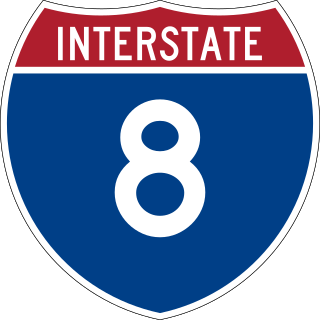
Interstate 8 (I-8) is an Interstate Highway in the southwestern United States. It runs from the southern edge of Mission Bay at Sunset Cliffs Boulevard in San Diego, California, almost at the Pacific Ocean, to the junction with I-10, just southeast of Casa Grande, Arizona. In California, the freeway travels through the San Diego metropolitan area as the Ocean Beach Freeway and the Mission Valley Freeway before traversing the Cuyamaca Mountains and providing access through the Imperial Valley, including the city of El Centro. Crossing the Colorado River into Arizona, I-8 continues through the city of Yuma across the Sonoran Desert to Casa Grande, in between the cities of Phoenix and Tucson.

Buckeye is a city in Maricopa County, Arizona, United States, and is the westernmost suburb in the Phoenix metropolitan area. As of the 2020 census the population was 91,502, up from 50,876 in 2010 and 6,537 in 2000. It was the fastest-growing city in the United States for both 2017 and 2018.

Gila Bend, founded in 1872, is a town in Maricopa County, Arizona, United States. The town is named for an approximately 90-degree bend in the Gila River, which is near the community's current location. As of the 2020 census, the population of the town was 1,892.
Ajo is an unincorporated community in Pima County, Arizona, United States. It is the closest community to Organ Pipe Cactus National Monument. The population was 3,304 at the 2010 census. Ajo is located on State Route 85 just 43 miles (69 km) from the Mexican border.

John Campbell Greenway was an American businessman and senior officer of the U.S. Army Reserve who served with Colonel Theodore Roosevelt in the Spanish–American War and commanded infantry in World War I. He was the late husband of U.S. congresswoman Isabella Greenway.
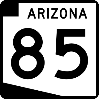
State Route 85 is a 128.86-mile-long (207.38 km) state highway in the U.S. state of Arizona. The highway runs from the United States–Mexico border near Lukeville to the north ending at Interstate 10 (I-10) in Buckeye. The highway also intersects I-8 in Gila Bend and serves as a connector between I-8 and I-10 and for travelers between Phoenix and Yuma as well as San Diego. SR 85 between I-10 and I-8, as well as I-8 between SR 85 and I-10 in Casa Grande, is touted as a bypass of the Phoenix area for long-distance travelers on I-10.
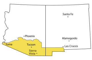
Southern Arizona is a region of the United States comprising the southernmost portion of the State of Arizona. It sometimes goes by the name Gadsden or Baja Arizona, which means "Lower Arizona" in Spanish.

State Route 84, also known as SR 84, is a 41-mile (66 km) east–west highway in south-central Arizona, with its western terminus at Exit 151 of Interstate 8 and its eastern signed terminus at its junction with State Route 387 and State Route 287 in Casa Grande. An unsigned section, which is mostly maintained by local governments, runs from the SR 287 and SR 387 junction southeast through Arizola and Eloy. East of Eloy, SR 84 is concurrent with the beginning 0.87 miles (1.40 km) of State Route 87 just north of Interstate 10 near Picacho.
Tom Childs, Jr. was an Arizona miner and rancher.
Eric Marcus Municipal Airport is a county-owned, public-use airport in Pima County, Arizona, United States. It is located 5.75 miles north of the central business district of Ajo and is about 82 miles southwest of Phoenix. The airport was renamed on February 11, 2006; it was formerly known as Ajo Municipal Airport.

The New Cornelia mine is a currently inactive open-pit copper mine in Pima County, Arizona, United States. It was the only productive mine in the Ajo mining district, and is located just outside the town of Ajo, which was built as a company town to serve the New Cornelia mines. The roughly circular pit is one and a half miles across at its widest point, and 1,100 feet deep at the center. Although not generally regarded as a 'dam', the New Cornelia Mine Tailings is often cited as the largest dam structure in the United States with a volume of 7.4 billion cubic feet.
U.S. Route 80 (US 80) also known as the Ocean-to-Ocean Highway, the Broadway of America and the Jefferson Davis Memorial Highway was a major transcontinental highway that existed in the U.S. state of Arizona from November 11, 1926, to October 6, 1989. At its peak, US 80 traveled from the California border in Yuma to the New Mexico state line near Lordsburg. US 80 was an important highway in the development of Arizona's car culture. Like its northern counterpart, US 66, the popularity of travel along US 80 helped lead to the establishment of many unique road side businesses and attractions, including many iconic motor hotels and restaurants. US 80 was a particularly long highway, reaching a length of almost 500 miles (800 km) within the state of Arizona alone for most of the route's existence.

Ajo Air Force Station is a closed United States Air Force General Surveillance Radar station. It is located 6.4 miles (10.3 km) northwest of Ajo, Arizona. It was closed in 1969 by the Air Force, and the radar site turned over to the Federal Aviation Administration (FAA).

Casa Blanca is a census-designated place (CDP) in Pinal County, Arizona, United States, located in the Gila River Indian Community. The population was 1,388 at the 2010 census.
Dennison was a stop on the Atchison, Topeka and Santa Fe Railway between Canyon Diablo, and Winslow, Arizona, United States, in Coconino County. Formerly in Yavapai County, it came to be in Coconino County upon the latter's creation in 1891. Dennison was named for a railroad roadmaster named Denny.
Midway is a populated place situated in Maricopa County, Arizona, United States. It is one of two populated places in Arizona with this name, the other being located in La Paz County.
Sacate is a populated place situated in Pinal County, Arizona, United States. It has an estimated elevation of 1,093 feet (333 m) above sea level. Located eight miles north of Maricopa on the south side of the Gila River, Sacate was an Indian village and railroad station for the Southern Pacific Railroad. It had originally been called Sacaton, but the name was shortened to its current version in 1904.

The Tucson, Cornelia and Gila Bend Railroad went from Gila Bend, Arizona to Ajo, Arizona.


