
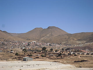
Calacoto or Qala Qutu is the third municipal section of the Pacajes Province in the La Paz Department, Bolivia. Its seat is Calacoto.

Chearoco, Chiaraco or Chiaroco is a mountain in the Cordillera Real in the Andes of Bolivia. It has a height of about 6,127 m (20,102 ft). It is situated in the La Paz Department, Larecaja Province, Guanay Municipality, southeast of the peak of Aman Pata. Chearoco lies between Qalsata in the northwest and Chachakumani in the southeast.

Nazacara or Nasa Q'ara is a village in the La Paz Department in Bolivia. It is the seat of the Nazacara Canton in the San Andrés de Machaca Municipality which is the fifth municipal section of the Ingavi Province.
Llallagua or Llallawa is a town in the Potosí Department in Bolivia. It is the seat of the Llallagua Municipality, the third municipal section of the Rafael Bustillo Province.
Jach'a Phasa is an archaeological site in Bolivia located in the La Paz Department, Pacajes Province, Calacoto Municipality, about 2 km north-east of Rosario. It is situated at a height of 4,126 metres (13,537 ft) on top of the mountain Jach'a Phasa north of the Mawri River.

Chuwa Chuwani is a 4,918-metre-high (16,135 ft) mountain in the Andes of Bolivia. It is situated in the La Paz Department, Pacajes Province, in the south of the Calacoto Municipality. Chuwa Chuwani lies between the mountain Anallaxchi in the north-east and Jach'a Kunturiri in the south-west.
Wiluyu Janq'u Uma or Wiluyu is a mountain in the Cordillera Real in the Andes of Bolivia, about 5,540 metres (18,176 ft) high. It is located in the La Paz Department, Larecaja Province, Sorata Municipality. It lies northwest of the mountain Yapuchañani, northeast of Misk'i T'ant'a and Uma Jalanta and east of Illampu.

Layqa Qullu is a 6,166-metre-high (20,230 ft) peak in the Cordillera Real in the Andes of Bolivia. It is one of the highest peaks in the Illimani massif. It is situated in the La Paz Department, Murillo Province, Palca Municipality, and in the Sud Yungas Province, Irupana Municipality. Layqa Qullu lies south-east of the highest point of the massif, north-west of Link'u Link'u and Silla Pata.
Jach'a Kunturiri is a 4,629-metre-high (15,187 ft) mountain in the Andes of Bolivia. It is situated in the La Paz Department, Pacajes Province, on the border of the Calacoto Municipality and the Charaña Municipality. Jach'a Kunturiri lies south-west of the mountains Jisk'a Kunturiri and Taypi Kunturiri.

Pichaqa is a 4,512-metre-high (14,803 ft) mountain in the Andes of Bolivia. It is situated in the La Paz Department, Pacajes Province, Calacoto Municipality. Pichaqa lies north-east of the Anallajsi volcano.
Urqipi is a 4,230-metre-high (13,878 ft) mountain in the Andes of Bolivia. It lies in the La Paz Department, Pacajes Province, Calacoto Municipality, north of the Anallajsi volcano. It is located at the Achuta River, north-east of the mountain Pukara and north of the mountain Churi Willk'i.
Pukara is a 4,266-metre-high (13,996 ft) mountain in the Andes of Bolivia. It is located in the La Paz Department, Pacajes Province, Calacoto Municipality. Pukara lies north of the Anallajsi volcano, north-west of the mountain Pichaqa and south-west of the mountains Urqipi and Churi Willk'i. It is situated at the Jalsuri River, a right affluent of the Achuta River. The village of Pukara (Pucara) lies at its feet, south-east of it.
Churi Willk'i is a 4,256-metre-high (13,963 ft) mountain in the Andes of Bolivia. It is located in the La Paz Department, Pacajes Province, Calacoto Municipality. Pukara lies north of the Anallajsi volcano, south of the mountain Urqipi and north-east of the mountain Pukara.
Suni Q'awa or Sani Q'awa is a 5,018-metre-high (16,463 ft) mountain in the Andes of Bolivia. It is located in the La Paz Department, Pacajes Province, in the south-west of the Calacoto Municipality. The mountain lies north-west of the Anallajsi volcano and north-east of the mountains Ch'uxña Quta and Chinchillani.
Ch'uxña Quta is a 4,952-metre-high (16,247 ft) mountain in the Andes of Bolivia. It is situated in the La Paz Department, Pacajes Province, Calacoto Municipality, north-west of the extinct Sajama volcano. It lies south-west of the mountain Suni Q'awa.
Jach'a Jawira which upstream is called Anallajchi and Sura K'uchu and downstream successively is named Qincha Jawira and Achuta is a Bolivian river in the La Paz Department, Pacajes Province, Calacoto Municipality. It is a right tributary of the Achuta River which originates near the Chilean border and flows northeast to reach the Mauri River.
Wallatiri is a mountain in the Andes of Bolivia, about 4,000 m (13,000 ft) high. It is located in the La Paz Department, Pacajes Province, Calacoto Municipality.

Chinchillani is a mountain in the Andes of southern Peru, about 4,800 m (15,700 ft) high. It is situated in the Moquegua Region, Mariscal Nieto Province, Torata District, and in the Tacna Region, Candarave Province, Camilaca District. Chinchillani lies southwest of Chuquiananta.
Chinchillani is a 4,122-metre-high (13,524 ft) mountain in the Andes of Bolivia. It is located in the Oruro Department, Sabaya Province, Sabaya Municipality, south of the Lauca River.
The Llallawa Jawira which upstream successively is named Patu Uma, Ch'alla Jawira, Jach'a Qura, Lupipi and Chuqi Phuju is a river in the La Paz Department in Bolivia. It is a left tributary of the Desaguadero River.


