Cooloola Cove, Queensland

Last updated

Cooloola Cove
Queensland
Australia Queensland location map.svg
Red pog.svg
Cooloola Cove
Coordinates 25°58′50″S152°59′40″E / 25.9805°S 152.9944°E / -25.9805; 152.9944 (Cooloola Cove (centre of locality))
Population2,921 (2021 census) [1]
 • Density197.4/km2 (511.2/sq mi)
Postcode(s) 4580
Elevation13 m (43 ft)
Area14.8 km2 (5.7 sq mi)
Time zone AEST (UTC+10:00)
Location
LGA(s) Gympie Region
State electorate(s) Gympie
Federal division(s) Wide Bay
Suburbs around Cooloola Cove:
Tin Can Bay Tin Can Bay Cooloola
Toolara Forest Cooloola Cove Cooloola
Toolara Forest Cooloola Cooloola

Cooloola Cove is a coastal locality in the Gympie Region, Queensland, Australia. [2] In the 2021 census, Cooloola Cove had a population of 2,921 people. [1]

Contents

Geography

Cooloola Cove is in the Wide Bay-Burnett region, 219 kilometers or a two-and-a-half-hour drive north of the state capital Brisbane and a 52-kilometre or half-hour drive from the Council Seat and city, Gympie.

History

The Veterans Memorial Wall was unveiled on Saturday 11 November 2006 and commemorates those who served in the Vietnam War. [3]

Demographics

In the 2011 census, Cooloola Cove had a population of 2,513 people. [4]

In the 2016 census, Cooloola Cove had a population of 2,633 people. [5]

In the 2021 census, Cooloola Cove had a population of 2,921 people. [1]

Education

There are no schools in Cooloola Cove. The nearest government school is Tin Can Bay State School in neighbouring Tin Can Bay to the north; it provides primary schooling and secondary schooling to Year 10. For secondary schooling to Year 12, the nearest government school is Gympie State High School in Gympie to the south-west. [6]

Amenities

The Veterans & Community Hall is on the corner of Nautilus Drive and Santa Maria Court ( 25°58′15″S152°59′06″E / 25.9709°S 152.9851°E / -25.9709; 152.9851 (Cooloola Wesleyan Methodist Church) ). [7] [8] There is a memorial wall for veterans of the Vietnam War. [3]

Cooloola Wesleyan Methodist Church meets at the Veterans & Community Hall. [9] It is part of the Wesleyan Methodist Church of Australia. [10]

Centenary Of Federation Park is in Mauretania Avenue ( 25°58′05″S152°58′36″E / 25.9680°S 152.9767°E / -25.9680; 152.9767 (Centenary Of Federation Park) ). Barbeques are available. [11] [12]

Related Research Articles

<span class="mw-page-title-main">Gympie</span> City in Queensland, Australia

Gympie is a city and a locality in the Gympie Region, Queensland, Australia. In the Wide Bay-Burnett District, Gympie is about 170.7 kilometres (110 mi) north of the state capital, Brisbane. The city lies on the Mary River, which floods Gympie occasionally. The locality of Gympie is the central business district for the city of Gympie and also the administrative centre for the Gympie Region local government area. In the 2021 census, Gympie had an urban population of 22,424 people.

<span class="mw-page-title-main">Goomeri</span> Town in Queensland, Australia

Goomeri is a rural town and locality in the Gympie Region, Queensland, Australia. In the 2021 census, the locality of Goomeri had a population of 677 people.
<span class="mw-page-title-main">Bray Park, Queensland</span> Suburb of Moreton Bay, Queensland, Australia

Bray Park is a suburb in the City of Moreton Bay, Queensland, Australia. In the 2021 census, Bray Park had a population of 10,271 people.
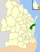
<span class="mw-page-title-main">Shire of Cooloola</span> Local government area in Queensland, Australia

The Shire of Cooloola was a local government area located about 170 kilometres (106 mi) north of Brisbane – the state capital of Queensland, Australia. The shire covered an area of 2,968.8 square kilometres (1,146.3 sq mi), and was the product of a merger in 1993 between the City of Gympie and the Shire of Widgee, which had both existed since 1879–1880. It merged with several other LGAs to form the Gympie Region on 15 March 2008.

<span class="mw-page-title-main">Chatsworth, Queensland</span> Suburb of Gympie, Queensland, Australia

Chatsworth is a rural locality in the Gympie Region, Queensland, Australia. In the 2021 census, Chatsworth had a population of 1,353 people.

<span class="mw-page-title-main">Tin Can Bay, Queensland</span> Town in Queensland, Australia

Tin Can Bay is a coastal town and locality in the Wide Bay–Burnett region in Queensland, Australia. The locality is split between the Fraser Coast Region and the Gympie Region, but the town itself is within Gympie Region. In the 2021 census, the locality of Tin Can Bay had a population of 2,293 people.

<span class="mw-page-title-main">Gympie Region</span> Local government area in Queensland, Australia

The Gympie Region is a local government area in the Wide Bay–Burnett region of Queensland, Australia, about 170 kilometres (110 mi) north of Brisbane, the state capital. It is between the Sunshine Coast and Hervey Bay and centred on the town of Gympie. It was created in 2008 from a merger of the Shires of Cooloola and Kilkivan and part of the Shire of Tiaro.

Araluen is a residential locality in Gympie in the Gympie Region, Queensland, Australia. In the 2021 census, Araluen had a population of 649 people.

Veteran is a rural residential locality in the Gympie Region, Queensland, Australia. In the 2021 census, Veteran had a population of 959 people.

<span class="mw-page-title-main">Monkland, Queensland</span> Suburb of Gympie, Queensland, Australia

Monkland is a rural locality in the Gympie Region, Queensland, Australia. In the 2021 census, Monkland had a population of 1,135 people.

Southside is a semi-rural locality in the Gympie Region, Queensland, Australia. In the 2021 census, Southside had a population of 6,312 people.

Jones Hill is a rural locality in the Gympie Region, Queensland, Australia. In the 2021 census, Jones Hill had a population of 1,135 people.

<span class="mw-page-title-main">Glanmire, Queensland</span> Suburb of Gympie, Queensland, Australia

Glanmire is an urban industrial locality in Gympie in the Gympie Region, Queensland, Australia. In the 2021 census, Glanmire had a population of 28 people.

Kybong is a rural locality in the Gympie Region, Queensland, Australia. In the 2021 census, Kybong had a population of 363 people.

<span class="mw-page-title-main">Brooloo, Queensland</span> Town in Queensland, Australia

Brooloo is a rural town and locality in the Gympie Region, Queensland, Australia. In the 2021 census, the locality of Brooloo had a population of 369 people.
<span class="mw-page-title-main">Imbil</span> Town in Queensland, Australia

Imbil is a rural town and locality in the Gympie Region, Queensland, Australia. In the 2021 census, the locality of Imbil had a population of 1,071 people.

<span class="mw-page-title-main">Theebine</span> Town in Queensland, Australia

Theebine is a rural town and locality split between the Gympie Region and the Fraser Coast Region, both in Queensland, Australia.

<span class="mw-page-title-main">Amamoor</span> Town in Queensland, Australia

Amamoor is a rural town and locality in the Gympie Region, Queensland, Australia. In the 2021 census, the locality of Amamoor had a population of 720 people.
<span class="mw-page-title-main">Torbanlea</span> Town in Queensland, Australia

Torbanlea is a rural town and locality in the Fraser Coast Region, Queensland, Australia. In the 2021 census, the locality of Torbanlea had a population of 841 people.

Milora is a rural locality in the Scenic Rim Region, Queensland, Australia. In the 2021 census, Milora had a population of 136 people.

References

  1. 1 2 3 Australian Bureau of Statistics (28 June 2022). "Cooloola Cove (SAL)". 2021 Census QuickStats. Retrieved 28 February 2023. OOjs UI icon edit-ltr-progressive.svg
  2. "Cooloola Cove – locality in Gympie Region (entry 46319)". Queensland Place Names. Queensland Government . Retrieved 4 November 2019.
  3. 1 2 "Cooloola Cove Memorial Wall". Monument Australia. Archived from the original on 31 August 2023. Retrieved 31 August 2023.
  4. Australian Bureau of Statistics (31 October 2012). "Cooloola Cove (State Suburb)". 2011 Census QuickStats. Retrieved 10 August 2015. OOjs UI icon edit-ltr-progressive.svg
  5. Australian Bureau of Statistics (27 June 2017). "Cooloola Cove (SSC)". 2016 Census QuickStats. Retrieved 20 October 2018. OOjs UI icon edit-ltr-progressive.svg
  6. "Queensland Globe". State of Queensland . Retrieved 31 August 2023.
  7. "Cooloola Cove Veterans Hall". Gympie Regional Council. Archived from the original on 31 August 2023. Retrieved 31 August 2023.
  8. Google (1 September 2023). "Cooloola Cove Veterans & Community Hall" (Map). Google Maps . Google. Retrieved 1 September 2023.
  9. "Cooloola". Wesleyan Methodist Church Australia. Archived from the original on 19 March 2021. Retrieved 25 August 2021.
  10. "South Queensland". Wesleyan Methodist Church Australia. Archived from the original on 21 August 2021. Retrieved 25 August 2021.
  11. "Land for public recreation - Queensland". Queensland Open Data. Queensland Government. 20 November 2020. Archived from the original on 22 November 2020. Retrieved 22 November 2020.
  12. "Centenary of Federation Park". Gympie Regional Council. Archived from the original on 31 August 2023. Retrieved 31 August 2023.