
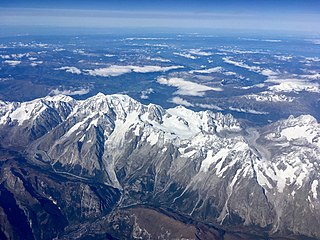
Mont Blanc is the highest mountain in the Alps and Western Europe, and the highest mountain in Europe outside the Caucasus Mountains, rising 4,805.59 m (15,766 ft) above sea level, located on the Franco-Italian border. It is the second-most prominent mountain in Europe, after Mount Elbrus, and the 11th most prominent mountain in the world.
The higher region of the Alps were long left to the exclusive attention of the inhabitants of the adjoining valleys, even when Alpine travellers began to visit these valleys. It is reckoned that about 20 glacier passes were certainly known before 1600, about 25 more before 1700, and yet another 20 before 1800. Even though the attempt of P.A. Arnod, an official of the duchy of Aosta, in 1689 to "re-open" the Col du Ceant may be counted as having been made by a non-native, historical records do not show any further such activities until the last quarter of the 18th century. Nor did it fare much better with the high peaks, though the two earliest recorded ascents were due to non-natives, that of the Rocciamelone in 1358 having been undertaken in fulfilment of a vow, and that of the Mont Aiguille in 1492 by order of Charles VIII of France, in order to destroy its immense reputation for inaccessibility – in 1555 Conrad Gesner did not climb Pilatus proper, but only the grassy mound of the Gnepfstein, the lowest and the most westerly of the seven summits.

The Aiguille de Bionnassay is a mountain in the Mont Blanc massif of the Alps in France and Italy. It has been described as "one of the most attractive satellite peaks of Mont Blanc", and is located on its western side. The mountain's south and east ridges form the frontier between the two countries, and its summit is a knife-edge crest of snow and ice. Reaching it via any route provides a "splendid and serious snow and ice climb".
The Aiguille du Midi is a 3,842-metre-tall (12,605 ft) mountain in the Mont Blanc massif within the French Alps. It is a popular tourist destination and can be directly accessed by cable car from Chamonix that takes visitors close to Mont Blanc.
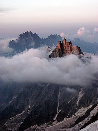
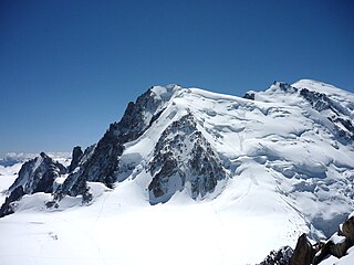
The Mont Blanc massif is a mountain range in the Alps, located mostly in France and Italy, but also straddling Switzerland at its northeastern end. It contains eleven major independent summits, each over 4,000 metres (13,123 ft) in height. It is named after Mont Blanc, the highest point in western Europe and the European Union. Because of its considerable overall altitude, a large proportion of the massif is covered by glaciers, which include the Mer de Glace and the Miage Glacier – the longest glaciers in France and Italy, respectively.
Mont Blanc du Tacul is a mountain in the Mont Blanc massif of the French Alps situated midway between the Aiguille du Midi and Mont Blanc.

The Argentière Hut is a refuge in the Mont Blanc massif in the Alps. Built in 1974 by the Club Alpin Français, it is located above the north bank of the Argentière Glacier in France at an altitude of 2,691 meters above sea level.

The Torino Hut is a high mountain refuge in the Alps in northwestern Italy. Located near the border with France, it is about 15 km (10 mi) southwest of Mont Dolent, the tripoint with Switzerland. The refuge is in the Mont Blanc massif above the town of Courmayeur in the Aosta Valley, Italy. It can be most easily accessed from the Italian side by the Skyway Monte Bianco cable car from La Palud in Courmayeur, with a change at the Pavilion du Mont Fréty. It can also be reached from Chamonix via the Aiguille du Midi, either by cable car which crosses the massif, or by a long crossing of the Glacier du Gèant. The refuge lies nearly directly above the 11.6 km (7.2 mi) Mont Blanc Tunnel, which passes deep underground, and connects Courmayeur to Chamonix.

The Aiguille du Chardonnet is a mountain in the Mont Blanc massif in Haute-Savoie, France. It lies between the Glacier du Tour and the Argentière Glacier. The border with Switzerland runs just east of the summit. The East or Forbes Arete provides a popular and classic mountaineering route to the summit.

Jean-Marc Boivin was a French mountaineer, extreme skier, hang glider and paraglider pilot, speleologist, BASE jumper, film maker and author. The holder of several altitude records for hang gliding and paragliding, the creator of numerous first ascents and first ski descents in the Alps, a member of the team that broke the record for a sub-glacial dive and the first person to paraglide from the summit of Mount Everest, Boivin was a pioneer of extreme sports. He died from injuries incurred after BASE jumping off Angel Falls in Venezuela, the highest waterfall in the world.
Pointe Lachenal is a mountain in the Mont Blanc massif in the French Alps.

Armand Charlet was a French mountaineer and mountain guide.
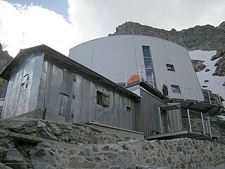
The Gonella Hut, sometimes called in Italian Rifugio del Dôme or in French Refuge du Dôme, is a high elevation mountain hut in the Aosta Valley in the Mont Blanc massif area of the Alps. It lies at an elevation of 3071 metres, above Val Veny near Courmayeur in Italy. The refuge is located on the Italian normal route to Mont Blanc.
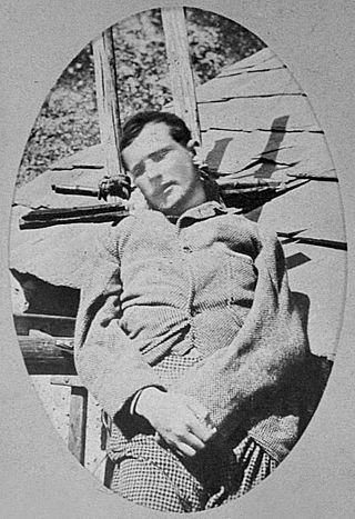
Henri Cordier or Henry Cordier was a French mountaineer. In his short two-year career, he became the first Frenchman to reach the level of the English members of the Alpine Club, in the silver age of alpinism in the second half of the 19th century, which was dominated by the development of mountaineering in the Alps. With some of the Alpine Club's mountain guides and mountaineers, he led significant first ascents in the Mont Blanc massif and in the Dauphiné Alps.
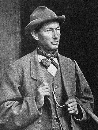
Émile Rey was an alpine mountain guide from Aosta Valley in Italy. Dubbed "the Prince of Guides" in Courmayeur, he was one of the most renowned guides at the end of the 19th century, making many first ascents on some of the highest and most difficult mountains in the Mont Blanc massif of the Alps. He has been described as "one of the greatest guides of his generation."
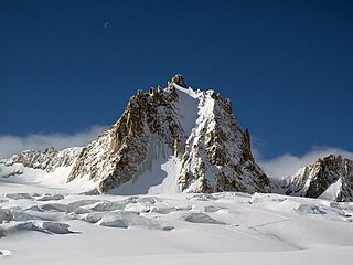
The Tour Ronde is a mountain in the Mont Blanc massif of the Alps, situated on the border between France and Italy. It is a prominent mountain, some 3.5 km north-east of Mont Blanc, but is effectively part of a continuation of the south eastern spur of Mont Maudit which forms a frontier ridge between the two countries. It is easily accessible to mountaineers and provides not only a very good viewpoint from its summit of the Brenva face and the major peaks on the southern side of Mont Blanc, but it also offers a popular introduction to alpine climbing of all grades, including a north face ascent.
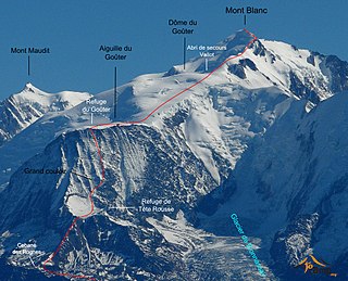
The Goûter Route is one of the two normal mountaineering routes used to reach the summit of Mont Blanc in the Alps, ascending to a height of 4,808 metres (15,774 ft). The route lies on the north side of the mountain, in France. Usually reckoned as the easiest route up Mont Blanc, it is extremely popular with mountaineers, seeing thousands of ascents per year.

The Grand Flambeau is a mountain peak in the Mont Blanc massif of the Alps. It is situated at the head of the Géant Glacier, approximately 0.5 km (0.31 mi) east of the Aiguille de Toule, between the Col Orientale de Toule and the Col de Saussure.

The Aiguille de Toule is a mountain peak in the Mont Blanc massif of the Alps. Its summit is one of a number which form part of the mountainous frontier ridge between France and Italy which descends eastwards from Mont Blanc and continues towards the Grandes Jorasses and Mont Dolent.

The Aiguille de la Brenva is a remote rocky mountain peak in the Mont Blanc massif of the Alps. It lies wholly within Italy on a ridge descending south-east from the Tour Ronde. It has been described as "a spectacular fin with a fine E face". It stands on a ridge separating the Entrèves glacier from the Brenva glacier, yet is somewhat overshadowed by its larger neighbours, such as the Aiguille Blanche and the Aiguille Noire de Peuterey. Nevertheless, it is a distinctive peak, offering a number of very challenging climbs, especially on its east face which consists of vertical granite flakes and cracks. On its northern side stands a distinctive, slender rock pinnacle about 60 metres high, known as the Père Eternel.


