| Pointe Helbronner | |
|---|---|
 | |
| Highest point | |
| Elevation | 3,462 m (11,358 ft) |
| Coordinates | 45°50′45″N6°55′54″E / 45.84583°N 6.93167°E Coordinates: 45°50′45″N6°55′54″E / 45.84583°N 6.93167°E |
| Naming | |
| English translation | Helbronner Peak |
| Language of name | French / Italian |
| Geography | |
| Location | Aosta Valley, Italy / Haute-Savoie, France |
| Parent range | Mont Blanc Massif |
| Climbing | |
| Easiest route | cable car |
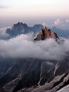
Pointe Helbronner (3,462 m (11,358 ft)) is a mountain in the Mont Blanc massif in the Graian Alps on the watershed between France and Italy.

A mountain is a large landform that rises above the surrounding land in a limited area, usually in the form of a peak. A mountain is generally steeper than a hill. Mountains are formed through tectonic forces or volcanism. These forces can locally raise the surface of the earth. Mountains erode slowly through the action of rivers, weather conditions, and glaciers. A few mountains are isolated summits, but most occur in huge mountain ranges.

The Mont Blanc massif is a mountain range in the Alps, located mostly in France and Italy, but also straddling Switzerland at its northeastern end. It contains eleven major independent summits, each over 4,000 metres (13,123 ft) in height. It is named after Mont Blanc, the highest point in western Europe and the European Union. Because of its considerable overall altitude, a large proportion of the massif is covered by glaciers, which include the Mer de Glace and the Miage Glacier – the longest glaciers in France and Italy, respectively.

The Graian Alps are a mountain range in the western part of the Alps.
The peak, which used to be a mere geodetic reference point, was named after Paul Helbronner, a French polytechnicien , alpinist and geodesist who pioneered cartography of the French Alps.

Paul Helbronner was a French topographer, alpinist and geodesist who pioneered cartography of the French Alps. Pointe Helbronner in the Mont Blanc massif is named in his honor.

École polytechnique is a French public institution of higher education and research in Palaiseau, a suburb southwest of Paris. It is one of the most prestigious and selective French scientific and engineering schools, called grandes écoles in French. It is known for its ingénieur polytechnicien scientific degree program which is equivalent to both a bachelor and master of science. Its entrance exam, the X-ENS exam, is renowned for its selectivity with a little over 500 admitted students out of the 53 848 students enrolled in the preparatory programs for the French scientific and engineering schools entrance exams.
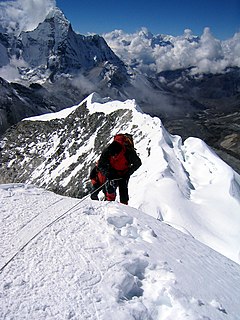
Mountaineering is the set of activities that involves ascending mountains. Mountaineering-related activities include traditional outdoor climbing, hiking, skiing, and traversing via ferratas. Indoor climbing, sport climbing and bouldering are usually considered mountaineering as well.
Pointe Helbronner is served on the Italian side by the Skyway Monte Bianco, a cable car from La Palud, a village 2.5 kilometres (1.6 mi) north of the town of Courmayeur in the Aosta Valley. Pointe Helbronner is also served by the Vallee Blanche Aerial Tramway, which crosses from the peak to the nearby peak of Aiguille du Midi in France—a peak-to-peak distance of 5 km (3.1 mi). This, in turn, gives access to the French Téléphérique de l'Aiguille du Midi, the cable car connecting Aiguille du Midi to the French village of Chamonix, Courmayeur's sister "city".

Skyway Monte Bianco is a cable car in the Alps, linking the Italian town of Courmayeur with Pointe Helbronner on the southern side of the Mont Blanc massif. Taking over three years to construct, it opened in 2015 at a cost of 110 million euros, and is considered to be the world's most expensive cable car installation.

Courmayeur ) is a town and comune in northern Italy, in the autonomous region of Aosta Valley.
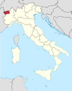
The Aosta Valley is a mountainous autonomous region in northwestern Italy. It is bordered by Auvergne-Rhône-Alpes, France, to the west, Valais, Switzerland, to the north and by the Metropolitan City of Turin in the region of Piedmont, Italy, to the south and east.
The Skyway Monte Bianco station platform on Pointe Helbronner offers a remarkable view over the Aosta Valley and the Piedmont region. The French-Italian border splits this platform.

Piedmont is a region in northwest Italy, one of the 20 regions of the country. It borders the Liguria region to the south, the Lombardy and Emilia-Romagna regions to the east and the Aosta Valley region to the northwest; it also borders Switzerland to the northeast and France to the west. It has an area of 25,402 square kilometres (9,808 sq mi) and a population of 4,377,941 as of 30 November 2017. The capital of Piedmont is Turin.
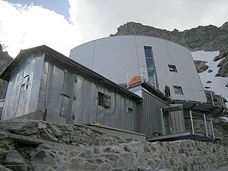
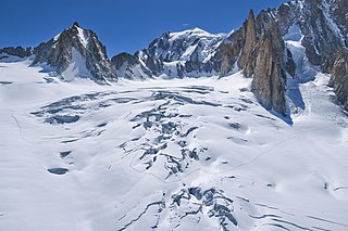
Pointe Helbronner is the starting point of a ski run via the Glacier du Géant and the Mer de Glace to Montenvers and Chamonix. The mountain is the starting point of various routes to other mountains on the Mont Blanc massif, with many mountaineers staying at the nearby Refuge Torino.

The Mer de Glace is a valley glacier located on the northern slopes of the Mont Blanc massif, in the French Alps. It is 7.5 km long and 200 metres (660 ft) deep but, when all its tributary glaciers are taken into account, it can be regarded as the longest and largest glacier in France, and the second longest in the Alps after the Aletsch Glacier.
I can no otherwise convey to you an image of this body of ice, broken into irregular ridges and deep chasms than by comparing it to waves instantaneously frozen in the midst of a violent storm.
In June 2015, Italian Prime Minister Matteo Renzi expressed repeated claims on the territory [1] [2] [3]

Matteo Renzi is an Italian politician who served as the Prime Minister of Italy from February 2014 until December 2016. After the rejection of his constitutional reform in the December 2016 referendum, Renzi formally resigned on 12 December when Foreign Affairs Minister Paolo Gentiloni was appointed new head of the government by President Sergio Mattarella. Renzi served, with a brief interruption, as Secretary of the Democratic Party from 2013 to 2018, when he resigned after the 2018 electoral defeat. He was also President of the Province of Florence from 2004 to 2009 and Mayor of Florence from 2009 to 2014. Renzi, who did not hold a seat in either house of Parliament during his tenure as Prime Minister, became a member of the Senate in March 2018.


